Pärnu tide times
Pärnu tide forecast — heights relative to MSL.
Tide chart for Pärnu
24-hour cosine-interpolated curve around the present moment. Heights relative to MSL. Predictions: Predictions: Open-Meteo Marine (MeteoFrance SMOC, 0.08° grid).
Sun, moon and conditions on Fri 31 Jul
Snapshot at build time — refreshes daily. Sea state from Open-Meteo Marine.
Highs and lows next 7 days
Every predicted high and low for the next week, with the daily tidal coefficient (0–120; higher = bigger swing, > 95 means stronger currents).
Other spots nearby
The three closest curated TideTurtle locations to Pärnu, measured by great-circle distance.
Today's solunar windows
Solunar tradition: major periods are the ≈3h windows around moon transit and opposition; minor are ≈2h around moonrise and moonset. Pair with the local tide stage and wind for the best read.
About tides at Pärnu
A short guide to the coastline at Pärnu — geography, sea state, and what the tide is actually doing under your feet.
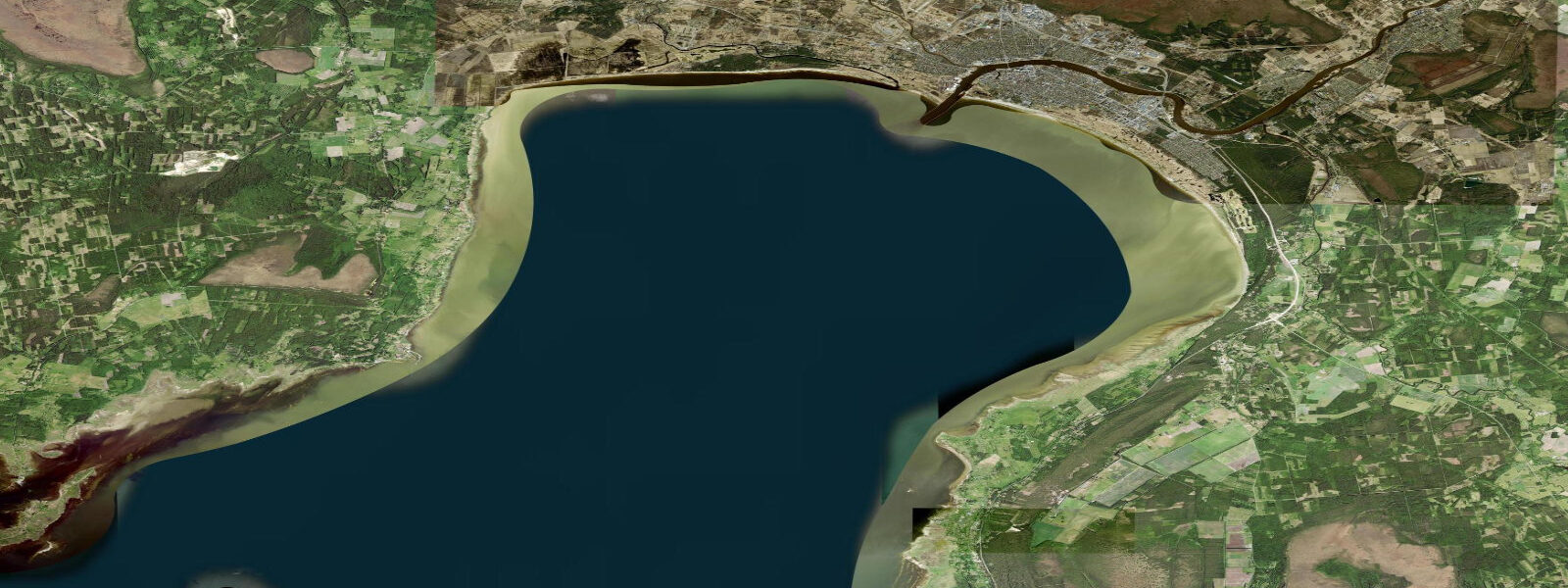
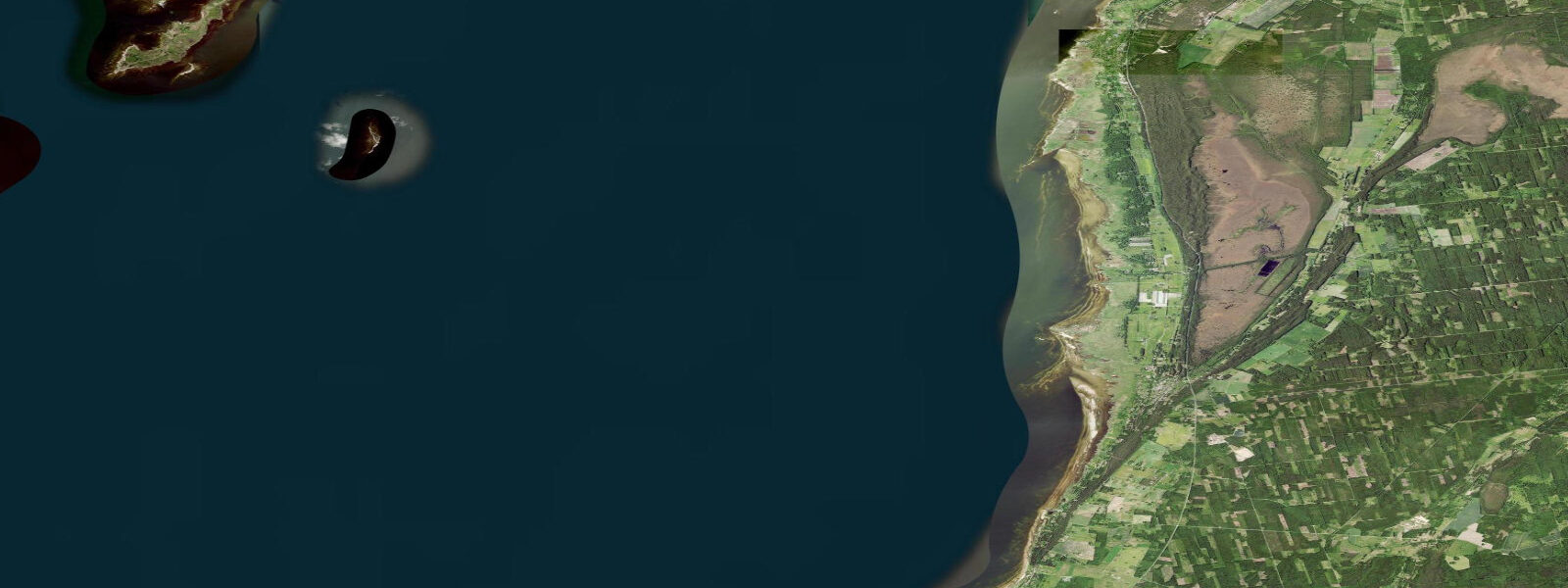
Pärnu is Estonia's main beach resort, a small city on the eastern shore of the Gulf of Riga where the Pärnu River meets the sea and a long arc of fine, pale sand has drawn Baltic holiday-makers since the 19th century. The coastal setting is unusual in European terms: the Gulf of Riga is an enclosed arm of the Baltic, roughly 150 kilometres north to south, bounded to the west by the Estonian islands of Saaremaa and Hiiumaa. Those islands act as a wave filter, blocking the full fetch of Baltic swell and leaving the Gulf of Riga with a predominantly wind-wave regime rather than the oceanic swell pattern seen on fully exposed Baltic coasts. The result at Pärnu is a beach that is calm by default, with gentle slope, modest wave height, and water warm enough to swim from late June through August.
The tide range at Pärnu is 5 to 15 centimetres — the smallest of Estonia's already small range, reflecting both the general Baltic micro-tidal regime and the additional enclosure of the Gulf of Riga. The gravitational tidal signal has been almost entirely attenuated before it reaches the inner Gulf. What drives water-level change here is wind. The Gulf of Riga's north-south orientation means that southwesterlies — the prevailing wind across this part of the Baltic for much of the year — push water northward toward Pärnu and the northeastern Gulf shore. A persistent southwest or south wind over 24 to 48 hours raises the water level at Pärnu beach by 30 to 60 centimetres above mean, visibly narrowing the beach and occasionally reaching the promenade edge during strong autumn and early winter storms. A reversal to northeast or east wind clears the water southward, dropping the level and exposing more of the sand flat east of the river mouth.
The beach at Pärnu faces roughly west-southwest along a roughly three-kilometre arc. Swimmers enter from the main beach in front of the resort hotels and the Rannapark area; the water temperature in July and August reaches 18 to 22 degrees Celsius on warm years, occasionally exceeding 23 degrees during heat periods when the shallow Gulf retains heat effectively. The gentle slope means a 30-centimetre wind-driven rise makes the waterline visibly retreat up the beach, but the change is gradual and predictable with the wind forecast rather than requiring a tide table.
Stand-up paddleboarders and kayakers on the Pärnu River and in the coastal shallows north of the river mouth work a calm, sheltered environment. The river current is modest, and the river mouth area is shallow enough to stand in across most conditions. Wind is the only meaningful variable for paddling safety: a strong onshore southwesterly can create choppy conditions in the open Gulf that are uncomfortable for beginners, while an offshore easterly produces the flattest water and is the preferred paddle-out direction for anyone heading north along the coast toward Kihnu Island.
Shore anglers at Pärnu target vimba, sea trout and pike-perch in the river mouth and the adjacent coastal shallows. Vimba run upstream to spawn in late spring and early summer when water temperature crosses roughly 12 to 14 degrees Celsius; sea trout appear inshore in autumn. Neither fishery responds to tide — the operative triggers are water temperature, seasonal timing, and the flow state of the Pärnu River, which is driven by precipitation and snowmelt rather than any tidal forcing.
The beach promenade, the spa hotels, and the art nouveau architecture in the old town draw significant visitor traffic from late June through August. Photographers planning the Pärnu beach landscape in evening light work the southwest-facing beach orientation for sunset, and the low sun angle in the Gulf of Riga latitude produces long golden-hour windows in midsummer — the coastal light at Pärnu in June and July is genuinely excellent, lasting until nearly 11 pm at the solstice. The water level in the foreground is whatever the southwest wind has set it to; on a calm evening after a day of light southerlies, the beach is wide and the water flat.
Tide predictions on this page come from Open-Meteo Marine, with typical accuracy of plus or minus 45 minutes and 0.2 to 0.3 metres. At Pärnu, the total astronomical range is 5 to 15 centimetres — the model's uncertainty floor exceeds the signal. Treat the predicted highs and lows as background context for the theoretical gravitational rhythm rather than operational guidance. For water-level conditions that actually affect beach use and coastal access, the Estonian Weather Service (Ilmateenistus) sea-level forecast at ilmateenistus.ee is the operative source. Wind direction and strength in the forecast determine the likely water level with far more accuracy than the tide prediction.
Tide questions about Pärnu
Quick answers to the most common questions about tide times, range, and water access at Pärnu.
When is the next high tide at Pärnu?
The prediction block at the top of this page shows the next predicted high in local Estonian time (EET/EEST, UTC+2/UTC+3 with daylight saving). The astronomical range at Pärnu is 5 to 15 centimetres — the smallest in Estonia and among the smallest in Europe. In practice, the water level at Pärnu beach on any given day is set by wind, not by the astronomical tide. Wind-driven level changes of 30 to 60 centimetres routinely dwarf the tidal signal during sustained southwesterly weather. The Estonian Weather Service (Ilmateenistus) at ilmateenistus.ee publishes the sea-level forecast that actually determines beach and coastal conditions.
Why is the tide range so small at Pärnu?
Pärnu sits inside the Gulf of Riga, which is an enclosed arm of the Baltic Sea. The Baltic itself is separated from the North Sea by the narrow Danish straits, which attenuate virtually all of the gravitational tidal signal before it reaches the inner Baltic. The Gulf of Riga is a further enclosure within the Baltic, and its geometry does not amplify what little signal remains. The 5 to 15 cm range at Pärnu is the genuine astronomical tide, not a measurement artefact. Wind-driven water-level change of 30 to 60 centimetres routinely exceeds the tidal range during sustained southwesterly weather.
Where do these tide predictions come from?
Predictions come from Open-Meteo Marine, a free gridded global ocean model that estimates tidal height across a geographic grid. At Pärnu, the model's inherent accuracy limit of plus or minus 45 minutes and 0.2 to 0.3 metres is larger than the 5 to 15 cm astronomical range being predicted. The predictions provide theoretical context — the background gravitational rhythm — not actionable planning data. The operative water-level reference for Pärnu is the Estonian Weather Service (Ilmateenistus) sea-level and storm-surge forecast.
What affects beach conditions at Pärnu most — tide or wind?
Wind dominates completely. A persistent southwesterly pushes water northward into the Gulf of Riga, raising the Pärnu waterline by 30 to 60 centimetres during strong events — enough to visibly narrow the beach and occasionally reach the promenade. A northeast or east wind clears the water south and exposes more of the sand flat. The 5 to 15 cm astronomical tide is buried inside this wind-driven variation and has no practical effect on beach width, swim depth, or paddling conditions. Check the wind forecast, not the tide table, before heading to the beach.
Is it safe to swim at Pärnu beach?
Yes, in normal summer conditions. The beach is sheltered from open Baltic swell by Saaremaa and Hiiumaa to the west, and the wave climate in the Gulf of Riga is generally gentle unless there is active onshore wind. Water temperature reaches 18 to 22 degrees Celsius in July and August. The main risk factors are cold-water shock in early June or after a cold northerly spell, and choppy wind-wave conditions when the southwesterly is strong — the beach faces southwest and takes the fetch directly during those events. The Pärnu beach lifeguard service operates through the main summer season. Jellyfish, primarily harmless Aurelia aurita, appear in calm warm periods but pose no medical risk.
8-day tide table — Pärnu
Heights relative to MSL. Predictions: Open-Meteo Marine (MeteoFrance SMOC, 0.08° grid) — heights relative to MSL (not chart datum / LAT). Model-derived.
| Day | Type | Time | Height |
|---|---|---|---|
| Fri 31 Jul | — | ||
| Sat 01 Aug | — | ||
| Sun 02 Aug | — | ||
| Mon 03 Aug | High | 06:00 | 0.1m |
| Tue 04 Aug | Low | 21:50 | -0.1m |
| Wed 05 Aug | — | ||
| Thu 06 Aug | — | ||
| Fri 07 Aug | High | 02:00 | 0.9m |