Cabo Polonio tide times
Cabo Polonio tide forecast — heights relative to MSL.
Today's tide times for Cabo Polonio
Tide times at Cabo Polonio on Saturday, 4 July 2026: first low tide at 05:52am, first high tide at 04:15pm, second low tide at 05:42pm, second high tide at 09:07pm. Sunrise 07:42am, sunset 05:37pm.
Tide chart for Cabo Polonio
24-hour cosine-interpolated curve around the present moment. Heights relative to MSL. Predictions: Predictions: Open-Meteo Marine (MeteoFrance SMOC, 0.08° grid).
Sun, moon and conditions on Sat 04 Jul
Snapshot at build time — refreshes daily. Sea state from Open-Meteo Marine.
Highs and lows next 7 days
Every predicted high and low for the next week, with the daily tidal coefficient (0–120; higher = bigger swing, > 95 means stronger currents).
Other spots nearby
The three closest curated TideTurtle locations to Cabo Polonio, measured by great-circle distance.
Today's solunar windows
Solunar tradition: major periods are the ≈3h windows around moon transit and opposition; minor are ≈2h around moonrise and moonset. Pair with the local tide stage and wind for the best read.
Cycle dates near Cabo Polonio
Next spring tide on Tue 07 Jul (range 0.5m). Last neap on Fri 03 Jul.
Spring tides cluster around new and full moons (biggest swings). Neap tides land on quarter moons (smallest swings). See the spring tide and neap tide glossary entries for the why.
About tides at Cabo Polonio
A short guide to the coastline at Cabo Polonio — geography, sea state, and what the tide is actually doing under your feet.
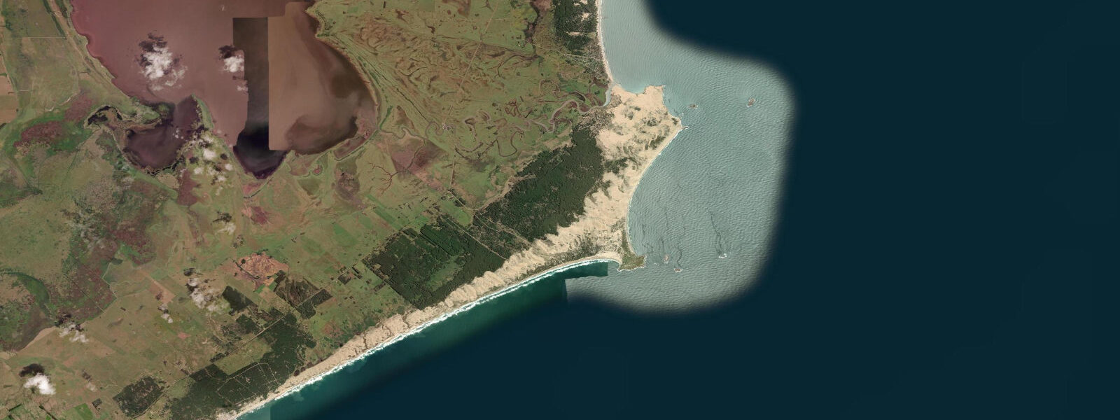
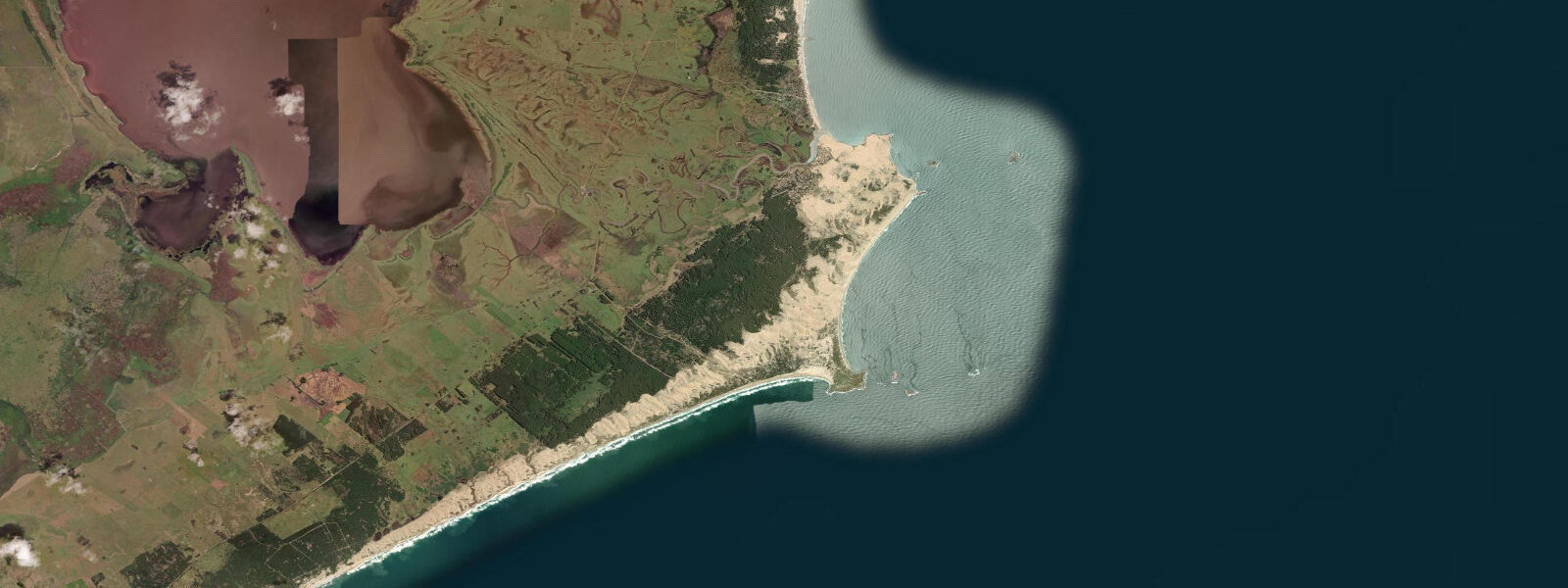
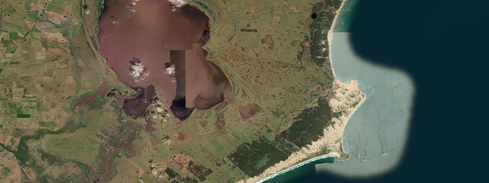
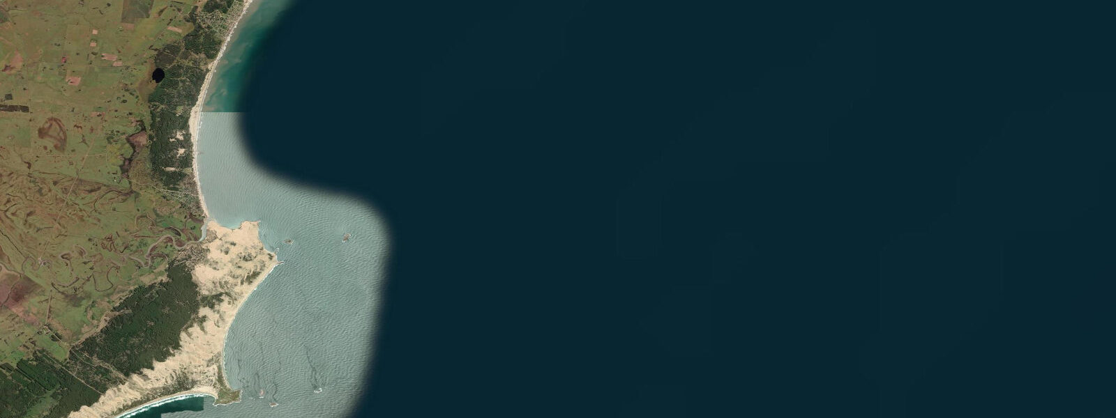
Cabo Polonio occupies a rocky headland on the southern edge of Rocha Department, jutting into the South Atlantic at the end of a dune system that runs 20 kilometres along the barrier beach from Route 10. There is no electricity grid here, no permanent paved road, and — for most of the year — no more than a hundred people. The community that does live here has chosen to, and the infrastructure reflects that: gas lamps, solar panels, water tanks, and a rhythm set by wind and tide rather than power schedules.
The primary landmark is the lighthouse, built in 1881, standing 27 metres above the headland. It remains operational and marks the turn of the coast for southbound traffic on the Río de la Plata approaches. Below the lighthouse and across the rocks to the north and south, a year-round colony of South American sea lions (Otaria flavescens) hauls out — between 1,000 and 2,000 animals depending on the season, with the colony at its largest during the austral summer breeding period (November through January). They are loud, they smell, and they are completely indifferent to observers on the path above. The bulls, which can reach 300 kilograms, occupy the prime haul-out rocks and move only when they choose to.
The dune system behind the beach is one of the largest active dune formations on the Uruguayan coast, rising to 40 metres in places. The dunes are not stable — they migrate slowly inland under the prevailing south and southwest winds, burying vegetation as they advance. Walking through them at any point in the day, you are likely to be the only person in view in any direction. In January, that same landscape will have 3,000 visitors camped along the beach access points, with 4WD trucks making runs every hour from the Route 10 trailhead.
The trucks — seasonal, unscheduled, operating on demand when enough people have gathered — are the standard transport option for those who don't want to walk the dunes. The walk takes 45 minutes to an hour through soft sand; the truck takes 15 minutes and charges a few hundred Uruguayan pesos per person. In summer, they run continuously. Outside the peak season (roughly December through February), service becomes unreliable and the walk is the only option.
The beach north of the headland faces northeast and takes the full fetch of South Atlantic swell wrapping around the point. It is one of the better surf breaks on this stretch of coast in a solid south or southwest swell, though the seabed is sand over rock and the breaks are inconsistent. The beach to the south is more sheltered and is where most of the year-round community concentrates.
Tidal range here is 0.6 to 0.9 metres at spring tides — the mixed semidiurnal cycle produces two unequal high waters and two unequal low waters each day. The practical effect on the beach is visible: at low water, the sand extends 50 to 100 metres further than at high water, exposing the lower-gradient flats where the sea lions occasionally wander when the surf is calm. The tidal flat is rocky in places close to the headland and transitions to sand beach further north and south.
Food in Cabo Polonio is basic and expensive by Uruguayan standards — everything comes in by truck, including fresh produce and water. The half-dozen restaurants and small shops operate on tourist-season logic: fully stocked and busy from December through February, intermittent the rest of the year. A few posadas (guesthouses) operate year-round; most open only for summer. Camping is possible but infrastructure is minimal.
DINAMA (Uruguay's environmental directorate) manages the protected area. Entry to the park is controlled at the Route 10 checkpoint during the season — there is an entry fee and visitor numbers are theoretically capped during peak periods, though enforcement is inconsistent. The sea lion colony and the lighthouse are both within the protected boundary; the village itself predates the park designation.
For weather, the prevailing winds are from the southwest and south, strongest in winter (May through August). Summer brings lighter, more variable winds and the warmest water temperatures (18 to 22°C). Winter water is cooler (12 to 16°C) and the surf is larger. Fog is common in spring, especially in the early morning.
Predictions on this page come from Open-Meteo Marine, a gridded global ocean model. Accuracy is typically within plus or minus 45 minutes on timing and 0.2 to 0.3 metres on height — model-derived, not from a local gauge. The nearest reference station is the Argentine Servicio de Hidrografía Naval (SHN) Buenos Aires gauge; DINAMA Uruguay does not operate a local tide gauge at Cabo Polonio.
Tide questions about Cabo Polonio
Quick answers to the most common questions about tide times, range, and water access at Cabo Polonio.
How do you get to Cabo Polonio?
The standard approach is by seasonal 4WD truck from the trailhead on Route 10 (Ruta 10), approximately 8 kilometres from the village. Trucks operate on demand — when enough passengers have gathered, the truck goes. In summer (December through February) they run constantly; in the shoulder season (October, November, March) service is intermittent; in winter they may not operate at all. The alternative is to walk across the dunes, which takes 45 to 60 minutes through soft sand. A small entry fee is charged at the Route 10 checkpoint during the regulated season. There is no public transport to the Route 10 trailhead itself — most visitors arrive by car from La Paloma (35km west) or Punta del Diablo (45km east). Hitchhiking from Castillos, the nearest town, is possible but slow.
Is there electricity and running water at Cabo Polonio?
Cabo Polonio has no connection to Uruguay's electricity grid. Most accommodation uses solar panels and gas for lighting and cooking; some places have small generators for evening hours. Water is supplied by truck and stored in tanks — it is safe to drink but in short supply during peak season. Do not expect hot water in most budget accommodation. Internet is extremely limited; mobile data coverage is patchy, though improving. ATM: there is none. Bring enough cash for your entire stay — the nearest ATM is in La Paloma or Chuy. Card payments are not accepted at most places.
When is the best time to see the sea lion colony?
The South American sea lion (Otaria flavescens) colony at Cabo Polonio is present year-round, with numbers peaking during the breeding season from November through January when territorial bulls haul out and cows arrive to give birth. Colony size is typically 1,000 to 2,000 animals; at breeding peak the count can be higher. The colony is visible from the path that runs below the lighthouse on the north side of the headland — the viewing area is close enough that a 50mm lens is sufficient for photography. The animals are fully wild and protected within the DINAMA management area; do not descend to the rock platform without a park guide. The smell and noise are significant regardless of season.
What is the surf like at Cabo Polonio?
The beach north of the headland receives South Atlantic swell wrapping around Cabo Polonio and can produce decent beach break in a solid south or southwest swell, typically 1.5 to 3 metres. The seabed is a mix of sand over rock, and the breaks shift position with each swell event and sandbar movement. There are no surf schools or rental shops in Cabo Polonio — if you surf here, you bring your own gear and read the conditions yourself. The best swell windows are in late autumn and winter (April through August) when Southern Ocean storm tracks push north. Summer swells arrive but are smaller and less consistent. The tidal range of 0.6 to 0.9 metres means wave behaviour changes noticeably between low and high water.
How does the tide affect the beach and access at Cabo Polonio?
The tidal range at Cabo Polonio is modest — 0.6 to 0.9 metres at spring tides, with neap tides closer to 0.3 to 0.5 metres. The cycle is mixed semidiurnal: two high waters and two low waters each day, but not all equal in height. At the lower low water of the day, the beach to the north and south of the headland extends 50 to 100 metres further than at high water, exposing the lower tidal flat and making the sea lion haul-out rocks more visible. The rocky area below the lighthouse is accessible only at lower tides and only via the designated path with a park guide. The tide does not significantly affect access to the village itself, which sits above the beach on the headland.
7-day tide table — Cabo Polonio
Heights relative to MSL. Predictions: Open-Meteo Marine (MeteoFrance SMOC, 0.08° grid) — heights relative to MSL (not chart datum / LAT). Model-derived.
| Day | Type | Time | Height |
|---|---|---|---|
| Sat 04 Jul | Low | 05:52 | -0.1m |
| High | 16:15 | 0.1m | |
| Low | 17:42 | 0.1m | |
| High | 21:07 | 0.3m | |
| Sun 05 Jul | Low | 06:00 | -0.2m |
| High | 10:00 | 0.0m | |
| Low | 12:45 | -0.1m | |
| High | 21:56 | 0.3m | |
| Mon 06 Jul | Low | 06:00 | -0.1m |
| High | 11:00 | 0.2m | |
| Low | 12:50 | 0.1m | |
| High | 22:38 | 0.5m | |
| Tue 07 Jul | Low | 06:45 | 0.0m |
| High | 23:06 | 0.3m | |
| Wed 08 Jul | Low | 07:15 | -0.2m |
| Thu 09 Jul | High | 13:12 | 0.3m |
| Fri 10 Jul | Low | 20:00 | -0.2m |