Nueva Palmira, Uruguay tide times
Nueva Palmira, Uruguay tide forecast — heights relative to MSL.
Today's tide times for Nueva Palmira, Uruguay
Tide times at Nueva Palmira, Uruguay on Saturday, 4 July 2026: first high tide at 01:13am, first low tide at 03:12am, second high tide at 05:54am, second low tide at 06:45am, third high tide at 09:38am, third low tide at 04:21pm, fourth low tide at 06:47pm, fourth high tide at 10:25pm. Sunrise 07:59am, sunset 05:57pm.
Tide chart for Nueva Palmira, Uruguay
24-hour cosine-interpolated curve around the present moment. Heights relative to MSL. Predictions: Predictions: Open-Meteo Marine (MeteoFrance SMOC, 0.08° grid).
Sun, moon and conditions on Sat 04 Jul
Snapshot at build time — refreshes daily. Sea state from Open-Meteo Marine.
Highs and lows next 7 days
Every predicted high and low for the next week, with the daily tidal coefficient (0–120; higher = bigger swing, > 95 means stronger currents).
Other spots nearby
The three closest curated TideTurtle locations to Nueva Palmira, Uruguay, measured by great-circle distance.
Today's solunar windows
Solunar tradition: major periods are the ≈3h windows around moon transit and opposition; minor are ≈2h around moonrise and moonset. Pair with the local tide stage and wind for the best read.
Cycle dates near Nueva Palmira, Uruguay
Next spring tide on Sun 05 Jul (range 0.7m). Next neap on Wed 08 Jul.
Spring tides cluster around new and full moons (biggest swings). Neap tides land on quarter moons (smallest swings). See the spring tide and neap tide glossary entries for the why.
About tides at Nueva Palmira, Uruguay
A short guide to the coastline at Nueva Palmira, Uruguay — geography, sea state, and what the tide is actually doing under your feet.
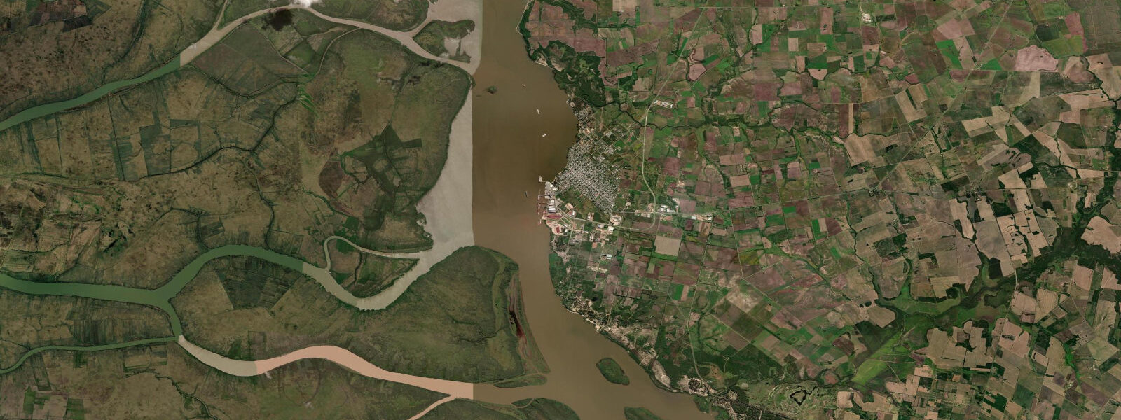
Nueva Palmira stands at the confluence of the Río Paraná and Río Uruguay where both rivers merge into the Río de la Plata estuary — one of the world's major grain export corridors. The port here is a free zone terminal handling soybeans, corn, and sunflower from the interior of Argentina and Bolivia down the Paraná-Paraguay waterway. Bulk carrier traffic in the channel off Nueva Palmira is constant, and the sight of ocean-going vessels navigating a river that looks too narrow for them is one of the defining visual experiences of the Uruguayan estuary coast.
The tidal pattern here is estuarine rather than open-coast: the Río de la Plata does not experience classical ocean tides. Water level is primarily driven by wind setup — sustained southeast winds (sudestadas) raise water level by 1–3 m along the western shore; persistent northwest winds lower it by a comparable amount. Open-Meteo Marine provides forecast data — the ±45-minute timing and ±0.2–0.3 m height accuracy applies to the modelled tidal component, but the wind-driven component at this location can exceed 2 m and is the dominant variable. Users should check both tidal and meteorological forecasts for accurate operational planning.
For anglers, Nueva Palmira and the surrounding Colonia and Soriano departments hold some of the finest river fishing in Uruguay. Dorado (Salminus brasiliensis) — a powerful, golden-flanked fish that fights on a fly like nothing else in South American freshwater — run the Río Uruguay and the Paraná delta channels 15–40 km upstream of the confluence. Pejerrey (silverside, Odontesthes bonariensis) school in the estuary margins and are caught in quantity from the town costanera and from small boats drifting the channel edges. Bagre (catfish species, including the large surubí) work the deeper river channel.
For photography, the grain elevator complex on the riverbank and the container cranes above the free zone terminal give Nueva Palmira an industrial-river aesthetic distinct from the country villa tourism of adjacent Carmelo. Dawn light on the channel from the costanera, with a grain carrier at anchor mid-river and the Entre Ríos province flatlands of Argentina beyond, is a flat-horizon river scene of considerable scale.
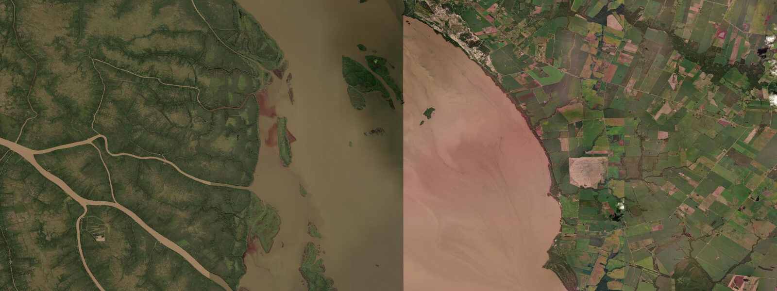
Beach families should be aware that the costanera beach is a brown-water river beach rather than a sea beach. The river water carries suspended sediment and is brown-coloured year-round. It's safe to swim but aesthetically different from an ocean beach. Families seeking a beach experience typically drive 25 km south to the Río de la Plata beaches at Conchillas or Playa Monjolo.
Tide questions about Nueva Palmira, Uruguay
Quick answers to the most common questions about tide times, range, and water access at Nueva Palmira, Uruguay.
How do river conditions and wind affect water levels at Nueva Palmira?
Nueva Palmira sits at the junction of two major rivers entering the Río de la Plata estuary. Unlike open-coast locations, the dominant water-level driver here is wind rather than astronomical tide. A sustained southeast wind (sudestada) raises water levels by 1–3 m along the western estuary shore within 12–24 hours; northwest winds lower levels. The modelled tidal component from Open-Meteo Marine carries ±45-minute timing and ±0.2–0.3 m height accuracy, but wind setup at this location routinely exceeds that range. Check the regional meteorological forecast (SMN Argentina or INUMET Uruguay) alongside the tide forecast for operational planning. Spring flood pulses on the Paraná and Uruguay rivers can raise levels by 4–6 m above normal in exceptional years.
What is dorado fishing like near Nueva Palmira?
Dorado (Salminus brasiliensis) are the primary target species for sport fishers at this confluence. The fish run the Río Uruguay and Paraná channels from October through April, peaking around February–March when water temperatures are warmest. Average fish in the 2–5 kg range are caught regularly; specimens above 10 kg are taken by experienced guides working the faster current seams and rocky structures upstream of the confluence. Fly fishing with large streamer patterns works, as does spinning with jigs and surface plugs. Local fishing guides operating from Carmelo (20 km east) and from puestos along the Río Uruguay are the most efficient access point for productive dorado water.
Can I watch large ships from the Nueva Palmira costanera?
The bulk carrier and barge traffic on the Paraná and Uruguay channels is close to the costanera — vessels navigating the dredged channel pass within 500 m to 1 km of the shore. The ships include Panamax-class bulk carriers loading soybeans at the free-zone terminal and long barge trains (empujadores) from the Hidrovía Paraguay-Paraná system. The scale of a 200-metre bulk carrier in a river context is dramatic. The port terminal cranes and grain silos on the waterfront are visually distinct from Uruguay's coastal landscapes further south and east. The costanera promenade is public access; the port itself is a restricted free-zone and not open to casual visitors.
What bird species can be seen around Nueva Palmira?
The river confluence and adjacent wetlands support a strong list of riparian and wetland species. Giant kingfisher and ringed kingfisher work the river margins; neotropical cormorant and snowy egret are constant. The islands and sandbanks mid-river hold Coscoroba swan and black-necked swan on migration. Yellow-billed cardinal, firewood-gatherer, and monk parakeet are year-round residents in the riverside tree lines. The Bañados del Santa Lucía and the Paraná delta wetlands to the north hold the more secretive species — limpkin, stripe-backed bittern, and sungrebe — requiring early morning boat access.
What else is worth visiting near Nueva Palmira?
Carmelo, 20 km east along the Colonia coast, has a marina, wine estancias (the Uruguayan Colonia department is one of South America's emerging wine regions), and a calmer colonial-era atmosphere than the industrial port town. The UNESCO World Heritage site of Colonia del Sacramento is 60 km east — a well-preserved Portuguese colonial town on a rocky peninsula with cobblestone streets and 18th-century buildings that works as a full-day excursion. The Isla de Martín García, a small Argentine island at the Paraná-Uruguay confluence, is accessible by ferry from Tigre (Argentina) and requires Argentine entry logistics — a half-day excursion for those already in the area.
7-day tide table — Nueva Palmira, Uruguay
Heights relative to MSL. Predictions: Open-Meteo Marine (MeteoFrance SMOC, 0.08° grid) — heights relative to MSL (not chart datum / LAT). Model-derived.
| Day | Type | Time | Height |
|---|---|---|---|
| Sat 04 Jul | High | 01:13 | 0.3m |
| Low | 03:12 | 0.2m | |
| High | 05:54 | 0.3m | |
| Low | 06:45 | 0.3m | |
| High | 09:38 | 0.6m | |
| Low | 16:21 | -0.2m | |
| Low | 18:47 | -0.1m | |
| High | 22:25 | 0.2m | |
| Sun 05 Jul | Low | 04:00 | 0.2m |
| High | 06:50 | 0.3m | |
| Low | 20:18 | -0.3m | |
| High | 23:11 | -0.0m | |
| Mon 06 Jul | Low | 00:46 | -0.1m |
| High | 11:20 | 0.6m | |
| Low | 18:16 | -0.1m | |
| Low | 21:05 | -0.2m | |
| High | 23:53 | 0.1m | |
| Tue 07 Jul | Low | 05:35 | -0.1m |
| High | 12:13 | 0.4m | |
| Low | 19:18 | -0.3m | |
| High | 19:38 | -0.2m | |
| Low | 22:04 | -0.4m | |
| Wed 08 Jul | High | 00:40 | -0.2m |
| Low | 03:15 | -0.3m | |
| High | 04:00 | -0.3m | |
| Low | 06:36 | -0.4m | |
| High | 09:12 | -0.3m | |
| Low | 09:47 | -0.3m | |
| High | 13:20 | 0.1m | |
| Low | 19:05 | -0.2m | |
| Thu 09 Jul | High | 01:46 | 0.2m |
| Low | 07:16 | 0.1m | |
| High | 10:12 | 0.3m | |
| Low | 10:43 | 0.2m | |
| High | 14:05 | 0.6m | |
| Low | 23:58 | -0.1m | |
| Fri 10 Jul | High | 02:06 | 0.1m |
| Low | 08:24 | -0.3m | |
| High | 15:21 | 0.3m | |
| High | 18:07 | 0.3m | |
| Low | 20:00 | 0.2m |