José Ignacio tide times
José Ignacio tide forecast — heights relative to MSL.
Today's tide times for José Ignacio
Tide times at José Ignacio on Sunday, 21 June 2026: first low tide at 07:37am, first high tide at 11:42am, second low tide at 08:18pm. Sunrise 07:46am, sunset 05:34pm.
Tide chart for José Ignacio
24-hour cosine-interpolated curve around the present moment. Heights relative to MSL. Predictions: Predictions: Open-Meteo Marine (MeteoFrance SMOC, 0.08° grid).
Sun, moon and conditions on Sun 21 Jun
Snapshot at build time — refreshes daily. Sea state from Open-Meteo Marine.
Highs and lows next 7 days
Every predicted high and low for the next week, with the daily tidal coefficient (0–120; higher = bigger swing, > 95 means stronger currents).
Other spots nearby
The three closest curated TideTurtle locations to José Ignacio, measured by great-circle distance.
Today's solunar windows
Solunar tradition: major periods are the ≈3h windows around moon transit and opposition; minor are ≈2h around moonrise and moonset. Pair with the local tide stage and wind for the best read.
Cycle dates near José Ignacio
Next spring tide on Fri 26 Jun (range 0.6m). Next neap on Thu 25 Jun.
Spring tides cluster around new and full moons (biggest swings). Neap tides land on quarter moons (smallest swings). See the spring tide and neap tide glossary entries for the why.
About tides at José Ignacio
A short guide to the coastline at José Ignacio — geography, sea state, and what the tide is actually doing under your feet.
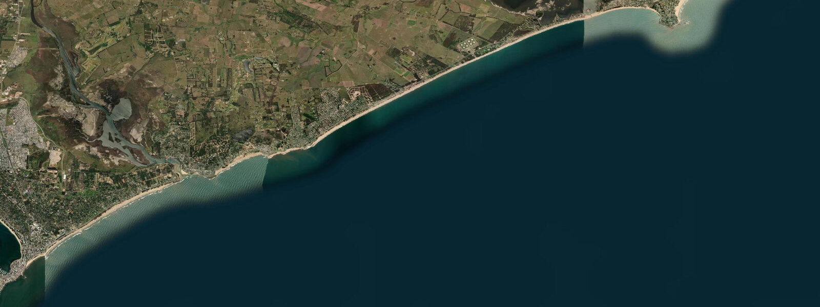
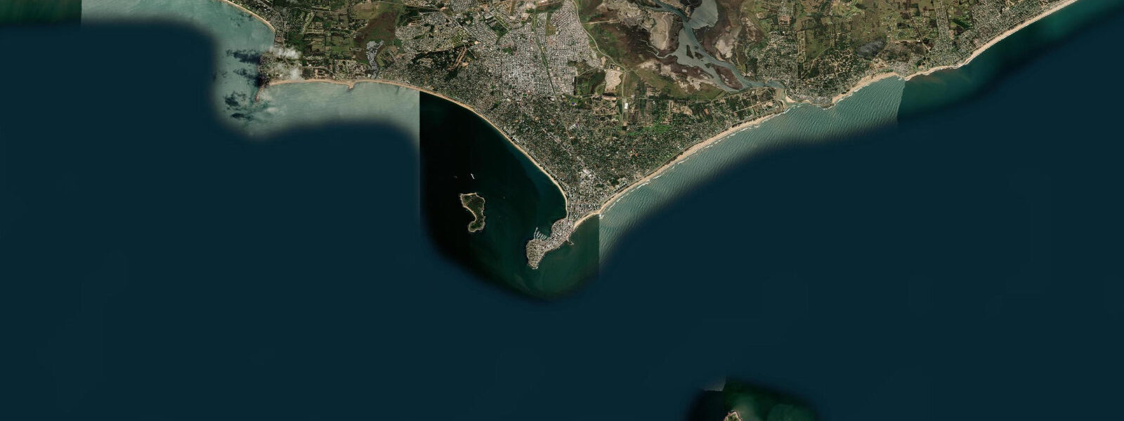
José Ignacio is a coastal village 100 km northeast of Montevideo and 35 km east of Punta del Este, at the tip of a low rocky headland where the Atlantic coast turns slightly northward. The village proper is small — a few hundred permanent residents — but it has developed a reputation as an upscale summer destination that draws a mix of Uruguayan and Argentine visitors and, since the 2000s, an international contingent attracted by the low-key luxury of the place. The lighthouse at the headland tip is the reference landmark.
The tidal regime at José Ignacio is semidiurnal, spring range approximately 1.1–1.5 m above Chart Datum — slightly larger than Punta del Este, consistent with the modest increase in range moving northeast toward the Brazilian border. SOHMA publishes tide data for this coast; José Ignacio itself does not have a permanent gauge but is interpolated from the Punta del Este and La Paloma reference stations.
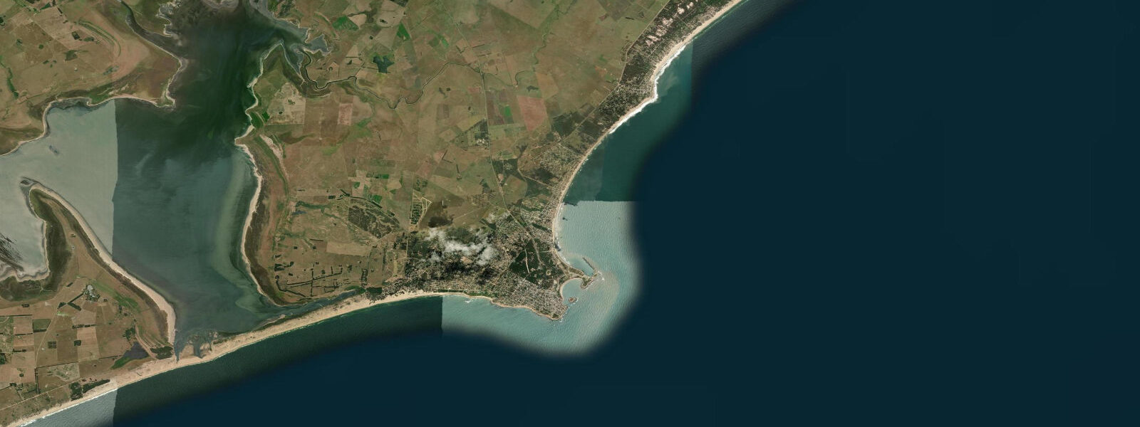
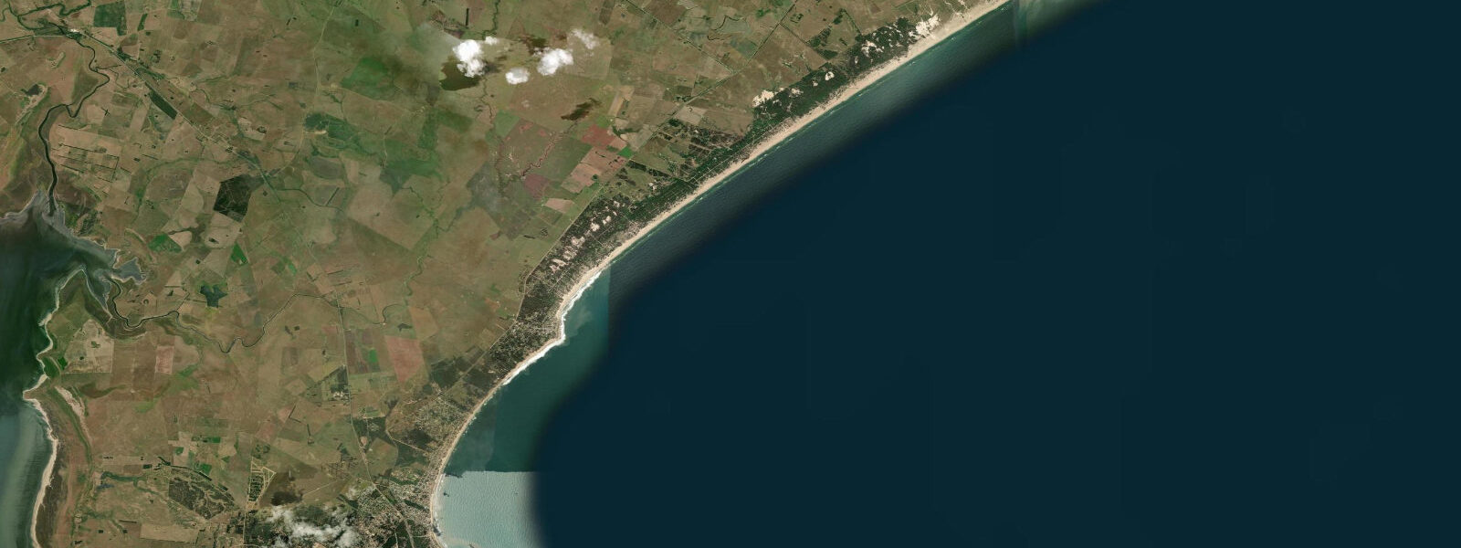
The headland at José Ignacio divides two distinctly different coastal environments. The east side — facing the open Atlantic — is exposed to SE and E groundswell; the beach here (Playa de los Botes) is narrower, rocky at the base, and delivers consistent if rough surf conditions. The west side (Playa Mansa at José Ignacio) faces NW across a protected bay; the water is calmer, warmer, and more suitable for paddling and casual swimming. The lagoon at Laguna Garzón, 5 km west of José Ignacio, adds a third character — a productive estuarine system where the tide drives water through a narrow channel between the lagoon and the sea.
Laguna Garzón is one of the most productive fishing environments on the Uruguayan coast. The lagoon mouth is a seasonal channel; depending on rainfall and wind, the bar opens and closes, connecting the 100 km² lagoon to the sea. When the bar is open, the tidal exchange through the narrow channel concentrates corvina (Micropogonias furnieri), pejerrey (Odontesthes argentinensis), and lisa (mullet). Shore fishing at the channel mouth on the incoming tide — the two-to-three hour window after the predicted low — is highly productive when the channel is open. The bar status varies seasonally and after heavy rain; check locally before making the trip specifically for the channel fishing.
The circular 'living bridge' over the lagoon channel at Laguna Garzón — a pedestrian wooden bridge designed by Rafael Viñoly — has become an attraction in itself. The bridge is positioned over the narrowest section of the channel where tidal current runs strongest; the water beneath the bridge runs 1.0–2.0 knots at springs when the bar is open.
Playa Brava (the exposed Atlantic side east of the lighthouse) works best on the incoming tide mid-morning when swell shape is cleanest. The headland produces a mild acceleration of tidal current around its tip, particularly at springs; swimmers and paddlers should be aware of this current at the headland itself. Tide predictions here come from Open-Meteo Marine: accuracy ±45 min / ±0.2–0.3 m. SOHMA is the official source for Uruguayan tides.
The lighthouse at José Ignacio's headland tip has become an iconic image for the village; the white tower is photographed from both the Atlantic and estuary sides. The lighthouse base is accessible by foot from the main road; at low water the rocky shelf at the lighthouse base is exposed and the tidepools are accessible. The exposed shelf on the Atlantic side carries sea urchins, chitons, and small hermit crabs in the surge channels.
The seasonal population of José Ignacio peaks in January — Uruguayan and Argentine summer — when the village fills with the specific mix of artists, writers, and internationally recognised visitors that has generated its reputation. Outside January the village returns to its year-round character of a few hundred residents, a fishing fleet, and the lighthouse. The combination of the empty beach in winter (May–September), the low-amplitude Atlantic swell, and the lagoon fishing makes José Ignacio equally appealing outside the peak season.
Tide questions about José Ignacio
Quick answers to the most common questions about tide times, range, and water access at José Ignacio.
Is the Laguna Garzón channel always open to the sea?
No. The Laguna Garzón bar opens and closes seasonally depending on rainfall, wind, and wave conditions. When the bar is open, tidal exchange through the narrow channel is significant and the fishing at the channel mouth is excellent. After prolonged dry periods or sustained offshore winds, the bar can close completely, cutting tidal exchange. Before making the trip specifically to fish the channel, check with local fishing operators or the José Ignacio municipality on current bar status. Local fishing operators in José Ignacio maintain contact with the coastguard through the main Punta del Este VHF channel.
Where do the tide predictions on this page come from?
Open-Meteo Marine, a free gridded global ocean model. Accuracy is typically ±45 minutes on timing and ±0.2–0.3 m on height. José Ignacio does not have its own permanent tide gauge; official predictions for this stretch of coast are interpolated from SOHMA (Servicio de Oceanografía, Hidrografía y Meteorología de la Armada) reference stations at Punta del Este and La Paloma. For navigation, use SOHMA data. This page is not for navigation. The SOHMA tide tables are published annually and available from the Uruguayan Navy Hydrographic Service website.
What is the best fishing window at Laguna Garzón channel?
When the bar is open, the most productive window for shore fishing at the channel mouth is the incoming tide — from roughly one hour after the predicted low to two hours before the predicted high. The flooding tide moves bait fish in from the sea into the lagoon mouth; corvina, pejerrey, and lisa concentrate at the channel entrance to feed. The channel itself runs 1.0–2.0 knots at springs; casting into the channel from the bank and fishing the current seam between the channel and the shallower lagoon margin produces the most consistent results. The angler tradition in José Ignacio rates the morning incoming tide as superior to the afternoon; current and temperature tend to be more stable.
What is the sea temperature at José Ignacio?
Sea temperatures at José Ignacio follow the South Atlantic seasonal cycle: 16–19°C in winter (June–September) and 22–25°C in summer (December–March). The Atlantic side of the headland can run slightly cooler than the sheltered Playa Mansa side during S-wind upwelling events. Uruguay's Atlantic coast is significantly cooler than Brazil's to the northeast; the Plata influence moderates the temperature on the western, lagoon-side beaches. South Atlantic water temperatures at José Ignacio run slightly cooler on the exposed Atlantic side than the Laguna Garzón water, which retains heat in summer.
Is there a rip current risk at José Ignacio's Atlantic beach?
Yes. Playa de los Botes on the exposed Atlantic side of the headland develops rip currents between sand banks, particularly at mid-tide on a moderate-to-large SE swell. The headland itself creates a circulation cell that concentrates rip flow around its base. Swim at the sheltered Playa Mansa on the western side if conditions on the Atlantic side are unsettled. There are no permanent lifeguards at José Ignacio; assess conditions before entering the water. The Atlantic-side beach at José Ignacio has no permanent red-flag warning system; assess conditions independently before entering.
7-day tide table — José Ignacio
Heights relative to MSL. Predictions: Open-Meteo Marine (MeteoFrance SMOC, 0.08° grid) — heights relative to MSL (not chart datum / LAT). Model-derived.
| Day | Type | Time | Height |
|---|---|---|---|
| Sun 21 Jun | Low | 07:37 | -0.3m |
| High | 11:42 | 0.1m | |
| Low | 20:18 | -0.2m | |
| Mon 22 Jun | High | 00:07 | 0.1m |
| Low | 01:54 | 0.1m | |
| High | 13:00 | 0.4m | |
| Tue 23 Jun | High | 01:04 | 0.5m |
| Low | 10:07 | 0.3m | |
| High | 13:23 | 0.5m | |
| Low | 22:42 | 0.1m | |
| Wed 24 Jun | High | 02:00 | 0.3m |
| Low | 10:52 | 0.2m | |
| High | 14:24 | 0.5m | |
| Low | 23:46 | 0.1m | |
| Thu 25 Jun | High | 02:38 | 0.3m |
| Low | 11:54 | 0.0m | |
| High | 15:06 | 0.3m | |
| Fri 26 Jun | Low | 00:24 | -0.1m |
| High | 10:00 | -0.0m | |
| Low | 12:48 | -0.1m | |
| High | 15:56 | 0.1m | |
| Low | 21:10 | -0.1m | |
| High | 22:00 | -0.1m | |
| Sat 27 Jun | Low | 01:16 | -0.3m |
| High | 17:07 | 0.3m |