Block Island, RI tide times
Block Island, RI tide forecast — heights relative to MSL.
Today's tide times for Block Island, RI
Tide times at Block Island, RI on Friday, 19 June 2026: first low tide at 05:36am, first high tide at 11:42am, second low tide at 05:55pm, second high tide at 11:43pm. Sunrise 05:13am, sunset 08:21pm.
Tide chart for Block Island, RI
24-hour cosine-interpolated curve around the present moment. Heights relative to MSL. Predictions: Predictions: Open-Meteo Marine (MeteoFrance SMOC, 0.08° grid).
Sun, moon and conditions on Fri 19 Jun
Snapshot at build time — refreshes daily. Sea state from Open-Meteo Marine.
Highs and lows next 7 days
Every predicted high and low for the next week, with the daily tidal coefficient (0–120; higher = bigger swing, > 95 means stronger currents).
Other spots nearby
The three closest curated TideTurtle locations to Block Island, RI, measured by great-circle distance.
Today's solunar windows
Solunar tradition: major periods are the ≈3h windows around moon transit and opposition; minor are ≈2h around moonrise and moonset. Pair with the local tide stage and wind for the best read.
Cycle dates near Block Island, RI
Last spring tide on Thu 18 Jun (range 1.0m / 3.4ft). Next neap on Wed 24 Jun.
Spring tides cluster around new and full moons (biggest swings). Neap tides land on quarter moons (smallest swings). See the spring tide and neap tide glossary entries for the why.
About tides at Block Island, RI
A short guide to the coastline at Block Island, RI — geography, sea state, and what the tide is actually doing under your feet.
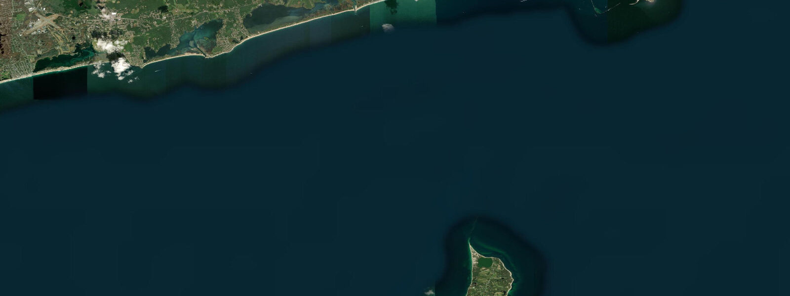
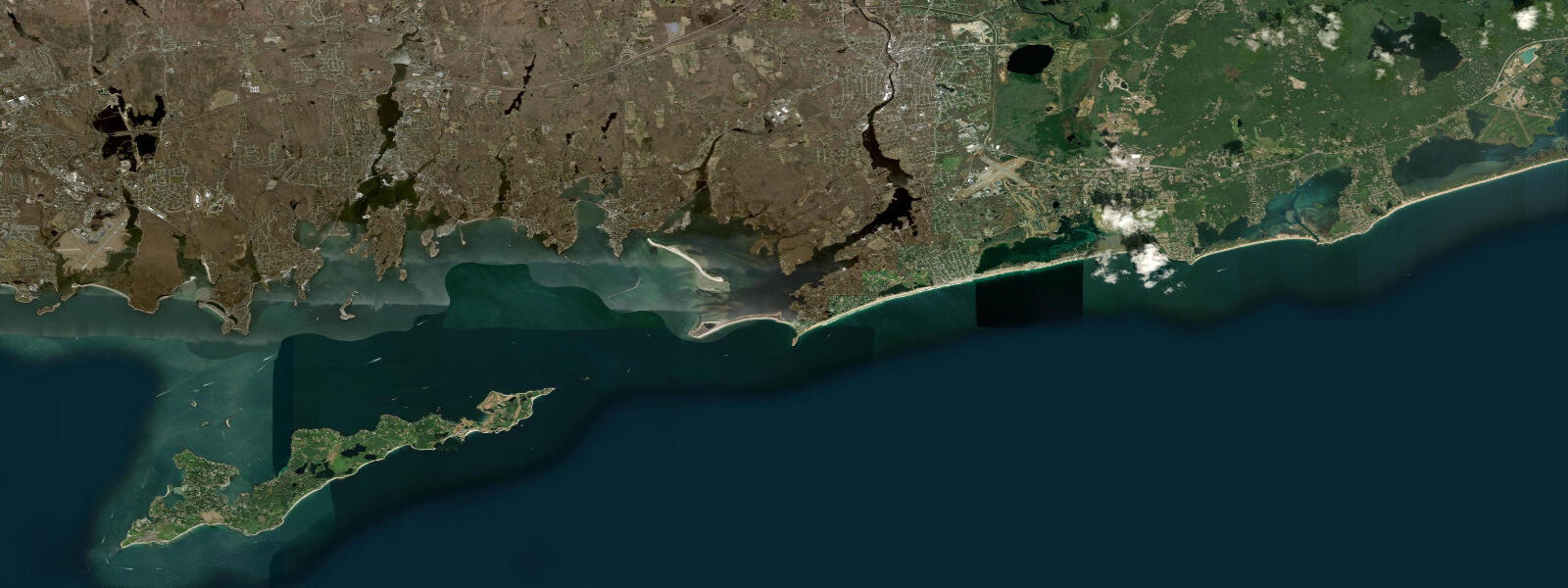
Block Island sits 21 kilometres south of Point Judith in Block Island Sound, isolated enough from the mainland to have developed a distinct ecology and character. The tidal regime here reflects the island's open Atlantic position: mean spring range is around 0.7 metres — lower than the Rhode Island mainland coast because the island's offshore location is less influenced by the tidal amplification in Narragansett Bay. The twice-daily cycle is regular but subtle, and the primary water-level driver on storm days is wind setup rather than the astronomical tide.
The Great Salt Pond occupies the northwestern third of the island — a 1.5-square-kilometre sheltered harbour enclosed by a narrow barrier beach, with the entrance channel through the Cut at the northwest corner. The Cut is the tidal exchange point for the entire salt pond, and the current through it runs to 2 knots on spring tides. The ferry from Point Judith enters the Great Salt Pond through the Cut and ties up at Old Harbor on the east side of the island; boats anchored in the pond use the Cut timing for entry and exit. New Harbor on the Salt Pond is the active marina and anchorage hub for cruising yachts.
Old Harbor is the traditional commercial and social centre — the Victorian-era hotel district, ferry dock, and main street shops are all concentrated in the few blocks above the east-facing beach. Southeast Light (1875, one of the most powerful lighthouses on the Atlantic coast at 67 metres above sea level on the Mohegan Bluffs) was moved 30 metres inland in 1993 as coastal erosion threatened its foundation — the bluffs actively erode at approximately 1 metre per year.
The Mohegan Bluffs on the south coast are a 12-kilometre line of clay and sand cliffs 20 to 30 metres high, with a staircase descent to the beach below. At low water, the rocky ledge platform below the bluffs extends 50 to 80 metres offshore and supports good tide pool communities. The exposed ledge is accessible for about 2 hours either side of low water before the incoming tide covers the lower sections.
Block Island is one of the most important bird migration stopovers in New England. The island's isolated position in the Atlantic concentrates tired migrants during northeast wind events in autumn — rare and uncommon species including Connecticut warblers, Philadelphia vireos, and western rarities appear annually. The Nature Conservancy owns approximately 40% of the island in protected land. The combination of lighthouse, Mohegan Bluffs, and freshwater ponds (Sands Pond, Fresh Pond) provides diverse habitat.
Surf casting from the southern beaches and the rocky shoreline at Sandy Point (north) produces striped bass from late May through October. The current rips off the southwest corner where Sound and open Atlantic tidal streams meet are productive for bass and bluefish when the current is running. The Block Island chapter of the Saltwater Anglers of Rhode Island has traditional spots documented over decades.
Predictions on this page come from Open-Meteo Marine, a gridded global ocean model. Accuracy is typically within plus or minus 45 minutes on timing and 0.2 to 0.3 metres on height — model-derived, not from a local gauge. For authoritative US tide data, consult NOAA CO-OPS at tidesandcurrents.noaa.gov.
Tide questions about Block Island, RI
Quick answers to the most common questions about tide times, range, and water access at Block Island, RI.
How do I get to Block Island?
Interstate Navigation (Block Island Ferry) runs from Galilee, Rhode Island year-round — 1 hour 10 minutes traditional ferry, 30 minutes high-speed. Summer service also runs from New London, CT (Nelseco, 2 hours); Newport, RI (BI Ferry, seasonal); and Fall River, MA. Car transport is possible on the traditional ferry from Galilee — reservations essential in summer. The island's compact size and bike rentals make car transport optional. The ferry landing is at Old Harbor on the east side of the island.
Can I anchor in the Great Salt Pond?
Yes. The Great Salt Pond (New Harbor) is one of the most popular cruising anchorages in New England, with room for several hundred boats. The Cut entrance channel from Block Island Sound has a controlling depth of approximately 2.1 metres MLLW — most recreational keelboats can enter. Current through the Cut runs to 2 knots on spring tides; enter at or near slack water to avoid being set onto the channel walls. The town maintains a designated anchorage area and moorings are available through Block Island Boat Basin.
What wildlife can I see on Block Island?
Block Island is a globally significant Important Bird Area. Autumn migration (September-November) brings tens of thousands of land birds to the island in concentrations driven by NE wind events — rare warblers, sparrows, and thrushes appear reliably. The Nature Conservancy trails through the interior wetlands and ponds are the best birding areas. Harbor seals haul out on offshore rocks in winter. White-tailed deer are abundant. The offshore waters host bluefish, striped bass, and occasional bluefin tuna in season.
Are the Mohegan Bluffs accessible?
Yes, with effort. The bluffs are accessible via a marked staircase at the end of Mohegan Trail road — approximately 141 wooden steps down the 25-metre cliff face. The beach at the bottom is narrow at high water and widens to a rocky ledge platform at low water. The platform provides the best access to tide pools and is walkable for 2 hours either side of low water. The climb back up the stairs is strenuous. The bluffs erode actively — do not approach the cliff edge from the top, as the clay undercuts unpredictably.
Where can I surf fish on Block Island?
The southwest shore from Beane Point to Black Rock is the premier striped bass location — the current rip at the southwest corner concentrates fish on tidal transitions in spring and autumn. Sandy Point (north) is productive when north or northwest winds push baitfish against the shore. The beaches on the east side (Crescent Beach) produce bluefish during summer blitzes. The island enforces beach access rules for 4WD (Rover Bureau permit required for driving on the beach); most surf casters walk in. Fishing from boats: the 30-fathom curve south of the island holds large bass in late season.
7-day tide table — Block Island, RI
Heights relative to MSL. Predictions: Open-Meteo Marine (MeteoFrance SMOC, 0.08° grid) — heights relative to MSL (not chart datum / LAT). Model-derived.
| Day | Type | Time | Height |
|---|---|---|---|
| Fri 19 Jun | Low | 05:36 | -1.0m / -3.1ft |
| High | 11:42 | 0.1m / 0.2ft | |
| Low | 17:55 | -0.8m / -2.8ft | |
| High | 23:43 | 0.0m / 0.1ft | |
| Sat 20 Jun | Low | 06:40 | -1.0m / -3.2ft |
| High | 12:36 | 0.0m / 0.1ft | |
| Sun 21 Jun | Low | 07:40 | -0.9m / -3.1ft |
| High | 13:40 | 0.0m / 0.1ft | |
| Low | 20:37 | -0.8m / -2.6ft | |
| Mon 22 Jun | High | 01:45 | -0.1m / -0.4ft |
| Low | 08:35 | -0.9m / -3.0ft | |
| High | 14:55 | 0.1m / 0.3ft | |
| Tue 23 Jun | Low | 09:10 | -0.9m / -2.8ft |
| Wed 24 Jun | High | 03:38 | -0.3m / -0.9ft |
| Low | 09:54 | -0.9m / -3.0ft | |
| High | 16:34 | -0.0m / -0.1ft | |
| Low | 23:18 | -0.9m / -2.8ft | |
| Thu 25 Jun | High | 04:43 | -0.3m / -0.9ft |
| Low | 10:42 | -0.9m / -2.9ft | |
| High | 17:23 | -0.0m / -0.0ft | |
| Low | 19:00 | -0.2m / -0.6ft |