St. Simons Island, GA tide times
St. Simons Island, GA tide forecast — heights relative to MSL.
Today's tide times for St. Simons Island, GA
Tide times at St. Simons Island, GA on Sunday, 21 June 2026: first high tide at 01:15am, first low tide at 07:47am, second high tide at 01:55pm, second low tide at 08:26pm. Sunrise 06:22am, sunset 08:32pm.
Tide chart for St. Simons Island, GA
24-hour cosine-interpolated curve around the present moment. Heights relative to MSL. Predictions: Predictions: Open-Meteo Marine (MeteoFrance SMOC, 0.08° grid).
Sun, moon and conditions on Sun 21 Jun
Snapshot at build time — refreshes daily. Sea state from Open-Meteo Marine.
Highs and lows next 7 days
Every predicted high and low for the next week, with the daily tidal coefficient (0–120; higher = bigger swing, > 95 means stronger currents).
Other spots nearby
The three closest curated TideTurtle locations to St. Simons Island, GA, measured by great-circle distance.

Today's solunar windows
Solunar tradition: major periods are the ≈3h windows around moon transit and opposition; minor are ≈2h around moonrise and moonset. Pair with the local tide stage and wind for the best read.
Cycle dates near St. Simons Island, GA
Next spring tide on Mon 22 Jun (range 1.9m / 6.3ft). Next neap on Wed 24 Jun.
Spring tides cluster around new and full moons (biggest swings). Neap tides land on quarter moons (smallest swings). See the spring tide and neap tide glossary entries for the why.
About tides at St. Simons Island, GA
A short guide to the coastline at St. Simons Island, GA — geography, sea state, and what the tide is actually doing under your feet.
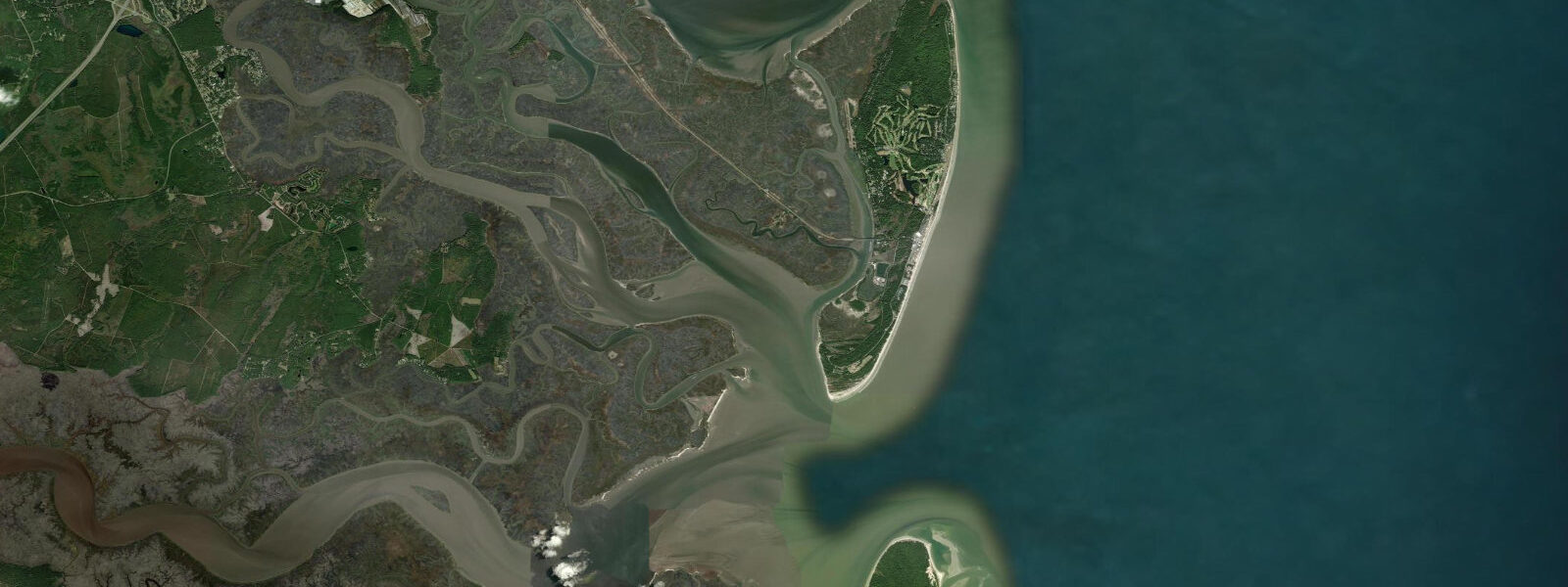
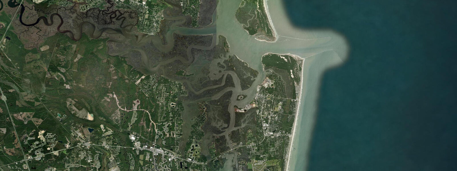
St. Simons Island is the largest of the Golden Isles, a group of barrier islands midway along the Georgia coast, linked to the mainland by a causeway and anchored on the north by the Brunswick River inlet. The tidal regime here is semidiurnal with a mean range of approximately 2.0 to 2.1 metres above MLLW and spring ranges approaching 2.5 metres — consistent with the large-range character of the Georgia coast as a whole. What distinguishes St. Simons from the more exposed Tybee is the layering of tidal environments: ocean beach on the east, Brunswick River tidal channel on the northwest, and an extensive network of tidal creeks and salt marsh on the back-island side, all draining on different timescales and with slightly different tidal timing.
The Brunswick River inlet at the northwest corner of the island connects St. Simons Sound to the Port of Brunswick — the second busiest port in Georgia and the third largest roll-on/roll-off vehicle port in the US. Tidal current in the main Brunswick shipping channel runs 1.0 to 2.0 knots on spring tides. The East River and the Mackay River on the south and west sides of St. Simons are tidal creeks of the scale and character that define the Georgia coast: Spanish-moss-draped live oaks lean over the water at the upper marsh edge, and at low tide the creek banks drop 1.5 to 2.0 metres from the high-water cordgrass to the exposed pluff mud — the dark, pungent clay that smells of hydrogen sulphide and supports the fiddler crabs and diamondback terrapins that form the base of the salt-marsh food web.
St. Simons Lighthouse, built in 1872 at the island's south tip, stands 49 metres above sea level and marks the entrance to St. Simons Sound from the Atlantic. The lighthouse museum is operated by the Coastal Georgia Historical Society and open for climbing; from the top, the full geometry of the tidal sound is visible — the wide Atlantic approach narrowing between Jekyll Island to the south and the St. Simons shoals to the north, with the Intracoastal Waterway channel threading behind both barriers. At low water, the tidal flats visible from the lighthouse tower extend hundreds of metres from the St. Simons shoreline toward the main channel.
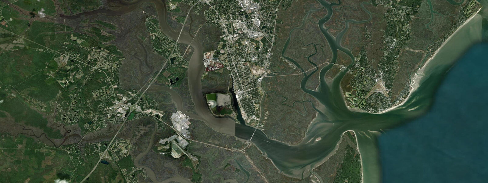
East Beach, the primary ocean beach on the Atlantic side of the island, faces east-southeast and receives attenuated Atlantic swell. The beach is wide at low tide — 50 to 70 metres of firm sand from the wrack line to the water's edge — and narrows noticeably at high water, especially during spring tides when the beach face above mean high water is narrow. The tidal pools exposed on the lower beach around spring low water hold sea lettuce, coquina clams, and small killifish. Neptune Park at the village pier provides the main beach access, and the public fishing pier at the south end of the park is active year-round for whiting, sheepshead, and flounder.
Anglers fishing the tidal creeks of St. Simons on the outgoing tide from kayaks or small flats boats routinely catch red drum and spotted seatrout in the 0.5 to 2.0 kg range on soft-plastic shrimp imitations. The drop from high marsh to exposed mud on the falling tide concentrates fish in the remaining channel water, making the last two hours of the ebb the most consistent window. Photographers targeting the live oak and Spanish-moss waterline landscapes will find the most dramatic compositions on the Mackay River and East River sides during the golden hour low tide, when the creek channels reflect the sky and the exposed mud banks provide foreground contrast. Families and paddlers use the protected creeks behind the island; the back-bay launch at the public boat ramp on Frederica Road is the most practical entry point for the tidal creek system.
Tide data here comes from Open-Meteo Marine, a global gridded ocean model. Typical accuracy is plus or minus 45 minutes on timing and 0.2 to 0.3 metres on height. For authoritative data, NOAA CO-OPS station 8679511 at Brunswick — 10 kilometres west of St. Simons — provides calibrated harmonic predictions; the tidal timing and range at St. Simons village closely tracks Brunswick.
Tide questions about St. Simons Island, GA
Quick answers to the most common questions about tide times, range, and water access at St. Simons Island, GA.
What is the tidal range at St. Simons Island?
Mean tidal range at St. Simons Island is approximately 2.0 to 2.1 metres above MLLW — semidiurnal, two highs and two lows each day. Spring tides near new and full moon approach 2.5 metres. The range is among the largest on the US Atlantic coast, produced by Georgia's wide continental shelf amplifying the tidal wave before it reaches the barrier islands. Neap tides drop to roughly 1.3 metres. The closest NOAA reference station is Brunswick (station 8679511), 10 kilometres west; tidal timing and range at St. Simons closely tracks that station.
What is the best tide for fishing the tidal creeks on St. Simons?
The outgoing (ebb) tide is the prime window for red drum and spotted seatrout in the back-island tidal creeks. As water level drops, fish that have spread across the shallow marsh grass on the flood are pushed into the deeper creek channels by the falling water. The last 90 minutes of the ebb concentrates fish in the channel — soft-plastic shrimp or paddle-tail lures worked along the creek bank edges on a 1/4 oz jig head is the standard technique. The Mackay River and East River systems on the west and south sides of the island are the most productive areas accessible by kayak.
Can I climb the St. Simons Lighthouse?
Yes. The St. Simons Lighthouse and Museum, operated by the Coastal Georgia Historical Society, is open to the public for climbing (129 steps to the top). Admission is charged; check current hours with the historical society as they vary seasonally. The lighthouse sits at the south tip of the island at 149 Lighthouse Drive. From the top, the full tidal geometry of St. Simons Sound is visible, including the shipping channel, Jekyll Island, and the exposed tidal flats at low water. The grounds around the lighthouse are accessible without admission.
Is East Beach on St. Simons Island suitable for swimming?
East Beach is an ocean-facing Atlantic beach with generally mild surf — swell energy is lower here than on exposed Florida and South Carolina ocean beaches because St. Simons is set back slightly behind the sound geometry. The beach is wider and calmer at low tide; during spring high tides the beach narrows and surf can reach the dune base. Neptune Park maintains lifeguard coverage in summer. The beach is not patrolled in the off-season. Rip currents can develop at the pier and at the south end of the beach where the tidal current from St. Simons Sound meets the surf line — check conditions with lifeguards or the local fire department before swimming.
Is this tide data safe to use for boating in St. Simons Sound or Brunswick shipping channel?
No. Open-Meteo Marine gridded predictions are not a substitute for official NOAA tide and current data in these waters. St. Simons Sound and the Brunswick River carry commercial vessel traffic including large roll-on/roll-off car carriers. Tidal current in the main channel runs 1.0 to 2.0 knots on spring tides, and the shoals on the St. Simons bar require knowledge of current tide state for safe transit. Use NOAA Chart 11506, NOAA CO-OPS station 8679511 (Brunswick) for tide heights, and NOAA's tidal current predictions for the Brunswick entrance. Monitor VHF Channel 16 and contact Brunswick VTS on VHF 13 when transiting the commercial channel.
7-day tide table — St. Simons Island, GA
Heights relative to MSL. Predictions: Open-Meteo Marine (MeteoFrance SMOC, 0.08° grid) — heights relative to MSL (not chart datum / LAT). Model-derived.
| Day | Type | Time | Height |
|---|---|---|---|
| Sun 21 Jun | High | 01:15 | 0.6m / 1.8ft |
| Low | 07:47 | -1.3m / -4.3ft | |
| High | 13:55 | 0.5m / 1.8ft | |
| Low | 20:26 | -1.2m / -3.9ft | |
| Mon 22 Jun | High | 02:08 | 0.4m / 1.3ft |
| Low | 08:40 | -1.4m / -4.6ft | |
| High | 14:51 | 0.5m / 1.5ft | |
| Low | 21:23 | -1.2m / -4.1ft | |
| Tue 23 Jun | High | 03:17 | 0.1m / 0.5ft |
| Low | 09:36 | -1.5m / -4.9ft | |
| High | 15:50 | 0.4m / 1.4ft | |
| Low | 22:13 | -1.3m / -4.3ft | |
| Wed 24 Jun | High | 04:03 | 0.1m / 0.4ft |
| Low | 10:21 | -1.3m / -4.4ft | |
| High | 16:48 | 0.6m / 1.8ft | |
| Low | 23:10 | -1.1m / -3.8ft | |
| Thu 25 Jun | High | 05:04 | 0.2m / 0.7ft |
| Low | 11:09 | -1.3m / -4.2ft | |
| High | 17:32 | 0.6m / 1.8ft | |
| Fri 26 Jun | Low | 00:04 | -1.2m / -3.9ft |
| High | 05:57 | 0.1m / 0.5ft | |
| Low | 11:54 | -1.3m / -4.3ft | |
| High | 18:14 | 0.6m / 1.8ft | |
| Sat 27 Jun | Low | 00:47 | -1.3m / -4.2ft |
| High | 06:38 | 0.1m / 0.3ft | |
| Low | 12:35 | -1.3m / -4.3ft | |
| High | 19:00 | 0.6m / 2.0ft |