Savannah, GA tide times
Savannah, GA tide forecast — heights relative to MSL.
Tide chart for Savannah, GA
24-hour cosine-interpolated curve around the present moment. Heights relative to MSL. Predictions: Predictions: Open-Meteo Marine (MeteoFrance SMOC, 0.08° grid).
Sun, moon and conditions on Sun 21 Jun
Snapshot at build time — refreshes daily. Sea state from Open-Meteo Marine.
Highs and lows next 7 days
Every predicted high and low for the next week, with the daily tidal coefficient (0–120; higher = bigger swing, > 95 means stronger currents).
Other spots nearby
The three closest curated TideTurtle locations to Savannah, GA, measured by great-circle distance.
Today's solunar windows
Solunar tradition: major periods are the ≈3h windows around moon transit and opposition; minor are ≈2h around moonrise and moonset. Pair with the local tide stage and wind for the best read.
About tides at Savannah, GA
A short guide to the coastline at Savannah, GA — geography, sea state, and what the tide is actually doing under your feet.
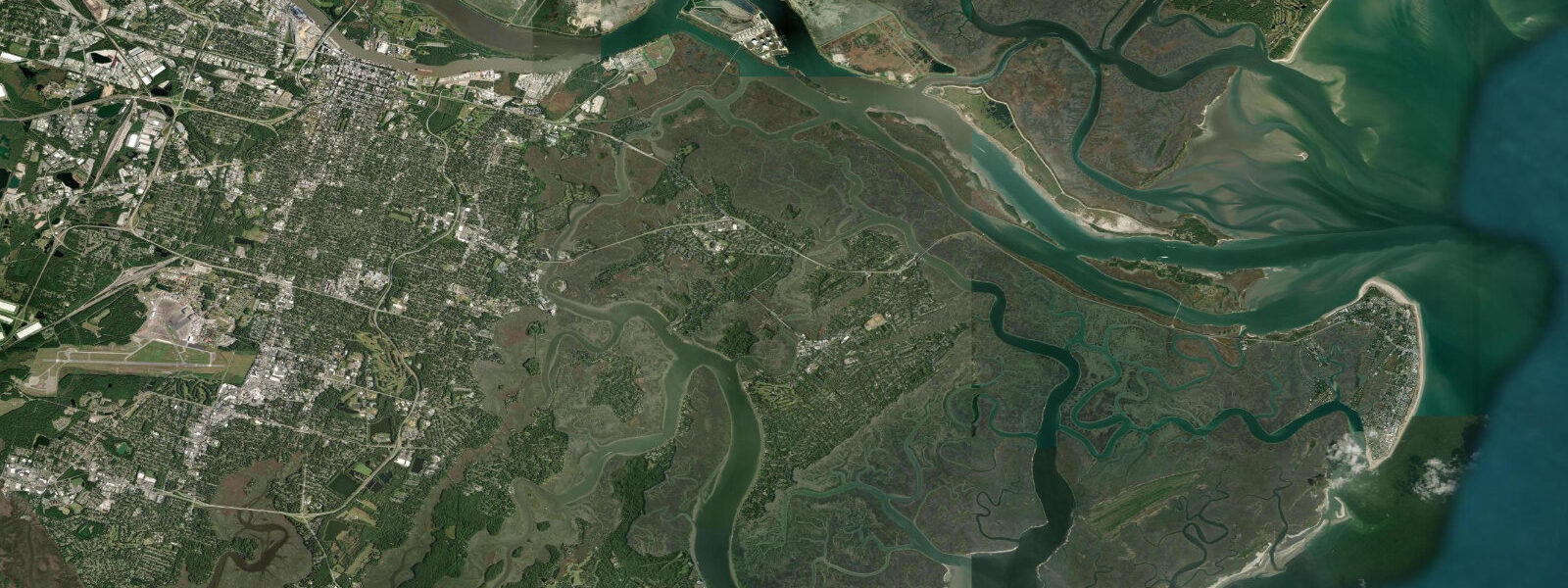
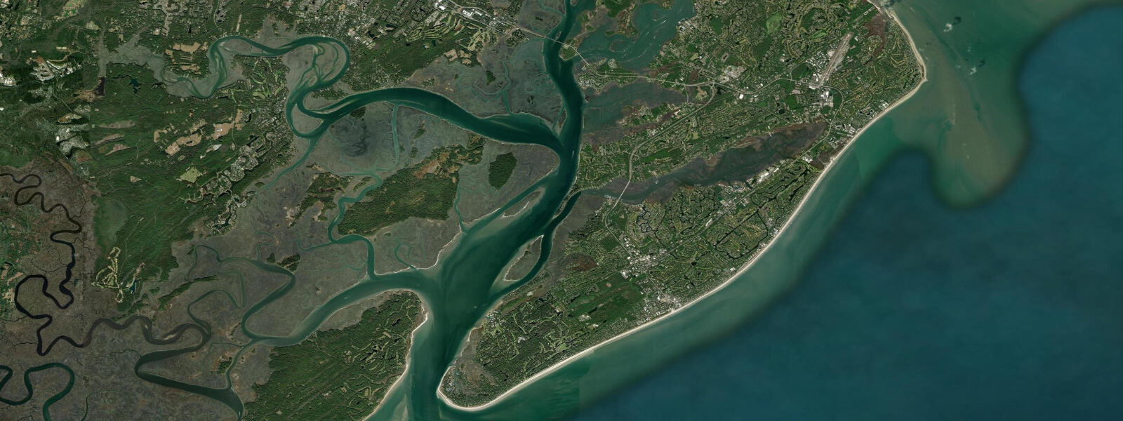
Savannah sits on a 15-metre bluff above the south bank of the Savannah River, 29 kilometres from the Atlantic at Tybee Island. The river is tidal all the way through the city and well upstream: the tidal wave travels roughly 50 kilometres inland from the coast, and the mean tidal range at the Savannah port approaches 2.1 metres, with spring ranges reaching 2.7 metres above MLLW. That range places Savannah among the largest semidiurnal tidal environments on the US East Coast — a fact that surprised early European colonists accustomed to the smaller ranges of the mid-Atlantic and New England shores.
The Savannah River generates tidal currents of 1.5 to 2.5 knots in the main navigation channel, reversing direction roughly every six hours. The Port of Savannah, operated by the Georgia Ports Authority, is one of the busiest container ports on the US East Coast; deep-draft vessels (up to 18 metres loaded) transit the river on tide-sensitive windows following the Army Corps of Engineers' ongoing deepening project. The turning basin south of the Talmadge Memorial Bridge is where container ships pivot under tug escort — timing these manoeuvres to the tidal current is the harbour pilot's primary logistical constraint.
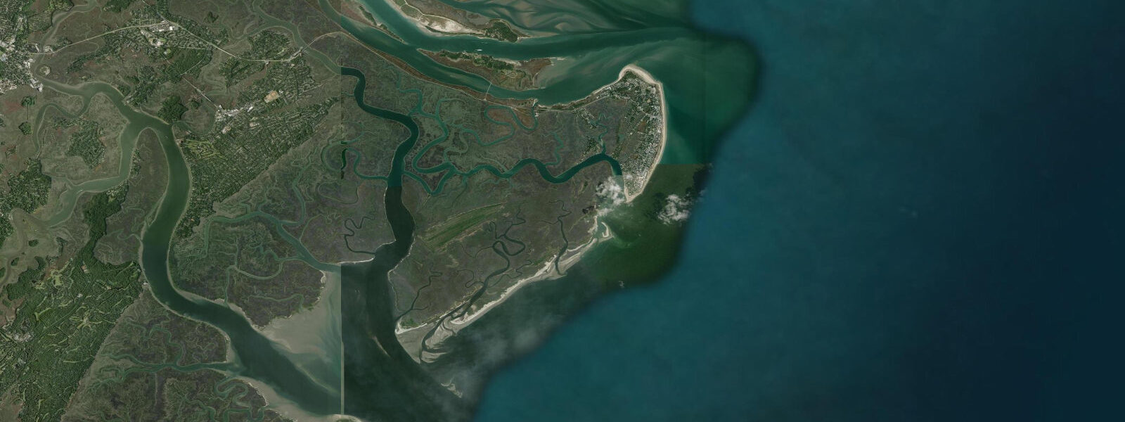
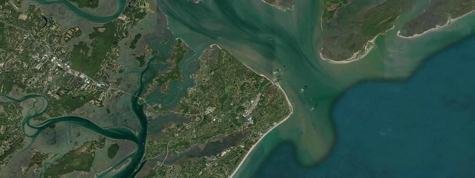
Fort Pulaski National Monument, 24 kilometres downriver at the river mouth, is a brick fortification completed in 1847 and surrounded by a tidal moat. In April 1862, Union rifled artillery at a distance of 1,600 metres breached the 1.8-metre walls in 30 hours, demonstrating that rifled cannon had made masonry fortifications obsolete — a turning point in military engineering history. The moat floods and empties with each tide, and the restored earthworks and marshes around the fort are accessible on self-guided trails at any tidal state. At low water, the mudflats along the river channel east of the fort expose extensive oyster reef — a habitat visible from the fort's sally port rampart.
River Street along the Savannah waterfront runs at river level, below the bluff, on the cobblestoned ramp of the old cotton factor warehouses. High tides in the 2.5 to 2.7 m spring range can lap the lower cobblestones and occasionally overtop the curb fronting the bars and restaurants during strong onshore wind combined with a spring high. The Savannah flood history is well-documented; the city experiences minor tidal flooding a handful of times per year, increasing with sea-level rise of approximately 3.5 mm per year recorded at the Fort Pulaski NOAA gauge (station 8670870).
For anglers, the outgoing tide on the lower Savannah River and the tidal creeks of Savannah National Wildlife Refuge (north bank, across the state line in South Carolina) produces consistent red drum and spotted seatrout catches as baitfish concentrate on channel edges. Flounder stack in the mud pockets at creek mouths on the incoming tide. Kayak anglers launching from the boat ramp at Houlihan Bridge (US 17) have access to roughly 50 kilometres of navigable tidal creek. Photographers targeting the tidal marsh landscape get the best light at the golden-hour low tide, when the creek banks and spartina roots reflect sunrise without the water obscuring the marsh structure. Families exploring Fort Pulaski should plan for the first two hours after low water, when mudflats are still drained and the trail around the moat is clear.
Tide data on this page comes from Open-Meteo Marine, a global gridded ocean model with typical accuracy of plus or minus 45 minutes on timing and 0.2 to 0.3 metres on height. For authoritative Savannah River tidal data, NOAA CO-OPS station 8670870 (Fort Pulaski) provides calibrated harmonic predictions updated daily.
Tide questions about Savannah, GA
Quick answers to the most common questions about tide times, range, and water access at Savannah, GA.
What is the tidal range in Savannah, GA?
Savannah has a semidiurnal tidal regime — two high and two low tides per day. Mean tidal range at the Savannah port is approximately 2.1 metres above MLLW; spring range (near new and full moon) reaches 2.7 metres. This is one of the largest mean ranges on the US Atlantic coast, driven by the wide, shallow continental shelf off Georgia that amplifies the incoming tidal wave. Neap range compresses to roughly 1.4 metres. The NOAA CO-OPS station at Fort Pulaski (station 8670870) is the authoritative reference for Savannah tidal heights.
Does the tide affect River Street in Savannah?
Yes. River Street runs at river level, below the Savannah bluff, and at high spring tides of 2.5 metres or above — particularly when combined with onshore wind or storm surge — water can overtop the lower cobblestones and reach the restaurants and shops fronting the river. Minor tidal flooding on River Street occurs several times per year on average, with frequency gradually increasing as sea level rises. The Fort Pulaski NOAA gauge records approximately 3.5 mm of sea-level rise per year. The city's floodplain maps and NOAA's inundation tool show the specific water-level thresholds.
When is the best fishing tide on the Savannah River?
The outgoing (ebb) tide is the most consistently productive window for red drum and spotted seatrout on the lower Savannah River tidal creeks. As the tide falls, baitfish and shrimp concentrate at the mouths of the creeks draining Savannah National Wildlife Refuge and the South Carolina side of the river. Flounder stage in the mud depressions at creek confluences on the incoming (flood) tide. For shore casting along the river and the bluff-side banks of the city, the first two hours of the incoming tide when current reversal begins is the active feeding window. Tidal current runs 1.5 to 2.5 knots in the main channel — drifting live shrimp under a popping cork is the local technique.
When should I visit Fort Pulaski for the best conditions?
Fort Pulaski National Monument is accessible at all tidal states, but the most interesting conditions for exploring the earthworks and moat area are the two hours around low tide, when the tidal moat is drained to its sill and the mudflat and oyster reef east of the fort are exposed. The trails around the exterior earthworks follow the moat edge and the riverside marsh — low water makes the marsh structure most visible. At high spring tides (2.5 m and above) the lower exterior paths can be ankle-deep. Admission is charged; check the National Park Service site for current hours and interpretive program schedules.
Is this tide data safe to use for navigating the Savannah River?
No. Open-Meteo Marine gridded predictions are not a substitute for official NOAA harmonic tide predictions or port authority guidance on the Savannah River. Deep-draft vessel transits of the Savannah ship channel are managed by Georgia Ports Authority harbour pilots using NOAA CO-OPS data, Army Corps of Engineers depth surveys, and real-time current measurements. Recreational boaters should use NOAA Chart 11512, the Fort Pulaski tide predictions from NOAA CO-OPS (station 8670870), and NOAA's tidal current predictions for the river approach. The channel currents of 1.5 to 2.5 knots and barge traffic make the lower river hazardous to unplanned navigation.
0-day tide table — Savannah, GA
Heights relative to MSL. Predictions: Open-Meteo Marine (MeteoFrance SMOC, 0.08° grid) — heights relative to MSL (not chart datum / LAT). Model-derived.
| Day | Type | Time | Height |
|---|