Destin, FL tide times
Destin, FL tide forecast — heights relative to MSL.
Today's tide times for Destin, FL
Tide times at Destin, FL on Tuesday, 23 June 2026: first low tide at 03:50pm, second low tide at 06:50pm. Sunrise 05:45am, sunset 07:51pm.
Tide chart for Destin, FL
24-hour cosine-interpolated curve around the present moment. Heights relative to MSL. Predictions: Predictions: Open-Meteo Marine (MeteoFrance SMOC, 0.08° grid).
Sun, moon and conditions on Tue 23 Jun
Snapshot at build time — refreshes daily. Sea state from Open-Meteo Marine.
Highs and lows next 7 days
Every predicted high and low for the next week, with the daily tidal coefficient (0–120; higher = bigger swing, > 95 means stronger currents).
Other spots nearby
The three closest curated TideTurtle locations to Destin, FL, measured by great-circle distance.
Today's solunar windows
Solunar tradition: major periods are the ≈3h windows around moon transit and opposition; minor are ≈2h around moonrise and moonset. Pair with the local tide stage and wind for the best read.
About tides at Destin, FL
A short guide to the coastline at Destin, FL — geography, sea state, and what the tide is actually doing under your feet.
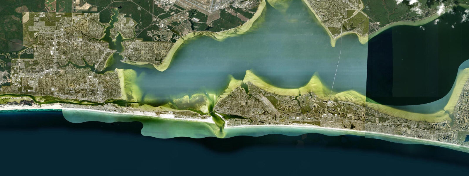
Destin sits on the south shore of Choctawhatchee Bay on the central Florida Panhandle, with the bay on its north side and the open Gulf of Mexico on its south. The town is built around East Pass, the single inlet connecting the bay to the Gulf, and the local economy and identity revolve around what comes through that pass. Destin calls itself the World's Luckiest Fishing Village; the nickname is older than the marketing department, and the offshore canyon edge sits unusually close to land here, putting blue-water species within a 30-minute boat ride of the pass.
The tide is the standard northern Gulf signal: diurnal, small, and overshadowed by wind on most days. Mean range at the East Pass gauge is about 0.18 metres above MLLW with a great diurnal range under 0.20 metres on the bigger days, making this one of the smallest tide swings on the entire US coast. The single-cycle pattern dominates; near the moon's quarter phases a brief mixed diurnal stretch shows up. The reason the tide is so muted here even by Gulf standards is the geography of Choctawhatchee Bay itself: the bay is large, shallow, and connected to the Gulf through a single narrow pass, so the open-Gulf signal is heavily attenuated before it reaches the gauge.
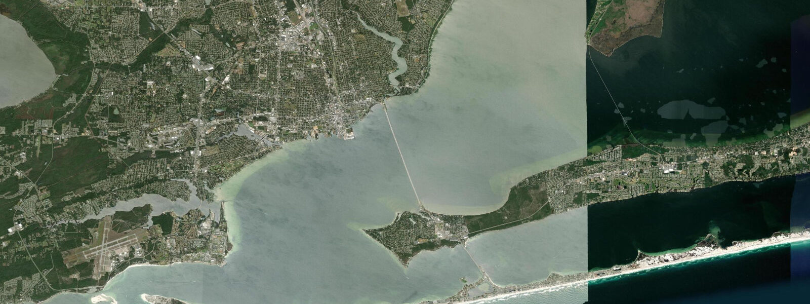
East Pass is the geographic spine of Destin. The inlet is roughly 200 metres wide at the throat, dredged to maintain depth for the charter and recreational fleet, and flanked by stone jetties on both sides. Tidal current through the pass runs harder than the height swing implies, regularly reaching 1.5 to 2 knots on the ebb. The current concentration makes the jetty rocks the most productive shore-fishing position on the central Panhandle: pompano, Spanish mackerel, redfish, and the occasional cobia and king mackerel work the pass on the moving water. The pass is also the staging ground for the deepwater charter fleet at HarborWalk Village, the large marina complex on the bay-side edge of the inlet.
The charter fleet is the working face of Destin. Roughly 100 charter boats run out of the harbour daily in season, targeting red snapper, gag and red grouper, amberjack, mahi, and on the right offshore days marlin and tuna at the canyon edge 50 to 80 kilometres south. Federal regulatory windows on red snapper and grouper are short and shift annually, so the calendar matters; check NOAA Fisheries for the current season dates. The Destin Fishing Rodeo every October is the longest-running fishing tournament on the Gulf, founded in 1948 and run as a month-long series with daily weigh-ins at the marina.
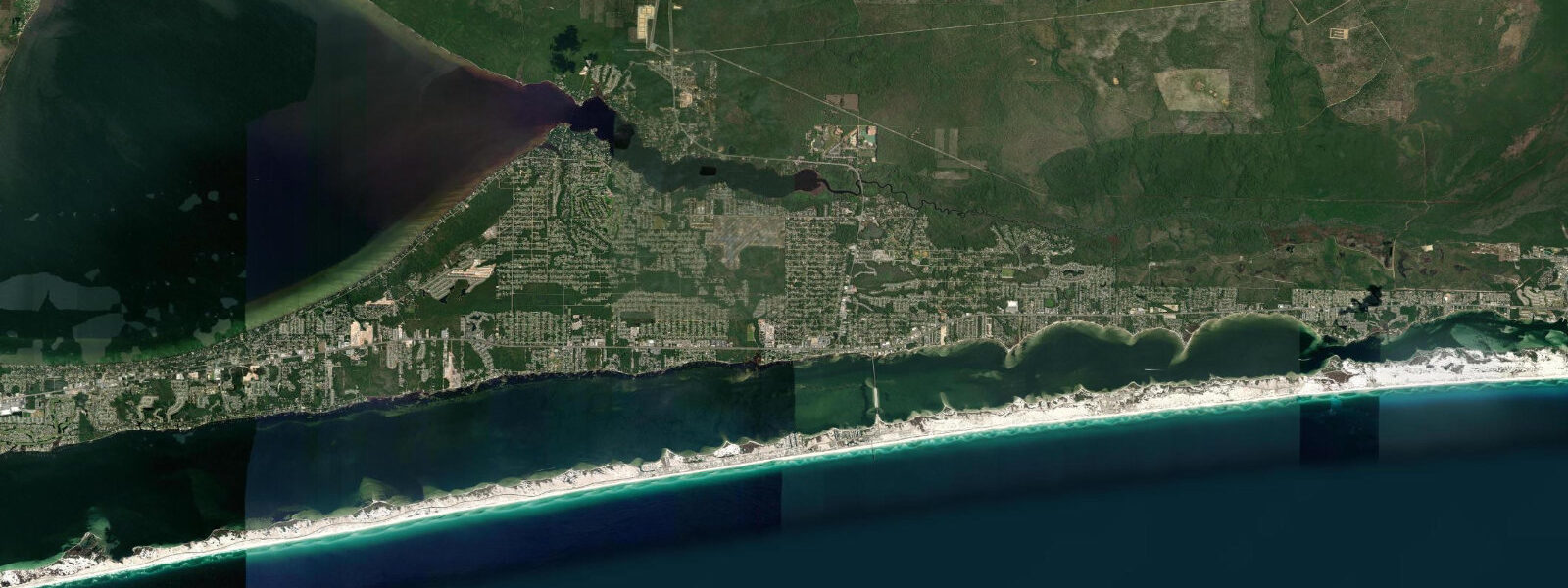
The beaches east of East Pass on Holiday Isle and west toward Henderson Beach State Park run on the same white quartz sand as Pensacola and Panama City. The very small tidal range means the wet-sand strip widens by only 10 to 20 metres between high and low water on the gently sloping foreshore, and beach width is determined far more by storm swell and longshore drift than by the daily tide. Henderson Beach State Park has the most undeveloped Gulf-front access in the Destin area, with dune walkovers protecting the foredune line.
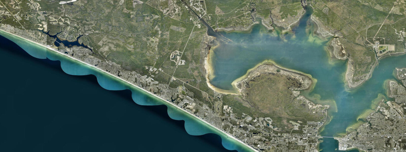
Choctawhatchee Bay on the north side of town is shallow, broad, and supports the inshore fishery for redfish, speckled trout, and flounder on the grass flats and oyster bars. Kayak anglers launch from the public ramps at Mid-Bay Bridge and at Walton County's Eden Gardens area; the incoming tide is the standard productive window, when fish push onto the warming flats to feed. The bay bridge crossings (Mid-Bay Bridge, US-331 Bay Bridge) are working fishing structures themselves, with sheepshead on the pilings in winter and tarpon staging near the channel edges in summer. The Crab Island sandbar inside East Pass — a submerged shoal that emerges at low water — is the standard summer raft-up destination and a useful tide-aware reference for the bay.
Predictions on this page come from NOAA CO-OPS station 8729511 at East Pass (harmonic predictions, accurate to within minutes). Hurricane season runs June through November.
Tide questions about Destin, FL
Quick answers to the most common questions about tide times, range, and water access at Destin, FL.
What kind of tides does Destin have?
Destin has a diurnal tide, one high and one low per day, with a mean range of only 0.18 metres above MLLW at East Pass. This is one of the smallest tidal ranges on the US coast. The pattern occasionally shifts to mixed diurnal near the moon's quarter phases, when a small second cycle appears. Wind setup from sustained Gulf winds regularly exceeds the astronomical tide; check the wind forecast alongside the tide table when planning bay or beach activities.
When is the best time to fish East Pass jetties?
The outgoing tide is the standard productive window. As Choctawhatchee Bay drains through the pass, baitfish concentrate in the throat and predators stage along the jetty rocks and the dredged channel edges. Tidal current can reach 1.5 to 2 knots on the ebb. Pompano and redfish on the inside edges, Spanish and king mackerel along the outside on the larger flood, cobia in spring and autumn migration windows. A Florida saltwater fishing licence is required from shore. The jetty rocks are accessible on foot but slippery and exposed; wear grippy footwear.
Why is Destin called the World's Luckiest Fishing Village?
The continental shelf is unusually narrow here. The 100-fathom (180-metre) contour sits about 50 to 80 kilometres south of East Pass, putting blue-water species within a single-day reach of the harbour. Most other Gulf ports run several hours offshore to reach equivalent depths. The proximity supports a charter fleet of around 100 boats year-round, the longest-running Gulf fishing tournament (the Destin Fishing Rodeo, since 1948), and a fishery that targets red snapper, grouper, amberjack, mahi, marlin, and tuna without an unreasonable transit. The nickname is in regular use locally and predates the marketing era.
Where do these tide predictions come from?
NOAA CO-OPS station 8729511, Destin East Pass, established 2003 and controlled by the Pensacola gauge. NOAA's harmonic predictions resolve the dominant diurnal constituent and produce navigation-grade accuracy under normal weather. The very small absolute range here means even small wind setups can swing the actual water level by a significant fraction of the tidal swing, and the tide table alone is rarely sufficient for planning bay navigation.
Is this safe to use for navigation through East Pass?
No. For piloting East Pass use NOAA Chart 11388 and the current USCG notices. The pass shoals at the bar on the Gulf side, the dredged channel position can shift, and the current in the throat runs harder than the modest tidal range implies. Federal channel buoys are the working reference, not the tide gauge; the Destin Coast Guard Auxiliary publishes local conditions, and HarborWalk Village monitors VHF Channel 16.
7-day tide table — Destin, FL
Heights relative to MSL. Predictions: Open-Meteo Marine (MeteoFrance SMOC, 0.08° grid) — heights relative to MSL (not chart datum / LAT). Model-derived.
| Day | Type | Time | Height |
|---|---|---|---|
| Tue 23 Jun | Low | 15:50 | -0.4m / -1.2ft |
| Low | 18:50 | -0.4m / -1.2ft | |
| Wed 24 Jun | High | 05:50 | -0.0m / -0.1ft |
| Low | 16:10 | -0.4m / -1.3ft | |
| Thu 25 Jun | High | 05:50 | 0.0m / 0.1ft |
| Fri 26 Jun | — | ||
| Sat 27 Jun | — | ||
| Sun 28 Jun | — | ||
| Mon 29 Jun | Low | 18:00 | -0.5m / -1.6ft |