Filey tide times
Filey tide forecast — heights relative to MSL.
Today's tide times for Filey
Tide times at Filey on Friday, 19 June 2026: first low tide at 01:00, first high tide at 07:27, second low tide at 14:02, second high tide at 20:22. Sunrise 04:26, sunset 21:37.
Tide chart for Filey
24-hour cosine-interpolated curve around the present moment. Heights relative to MSL. Predictions: Predictions: Open-Meteo Marine (MeteoFrance SMOC, 0.08° grid).
Sun, moon and conditions on Fri 19 Jun
Snapshot at build time — refreshes daily. Sea state from Open-Meteo Marine.
Highs and lows next 7 days
Every predicted high and low for the next week, with the daily tidal coefficient (0–120; higher = bigger swing, > 95 means stronger currents).
Other spots nearby
The three closest curated TideTurtle locations to Filey, measured by great-circle distance.
Today's solunar windows
Solunar tradition: major periods are the ≈3h windows around moon transit and opposition; minor are ≈2h around moonrise and moonset. Pair with the local tide stage and wind for the best read.
Cycle dates near Filey
Last spring tide on Fri 19 Jun (range 4.8m / 15.7ft). Next neap on Thu 25 Jun.
Spring tides cluster around new and full moons (biggest swings). Neap tides land on quarter moons (smallest swings). See the spring tide and neap tide glossary entries for the why.
About tides at Filey
A short guide to the coastline at Filey — geography, sea state, and what the tide is actually doing under your feet.
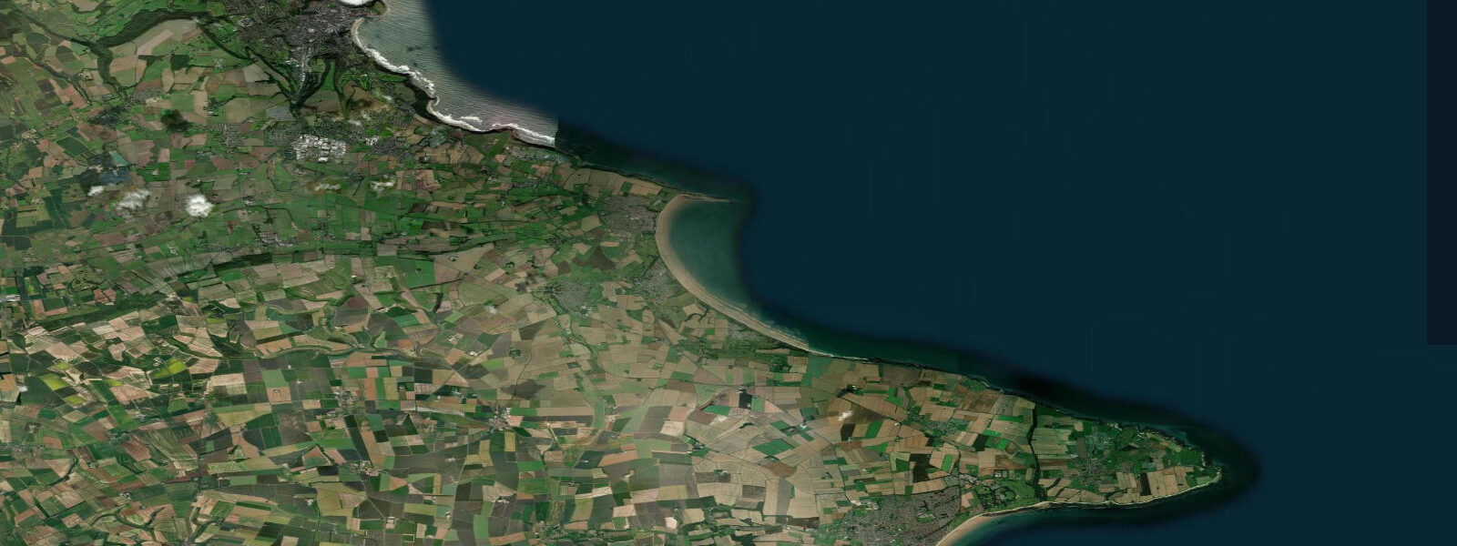
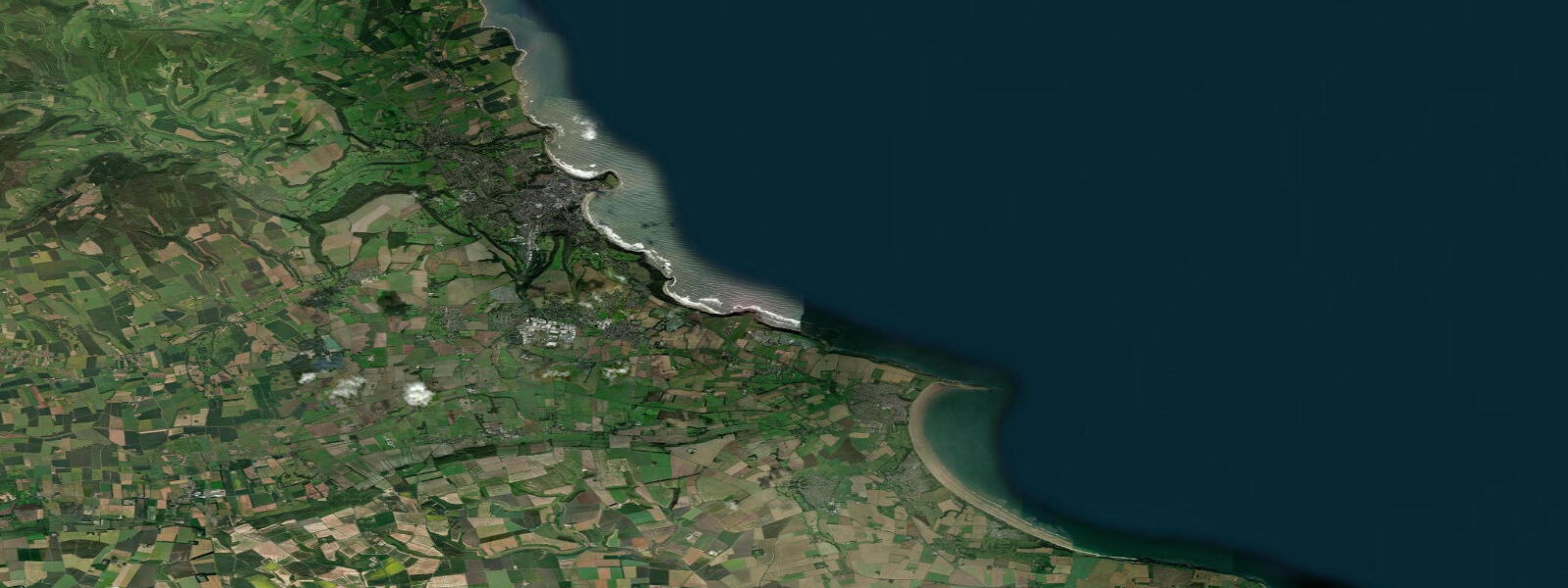
Filey sits between Scarborough (10 km north) and Flamborough Head (15 km south), on a gentle bay that is one of the cleaner and less commercialised beaches on the Yorkshire coast. The beach is 8 kilometres of sand; the town is Victorian, compact, and has largely resisted the seafront amusement culture that dominates Scarborough and Bridlington. Filey Brigg, a 1.5-kilometre rock causeway that extends into the sea from the north end of the bay, is the most distinctive geological feature on this part of the coast.
The tidal range at Filey is substantial: mean spring range around 4.7 metres, neaps about 3.0 m. Low spring tides expose the full length of Filey Brigg, creating a walkable rock platform with extensive rock pools. The Brigg is the best rock pooling location on the Yorkshire coast — the limestone reef holds anemones, hermit crabs, starfish, and shore crabs in the mid-tide pools, with richer species in the lower pools exposed only at spring tides.
Surf at Filey Beach is generally smaller and slower than at Scarborough. The bay's semi-circular shape damps the wave energy, and the sandy bottom produces rolling beach breaks more suitable for longboarding and beginners. The best surf window is northeast to east swell at 1 to 1.5 metres; the beach works across most tide states, though mid-tide is cleanest. There is no dedicated surf school at Filey, so most learners come from Scarborough.
Filey Brigg is a productive shore fishing location, particularly from the seaward end where the reef drops into deeper water. Codling and whiting are the winter targets; mackerel shoals run close to the point in summer. The rocks on the north side of the Brigg hold large wrasse. Accessing the outer end of the Brigg requires care — the limestone is slippery with kelp at low water, and rising tides cut off the seaward section in under an hour. Check the tide times and plan to return well before the flood reaches the causeway.
The Cleveland Way National Trail ends at Filey Brigg, having covered 177 kilometres from Helmsley on the North York Moors. The final section from Scarborough follows the clifftop path above the bay; it's one of the more satisfying finishes on any long-distance trail in England, ending at the Brigg with views across the bay.
Filey is a good base for family visits: the beach is large, the town is quiet, and the tidal range means the sand is always accessible at some point in the day. Bucket-and-spade activities at the rock pools are the classic Filey experience — bring a net for the mid-tide hour when pools are accessible and well-populated.
Tide predictions on this page come from Open-Meteo Marine, a gridded global ocean model, cross-referenced with UK Environment Agency gauge data. For the most accurate local predictions, consult the UK National Tide Gauge Network via CEFAS or the UKHO's EasyTide service.
Tide questions about Filey
Quick answers to the most common questions about tide times, range, and water access at Filey.
What is Filey Brigg?
Filey Brigg is a narrow limestone reef that extends 1.5 kilometres into the North Sea from the north end of Filey Bay. At low spring tide it becomes a walkable causeway to the sea. The Brigg has excellent rock pools and is a productive shore fishing location. It's important to keep an eye on the tide — the incoming flood cuts off the outer sections relatively quickly, and the limestone is slippery. Return to shore before the causeway section begins to submerge.
What is the tidal range at Filey?
Filey has a mean spring tidal range of about 4.7 metres — one of the larger ranges on the Yorkshire coast. At low spring tide the beach extends 200 to 300 metres from the promenade and Filey Brigg is fully exposed. Neap range drops to around 3.0 m, which still produces a substantial change in beach width. The falling tide from high water is the standard window for rock pooling at the Brigg.
Is the beach at Filey safe for children?
Filey Beach has a RNLI lifeguard presence during summer (late July through August) with flagged swimming zones. The sandy bottom and gentle gradients make it one of the more family-friendly beaches on the Yorkshire coast. The rip current risk is lower than at rocky, higher-energy beaches, but any beach can be hazardous in onshore wind and breaking surf. Keep children away from Filey Brigg rocks in any sea state — the limestone is slippery and the swell can surge unexpectedly.
Does the Cleveland Way end at Filey?
Yes — Filey Brigg is the official southern terminus of the Cleveland Way National Trail. The route covers 177 km from Helmsley across the North York Moors and then follows the coastal cliffs from Saltburn to Filey. Walking the whole trail takes 9 to 11 days; the coastal section from Whitby to Filey (50 km) is commonly done as a 3-day walk. The Brigg finish is satisfying — the trail literally walks to the end of the land.
Are there accommodation options at Filey?
Filey has a mix of B&Bs, self-catering cottages, and a caravan park at the north end of town above the Brigg. It's notably less expensive than nearby Scarborough for accommodation, and the beach is larger and less crowded in summer. The town has a good selection of independent cafes and fish-and-chip shops but fewer evening restaurant options than Scarborough. Book ahead in July and August.
8-day tide table — Filey
Heights relative to MSL. Predictions: Open-Meteo Marine (MeteoFrance SMOC, 0.08° grid) — heights relative to MSL (not chart datum / LAT). Model-derived.
| Day | Type | Time | Height |
|---|---|---|---|
| Fri 19 Jun | Low | 01:00 | -2.1m / -7.0ft |
| High | 07:27 | 1.9m / 6.2ft | |
| Low | 14:02 | -2.9m / -9.5ft | |
| High | 20:22 | 1.4m / 4.7ft | |
| Sat 20 Jun | Low | 02:16 | -1.9m / -6.3ft |
| High | 08:17 | 1.8m / 5.7ft | |
| Low | 14:54 | -2.7m / -8.8ft | |
| High | 21:13 | 1.3m / 4.2ft | |
| Sun 21 Jun | Low | 03:13 | -1.9m / -6.2ft |
| High | 09:15 | 1.5m / 4.9ft | |
| Low | 15:53 | -2.5m / -8.1ft | |
| High | 22:07 | 0.9m / 2.8ft | |
| Mon 22 Jun | Low | 04:05 | -1.8m / -5.8ft |
| High | 10:10 | 1.2m / 4.1ft | |
| Low | 16:48 | -2.3m / -7.4ft | |
| High | 23:09 | 0.9m / 2.8ft | |
| Tue 23 Jun | Low | 05:10 | -1.5m / -4.9ft |
| High | 11:10 | 1.1m / 3.6ft | |
| Low | 17:48 | -1.9m / -6.2ft | |
| Wed 24 Jun | High | 00:04 | 0.9m / 2.9ft |
| Low | 06:16 | -1.4m / -4.5ft | |
| High | 12:14 | 1.0m / 3.4ft | |
| Low | 18:52 | -1.8m / -5.7ft | |
| Thu 25 Jun | High | 01:03 | 0.8m / 2.8ft |
| Low | 07:18 | -1.5m / -5.0ft | |
| High | 13:24 | 1.0m / 3.2ft | |
| Low | 19:51 | -1.6m / -5.3ft | |
| Fri 26 Jun | High | 00:00 | 0.4m / 1.3ft |