Felixstowe tide times
Felixstowe tide forecast — heights relative to MSL.
Today's tide times for Felixstowe
Tide times at Felixstowe on Sunday, 21 June 2026: first low tide at 01:00, first high tide at 04:21, second low tide at 10:26, second high tide at 16:33, third low tide at 22:58. Sunrise 04:34, sunset 21:17.
Tide chart for Felixstowe
24-hour cosine-interpolated curve around the present moment. Heights relative to MSL. Predictions: Predictions: Open-Meteo Marine (MeteoFrance SMOC, 0.08° grid).
Sun, moon and conditions on Sun 21 Jun
Snapshot at build time — refreshes daily. Sea state from Open-Meteo Marine.
Highs and lows next 7 days
Every predicted high and low for the next week, with the daily tidal coefficient (0–120; higher = bigger swing, > 95 means stronger currents).
Other spots nearby
The three closest curated TideTurtle locations to Felixstowe, measured by great-circle distance.
Today's solunar windows
Solunar tradition: major periods are the ≈3h windows around moon transit and opposition; minor are ≈2h around moonrise and moonset. Pair with the local tide stage and wind for the best read.
Cycle dates near Felixstowe
Last spring tide on Sun 21 Jun (range 3.2m / 10.6ft). Next neap on Wed 24 Jun.
Spring tides cluster around new and full moons (biggest swings). Neap tides land on quarter moons (smallest swings). See the spring tide and neap tide glossary entries for the why.
About tides at Felixstowe
A short guide to the coastline at Felixstowe — geography, sea state, and what the tide is actually doing under your feet.
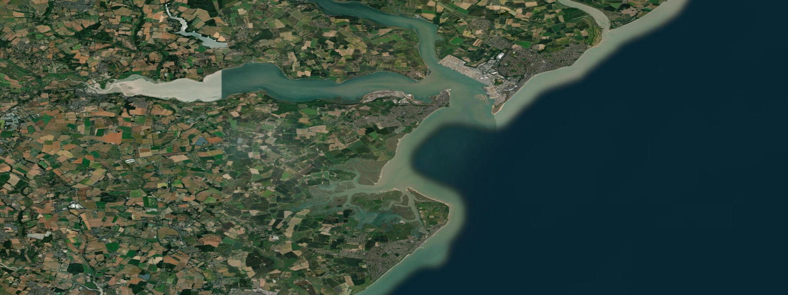
Felixstowe occupies the southern tip of the Suffolk peninsula, where the Orwell and Stour rivers merge before meeting the North Sea at Harwich Harbour. The town has two distinct identities: a Victorian seaside resort with a long shingle-and-sand beach, and the UK's largest container port — visible from the beach as a continuous horizon of gantry cranes and stacked boxes extending 3 kilometres along the Orwell bank.
The tidal character here is macrotidal and amplified. Mean spring range at Felixstowe is approximately 3.5 m above Chart Datum, elevated above the open Suffolk coast to the north because the Thames Estuary funnels and amplifies the tidal wave as it propagates northward through the shallowing water of the outer estuary. The deep-water approach channel through Harwich Harbour carries vessels drawing up to 16 metres; tidal currents in the main channel can reach 3 to 4 knots on spring ebbs, and the harbour is navigated on tidal windows by the larger container vessels.
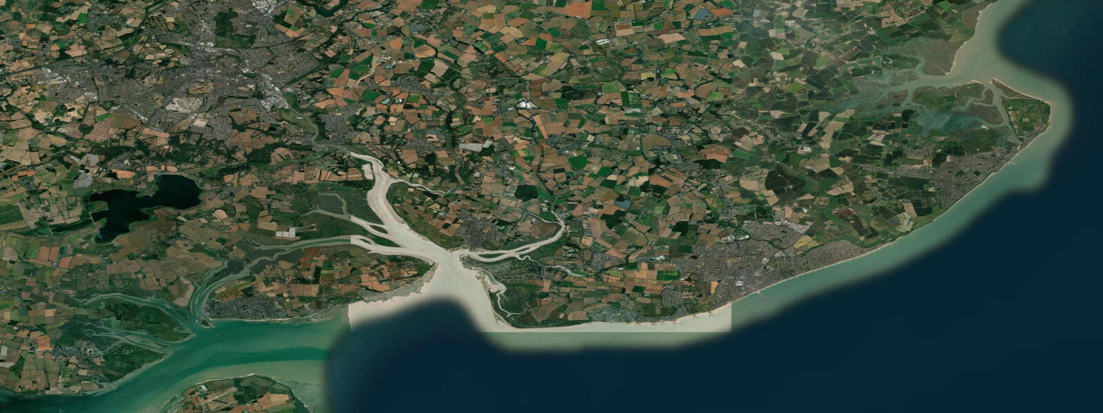
The beach runs south from the pier toward Landguard Point, a low shingle spit at the extreme southern tip of the peninsula. Landguard Point is significant navigation history: it was the landing point of the last successful Dutch naval invasion of England in 1667 (repelled by the garrison). Landguard Fort still stands and is open to visitors. The shingle spit itself is a nature reserve; little terns nest on the upper beach from April through August, and access to the nesting area is restricted during the breeding season.
For sea anglers, Landguard and the pier are the prime marks. The point fishes the Harwich channel edge, where bass and flounder follow the flood tide onto the spit. Sole and plaice are common spring catches from the beach in settled southerly conditions. The pier (330 metres, open for fishing year-round) produces pouting, whiting, and codling; the best sessions are two hours before high water on spring tides when the tide is pushing baitfish into the pier piles.
The beach itself is shingle on the upper foreshore with patches of firm sand revealed at low water, particularly south of the pier. Swimming conditions are rated as good in the designated bathing water at the central beach; however, the nearshore currents strengthen markedly toward Landguard Point and the harbour entrance — this is not a gentle beach for open-water swimming. The currents at the point are commercially navigated water.
Families concentrate on the northern beach near the leisure centre and Spa Pavilion. The promenade walk from Felixstowe Pier to Landguard Point and back (about 6 km round trip) takes in the container port spectacle, the shingle ridge, and the fort. Low tide is the best time to do the walk — the firmer beach surface makes the shingle far easier underfoot.
Photographers come for the container ships framed against the beach. The largest vessels — 400-metre ultra-large container ships — pass within 500 metres of Landguard Point on the inbound tide; the spectacle of a 20,000 TEU vessel riding a flood tide past a shingle beach stacked with little tern nests is one of the more arresting images the UK coast offers.
Tide predictions here come from Open-Meteo Marine (±45 min / ±0.2–0.3 m above Chart Datum), cross-referenced with EA Flood Monitoring and the NTSLF network. For navigation in Harwich Harbour and the Stour-Orwell approaches, consult the UK Hydrographic Office Admiralty charts and the Harwich Haven Authority for current tidal stream atlases.
Tide questions about Felixstowe
Quick answers to the most common questions about tide times, range, and water access at Felixstowe.
What is the tidal range at Felixstowe and how does it compare to the rest of Suffolk?
Felixstowe's mean spring range is approximately 3.5 m above Chart Datum — larger than Southwold (around 2.3 m) to the north and reflecting the amplification effect of the Thames Estuary funnelling the tidal wave into Harwich Harbour. Neap range drops to around 2.5 m. This macrotidal character means the beach widens substantially at low water: the shingle foreshore at low spring tide can expose 100 to 150 metres of beach south of the pier. In the main Harwich navigation channel, tidal currents during spring ebbs reach 3 to 4 knots — this is commercially trafficked, deep-water navigation, not a recreational swimming environment.
Is it safe to swim at Felixstowe Beach?
Swimming is safe at the designated bathing water section of the central beach, which runs approximately from the pier northward toward the Spa Pavilion. The Environment Agency monitors water quality here, and the site holds a Good or Excellent designation in most recent assessments — check the current year's result before visiting, particularly after heavy rain when storm drain overflow can affect quality. Swimming toward Landguard Point or near the harbour entrance is not safe: tidal currents intensify around the spit and in the approach channel, where spring ebb flows reach 3 to 4 knots. The point is navigated by ocean-going container vessels.
What fish can I catch from Felixstowe Pier and Landguard Point?
The 330-metre pier fishes year-round. Best sessions run from two hours before high water on spring tides: pouting, whiting, and codling are the primary catches in autumn and winter; summer produces mackerel (July through September) and occasional smoothhound. Landguard Point is a premier bass and flounder mark — the shingle spit on a flooding tide concentrates baitfish along the channel edge. Sole and plaice are caught from the open beach in spring (April through June) on calm nights. Night spring tides in October and November are the classic Felixstowe cod sessions.
Can I watch the container ships arriving at Felixstowe Port?
The best shore-based viewing point is the southern end of the beach near Landguard Point. The main approach channel passes within approximately 500 metres of the shingle spit, and the largest vessels — including 400-metre ultra-large container ships — arrive and depart on tidal windows when the deep-water channel is at its most favourable depth. Inbound arrivals typically come on the flood tide; departures tend to favour the start of the ebb. The Port of Felixstowe website publishes a vessel schedule. Arrivals at sunrise or sunset produce dramatic photography.
Where can I get accurate tide times for navigating Harwich Harbour?
Tide predictions on this page come from Open-Meteo Marine, a gridded ocean model with accuracy of ±45 minutes and ±0.2–0.3 m above Chart Datum — suitable for beach and leisure planning. For navigational use of Harwich Harbour and the Stour-Orwell approach channels, consult the UK Hydrographic Office Admiralty Tide Tables (NP201, Volume 1) and the tidal stream atlases for the Thames Estuary and Approaches. The Harwich Haven Authority publishes local notices for mariners covering the approach channels. Never rely on model-derived predictions for navigation of commercial port approaches — use UKHO / Admiralty Charts as the authoritative source.
8-day tide table — Felixstowe
Heights relative to MSL. Predictions: Open-Meteo Marine (MeteoFrance SMOC, 0.08° grid) — heights relative to MSL (not chart datum / LAT). Model-derived.
| Day | Type | Time | Height |
|---|---|---|---|
| Sun 21 Jun | Low | 01:00 | -0.8m / -2.7ft |
| High | 04:21 | 1.1m / 3.6ft | |
| Low | 10:26 | -1.4m / -4.7ft | |
| High | 16:33 | 1.1m / 3.8ft | |
| Low | 22:58 | -2.1m / -6.9ft | |
| Mon 22 Jun | High | 05:16 | 0.8m / 2.6ft |
| Low | 11:15 | -1.5m / -4.8ft | |
| High | 17:26 | 1.0m / 3.1ft | |
| Low | 23:51 | -2.1m / -6.9ft | |
| Tue 23 Jun | High | 06:16 | 0.7m / 2.4ft |
| Low | 12:15 | -1.5m / -4.8ft | |
| High | 18:27 | 0.7m / 2.4ft | |
| Wed 24 Jun | Low | 00:42 | -1.9m / -6.2ft |
| High | 07:20 | 0.9m / 2.9ft | |
| Low | 13:10 | -1.2m / -4.0ft | |
| High | 19:27 | 0.9m / 2.9ft | |
| Thu 25 Jun | Low | 01:34 | -1.7m / -5.7ft |
| High | 08:15 | 0.8m / 2.5ft | |
| Low | 14:04 | -1.5m / -4.9ft | |
| High | 20:33 | 0.8m / 2.5ft | |
| Fri 26 Jun | Low | 02:28 | -1.7m / -5.5ft |
| High | 09:12 | 0.7m / 2.3ft | |
| Sat 27 Jun | Low | 03:20 | -1.7m / -5.5ft |
| High | 10:06 | 0.8m / 2.6ft | |
| Low | 15:48 | -1.5m / -4.9ft | |
| High | 22:20 | 0.8m / 2.7ft | |
| Sun 28 Jun | Low | 00:00 | 0.4m / 1.2ft |