Sumburgh tide times
Sumburgh tide forecast — heights relative to MSL.
Today's tide times for Sumburgh
Tide times at Sumburgh on Saturday, 27 June 2026: first high tide at 01:00, first low tide at 02:58, second high tide at 09:34, second low tide at 15:12, third high tide at 21:46. Sunrise 03:44, sunset 22:30.
Tide chart for Sumburgh
24-hour cosine-interpolated curve around the present moment. Heights relative to MSL. Predictions: Predictions: Open-Meteo Marine (MeteoFrance SMOC, 0.08° grid).
Sun, moon and conditions on Sat 27 Jun
Snapshot at build time — refreshes daily. Sea state from Open-Meteo Marine.
Highs and lows next 7 days
Every predicted high and low for the next week, with the daily tidal coefficient (0–120; higher = bigger swing, > 95 means stronger currents).
Other spots nearby
The three closest curated TideTurtle locations to Sumburgh, measured by great-circle distance.

Today's solunar windows
Solunar tradition: major periods are the ≈3h windows around moon transit and opposition; minor are ≈2h around moonrise and moonset. Pair with the local tide stage and wind for the best read.
Cycle dates near Sumburgh
Next spring tide on Wed 01 Jul (range 1.2m / 3.8ft). Next neap on Sun 28 Jun.
Spring tides cluster around new and full moons (biggest swings). Neap tides land on quarter moons (smallest swings). See the spring tide and neap tide glossary entries for the why.
About tides at Sumburgh
A short guide to the coastline at Sumburgh — geography, sea state, and what the tide is actually doing under your feet.
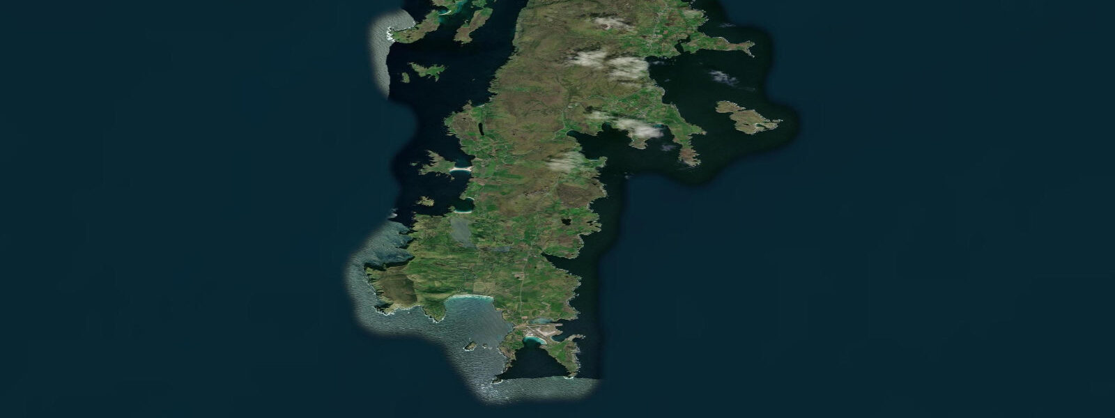
Sumburgh Head is the southernmost point of the Shetland Mainland, an exposed sandstone headland 45 km south of Lerwick where the tides of the North Sea and the Atlantic margins converge. The spring range at Sumburgh is approximately 2.0 m — slightly larger than Lerwick's 1.8 m, reflecting the more exposed southern position. The tidal current off the headland is the dominant feature: the Sumburgh Roost, the tidal race south of the head, runs at 5–7 knots on spring tides and produces breaking seas and steep wave trains even in calm weather. In wind-against-tide conditions, the Roost is one of the most dangerous stretches of UK coastal water for small craft.
The RSPB Sumburgh Head reserve occupies the clifftop above the lighthouse, and from May through early August it holds one of the most accessible puffin colonies in Britain. The puffins nest in burrows on the short-cropped clifftop turf and walk to and from their burrows within a few metres of the viewing path. At peak season (mid-June), 20,000+ puffins are present on the headland. The birds are accustomed to people and approach within 2–3 metres — telephoto lenses are unnecessary, which is unusual for Atlantic seabird photography. The cliffs below the puffin colony also hold guillemot, razorbill, kittiwake, and fulmar, visible from the clifftop at close range.
Sumburgh Airport, adjacent to the headland, is Shetland's main airport and the helicopter base for North Sea oil platform operations. The airport occupies the flat ground between the headland and the Loch of Spiggie; its operational history is intimately connected to the oil industry. Loganair flights connect Sumburgh to Edinburgh, Aberdeen, Glasgow, Bergen, and Faroe; the airport is the main transport link for Shetland. The airport perimeter fence runs within a few hundred metres of the puffin colony — the contrast between industrial aviation infrastructure and nesting seabirds is one of the more unusual juxtapositions on the British coast.
Jarlshof, the archaeological site immediately south of the airport on the shore of West Voe of Sumburgh, is among the most significant ancient settlements in Scotland: 3,000 years of continuous occupation from Bronze Age through Neolithic, Iron Age, Viking, and medieval periods are visible in a single excavated site. The Viking longhouse foundations, the broch tower, and the Bronze Age oval houses are all present within a compact area above the beach. The site is managed by Historic Environment Scotland and open to visitors; the adjacent Shetland Museum annex provides context.
For shore anglers, the rock platforms on the east side of Sumburgh Head at low water produce pollock, coalfish, and large wrasse. The tidal race south of the head creates feeding aggregations on the eddy lines — predatory fish concentrate where the fast current meets the slack water behind the headland. Night fishing with large lures or mackerel strip is the technique for pollock and coalfish in the 45 minutes either side of the tidal slack, when the race briefly moderates. The east coast platform rocks are only accessible at low spring water; check the predicted low and allow enough time to climb back before the flood covers the lower ledges.
The bay of West Voe of Sumburgh, south of the airport and north of Sumburgh Head, provides sheltered anchorage for small craft in southwest through northwest winds. The bay is exposed to the southeast; in southeasterly conditions the anchorage becomes untenable and vessels must proceed north to Lerwick. Tidal streams in the bay are 0.5–1.0 knots, manageable for anchored vessels.
All tide predictions for Sumburgh come from the Open-Meteo Marine gridded model. Timing accuracy is ±45 minutes; height accuracy is ±0.3 m above Chart Datum.
Tide questions about Sumburgh
Quick answers to the most common questions about tide times, range, and water access at Sumburgh.
When is the best time to see puffins at Sumburgh Head?
Puffins are present at Sumburgh Head from late April through early August. Peak numbers are in June, when up to 20,000+ birds are on the headland. The birds are unusually approachable — they nest in burrows on the clifftop path and walk within 2–3 metres of visitors. Best viewing is in the morning and evening when puffins are actively flying to and from the sea with sand eels. The RSPB reserve is free to access year-round; the car park at the lighthouse is the starting point. Bring wind protection regardless of the forecast — exposed at 60°N, the headland is windy even in calm conditions.
What is the Sumburgh Roost and how dangerous is it?
The Sumburgh Roost is the tidal race that forms south of Sumburgh Head where North Sea and Atlantic tidal streams converge over shallow ground. Spring tidal streams reach 5–7 knots; the shallow water amplifies wave height and the current creates standing waves and steep breaking seas even in calm wind conditions. In wind-against-tide conditions the roost becomes violent and is impassable for small craft. The Roost is a well-documented hazard in all Shetland cruising guides; vessels rounding Sumburgh Head should time the passage for slack water (within ±1 hour of low or high water at Sumburgh) and keep the headland well to port or starboard.
What is Jarlshof and how do I visit it?
Jarlshof is on the shore at West Voe of Sumburgh, 1 km from Sumburgh Head on the south end of the airport access road. It is one of Scotland's most important archaeological sites — 3,000 years of settlement from Bronze Age through Viking to medieval periods, excavated and open to view in a compact area above the beach. Managed by Historic Environment Scotland; open daily from April through October, winter openings are reduced. Entry fee applies. Allow 90 minutes. The adjacent Shetland Museum annex provides detailed context. The combination of Jarlshof and the Sumburgh Head puffins makes a full day from Lerwick.
Is shore fishing at Sumburgh Head accessible and worthwhile?
The east-side rock platforms below Sumburgh Head lighthouse are accessible at low spring water — a 20-minute walk from the car park via the cliff path. Pollock and coalfish are the main targets, feeding on the eddy line where the Roost current meets slack water behind the head. Large lures or mackerel strip fished on the 45-minute window around the tidal slack produce the best results. The ledges are only accessible at low spring water; check predicted low water before descending and leave at least 45 minutes before the flood covers the lower platforms. Do not fish from the lower platforms when swell is running — the rocks are exposed and wet.
Can I fly direct to Sumburgh from Edinburgh or Aberdeen?
Loganair operates direct flights from Edinburgh, Aberdeen, and Glasgow to Sumburgh Airport year-round. Typical journey times are 1 hour 15 minutes from Edinburgh, 55 minutes from Aberdeen. Flights connect onward to Bergen and Faroe. Sumburgh Airport is 45 km south of Lerwick; a local bus service connects the airport to Lerwick town centre in approximately 45 minutes, or taxis are available. Ferry connections (NorthLink from Aberdeen to Lerwick, overnight crossing 12–13 hours) are an alternative for those bringing vehicles.
8-day tide table — Sumburgh
Heights relative to MSL. Predictions: Open-Meteo Marine (MeteoFrance SMOC, 0.08° grid) — heights relative to MSL (not chart datum / LAT). Model-derived.
| Day | Type | Time | Height |
|---|---|---|---|
| Sat 27 Jun | High | 01:00 | -0.6m / -1.9ft |
| Low | 02:58 | -0.8m / -2.7ft | |
| High | 09:34 | -0.0m / -0.1ft | |
| Low | 15:12 | -0.7m / -2.3ft | |
| High | 21:46 | 0.1m / 0.4ft | |
| Sun 28 Jun | Low | 03:48 | -0.8m / -2.6ft |
| High | 10:12 | 0.1m / 0.2ft | |
| Low | 15:58 | -0.7m / -2.3ft | |
| Mon 29 Jun | High | 10:56 | 0.1m / 0.2ft |
| Low | 16:40 | -0.8m / -2.5ft | |
| High | 23:05 | 0.2m / 0.5ft | |
| Tue 30 Jun | Low | 05:15 | -1.0m / -3.1ft |
| High | 11:42 | -0.0m / -0.1ft | |
| Low | 17:15 | -0.8m / -2.7ft | |
| High | 23:45 | 0.1m / 0.4ft | |
| Wed 01 Jul | Low | 05:54 | -1.0m / -3.3ft |
| High | 12:22 | -0.1m / -0.2ft | |
| Low | 17:48 | -0.8m / -2.7ft | |
| Thu 02 Jul | High | 00:25 | 0.2m / 0.5ft |
| Low | 06:37 | -1.0m / -3.3ft | |
| Fri 03 Jul | High | 00:57 | 0.1m / 0.4ft |
| Low | 07:19 | -1.0m / -3.4ft | |
| High | 13:44 | -0.2m / -0.5ft | |
| Low | 18:38 | -0.8m / -2.7ft | |
| Sat 04 Jul | High | 00:00 | 0.1m / 0.2ft |