Ballycastle tide times
Ballycastle tide forecast — heights relative to MSL.
Today's tide times for Ballycastle
Tide times at Ballycastle on Friday, 19 June 2026: first high tide at 01:00, first low tide at 07:12, second high tide at 11:42, second low tide at 16:16. Sunrise 04:43, sunset 22:08.
Tide chart for Ballycastle
24-hour cosine-interpolated curve around the present moment. Heights relative to MSL. Predictions: Predictions: Open-Meteo Marine (MeteoFrance SMOC, 0.08° grid).
Sun, moon and conditions on Fri 19 Jun
Snapshot at build time — refreshes daily. Sea state from Open-Meteo Marine.
Highs and lows next 7 days
Every predicted high and low for the next week, with the daily tidal coefficient (0–120; higher = bigger swing, > 95 means stronger currents).
Other spots nearby
The three closest curated TideTurtle locations to Ballycastle, measured by great-circle distance.

Today's solunar windows
Solunar tradition: major periods are the ≈3h windows around moon transit and opposition; minor are ≈2h around moonrise and moonset. Pair with the local tide stage and wind for the best read.
Cycle dates near Ballycastle
Last spring tide on Fri 19 Jun (range 0.9m / 3.0ft). Next neap on Thu 25 Jun.
Spring tides cluster around new and full moons (biggest swings). Neap tides land on quarter moons (smallest swings). See the spring tide and neap tide glossary entries for the why.
About tides at Ballycastle
A short guide to the coastline at Ballycastle — geography, sea state, and what the tide is actually doing under your feet.
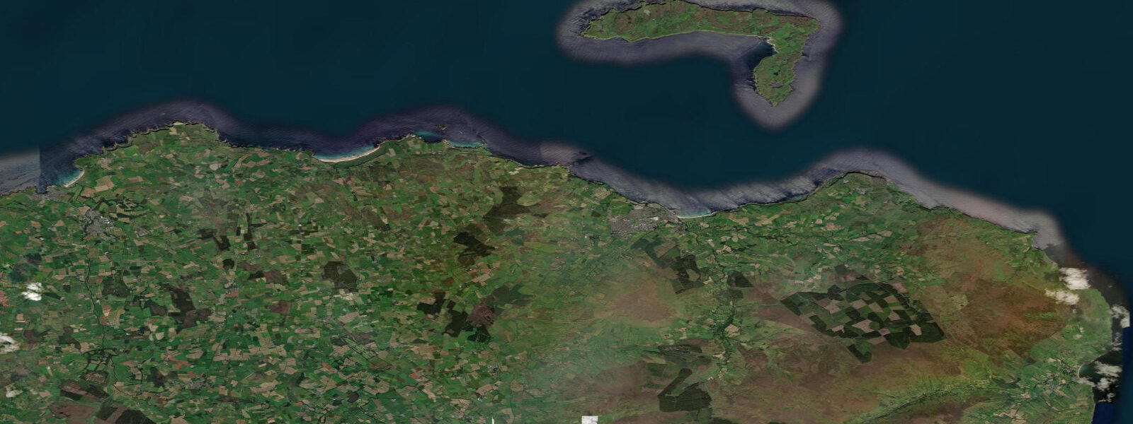
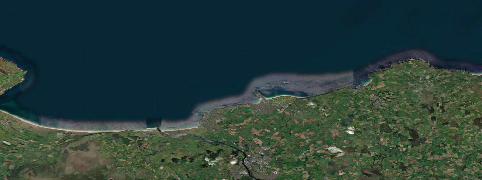
Ballycastle is a small harbour town on the northeast corner of Northern Ireland, between Fairhead to the west and Torr Head to the east, facing across the North Channel toward the Mull of Kintyre in Scotland — only 19 km away. The tidal character of the North Channel is distinctive: the strait between Northern Ireland and Scotland is one of the most energetic tidal passages in the British Isles, with currents exceeding 5 knots in Rathlin Sound between the mainland and Rathlin Island. Mean spring range at Ballycastle is around 1.8 metres, but the tidal flow rather than the range is what defines conditions here.
Rathlin Island sits 9 km north of Ballycastle. The island has the UK's only seabird viewing centre of scale, managed by the RSPB, with 250,000 breeding seabirds including puffins, razorbills, guillemots, and fulmars. The ferry from Ballycastle harbour runs daily from Easter through October; journey time about 25 minutes in settled conditions. The crossing timing is influenced by tidal current in Rathlin Sound — the boat operators work the crossing windows carefully.
Kayaking to Rathlin Island is done by experienced sea kayakers who plan around the tidal current windows in the Sound. Rathlin Sound runs 3 to 5 knots on spring tides, with the flood running northeast and the ebb running southwest. The crossing window at slack is approximately 20 to 30 minutes on spring tides — crossing must be initiated before the current exceeds about 1.5 knots, or the boat is swept off course significantly. Local paddlers with tide table experience regularly make the crossing.
Fairhead to the west of Ballycastle is one of the most dramatic cliff faces in Ireland — 180 metres of dolerite columns rising straight from the sea. The headland is accessible by a 4-km cliff walk from the town. Sea conditions at Fairhead produce severe tidal races; the area is not suitable for paddling except in the calmest conditions.
The town beach at Ballycastle is a curved sandy bay, sheltered by the harbour breakwater, with calm water suitable for swimming and stand-up paddleboarding in summer. The water temperature peaks around 15°C in August — cold, but manageable in a 3mm wetsuit. Winter sea temperature drops to 8°C.
Tide predictions on this page come from Open-Meteo Marine, a gridded global ocean model, cross-referenced with UK Environment Agency gauge data. For the most accurate local predictions, consult the UK National Tide Gauge Network via CEFAS or the UKHO's EasyTide service.
Tide questions about Ballycastle
Quick answers to the most common questions about tide times, range, and water access at Ballycastle.
How strong is the tidal current at Rathlin Sound?
Rathlin Sound, between Ballycastle and Rathlin Island, is one of the most powerful tidal passages in the British Isles. Springs run 3 to 5 knots with severe turbulence near headlands. The ferry operators time crossings for favourable current; the crossing by kayak requires meticulous tidal planning. Slack water in the Sound lasts 20 to 30 minutes on spring tides — this is the only safe paddling window.
When can I see puffins at Rathlin Island?
Puffins arrive at Rathlin from April and are most visible in May and June during chick-rearing season. The RSPB Seabird Centre at the West Light (accessible by minibus from the ferry landing) provides viewing platforms above the nesting colony. By August most puffins have departed. The island also has large numbers of razorbills, guillemots, and kittiwakes visible throughout the summer. Ferry services from Ballycastle run frequently in summer — book ahead on weekends.
Can I kayak to Rathlin Island from Ballycastle?
Experienced sea kayakers with tidal planning skills do make this crossing. The route is 9 km in waters that carry 3 to 5 knots of tidal current on springs. The crossing is only safe during the short slack water window; getting it wrong means being swept several kilometres off course in minutes. This is not a beginner or intermediate undertaking. Take a local tidal planning course, check conditions with the ferry operators, and do not attempt solo.
What is Fairhead and how do I visit it?
Fairhead (Benmore) is a 180-metre dolerite cliff headland 4 km west of Ballycastle, accessible by a footpath from the car park at Ballypatrick Forest or by a 4 km walk from Ballycastle town along the B15 road toward Murlough Bay. The view from the cliff top takes in Rathlin Island, the Mull of Kintyre, and on clear days, the hills of Islay. The cliff face is a serious technical rock climbing venue. Never approach the cliff edge — the top is unfenced and the drop is severe.
Is Ballycastle beach safe for swimming?
The town beach at Ballycastle — Castle Bay — is sheltered by the harbour breakwater and generally calm for swimming. It's not a lifeguarded beach; the Ballycastle area beaches are less supervised than the main resort beaches at Portrush. The water is cold (peak 15°C in August) but clean. A 3mm wetsuit makes summer swimming comfortable. The beach is sandy with some shingle toward the harbour end.
8-day tide table — Ballycastle
Heights relative to MSL. Predictions: Open-Meteo Marine (MeteoFrance SMOC, 0.08° grid) — heights relative to MSL (not chart datum / LAT). Model-derived.
| Day | Type | Time | Height |
|---|---|---|---|
| Fri 19 Jun | High | 01:00 | 0.1m / 0.5ft |
| Low | 07:12 | -0.6m / -2.1ft | |
| High | 11:42 | -0.2m / -0.7ft | |
| Low | 16:16 | -0.5m / -1.7ft | |
| Sat 20 Jun | High | 00:03 | 0.3m / 0.9ft |
| Sun 21 Jun | Low | 09:36 | -0.9m / -3.0ft |
| Mon 22 Jun | High | 03:23 | 0.1m / 0.3ft |
| Low | 10:45 | -0.7m / -2.3ft | |
| High | 16:36 | -0.2m / -0.5ft | |
| Low | 22:10 | -0.4m / -1.2ft | |
| Tue 23 Jun | High | 04:34 | 0.2m / 0.7ft |
| Low | 12:00 | -0.6m / -1.9ft | |
| High | 17:11 | -0.1m / -0.5ft | |
| Low | 23:42 | -0.5m / -1.7ft | |
| Wed 24 Jun | High | 05:34 | 0.1m / 0.2ft |
| Low | 12:38 | -0.6m / -2.0ft | |
| High | 18:10 | 0.0m / 0.0ft | |
| Thu 25 Jun | Low | 00:50 | -0.4m / -1.4ft |
| High | 06:18 | 0.1m / 0.4ft | |
| Low | 13:15 | -0.5m / -1.5ft | |
| High | 18:52 | 0.2m / 0.7ft | |
| Fri 26 Jun | Low | 00:00 | -0.3m / -0.9ft |