Great Yarmouth tide times
Great Yarmouth tide forecast — heights relative to MSL.
Today's tide times for Great Yarmouth
Tide times at Great Yarmouth on Friday, 31 July 2026: first high tide at 01:00, first low tide at 03:56, second high tide at 09:34, second low tide at 16:39, third high tide at 22:40. Sunrise 05:09, sunset 20:48.
Tide chart for Great Yarmouth
24-hour cosine-interpolated curve around the present moment. Heights relative to MSL. Predictions: Predictions: Open-Meteo Marine (MeteoFrance SMOC, 0.08° grid).
Sun, moon and conditions on Fri 31 Jul
Snapshot at build time — refreshes daily. Sea state from Open-Meteo Marine.
Highs and lows next 7 days
Every predicted high and low for the next week, with the daily tidal coefficient (0–120; higher = bigger swing, > 95 means stronger currents).
Other spots nearby
The three closest curated TideTurtle locations to Great Yarmouth, measured by great-circle distance.
Today's solunar windows
Solunar tradition: major periods are the ≈3h windows around moon transit and opposition; minor are ≈2h around moonrise and moonset. Pair with the local tide stage and wind for the best read.
Cycle dates near Great Yarmouth
Next spring tide on Sun 02 Aug (range 2.2m / 7.3ft). Next neap on Sat 01 Aug.
Spring tides cluster around new and full moons (biggest swings). Neap tides land on quarter moons (smallest swings). See the spring tide and neap tide glossary entries for the why.
About tides at Great Yarmouth
A short guide to the coastline at Great Yarmouth — geography, sea state, and what the tide is actually doing under your feet.
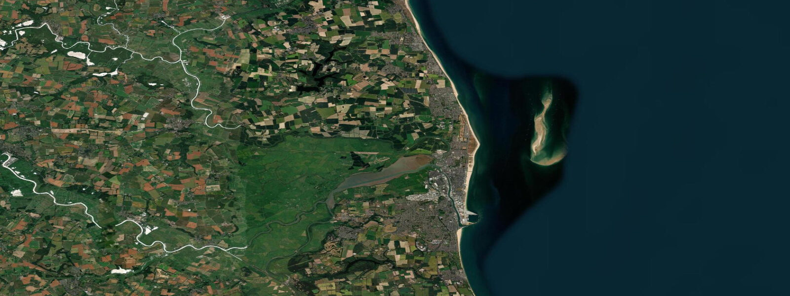
Great Yarmouth sits on a thin strip of sand between the North Sea to the east and the River Yare and Breydon Water to the west — a geography that has defined the town since its medieval herring-fishing peak. 0 metres. Two tides a day, reliably semidiurnal, nothing dramatic in range — but on a low-lying coast where even a modest surge can push water onto the roads, that 2 metres matters more than it would on a cliffy coast with a similar range.
The Yare mouth — Haven Bridge area — is where the tidal river meets the sea, and the interaction creates a daily pulse through Breydon Water, the broad tidal estuary that backs the town to the west. Breydon Water is a nationally designated SSSI: around 500 hectares of intertidal mudflat, saltmarsh fringe, and shallow open water that provides internationally important wintering habitat for white-fronted geese, pink-footed geese, golden plover, lapwing, and large numbers of ducks. The RSPB's Breydon Water reserve is accessed from the south bank.
The best birding is on the falling tide when the mudflats begin to expose, pushing feeding waders and wildfowl into concentrated areas visible from the walkways. Tidal bores occasionally form in the River Yare on large spring tides when the flood pushes upstream with enough force to create a perceptible wave front. The bore is modest by global standards — nothing like the Severn or the Qiantang — but it is real, and anglers who fish the river upstream from the town are aware of it as a timing signal for the flood push.
The salinity gradient in the river shifts with each tide: at high water springs the salt penetrates several kilometres upstream, pushing the freshwater fish species back and bringing in estuarine species that follow the salt front. Anglers fishing Breydon Water and the lower Yare target flounder, dace, roach, and occasional sea bass, with the tidal state governing where each species is likely to be feeding. The incoming flood two hours before high water is the consistent producer — fish moving onto the exposed edges as the water rises, actively feeding in the disturbance zone where fresh and salt water mix.
On the sea beach, Great Yarmouth's wide North Sea strand runs several kilometres north from the harbour mouth. The beach widens at low tide as the sand exposed between the low and high water marks is considerable — with a 2 metre range on a gently shelving beach, the intertidal width can be 50 to 100 metres of firm sand above the low-water line. Families with children can plan for maximum sand exposure at low tide, while the beach at high water on a rough day is a narrower, more energetic place.
The North Sea fetch from the northeast is long — the nearest coast in that direction is Denmark — and groundswells from North Sea storms can build to 3 to 4 metres offshore. The sandbanks off Yarmouth — the Nicholas, the Scroby, the Holm — absorb some of that energy, but the beach sees genuine surf on northeast winds. Scroby Sands Wind Farm sits on the offshore sandbank of that name, visible from the beach, and the commercial shipping lane through the channels between the banks makes the approaches to Yarmouth Harbour one of the more traffic-dense sections of the Norfolk coast.
Navigation through the cross-channel approaches uses the tidal window in the harbour entrance channel, which can silt and shift. The coast immediately north of Yarmouth — Caister-on-Sea, California, Scratby — is a low-lying dune and clay cliff coast under active erosion. The combination of North Sea storm surge (the 1953 surge killed 307 people in East Anglia, still the UK's worst peacetime flooding disaster) and sea-level rise makes the coastal flood risk here genuinely serious.
Spring high tides combined with northerly gale surge have inundated the roads behind Yarmouth in recent years; the Environment Agency's flood warning service monitors both tidal and surge conditions and issues advance warnings for the area. Any serious planning around this coast should check the EA flood alert system alongside the tide table. 3 metres on height — model-derived, not a local gauge.
3 metres is proportionally significant, so treat the times as planning guidance and use the authoritative Environment Agency gauge data for decisions where precision matters.
Tide questions about Great Yarmouth
Quick answers to the most common questions about tide times, range, and water access at Great Yarmouth.
What is the tidal range at Great Yarmouth?
The mean spring tidal range at Great Yarmouth is approximately 1.8 to 2.0 metres, with neap tides reducing the range to around 0.8 to 1.0 metres. This is a mesotidal North Sea coast — bigger than the microtidal English Channel at Dover, but nowhere near the 5 to 6 metre spring ranges of the East Yorkshire or Norfolk north coasts further around the bight. The flat, low-lying terrain behind the beach means even a 2 metre spring tide is operationally significant: the beach, the harbour approaches, and the low ground behind the dune line all change substantially between low and high water. Storm surge from northerly gales adds to the astronomical tide and is tracked separately by the Environment Agency flood warning service.
When is the next high tide at Great Yarmouth?
The tide table at the top of this page shows today's predicted high and low tide times for Great Yarmouth in local time — GMT in winter, BST (UTC+1) from late March to late October. Yarmouth sees two high waters and two low waters every 24 hours and 50 minutes, with each cycle shifting approximately 45 to 50 minutes later per day. Predictions here come from Open-Meteo Marine, typically within plus or minus 45 minutes on timing — model-derived. Authoritative tide predictions for Great Yarmouth are published in Admiralty Tide Tables volume 1 by the UKHO, and the Environment Agency maintains a real-time gauge station at the harbour.
Where does Great Yarmouth's tide data come from?
Tide predictions on this page are from Open-Meteo Marine, a global gridded ocean model. Accuracy is typically within plus or minus 45 minutes on timing and 0.2 to 0.3 metres on height — useful for general trip planning, not precision navigation. On a 2-metre spring range, the height uncertainty of 0.2 to 0.3 metres is proportionally meaningful, so treat these predictions as planning guidance. Authoritative data for Great Yarmouth comes from the Environment Agency river and tidal gauge network, the National Tidal and Sea Level Facility, and Admiralty Tide Tables volume 1 published annually by the UK Hydrographic Office.
What wildlife can I see at Breydon Water and when is best to visit?
Breydon Water, immediately west of Great Yarmouth, is a nationally important SSSI and RSPB reserve holding wintering white-fronted geese, pink-footed geese, golden plover, lapwing, teal, wigeon, and large numbers of wading birds including dunlin, black-tailed godwit, and redshank. The best viewing is on the falling tide: as the mudflats expose, birds that were spread across the water surface concentrate on the emergent mud to feed, making counting and identification much easier. At high water in winter the site is quieter — birds roost rather than feed. The RSPB's south bank access path runs the length of the estuary from the A47 road bridge; the north bank is more limited. Peak counts are November through February for geese and duck; wader diversity peaks on spring and autumn migration in April to May and August to October.
Is the beach safe for swimming at Great Yarmouth?
Great Yarmouth's main beach is a traditional resort beach with lifeguard cover during summer season — the RNLI flag system (red-and-yellow for designated swimming areas, red for dangerous, chequered for water sports) is the day-to-day safety guide. The North Sea off Yarmouth can produce rip currents near the harbour training walls and groynes, and offshore sandbanks mean wave patterns are complex in certain conditions. Tidal state matters mostly for the width of beach available: at low water there is considerably more dry sand, and the water temperature at low tide after the flood has been warming over exposed sand can be marginally warmer. Storm conditions with northerly swell are not beginner swimming conditions regardless of tidal state. Check the RNLI seasonal lifeguard rota for cover dates and times before planning a visit.
8-day tide table — Great Yarmouth
Heights relative to MSL. Predictions: Open-Meteo Marine (MeteoFrance SMOC, 0.08° grid) — heights relative to MSL (not chart datum / LAT). Model-derived.
| Day | Type | Time | Height |
|---|---|---|---|
| Fri 31 Jul | High | 01:00 | -0.5m / -1.6ft |
| Low | 03:56 | -1.1m / -3.6ft | |
| High | 09:34 | 0.7m / 2.2ft | |
| Low | 16:39 | -1.5m / -4.9ft | |
| High | 22:40 | 0.2m / 0.7ft | |
| Sat 01 Aug | Low | 17:13 | -1.6m / -5.1ft |
| High | 23:06 | 0.1m / 0.3ft | |
| Sun 02 Aug | Low | 04:51 | -1.1m / -3.5ft |
| High | 10:04 | 0.7m / 2.4ft | |
| Low | 17:39 | -1.5m / -4.9ft | |
| High | 23:06 | 0.3m / 1.0ft | |
| Mon 03 Aug | Low | 05:35 | -1.0m / -3.4ft |
| High | 10:37 | 0.7m / 2.3ft | |
| Low | 18:14 | -1.5m / -4.8ft | |
| High | 23:21 | 0.3m / 0.8ft | |
| Tue 04 Aug | Low | 06:03 | -1.1m / -3.5ft |
| High | 11:17 | 0.7m / 2.1ft | |
| Low | 18:45 | -1.4m / -4.7ft | |
| Wed 05 Aug | High | 00:13 | 0.3m / 1.0ft |
| Low | 06:42 | -0.9m / -2.9ft | |
| High | 12:03 | 0.7m / 2.4ft | |
| Low | 19:44 | -1.3m / -4.4ft | |
| Thu 06 Aug | High | 12:51 | 0.4m / 1.4ft |
| Low | 20:38 | -1.3m / -4.3ft | |
| Fri 07 Aug | High | 00:00 | -0.3m / -1.0ft |