Lytham St Annes tide times
Lytham St Annes tide forecast — heights relative to MSL.
Today's tide times for Lytham St Annes
Tide times at Lytham St Annes on Saturday, 4 July 2026: first high tide at 01:39, first low tide at 08:26, second high tide at 14:00, second low tide at 20:37. Sunrise 04:47, sunset 21:44.
Tide chart for Lytham St Annes
24-hour cosine-interpolated curve around the present moment. Heights relative to MSL. Predictions: Predictions: Open-Meteo Marine (MeteoFrance SMOC, 0.08° grid).
Sun, moon and conditions on Sat 04 Jul
Snapshot at build time — refreshes daily. Sea state from Open-Meteo Marine.
Highs and lows next 7 days
Every predicted high and low for the next week, with the daily tidal coefficient (0–120; higher = bigger swing, > 95 means stronger currents).
Other spots nearby
The three closest curated TideTurtle locations to Lytham St Annes, measured by great-circle distance.
Today's solunar windows
Solunar tradition: major periods are the ≈3h windows around moon transit and opposition; minor are ≈2h around moonrise and moonset. Pair with the local tide stage and wind for the best read.
Cycle dates near Lytham St Annes
Last spring tide on Sat 04 Jul (range 6.5m / 21.2ft). Next neap on Fri 10 Jul.
Spring tides cluster around new and full moons (biggest swings). Neap tides land on quarter moons (smallest swings). See the spring tide and neap tide glossary entries for the why.
About tides at Lytham St Annes
A short guide to the coastline at Lytham St Annes — geography, sea state, and what the tide is actually doing under your feet.
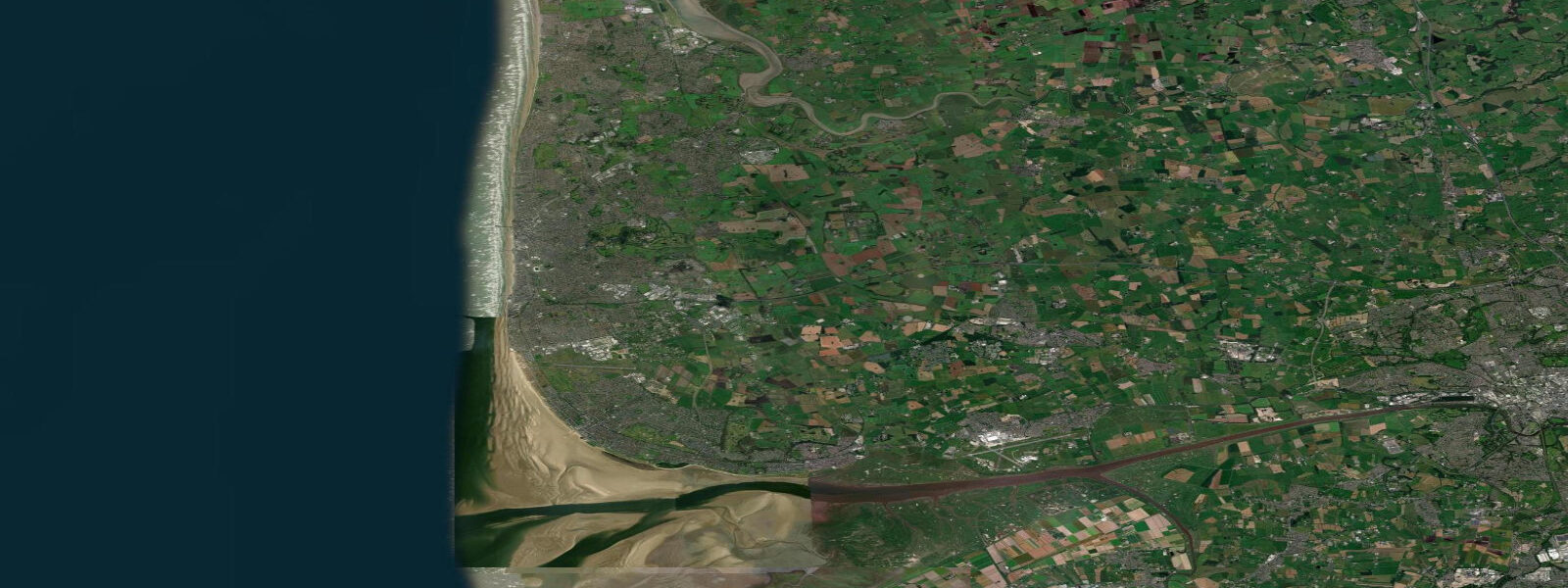
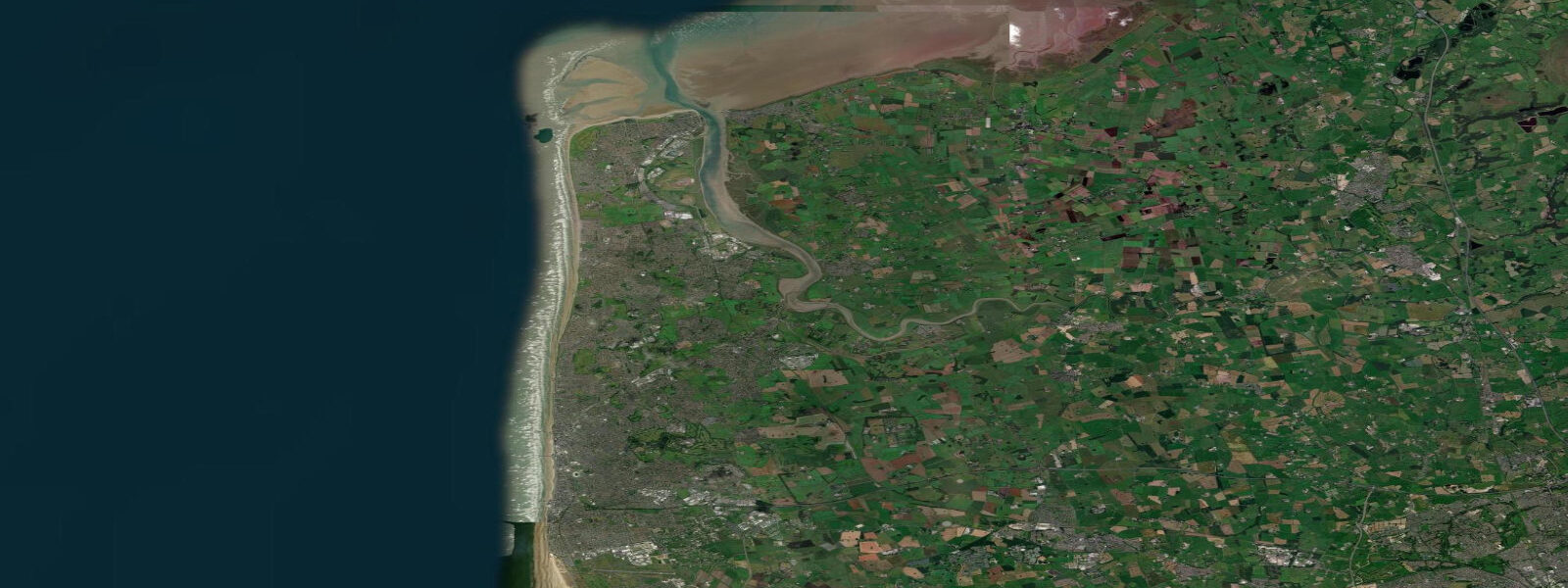
Lytham St Annes sits on the Fylde coast at the southern end of the Blackpool conurbation, where the flat Lancashire plain meets the Irish Sea in a broad, gently shelving beach of fine sand. The town is two communities grown together — Lytham to the east, with its handsome green, windmill, and estuary frontage on the River Ribble, and St Annes-on-Sea to the west, a planned Edwardian resort with a pier (truncated by storm damage and fire over the years) and a promenade that runs the length of the seafront. The unifying feature is the beach: at low water on a spring tide the sand drains for 300 metres and more, exposing a flat, firm expanse that has historically been used for speed record attempts and still draws land yacht racing from the St Annes club.
The tidal range here is one of the most dramatic on the Irish Sea coast — mean spring range approximately 8 metres. High water arrives visibly fast; the flood crosses the flat beach at a pace that catches the unwary, so awareness of the tide table is not optional but essential for anyone walking out onto the lower beach. Low water times are published daily and displayed on the resort's information boards.
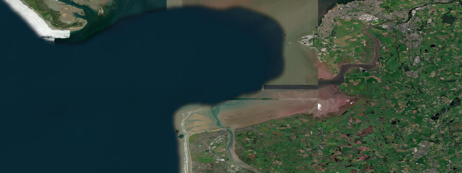
The River Ribble estuary opens to the south of Lytham. At low water, the estuary mudflats extend for several kilometres, and these inter-tidal zones are among the most important wader staging grounds in northern England. Oystercatchers are present year-round; bar-tailed godwit arrive in autumn having flown non-stop from their Siberian breeding grounds; knot gather in flocks of tens of thousands in winter, performing their wheeling murmurations over the Ribble estuary mudflats in a spectacle that ranks among the best wildlife watching in northwest England.
Dunlin, sanderling, and curlew are regular. The RSPB manages the Ribble Estuary National Nature Reserve from its Fairhaven base near Lytham, and the winter guided walks from the reserve are the easiest route to understanding the estuary ecology. Royal Lytham and St Annes Golf Club occupies the land between the town and the sea — a links course that has hosted the Open Championship multiple times, most recently in 2001 when David Duval won.
The course is private and not accessible to casual visitors, but its presence defines the character of the town: this is a place that takes its traditions seriously. The Lytham windmill on the green dates from 1805 and is one of the last surviving windmills in Lancashire. It is still operational and open to visitors in summer, giving a clear view across the estuary toward the Ribble marshes and, on clear days, to the hills above Southport to the south.
The St Annes promenade connects the two town centres and runs directly behind the dunes that front the beach. The dune system is actively managed and in places rises to 10 metres, providing shelter from westerly winds and a natural buffer to coastal erosion. Beach access points are clearly marked.
For paddlers, the estuary channel of the Ribble carries enough water at all tide stages to allow kayaking in the sheltered sections upstream of Lytham; the outer estuary at low tide is a complex of channels and banks that requires local knowledge to navigate safely. Photography conditions are best in the two hours around low water on a spring tide, when the expanse of wet sand reflects cloud formations and the windmill and St Annes pier frame the western horizon. Predictions on this page come from Open-Meteo Marine, a gridded global ocean model.
3 metres on height — model-derived, not from a local gauge. The UK Environment Agency and the RNLI coastal safety service maintain monitoring and safety infrastructure for this stretch of the Fylde coast.
Tide questions about Lytham St Annes
Quick answers to the most common questions about tide times, range, and water access at Lytham St Annes.
How fast does the tide come in at Lytham St Annes?
On a spring tide, the flood covers the full 300-metre beach width in approximately 90 minutes, which works out to roughly 3 to 4 metres of horizontal beach covered per minute across the flat sand. The rate is not constant — it accelerates through the lower beach where the gradient is gentlest. Anyone walking onto the lower beach at low water should return before the tide has been flooding for 45 minutes. The RNLI posts current tide times at the main beach access points, and the Fylde coast Coastguard broadcasts a safety message during high-risk tidal windows.
Is Lytham St Annes beach safe for children?
The upper beach and the sand above the mid-tide line is safe for children at all tide stages. The firm, flat sand is ideal for ball games, sandcastle building, and donkey rides (available from Easter to September). The critical rule is the lower beach: below the mid-tide line the tide advances fast enough to cut off the unwary, and the firm sand gives no warning. Keep children above the mid-tide marker posts. Water quality on the main beach consistently meets Bathing Water Directive standards; the local council posts current status on the promenade information boards.
What wading birds can I see at the Ribble Estuary near Lytham?
The Ribble Estuary National Nature Reserve holds internationally important numbers of bar-tailed godwit and knot from October through March. The godwit staging peak is September to November, with birds fuelling up on Ribble invertebrates before their Atlantic crossing. Knot perform large murmurations around high tide when they are pushed off the mudflats. Oystercatchers, dunlin, curlew, and redshank are present year-round. The best watching is from the RSPB Ribble Estuary reserve on the south side of the estuary, reachable from Lytham via the coastal path, or from Fairhaven Lake on the St Annes side at high tide when birds roost close to the seawall.
Can I walk from Lytham to Blackpool along the beach?
The beach walk from St Annes to Blackpool (roughly 8 kilometres) is possible at low water on a spring tide and is a popular route in summer. The key constraint is timing: the walk must be completed within 3 to 4 hours of low water to avoid being cut off by the returning flood. The northern end near Blackpool Pleasure Beach has groynes and rock armour that require care at the top of the beach. The promenade alternative runs the full length and is a straightforward route at any tide stage. Starting from Lytham and adding the estuary section to St Annes adds approximately 3 kilometres.
When is Royal Lytham and St Annes Golf Club open to visitors?
Royal Lytham and St Annes is a private members club and does not operate as a public course. Visitors can play as guests of members or through occasional open visitor days announced on the club's official website. The clubhouse exterior and the famous first tee, which backs directly onto the town rather than onto the sea in a quirk that surprises first-time visitors, can be seen from the adjacent streets. The British Golf Museum has a permanent display covering the Open Championship history at Lytham; the club's own small museum is accessible on approved visitor days.
7-day tide table — Lytham St Annes
Heights relative to MSL. Predictions: Open-Meteo Marine (MeteoFrance SMOC, 0.08° grid) — heights relative to MSL (not chart datum / LAT). Model-derived.
| Day | Type | Time | Height |
|---|---|---|---|
| Sat 04 Jul | High | 01:39 | 2.9m / 9.6ft |
| Low | 08:26 | -3.5m / -11.5ft | |
| High | 14:00 | 2.5m / 8.1ft | |
| Low | 20:37 | -3.3m / -10.8ft | |
| Sun 05 Jul | High | 02:14 | 2.8m / 9.3ft |
| Low | 09:02 | -3.5m / -11.6ft | |
| High | 14:42 | 2.3m / 7.6ft | |
| Low | 21:14 | -3.0m / -10.0ft | |
| Mon 06 Jul | High | 02:53 | 2.8m / 9.2ft |
| Low | 09:43 | -3.5m / -11.4ft | |
| High | 15:24 | 2.3m / 7.5ft | |
| Low | 21:57 | -2.9m / -9.6ft | |
| Tue 07 Jul | High | 03:39 | 2.6m / 8.7ft |
| Low | 10:31 | -3.3m / -11.0ft | |
| High | 16:14 | 2.1m / 7.0ft | |
| Low | 22:47 | -2.9m / -9.4ft | |
| Wed 08 Jul | High | 04:33 | 2.4m / 7.7ft |
| Low | 11:20 | -3.2m / -10.5ft | |
| High | 17:12 | 2.1m / 6.7ft | |
| Low | 23:45 | -2.8m / -9.0ft | |
| Thu 09 Jul | High | 05:39 | 2.3m / 7.4ft |
| Low | 12:23 | -2.9m / -9.7ft | |
| High | 18:19 | 2.0m / 6.6ft | |
| Fri 10 Jul | Low | 00:53 | -2.6m / -8.6ft |
| High | 06:48 | 2.3m / 7.4ft | |
| Low | 13:33 | -2.9m / -9.4ft |