Ryde tide times
Ryde tide forecast — heights relative to MSL.
Today's tide times for Ryde
Tide times at Ryde on Saturday, 27 June 2026: first high tide at 01:00, first low tide at 03:18, second high tide at 22:41. Sunrise 04:53, sunset 21:21.
Tide chart for Ryde
24-hour cosine-interpolated curve around the present moment. Heights relative to MSL. Predictions: Predictions: Open-Meteo Marine (MeteoFrance SMOC, 0.08° grid).
Sun, moon and conditions on Sat 27 Jun
Snapshot at build time — refreshes daily. Sea state from Open-Meteo Marine.
Highs and lows next 7 days
Every predicted high and low for the next week, with the daily tidal coefficient (0–120; higher = bigger swing, > 95 means stronger currents).
Other spots nearby
The three closest curated TideTurtle locations to Ryde, measured by great-circle distance.
Today's solunar windows
Solunar tradition: major periods are the ≈3h windows around moon transit and opposition; minor are ≈2h around moonrise and moonset. Pair with the local tide stage and wind for the best read.
Cycle dates near Ryde
Next spring tide on Fri 03 Jul (range 2.6m / 8.5ft). Last neap on Sat 27 Jun.
Spring tides cluster around new and full moons (biggest swings). Neap tides land on quarter moons (smallest swings). See the spring tide and neap tide glossary entries for the why.
About tides at Ryde
A short guide to the coastline at Ryde — geography, sea state, and what the tide is actually doing under your feet.
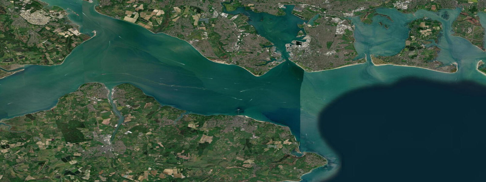
Ryde is the main arrival point on the Isle of Wight for visitors from Portsmouth, sitting on the island's northeast shore facing directly across the eastern Solent. The 700 m pier is the second fact most visitors learn about Ryde, after the hovercraft: the pier extends that distance because the shore is so shallow that ferries cannot reach the promenade at low water without it. The hovercraft from Southsea beach is one of only two scheduled commercial hovercraft services in the world; it lands at the pier head beside the catamaran ferry terminal.
The tidal regime at Ryde is the eastern Solent double high water — among the most unusual tidal signatures anywhere in the British Isles. The tidal wave entering the English Channel from the Atlantic travels northeast and diffracts around both ends of the Isle of Wight. The wave going around the west end (past the Needles) arrives at the eastern Solent sooner; the wave going around the east end (past Bembridge) arrives slightly later. The two waves superimpose to produce a double high water: the water rises to a first peak, partially ebbs, rises again to a second peak, and only then begins the main ebb. The high-water stand at Ryde can last 2–3 hours on some tidal cycles. Spring range is approximately 4.5 m.
For the practical user, the double high water means that high-water-dependent activities — launching a boat, crossing a tidal causeway, accessing a tidal ramp — have a longer usable window than a single-peak system at the same range would provide. Harbour managers on the eastern IoW plan around it as a feature, not a complication. For anglers working the top of the tide, the stand means the slack lasts longer, changing the bite window significantly compared to a coast with a clean single peak.
Ryde beach, directly in front of the esplanade, is one of the finest on the IoW: a broad, gently sloping sand beach that at low water extends over 400 m to the waterline. The sand is clean and fine; in summer the beach fills with families from the Portsmouth/Southampton conurbation accessible by ferry in 22 minutes. At high water the beach narrows but remains functional. The double high water means the beach is at its largest for a longer period than the nominal low-water time suggests — the tide drops to its minimum and then stays there, rather than immediately returning.
The esplanade at Ryde runs 2 km east to west, connecting the pier and the ferry terminal to the beach and the town centre. Cycling and walking are the primary uses. The amusement park and funfair occupy the western end of the esplanade in season. For paddleboarders, the beach launch at low to mid-tide provides easy entry into the eastern Solent with enough depth to avoid the sandbanks immediately offshore. The Ryde Sands shoals extend eastward; local knowledge of the channel marks is useful before venturing further east.
For photographers, the pier at sunrise — the ferry or hovercraft docking, the steam rising from the Solent in cool morning air, the Isle of Wight coast visible in both directions — is the compositional starting point. The best light on the esplanade promenade is from the east in the morning, which illuminates the Victorian seafront buildings face-on. The beach at spring low water, with the pier extending into the distance and the Portsmouth skyline on the horizon, is the wide-angle landscape shot.
All tide predictions for Ryde come from the Open-Meteo Marine gridded model. Timing accuracy is ±45 minutes; height accuracy is ±0.3 m above Chart Datum.
Tide questions about Ryde
Quick answers to the most common questions about tide times, range, and water access at Ryde.
What is the double high water at Ryde and why does it happen?
The eastern Solent's double high water occurs because the tidal wave entering the English Channel diffracts around both ends of the Isle of Wight, arriving at the eastern Solent from two directions at slightly different times. The two waves combine to produce a first high, a partial fall, and then a second high — the high-water stand can last 2–3 hours. The same phenomenon affects Southampton, Cowes (to a lesser extent), and the entire eastern Solent. Ryde's spring range is approximately 4.5 m; the double peak is visible on any tidal curve for the station.
Why does Ryde pier extend 700 m into the Solent?
The foreshore at Ryde is extremely shallow — the beach extends over 400 m at spring low water. Without the pier, ferries and the hovercraft could not reach the shore at low tide. The pier was first built in 1814 and has been extended and rebuilt several times since; the current structure carries a railway line (the Island Line, using former London Underground rolling stock) from the pier head to the town centre. The hovercraft from Southsea lands at the pier head alongside the catamaran ferry terminal.
How good is Ryde beach and when is it at its widest?
Ryde beach is one of the best beaches on the Isle of Wight — broad, flat, and sandy, with clean water. At spring low water the beach extends over 400 m from the esplanade to the waterline. The double high water means the beach stays at its maximum low-water width for longer than a single-peak tidal station at the same range would allow. The best family beach conditions are 2–4 hours after the morning high tide, when the beach has drained and firmed. Summer water temperatures in the eastern Solent reach 17–19 °C.
Can I paddleboard or kayak from Ryde beach?
Ryde beach is a practical launch point for paddleboarding and kayaking in the eastern Solent. Launch at mid-tide — at low water the shallows extend far enough that launching and carrying a board to knee-depth water is a long walk. The Ryde Sands shoals extend east of the pier; keep to the channel marked by the pier and avoid the shoal ground east of the pier head in vessels drawing over 0.5 m. The eastern Solent has moderate tidal streams (1–2 knots at springs); paddle with the flood to go east and return on the ebb. Stay clear of the hovercraft approach lane north of the pier head.
How long does the ferry from Portsmouth to Ryde take and which service should I use?
The hovercraft from Southsea seafront to Ryde Esplanade takes approximately 10 minutes — the fastest crossing, but it operates only in suitable sea conditions and may be cancelled in strong winds or rough water. The Wightlink catamaran ferry from Portsmouth Harbour station to Ryde Pier Head takes 22 minutes and operates in most conditions. Both services run frequently during the day (approximately every 30 minutes). The catamaran connects directly to the Island Line railway at Ryde Pier Head for onward travel to Shanklin.
8-day tide table — Ryde
Heights relative to MSL. Predictions: Open-Meteo Marine (MeteoFrance SMOC, 0.08° grid) — heights relative to MSL (not chart datum / LAT). Model-derived.
| Day | Type | Time | Height |
|---|---|---|---|
| Sat 27 Jun | High | 01:00 | -0.7m / -2.3ft |
| Low | 03:18 | -1.3m / -4.2ft | |
| High | 22:41 | 0.7m / 2.2ft | |
| Sun 28 Jun | Low | 03:56 | -1.4m / -4.4ft |
| High | 11:03 | 0.7m / 2.4ft | |
| Low | 16:11 | -1.3m / -4.2ft | |
| High | 23:16 | 0.6m / 2.0ft | |
| Mon 29 Jun | Low | 04:26 | -1.5m / -5.1ft |
| High | 11:45 | 0.7m / 2.3ft | |
| Low | 16:40 | -1.4m / -4.5ft | |
| High | 23:55 | 0.7m / 2.4ft | |
| Tue 30 Jun | Low | 05:07 | -1.6m / -5.1ft |
| High | 12:22 | 0.7m / 2.3ft | |
| Low | 17:16 | -1.5m / -4.8ft | |
| Wed 01 Jul | High | 00:31 | 0.7m / 2.4ft |
| Low | 05:32 | -1.6m / -5.4ft | |
| High | 12:52 | 0.7m / 2.4ft | |
| Low | 17:50 | -1.5m / -4.9ft | |
| Thu 02 Jul | High | 00:57 | 0.8m / 2.5ft |
| Low | 06:12 | -1.7m / -5.6ft | |
| Fri 03 Jul | High | 01:25 | 0.7m / 2.4ft |
| Low | 06:44 | -1.8m / -5.9ft | |
| High | 13:58 | 0.8m / 2.7ft | |
| Low | 19:03 | -1.5m / -4.9ft | |
| Sat 04 Jul | High | 00:00 | 0.1m / 0.3ft |