Whitehaven tide times
Whitehaven tide forecast — heights relative to MSL.
Today's tide times for Whitehaven
Tide times at Whitehaven on Sunday, 21 June 2026: first low tide at 01:00, first high tide at 04:15, second low tide at 11:00, second high tide at 16:58, third low tide at 23:14. Sunrise 04:37, sunset 21:54.
Tide chart for Whitehaven
24-hour cosine-interpolated curve around the present moment. Heights relative to MSL. Predictions: Predictions: Open-Meteo Marine (MeteoFrance SMOC, 0.08° grid).
Sun, moon and conditions on Sun 21 Jun
Snapshot at build time — refreshes daily. Sea state from Open-Meteo Marine.
Highs and lows next 7 days
Every predicted high and low for the next week, with the daily tidal coefficient (0–120; higher = bigger swing, > 95 means stronger currents).
Other spots nearby
The three closest curated TideTurtle locations to Whitehaven, measured by great-circle distance.
Today's solunar windows
Solunar tradition: major periods are the ≈3h windows around moon transit and opposition; minor are ≈2h around moonrise and moonset. Pair with the local tide stage and wind for the best read.
Cycle dates near Whitehaven
Last spring tide on Sun 21 Jun (range 6.1m / 20.2ft). Next spring tide on Sat 27 Jun (range 4.7m / 15.4ft). Next neap on Thu 25 Jun.
Spring tides cluster around new and full moons (biggest swings). Neap tides land on quarter moons (smallest swings). See the spring tide and neap tide glossary entries for the why.
About tides at Whitehaven
A short guide to the coastline at Whitehaven — geography, sea state, and what the tide is actually doing under your feet.
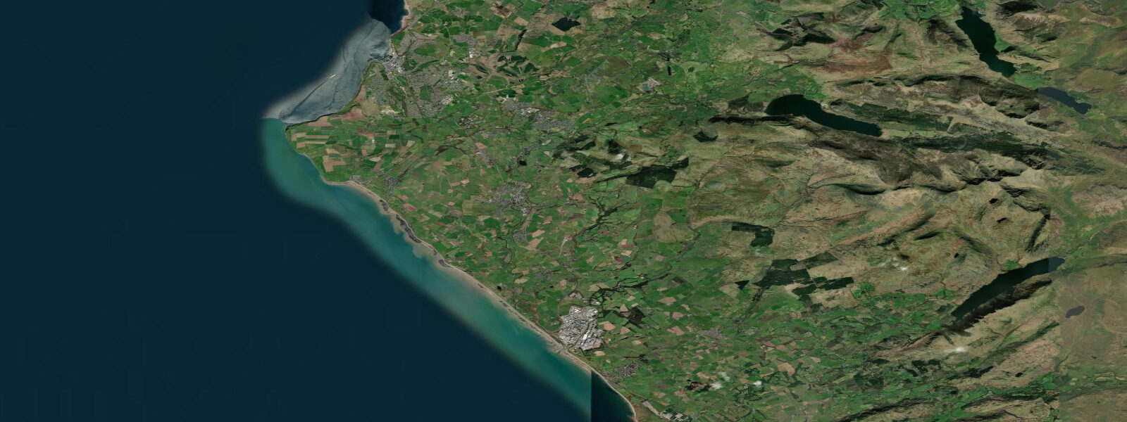
Whitehaven faces west onto the Irish Sea, a Georgian port town on Cumbria's west coast about 45 kilometres north of Barrow-in-Furness. The harbour was purpose-built in the late seventeenth and eighteenth centuries to export coal from the Cumberland coalfield, and at its peak in the mid-1700s it was the second-largest port in England after London. The Georgian street grid that coal revenue paid for still defines the town centre — it's one of the best-preserved planned Georgian townscapes outside Bath.
The tidal character at Whitehaven differs from Morecambe Bay. The harbour faces the open Irish Sea rather than a closed embayment, and the mean spring range is around 5.5 metres — still macrotidal by global standards, but roughly half the range of the bay sites to the south. Low water exposes the harbour floor and the outer harbour walls, with the inner marina maintaining some depth via a gate. The outer walls and the West Pier, extending south from the harbour mouth, are wave-exposed in westerly and southwesterly gales.
The Beacon Museum, built on the West Pier, covers the town's history from the tobacco trade through coal export, with the most complete collection relating to the Lowther family, who controlled much of the port's development in the eighteenth century. The top floor of the building has a panoramic view over the harbour and out to the Isle of Man on clear days. The museum reopened after major refurbishment and is free to enter.
Coal-loading infrastructure from the port's peak — the wharves, the staiths, the old railway alignment — has mostly been absorbed into the marina development, but the Georgian buildings on Marlborough Street and Duke Street survive largely intact. The town was also the site of two significant moments in American history: Paul Jones (who became John Paul Jones, father of the American navy) was born in nearby Kirkbean and led a raid on Whitehaven harbour in 1778 during the American Revolutionary War — the last foreign armed raid on British soil.
Sea angling from the harbour walls and the North Pier is productive. Codling appear in the outer harbour from October through January; flounder are present year-round in the inner harbour on a flooding tide. The Irish Sea gives a long westerly fetch, and when Atlantic swells wrap around St Bees Head (5 kilometres south), they arrive at Whitehaven as a short, steep, residual swell that can produce surfable waves on the south side of the harbour entrance on low to mid tide.
The C2C (Coast to Coast) cycle route begins at Whitehaven, on the quayside, before crossing the full width of northern England to Sunderland. Cyclists dip their rear wheel in the Irish Sea here on day one; the route is 225 kilometres and climbs over the Lake District fells, the Pennines, and the Yorkshire Dales.
Tide predictions on this page come from Open-Meteo Marine (±45 minutes, ±0.2–0.3 m accuracy). For authoritative local tide times consult UKHO EasyTide or NTSLF gauge data.
Tide questions about Whitehaven
Quick answers to the most common questions about tide times, range, and water access at Whitehaven.
What is the tidal range at Whitehaven?
The mean spring range at Whitehaven is around 5.5 metres — macrotidal, but lower than the extreme ranges recorded further south in Morecambe Bay. Neap range is approximately 2.5 to 3.0 metres. The outer harbour and pier are exposed at low water; the inner marina uses a gate to retain water. The Irish Sea exposure means tidal conditions at Whitehaven are influenced by storm surges from Atlantic depressions more directly than the sheltered bay sites to the south.
What is the Beacon Museum and is it worth visiting?
The Beacon Museum is Whitehaven's main cultural site, built into the West Pier at the harbour entrance. It covers the full history of the port from the coal trade through the tobacco import era, with an extensive Lowther family archive. The top floor offers a 360-degree view over the harbour and out to the Isle of Man — worth the climb. Entry is free. The museum also covers the John Paul Jones raid of 1778, the last armed foreign attack on mainland Britain.
Is there surf at Whitehaven?
Occasionally. When Atlantic groundswell wraps around St Bees Head (5 km south) and enters the harbour bay from the southwest, short-period waves can produce a surfable shore break on the south side of the harbour at low to mid tide. Consistent surf is not the town's selling point — St Bees Beach, 5 kilometres south, catches more direct swell and has a better beach profile for surfing. Whitehaven's surf is opportunistic rather than reliable.
Where does the C2C cycle route start in Whitehaven?
The Coast to Coast (C2C) cycle route begins at the Whitehaven harbourside, on the quay adjacent to the inner marina. Cyclists traditionally dip their rear wheel in the Irish Sea at the start and their front wheel in the North Sea at journey's end (usually Sunderland or Tynemouth, 225 km east). The route climbs through the Lake District, over the Pennines via Hartside Pass, and across the Yorkshire Dales. Most cyclists complete it in three to five days; the route is well-signed from the harbour.
How accurate are tide predictions for Whitehaven, and where can I get official forecasts?
Tide predictions on this page use Open-Meteo Marine, a global ocean model accurate to approximately ±45 minutes in timing and ±0.2–0.3 metres in height. These are sufficient for general planning. For maritime navigation or safety-critical timing, use the UKHO EasyTide service, which provides site-specific secondary port corrections for Whitehaven derived from the Heysham standard port. Tide data is not a substitute for local weather and sea-state information — check the Met Office inshore forecast for the Irish Sea before any water activity.
7-day tide table — Whitehaven
Heights relative to MSL. Predictions: Open-Meteo Marine (MeteoFrance SMOC, 0.08° grid) — heights relative to MSL (not chart datum / LAT). Model-derived.
| Day | Type | Time | Height |
|---|---|---|---|
| Sun 21 Jun | Low | 01:00 | -0.7m / -2.3ft |
| High | 04:15 | 2.7m / 8.7ft | |
| Low | 11:00 | -3.5m / -11.5ft | |
| High | 16:58 | 1.9m / 6.2ft | |
| Low | 23:14 | -2.7m / -9.0ft | |
| Mon 22 Jun | High | 05:15 | 2.3m / 7.5ft |
| Low | 11:48 | -3.1m / -10.1ft | |
| High | 17:58 | 1.9m / 6.1ft | |
| Tue 23 Jun | Low | 00:08 | -2.5m / -8.3ft |
| High | 06:21 | 2.1m / 7.0ft | |
| Low | 12:45 | -2.6m / -8.6ft | |
| High | 18:59 | 1.7m / 5.7ft | |
| Wed 24 Jun | Low | 01:05 | -2.3m / -7.6ft |
| High | 07:21 | 2.0m / 6.4ft | |
| Low | 13:43 | -2.6m / -8.7ft | |
| High | 20:01 | 1.7m / 5.6ft | |
| Thu 25 Jun | Low | 02:11 | -2.2m / -7.3ft |
| High | 08:22 | 1.8m / 6.0ft | |
| Low | 14:39 | -2.4m / -7.7ft | |
| High | 20:56 | 2.0m / 6.5ft | |
| Fri 26 Jun | Low | 03:14 | -2.2m / -7.2ft |
| High | 09:18 | 2.0m / 6.7ft | |
| Low | 15:42 | -2.3m / -7.5ft | |
| High | 21:46 | 2.2m / 7.1ft | |
| Sat 27 Jun | Low | 04:10 | -2.3m / -7.5ft |
| High | 10:07 | 2.2m / 7.1ft | |
| Low | 16:32 | -2.3m / -7.6ft | |
| High | 22:30 | 2.4m / 7.8ft |