St Helier, Jersey tide times
St Helier, Jersey tide forecast — heights relative to MSL.
Today's tide times for St Helier, Jersey
Tide times at St Helier, Jersey on Sunday, 21 June 2026: first high tide at 01:00, first low tide at 05:45, second high tide at 11:41, second low tide at 18:02. Sunrise 05:03, sunset 21:17.
Tide chart for St Helier, Jersey
24-hour cosine-interpolated curve around the present moment. Heights relative to MSL. Predictions: Predictions: Open-Meteo Marine (MeteoFrance SMOC, 0.08° grid).
Sun, moon and conditions on Sun 21 Jun
Snapshot at build time — refreshes daily. Sea state from Open-Meteo Marine.
Highs and lows next 7 days
Every predicted high and low for the next week, with the daily tidal coefficient (0–120; higher = bigger swing, > 95 means stronger currents).
Other spots nearby
The three closest curated TideTurtle locations to St Helier, Jersey, measured by great-circle distance.
Today's solunar windows
Solunar tradition: major periods are the ≈3h windows around moon transit and opposition; minor are ≈2h around moonrise and moonset. Pair with the local tide stage and wind for the best read.
Cycle dates near St Helier, Jersey
Last spring tide on Sun 21 Jun (range 6.6m / 21.7ft). Next spring tide on Sat 27 Jun (range 5.8m / 19.2ft). Next neap on Wed 24 Jun.
Spring tides cluster around new and full moons (biggest swings). Neap tides land on quarter moons (smallest swings). See the spring tide and neap tide glossary entries for the why.
About tides at St Helier, Jersey
A short guide to the coastline at St Helier, Jersey — geography, sea state, and what the tide is actually doing under your feet.
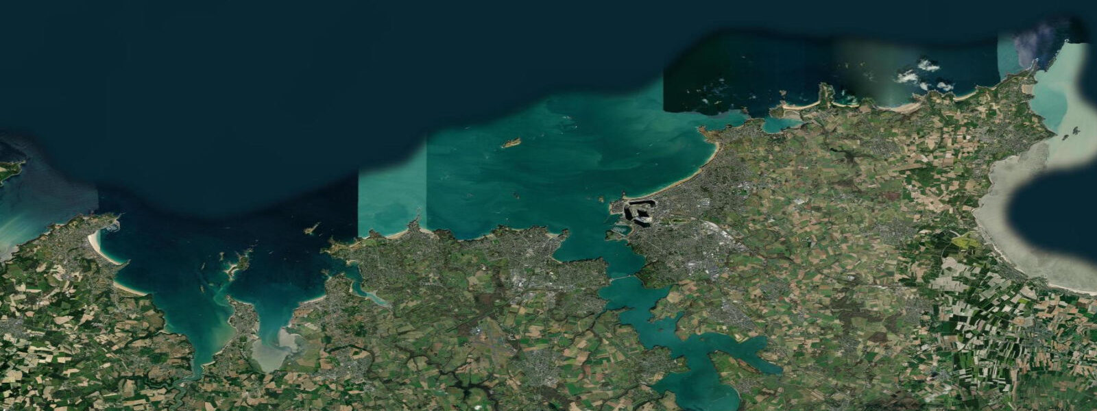
St Helier is the capital and main harbour of Jersey, sitting on the island's southern coast directly facing the Bay of Mont Saint-Michel. The tidal range here is extreme. Mean spring range at St Helier is around 12.0 metres — one of the five largest tidal ranges recorded anywhere in the world. The physical cause is the Bay of Mont Saint-Michel resonance system: Atlantic tides amplify as they funnel through the narrowing gap between Jersey and the Normandy coast, with the bay's resonant frequency reinforcing each tidal pulse. Mont Saint-Michel itself, a few nautical miles north, reaches 13 to 14 metres at equinoctial springs.
At low water, the harbour geography transforms. The Victoria, Albert, and Elizabeth harbours — a connected system of basins built through the nineteenth and early twentieth centuries — partially drain, with vessels in the tidal sections sitting on their keels in the mud. The Elizabeth Marina uses a gate to maintain depth. The most dramatic low-water feature is Elizabeth Castle, built on the tidal islet Île au Guerdain in the mid-harbour. At high tide it stands entirely surrounded by water. At low water a 700-metre sand causeway emerges, connecting the castle to the St Helier waterfront. The walkable window is roughly four hours centred on low tide, typically two hours before and two hours after low water. A seasonal amphibious vehicle also operates the causeway crossing when conditions allow.
The castle dates to the late sixteenth century and was expanded through the seventeenth. It held out for the Royalists during the Civil War; Charles II sheltered here briefly before his restoration. The site is now a Jersey Heritage property open to visitors. Low-water morning visits, when the causeway is dry and the light is best, are the way to experience the castle properly.
St Helier's fish market, on the Weighbridge, is one of the best in the British Isles. Jersey's own fishing fleet brings bass, spider crab, lobster, and ormer (a large abalone species native to Jersey, seasonally restricted by law) to the market stalls. Ormers are one of the few things genuinely unique to the Channel Islands — they live on the low-water reefs and are harvested under a strict licence and season regime. They cannot be legally exported; eating them means being in Jersey.
For swimmers and paddlers, St Brelade's Bay (9 kilometres west) has the better beach. St Helier itself is primarily a working harbour and commercial waterfront. The town centre — Royal Square, the market halls, the Liberation Monument — is compact and walkable within 15 minutes from the waterfront.
Tide predictions on this page come from Open-Meteo Marine (±45 minutes, ±0.2–0.3 m accuracy). Given St Helier's extreme 12-metre spring range, small model errors translate to significant timing and height differences. For authoritative predictions, use the NTSLF station data for St Helier or UKHO EasyTide, which publishes a full year of verified St Helier predictions.
Tide questions about St Helier, Jersey
Quick answers to the most common questions about tide times, range, and water access at St Helier, Jersey.
What is the tidal range at St Helier, Jersey?
St Helier has a mean spring tidal range of approximately 12.0 metres, placing it among the five largest tidal ranges on earth. Neap range drops to around 6.0 metres — which is itself considered large by global standards. The cause is the resonance of the Bay of Mont Saint-Michel: the shape and depth of the bay amplify each tidal pulse as it arrives from the Atlantic. At equinoctial springs in March and September, the range at St Helier can exceed 12.2 metres.
When can I walk to Elizabeth Castle across the sand?
The causeway to Elizabeth Castle is walkable for approximately four hours centred on low tide — typically two hours before and two hours after the predicted low water. With a 12-metre spring range, the window is relatively generous but the incoming tide fills the causeway quickly. Check the predicted low water time for the day and plan to be back on the shore no later than 90 minutes after low water to allow a comfortable margin. A seasonal amphibious vehicle service also makes the crossing when the causeway is flooded. Jersey Heritage publishes causeway access times daily at the castle entrance.
What are ormers and where can I try them?
Ormers (Haliotis tuberculata) are a large abalone species native to the Channel Islands — found nowhere else in the British Isles. They live on low-water reefs and are harvested under a strict seasonal and licence system; collection is only legal on the first day of each new or full moon from January through April, and then only by licensed harvesters. Ormers cannot be legally exported from Jersey. Restaurants in St Helier and across the island serve them when in season; the fish market on the Weighbridge is the place to ask about availability.
Is St Helier's harbour safe for small boats?
St Helier is one of the busiest ferry and commercial ports in the British Isles and requires proper passage planning for visiting vessels. The 12-metre spring range means harbour depths change dramatically over the tidal cycle; some berths and anchorages dry at low water. The Elizabeth Marina maintains depth via a locked gate. Harbour authorities publish entry signals, gate-lock times, and berthing arrangements — contact Jersey Harbours well in advance of any planned visit. Tidal streams in the approaches run strongly on spring tides.
How reliable are the tide predictions for St Helier on this page?
Tide predictions here use Open-Meteo Marine, a global gridded ocean model. Typical accuracy is ±45 minutes in timing and ±0.2–0.3 metres in height — in a 12-metre tidal range environment, a 0.3-metre height error is proportionally small but can still affect causeway and reef access. For navigation and safety-critical decisions, use UKHO EasyTide or the Admiralty Tide Tables (NP308, Channel Islands and adjacent French coasts), which provide verified, station-specific St Helier predictions. These are the authoritative source; Open-Meteo is for orientation only.
8-day tide table — St Helier, Jersey
Heights relative to MSL. Predictions: Open-Meteo Marine (MeteoFrance SMOC, 0.08° grid) — heights relative to MSL (not chart datum / LAT). Model-derived.
| Day | Type | Time | Height |
|---|---|---|---|
| Sun 21 Jun | High | 01:00 | 1.7m / 5.7ft |
| Low | 05:45 | -3.9m / -12.8ft | |
| High | 11:41 | 2.6m / 8.4ft | |
| Low | 18:02 | -3.4m / -11.1ft | |
| Mon 22 Jun | High | 00:03 | 2.7m / 8.8ft |
| Low | 06:34 | -3.4m / -11.1ft | |
| High | 12:36 | 2.3m / 7.6ft | |
| Low | 18:51 | -2.8m / -9.2ft | |
| Tue 23 Jun | High | 00:57 | 2.4m / 7.8ft |
| Low | 07:24 | -2.9m / -9.5ft | |
| High | 13:31 | 2.2m / 7.2ft | |
| Low | 19:54 | -2.5m / -8.2ft | |
| Wed 24 Jun | High | 01:55 | 2.2m / 7.1ft |
| Low | 21:10 | -2.4m / -7.8ft | |
| Thu 25 Jun | High | 02:54 | 2.1m / 6.7ft |
| Low | 09:39 | -2.5m / -8.2ft | |
| High | 15:23 | 2.2m / 7.4ft | |
| Low | 22:18 | -2.5m / -8.3ft | |
| Fri 26 Jun | High | 03:51 | 2.2m / 7.2ft |
| Low | 10:42 | -2.6m / -8.5ft | |
| High | 16:17 | 2.4m / 8.0ft | |
| Low | 23:13 | -2.8m / -9.1ft | |
| Sat 27 Jun | High | 04:45 | 2.4m / 7.8ft |
| Low | 11:37 | -2.9m / -9.5ft | |
| High | 17:09 | 2.7m / 8.8ft | |
| Sun 28 Jun | Low | 00:00 | -3.1m / -10.3ft |