Jebel Ali, Dubai tide times
Jebel Ali, Dubai tide forecast — heights relative to MSL.
Today's tide times for Jebel Ali, Dubai
Tide times at Jebel Ali, Dubai on Friday, 19 June 2026: first high tide at 04:00, first low tide at 09:38, second high tide at 16:00, second low tide at 21:00. Sunrise 05:30, sunset 19:11.
Tide chart for Jebel Ali, Dubai
24-hour cosine-interpolated curve around the present moment. Heights relative to MSL. Predictions: Predictions: Open-Meteo Marine (MeteoFrance SMOC, 0.08° grid).
Sun, moon and conditions on Fri 19 Jun
Snapshot at build time — refreshes daily. Sea state from Open-Meteo Marine.
Highs and lows next 7 days
Every predicted high and low for the next week, with the daily tidal coefficient (0–120; higher = bigger swing, > 95 means stronger currents).
Other spots nearby
The three closest curated TideTurtle locations to Jebel Ali, Dubai, measured by great-circle distance.
Today's solunar windows
Solunar tradition: major periods are the ≈3h windows around moon transit and opposition; minor are ≈2h around moonrise and moonset. Pair with the local tide stage and wind for the best read.
Cycle dates near Jebel Ali, Dubai
Last spring tide on Fri 19 Jun (range 1.8m). Next neap on Wed 24 Jun.
Spring tides cluster around new and full moons (biggest swings). Neap tides land on quarter moons (smallest swings). See the spring tide and neap tide glossary entries for the why.
About tides at Jebel Ali, Dubai
A short guide to the coastline at Jebel Ali, Dubai — geography, sea state, and what the tide is actually doing under your feet.
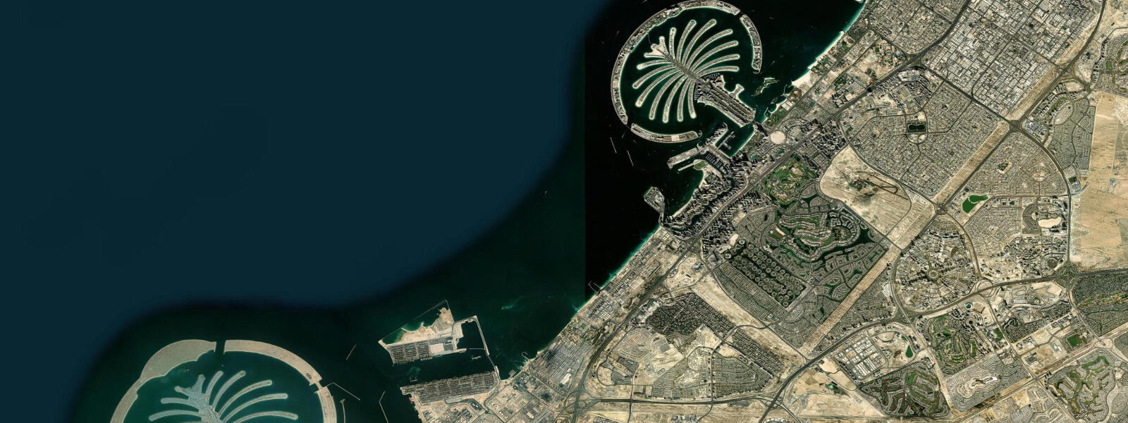
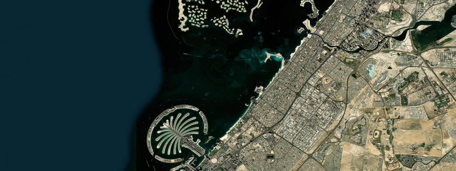
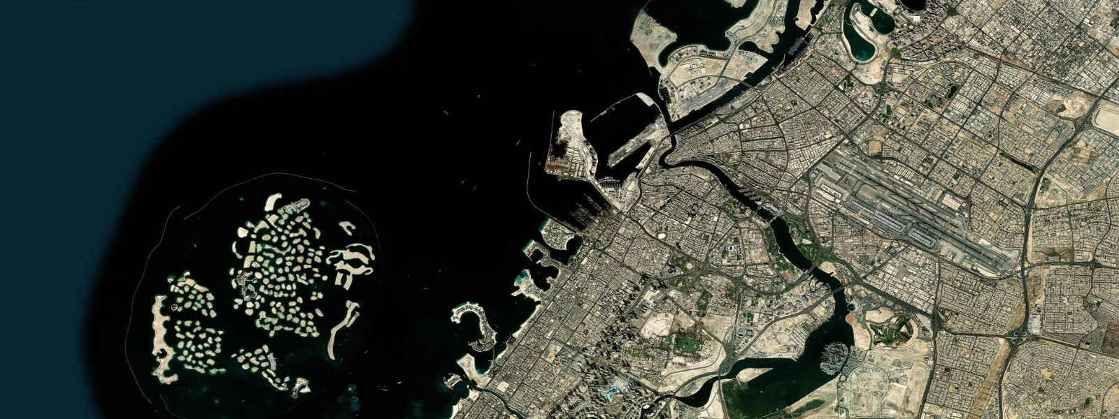
Jebel Ali sits 35 km southwest of Dubai city, where the Gulf coastline bends slightly and the water deepens enough to have justified one of the largest engineering projects in the modern Middle East: Jebel Ali Port, the world's largest man-made harbour. The port's scale is difficult to absorb from the ground — the outer breakwater runs more than 15 km from end to end, enclosing a harbour basin large enough that ultra-large container vessels manoeuvre inside it with little restriction. Outside the port boundary, the coastline still holds remnants of what the Dubai littoral used to look like: natural beach, intertidal flats, and mangrove forest.
The tidal regime at Jebel Ali is semidiurnal Persian Gulf — two highs and two lows daily, mean range 1.0–1.5 m. Spring tides reach approximately 2.0 m; neap tides reduce to around 0.6 m. The position 35 km southwest of Dubai sits slightly further into the Gulf's resonance geometry, but tidal timing and range are comparable to the Dubai Port reference gauge. The port's own tide gauge is a critical operational instrument: the channel entrance is dredged to 16–17 m chart datum, maintained for the draft requirements of ultra-large container vessels (ULCVs) carrying 20,000+ TEU. These vessels draw 14–15.5 m loaded; the operational margin in the entrance channel is real but not large, and port approach planning includes tidal window calculation as a standard step. An incoming ULCV with 15.0 m draft passes through the entrance channel with approximately 1.5 m under the keel at mean low water — less at astronomical low water on spring tides. The port authority coordinates berth scheduling to ensure critical arrivals and departures occur within acceptable tidal windows.
Jebel Ali Port handles over 14 million TEU per year, ranking consistently in the top ten busiest container ports globally. The Free Zone surrounding the port — Jebel Ali Free Zone (JAFZA) — is the largest free trade zone in the Middle East, occupying 57 km² of reclaimed land and purpose-built industrial territory southwest of the city. The Free Zone is a working industrial and commercial area, not a visitor destination, but its existence concentrates vessel traffic at the port to a degree that makes the approach channel one of the most consistently active shipping corridors in the Gulf. The view from Al Hamra Beach, looking west-northwest, typically includes several container ships at anchor or in transit at any given time.
Al Hamra Beach is the natural beach immediately adjacent to the Jebel Ali Free Zone boundary — one of the few remaining stretches of undeveloped sandy coastline in Dubai. The beach is wide, with a moderate gradient dropping to 1.0–1.5 m depth within 50 m of shore. Tidal exposure here is visible and measurable: at low spring water the foreshore extends an additional 80–120 m from the high-water mark, exposing sand flat and some coarse shell material. The beach is used primarily by Free Zone residents and workers; it is not heavily commercialised and lacks the beach club infrastructure of the Palm Jumeirah or JBR sections of coast. This is the asset: on a winter morning Al Hamra is calm, uncrowded, and has a direct view across open Gulf water with vessels on the horizon.
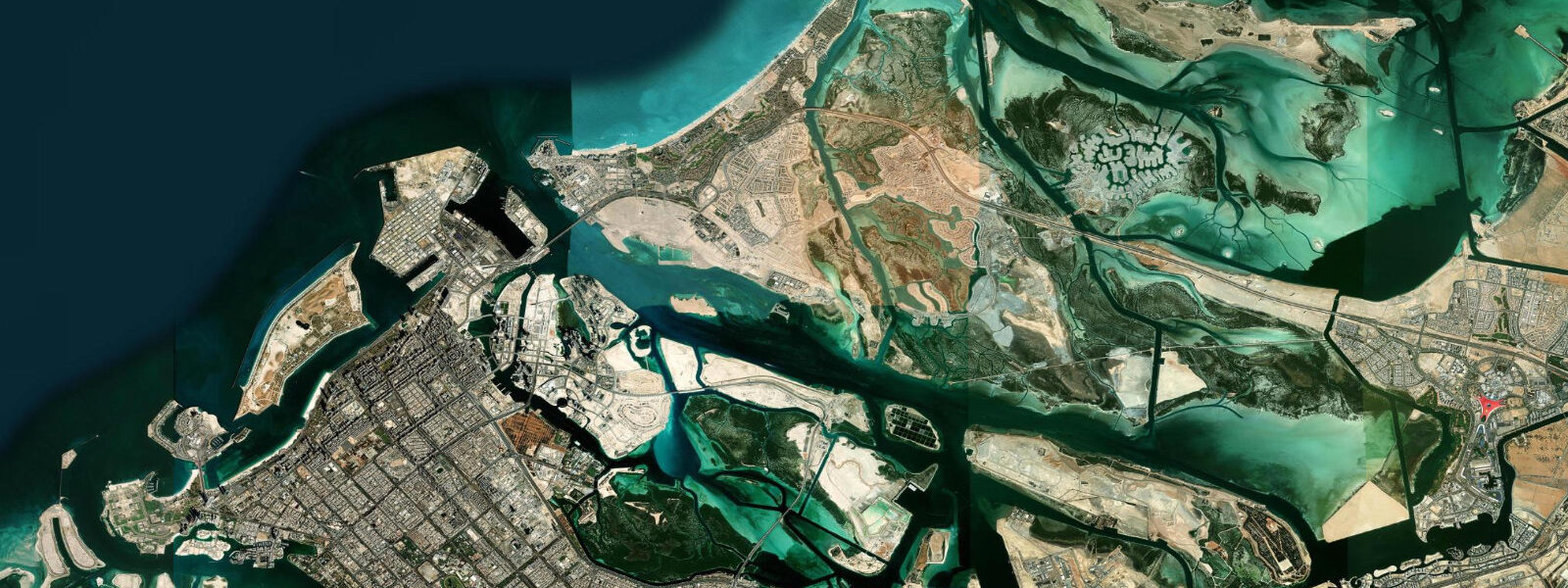
The Jebel Ali Wildlife Sanctuary occupies the intertidal and coastal zone south of the port. Established to protect the remnant mangrove ecosystem, the sanctuary holds one of the more significant mangrove stands remaining in the Dubai emirate. The dominant species is Avicennia marina — grey mangrove — which is well adapted to the Gulf's extreme salinity (40–45 ppt in summer, above open-ocean values) and the temperature range (water temperatures from 18°C in January to 35°C in August). The mangrove forest floods on the flood tide, with water rising through the pneumatophore zone — the aerial root field that extends seaward of the canopy — and reaching the forest floor at high water. On the ebb, the mangrove drains through tidal channels that cut the forest into navigable passages.
Kayaking the mangrove channels is the primary access mode for the sanctuary interior. High water is the entry point: launch 30–60 minutes before high water, paddle into the forest as tide continues to rise, and allow 2–3 hours to explore before the ebb makes the shallower channels too restricted to navigate. The tidal channels range from 3–4 m wide in the outer passages to 1–2 m in the interior sections. At low water, much of the forest floor is exposed and inaccessible; timing is not optional. Guided kayak tours operate from the Al Hamra Beach area and include tidal planning as part of the booking process.
The wildlife sanctuary is important habitat for wading birds and waterfowl: flamingo, grey heron, western reef heron, and various tern species use the intertidal flats and mangrove margins year-round. Migrant waders including broad-billed sandpiper and Terek sandpiper use the exposed tidal flat on passage in spring and autumn. The best observation timing is 1–2 hours before and after low water, when the intertidal flat is exposed and birds are feeding actively in the open.
From the beach and the upper point of the sanctuary, Palm Jebel Ali — the second, larger artificial palm island, whose construction began in 2002 but stalled and remains uncompleted — is visible as a low land mass 5–8 km offshore. The fronds are formed in sand but largely undeveloped; the crescent breakwater is complete. The structure sits at low tide level, a half-finished land form that gives the offshore view from Jebel Ali a distinctive character.
For anglers, the Jebel Ali coast offers access to both beach fishing on Al Hamra and shore fishing from rocky sections of the sanctuary boundary at low water. The tidal flat at the sanctuary edge concentrates flathead and various Gulf snapper species on the flood as the flat covers. Fishing the rising tide from the mangrove edge — 1 hour before high water through high water — is a productive pattern. Do not enter the sanctuary itself without a permit from the Dubai Municipality Environment Department.
Tide data for Jebel Ali, Dubai comes from the Open-Meteo Marine API, a gridded model product. Timing accuracy is ±45 minutes, height accuracy ±0.3 m — usable for trip planning, not for navigation.
Tide questions about Jebel Ali, Dubai
Quick answers to the most common questions about tide times, range, and water access at Jebel Ali, Dubai.
Why do large ships time their arrival at Jebel Ali Port around the tide?
The Jebel Ali Port entrance channel is dredged to 16–17 m chart datum. Ultra-large container vessels (ULCVs) operating on the largest Asia–Europe routes carry 20,000+ TEU and draw 14–15.5 m when loaded. At mean low water, a vessel with 15.0 m draft has approximately 1.5 m under the keel in the entrance channel — a real but manageable margin. On spring tides when low water drops below mean, that margin shrinks further. Port approach planning includes tidal window calculation as a standard step; the port authority coordinates arrival and departure scheduling to ensure critical passages occur during acceptable tidal windows.
When should I kayak the mangroves in the Jebel Ali Wildlife Sanctuary?
Launch 30–60 minutes before high water to paddle into the mangrove forest as tide continues to rise, giving 2–3 hours of navigable interior before the ebb restricts the shallower channels. At low water, much of the forest floor is exposed and the narrow interior passages are too shallow to paddle. The tidal channels run 3–4 m wide in outer passages and narrow to 1–2 m inside the forest. Most guided kayak tours operating from the Al Hamra Beach area include tidal planning in the booking process — check departure time relative to that day's high water. Entry into the sanctuary without a permit is restricted.
What wildlife can I see at the Jebel Ali Wildlife Sanctuary?
The mangrove system and adjacent intertidal flat support flamingo, grey heron, western reef heron, and multiple tern species year-round. On spring and autumn passage, migrant waders including broad-billed sandpiper and Terek sandpiper use the exposed tidal flat. The best observation timing is 1–2 hours before and after low water, when the intertidal flat is exposed and birds are actively feeding. The mangrove canopy itself shelters roosting herons and cormorants. Avicennia marina — grey mangrove — is the dominant tree species, tolerating Gulf salinity of 40–45 ppt and the extreme seasonal temperature range.
What is Al Hamra Beach and how does it differ from Dubai's beach club coast?
Al Hamra Beach is a stretch of natural sandy coastline adjacent to the Jebel Ali Free Zone, approximately 35 km southwest of central Dubai. It is one of the few remaining undeveloped beach sections in the emirate — no beach clubs, no tower development on the waterfront. The beach has a moderate gradient with the foreshore extending 80–120 m from the high-water mark at low spring tide. It is used primarily by Free Zone residents and workers. The offshore view typically includes container ships at anchor or transiting to and from Jebel Ali Port, and on clear days Palm Jebel Ali — the incomplete second palm island — is visible 5–8 km offshore.
What is the tidal range at Jebel Ali and how does it affect the beach?
Tidal range at Jebel Ali follows the Persian Gulf semidiurnal pattern: mean range 1.0–1.5 m, spring tides reaching approximately 2.0 m. This is a meaningful range for a flat, low-gradient coast. At low spring water, the Al Hamra foreshore exposes an additional 80–120 m of sand flat beyond the normal waterline; the mangrove sanctuary south of the port floods fully at high water and drains to exposed mud on the ebb. For beach fishing, the flood tide — rising through the intertidal zone — is the productive window as fish follow the water onto the flat. High-water timing varies day to day; check the tide prediction before planning a mangrove kayak or a beach fishing session.
8-day tide table — Jebel Ali, Dubai
Heights relative to MSL. Predictions: Open-Meteo Marine (MeteoFrance SMOC, 0.08° grid) — heights relative to MSL (not chart datum / LAT). Model-derived.
| Day | Type | Time | Height |
|---|---|---|---|
| Fri 19 Jun | High | 04:00 | 1.1m |
| Low | 09:38 | -0.6m | |
| High | 16:00 | 0.7m | |
| Low | 21:00 | 0.2m | |
| Sat 20 Jun | High | 03:08 | 1.2m |
| Low | 10:22 | -0.6m | |
| High | 16:51 | 0.6m | |
| Low | 21:56 | 0.1m | |
| Sun 21 Jun | High | 03:58 | 1.0m |
| Low | 11:02 | -0.5m | |
| High | 17:40 | 0.7m | |
| Low | 23:07 | 0.2m | |
| Mon 22 Jun | High | 04:55 | 0.8m |
| Low | 11:43 | -0.3m | |
| High | 18:24 | 0.8m | |
| Tue 23 Jun | Low | 00:16 | 0.2m |
| High | 05:57 | 0.7m | |
| Low | 12:22 | -0.0m | |
| High | 19:08 | 0.9m | |
| Wed 24 Jun | Low | 02:00 | 0.2m |
| High | 07:10 | 0.6m | |
| Low | 13:04 | 0.1m | |
| High | 20:00 | 1.0m | |
| Thu 25 Jun | Low | 03:21 | 0.1m |
| High | 08:40 | 0.5m | |
| Low | 13:50 | 0.2m | |
| High | 20:45 | 1.0m | |
| Fri 26 Jun | Low | 03:00 | 0.0m |