Salt Cay tide times
Salt Cay tide forecast — heights relative to MSL.
Today's tide times for Salt Cay
Tide times at Salt Cay on Saturday, 27 June 2026: first low tide at 12:54am, first high tide at 05:50am, second low tide at 11:55am, second high tide at 07:00pm. Sunrise 06:05am, sunset 07:30pm.
Tide chart for Salt Cay
24-hour cosine-interpolated curve around the present moment. Heights relative to MSL. Predictions: Predictions: Open-Meteo Marine (MeteoFrance SMOC, 0.08° grid).
Sun, moon and conditions on Sat 27 Jun
Snapshot at build time — refreshes daily. Sea state from Open-Meteo Marine.
Highs and lows next 7 days
Every predicted high and low for the next week, with the daily tidal coefficient (0–120; higher = bigger swing, > 95 means stronger currents).
Other spots nearby
The three closest curated TideTurtle locations to Salt Cay, measured by great-circle distance.
Today's solunar windows
Solunar tradition: major periods are the ≈3h windows around moon transit and opposition; minor are ≈2h around moonrise and moonset. Pair with the local tide stage and wind for the best read.
Cycle dates near Salt Cay
Next spring tide on Sat 27 Jun (range 0.7m). Next neap on Sun 28 Jun.
Spring tides cluster around new and full moons (biggest swings). Neap tides land on quarter moons (smallest swings). See the spring tide and neap tide glossary entries for the why.
About tides at Salt Cay
A short guide to the coastline at Salt Cay — geography, sea state, and what the tide is actually doing under your feet.
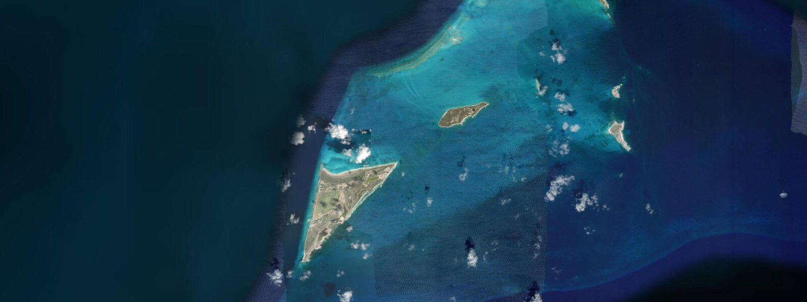
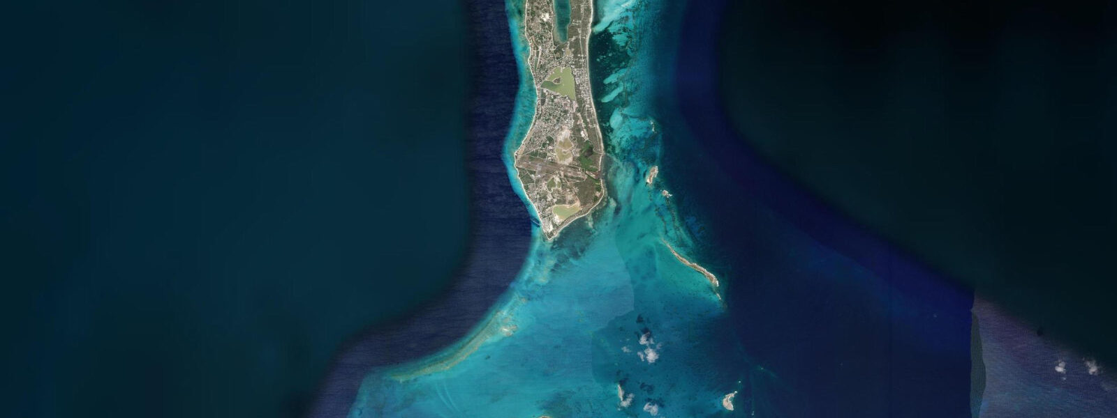
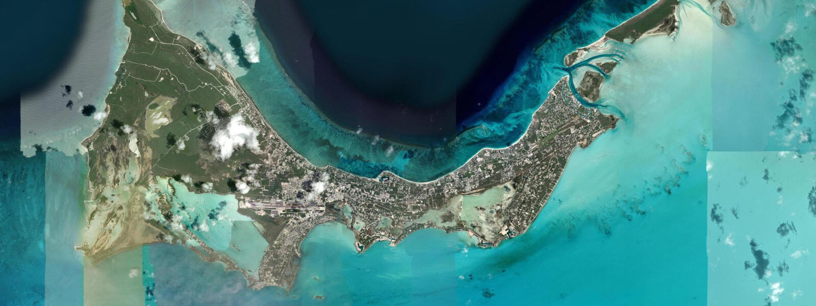
Salt Cay is the southernmost inhabited island of the Turks and Caicos, 14 km south of Grand Turk across open water. It is the smallest and least visited of the TCI's populated islands — roughly 60 permanent residents, no airport, no ATM, no resort infrastructure — and arguably the most intact example of a Bermudan salt-raking settlement in the Caribbean. The island's economy for two centuries ran on a single product: solar-evaporated salt harvested from the crystallisation ponds that cover a significant fraction of its low-lying interior. Bermudian and British merchants built the white-painted salt-era houses that line the small harbour, and the windmill remnants and salina gates are still standing as functional artefacts rather than museum pieces.
The tidal regime at Salt Cay is mixed semidiurnal with a spring range of 0.4–0.6 m above Chart Datum — the same microtidal character as the rest of the Turks Islands. The island's position on the Turks Bank south of the Turks Island Passage means it catches more direct exposure from northeast trade swell than Grand Turk; the south and east coasts take Atlantic fetch in winter cold-front passages. Mean low water springs at Salt Cay drops to approximately 0.0 m Chart Datum, exposing the shallow reef crest on the western shore and rock platform on the north and east sides.
The western reef at Salt Cay shares the same geological structure as the Grand Turk wall — the Turks Bank edge drops precipitously on its western face — but receives a fraction of the dive traffic. The wall here begins at 10–12 m and drops beyond safe recreational diving limits within metres. The reef crest on the approach from the western shore sits 0.5–1.0 m below the surface at high spring tide; at low spring water some sections break the surface. The current along the wall mirrors Grand Turk: northward on the flood, southward on the ebb, 0.3–0.5 knots on springs. There are no dive operators permanently based on Salt Cay; dive trips come by arrangement from Grand Turk or from liveaboards transiting the TCI.
Whale watching is the primary draw from January through April. Humpback whales use the Turks Island Passage as a northward migration corridor and calving ground, moving through the deep water between Grand Turk and Salt Cay. Salt Cay's position at the southern entrance of the passage gives it excellent access to the whale activity. Boat-based whale watching departs from the small harbour on the northwest side of the island; flat-calm days in February and March can produce mother-calf pairs resting at the surface within 200 m of the boat. The whales are not affected by tidal phase in any practical sense — their movement is governed by calving cycle and migration timing, not water level. However, sea conditions for the boat trip depend on wind more than tide; the harbour is sheltered enough to launch a small vessel in up to 15 knots of northeast trade wind.
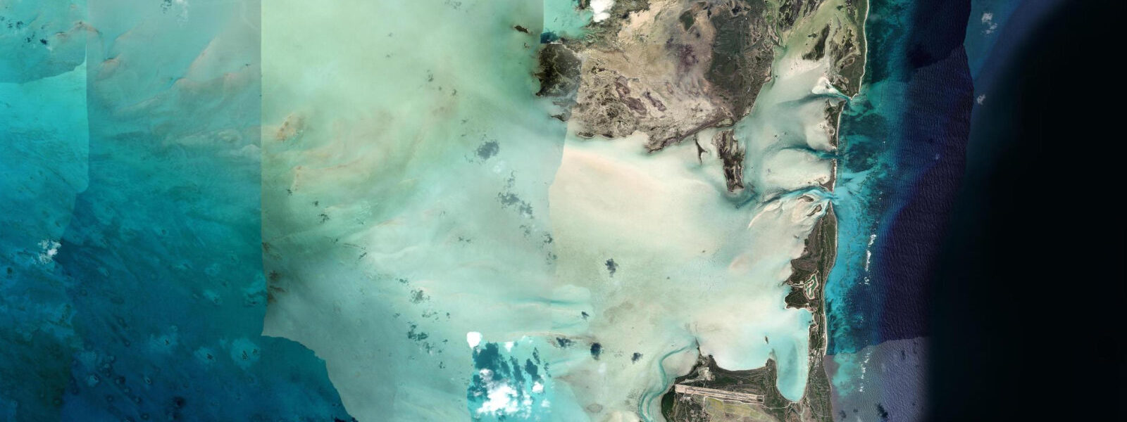
The salt ponds in the island's interior are still connected to the sea by tidal gates and channels cut by the original salina engineers. On spring tides the gates allow a partial tidal exchange with the outer reef — seawater flows in on the flood, concentrating as it evaporates over the following weeks. The ponds produce a colour gradient visible from the air: grey-blue near the inlet gates, deepening to pink and white at the highest-salinity crystallisation pans further inland. The pink colour comes from halophilic bacteria, the same organisms that colour salt pans from Bonaire to the Camargue. At low spring tide the channels between ponds and sea are at their shallowest — accessible by wading for anyone exploring the salina infrastructure on foot.
For anglers, the shallow reef platform on the east and north coasts produces bonefish and permit on the flooding tide. The flat is less developed and less visited than equivalent bonefishing grounds at Provo; anglers who reach Salt Cay by the twice-weekly ferry from Grand Turk or by private charter often find the flat unfished. The ebb tide off the west coast concentrates snapper and grouper at the reef crest edge.
Families visiting Salt Cay on day trips from Grand Turk find a single small beach on the northwest side of the island, in the shelter of the harbour. The beach is narrow at high water and widens 10–15 m at low spring tide. The water is shallow — 0.5–1.0 m depth at 30 m from shore at mid-tide — and calm, protected by the outer reef.
All tide predictions for Salt Cay come from the Open-Meteo Marine gridded model. Timing accuracy is ±45 minutes; height accuracy is ±0.3 m above Chart Datum.
Tide questions about Salt Cay
Quick answers to the most common questions about tide times, range, and water access at Salt Cay.
When do humpback whales pass through the waters around Salt Cay?
Humpback whales use the Turks Island Passage between Grand Turk and Salt Cay as a migration corridor and calving ground from January through April, with February and March being peak months. Mother-calf pairs rest in the protected waters of the passage before continuing north. Boat-based whale watch trips depart from Salt Cay's small northwest harbour; the best sea conditions are calm days with northeast trade wind under 15 knots. Whale presence is not governed by tidal phase — the animals are responding to calving cycle and migration timing. The boat trip itself (5–15 minutes to the whale area) is calmer on a flood tide when the harbour entrance is deeper.
How does the tidal exchange work in Salt Cay's historic salt ponds?
The salt crystallisation ponds in Salt Cay's interior are connected to the sea by tidal gates and channels cut by Bermudan salt merchants. On spring tides, seawater enters the salina system through the inlet gates on the flood, then evaporates over subsequent weeks as it moves through progressively higher-salinity pans toward the crystallisation beds. The spring tidal range of 0.4–0.6 m is sufficient to push water through the gates on the flood; the gates were engineered to close on the ebb, trapping the incoming water. At low spring tide the inlet channels are at their shallowest — 0.1–0.2 m in places — accessible by wading for anyone exploring the salina on foot. The ponds' pink colour from halophilic bacteria is most vivid in the high-salinity crystallisation pans furthest from the sea.
Is the Salt Cay wall dive comparable to Grand Turk's western wall?
Structurally yes — Salt Cay's western wall shares the same Turks Bank geology, dropping from 10–12 m at the crest to beyond 2,000 m within a short horizontal distance. Coral coverage and fish density are comparable. The practical difference is logistics: there are no permanently based dive operators on Salt Cay. Dive access requires prior arrangement with operators in Grand Turk (who run occasional Salt Cay trips by schedule or charter), or a liveaboard. Tidal drift on the wall mirrors Grand Turk — northward flood, southward ebb, 0.3–0.5 knots on springs — and the same drift-dive approach applies.
How do anglers reach the bonefishing flats at Salt Cay?
The shallow reef and sand flats on the east and north coasts of Salt Cay are accessible by wading from shore at low-to-mid tide or by skiff for the outer sections. The twice-weekly ferry from Grand Turk is the standard transport link; anglers with their own gear can bring rods as checked luggage and arrange a guide through the handful of accommodation options on the island. The flat receives minimal pressure compared to bonefishing destinations on Provo or Grand Bahama — partly because access is genuinely inconvenient, and partly because Salt Cay's population is small and guide availability is limited. The flooding tide is the productive window, as everywhere in the Caribbean; aim to be on the flat for the first two hours of the incoming tide.
How do you get to Salt Cay from Grand Turk, and does tidal state affect the boat crossing?
The government ferry from Grand Turk's South Dock runs twice a week (typically Tuesday and Thursday) and takes approximately 45 minutes. Charter boat access is available for groups willing to arrange a private crossing. The 14 km route crosses open water between the two islands with the Turks Island Passage to the east; swell from the northeast trade wind is the primary discomfort factor, not tidal current. The ferry runs regardless of tidal state, though the South Dock approach at Grand Turk is slightly easier at high water. Charters should plan the crossing for morning when trade wind is lightest; afternoon northeast wind in winter can build 1.0–1.5 m chop on the crossing.
7-day tide table — Salt Cay
Heights relative to MSL. Predictions: Open-Meteo Marine (MeteoFrance SMOC, 0.08° grid) — heights relative to MSL (not chart datum / LAT). Model-derived.
| Day | Type | Time | Height |
|---|---|---|---|
| Sat 27 Jun | Low | 00:54 | 0.2m |
| High | 05:50 | 0.4m | |
| Low | 11:55 | 0.0m | |
| High | 19:00 | 0.7m | |
| Sun 28 Jun | Low | 12:38 | 0.0m |
| High | 19:38 | 0.7m | |
| Mon 29 Jun | Low | 02:18 | 0.2m |
| High | 07:18 | 0.4m | |
| Low | 13:12 | 0.0m | |
| High | 20:20 | 0.7m | |
| Tue 30 Jun | Low | 02:54 | 0.2m |
| High | 08:00 | 0.5m | |
| Low | 13:55 | 0.1m | |
| High | 20:55 | 0.8m | |
| Wed 01 Jul | Low | 14:38 | 0.1m |
| Thu 02 Jul | High | 22:12 | 0.7m |
| Fri 03 Jul | Low | 04:42 | 0.2m |
| High | 10:20 | 0.5m | |
| Low | 16:04 | 0.1m | |
| High | 19:00 | 0.4m |