Tuzla, Istanbul tide times
Tuzla, Istanbul tide forecast — heights relative to MSL.
Today's tide times for Tuzla, Istanbul
Tide times at Tuzla, Istanbul on Friday, 19 June 2026: first high tide at 03:00. Sunrise 05:30, sunset 20:37.
Tide chart for Tuzla, Istanbul
24-hour cosine-interpolated curve around the present moment. Heights relative to MSL. Predictions: Predictions: Open-Meteo Marine (MeteoFrance SMOC, 0.08° grid).
Sun, moon and conditions on Fri 19 Jun
Snapshot at build time — refreshes daily. Sea state from Open-Meteo Marine.
Highs and lows next 7 days
Every predicted high and low for the next week, with the daily tidal coefficient (0–120; higher = bigger swing, > 95 means stronger currents).
Other spots nearby
The three closest curated TideTurtle locations to Tuzla, Istanbul, measured by great-circle distance.
Today's solunar windows
Solunar tradition: major periods are the ≈3h windows around moon transit and opposition; minor are ≈2h around moonrise and moonset. Pair with the local tide stage and wind for the best read.
About tides at Tuzla, Istanbul
A short guide to the coastline at Tuzla, Istanbul — geography, sea state, and what the tide is actually doing under your feet.
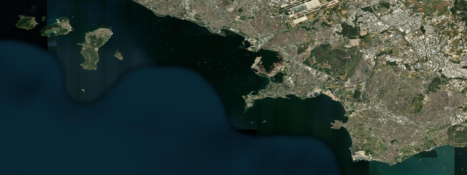
Tuzla occupies the far eastern end of Istanbul's Marmara Sea coast, where the water narrows toward the Gulf of İzmit and the hills close in on both sides. It is a working waterfront town, not a resort: the coastline is dominated by shipyards, dry docks, and the logistics infrastructure of a major maritime industry cluster. From the coast road you can watch bulk carriers hauled out of the water on enormous cradles — the facilities here can accommodate vessels up to 50,000 dwt. That industrial backdrop is the defining feature of Tuzla's relationship with the sea.
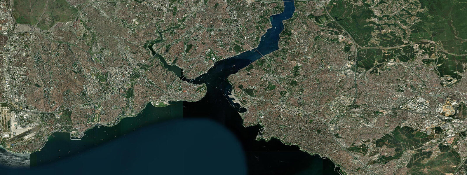
The Sea of Marmara itself is an unusual body of water. It sits between the Black Sea (connected via the Bosphorus to the north) and the Aegean Sea (connected via the Dardanelles to the southwest). Both connections are narrow straits, and the result is that the standard astronomical tide — the signal that dominates the Atlantic and much of the Pacific — is effectively cancelled inside the Marmara. The tidal wave entering from the Aegean side meets the complex resonance pattern of the enclosed basin and the result at Tuzla is a mean range of 0.1-0.2 m, with a mixed semidiurnal pattern. That is not quite as negligible as the Black Sea (where the range is 5-10 cm), but it is close enough to negligible for all practical coastal purposes.
What drives water levels here is not the tide but a persistent through-current. The Black Sea's excess freshwater budget discharges through the Bosphorus as a surface current, runs across the Marmara, and exits through the Dardanelles into the Aegean. This two-layer exchange — fresh Black Sea water flowing out at the surface, saltier Aegean water flowing in at depth — is permanent and measurable. At Tuzla, on the eastern Marmara shore, this circulation creates a net surface drift toward the southwest. It is not fast in open water (0.3-0.5 knots), but it matters for small craft, particularly when exiting the shelter of the shipyard breakwaters.
The dry docks are worth noting specifically in the context of tides. In tidal ports with significant range, dry-dock scheduling follows the tidal cycle — vessels are floated in on the flood and the dock gates closed at high water. At Tuzla, with 0.1-0.2 m range, none of that logic applies. Vessels are moved on and off the cradle systems using hydraulic lifts and tugs, entirely independent of any tidal rhythm. The shipyard workers here do not watch tide tables; they watch the current forecast and the berth schedule.
Looking south from Tuzla's waterfront on a clear day, the Prince's Islands (Kızıl Adalar in Turkish — literally "Red Islands") are visible 12-15 km offshore. The four main inhabited islands — Büyükada, Heybeliada, Burgazadası, and Kınalıada — are a distinctive silhouette against the Marmara. They are accessible by scheduled ferry from Istanbul's European shore (approximately 1 hour 20 minutes from Kabataş) and by faster sea-bus services. The islands ban private motor vehicles and have done so for over a century; the characteristic transport is horse-drawn carriage or bicycle. The island coastlines have the same negligible tidal range as Tuzla — rock platforms and small sand pockets are accessible at all states of the minimal tide.
Anglers working the Tuzla coast focus on the seasonal movements of bluefish (lüfer), sea bass (levrek), and bream (çipura) along the Marmara shore. The through-current concentrates baitfish at headlands and the edges of the shipyard breakwaters; these artificial structures create predictable feeding stations. Spring and autumn are the productive seasons, when pelagic fish follow the temperature gradient along the Marmara's surface layer.
Kayakers should approach Tuzla with attention to shipping traffic. The Gulf of İzmit is one of Turkey's busiest industrial waterways, with tankers and bulk carriers passing regularly. The ferry lanes between Tuzla and the Prince's Islands carry fast sea-bus services that generate significant wake. Paddling along the shore rather than crossing open water is the practical approach. The Marmara surface in summer is calm and warm (24-26°C in August), and the current in the nearshore zone is mild.
For photographers, the juxtaposition of the Tuzla waterfront is genuine: dry-dock cranes and gantries frame the pastoral silhouette of the Prince's Islands in a single shot. The late-afternoon light from the southwest (toward Istanbul and the Bosphorus) catches the metalwork of the shipyards against the open Marmara. The narrow-angle tidal range means the rock and concrete margins of the waterfront look the same at any time of day — no need to chase a low-tide window for foreground composition.
Tide data for Tuzla, Istanbul comes from the Open-Meteo Marine API, a gridded model product. Timing accuracy is ±45 minutes, height accuracy ±0.3 m — usable for trip planning, not for navigation.
Tide questions about Tuzla, Istanbul
Quick answers to the most common questions about tide times, range, and water access at Tuzla, Istanbul.
Why is the tidal range at Tuzla so small?
The Sea of Marmara sits between two narrow straits — the Bosphorus to the north and the Dardanelles to the southwest. The astronomical tidal wave from the Aegean enters through the Dardanelles but loses most of its energy to the complex resonance pattern of this enclosed basin before reaching the eastern Marmara. The result at Tuzla is a mean range of 0.1-0.2 m, barely detectable above the normal background of wind-driven water-level variation. This is not unusual — many semi-enclosed Mediterranean and connected seas show the same suppression of the tidal signal.
What is the Bosphorus through-current and does it affect Tuzla?
The Black Sea permanently exports excess freshwater through the Bosphorus as a surface current — roughly 10,000 cubic metres per second — which flows across the Marmara and exits through the Dardanelles into the Aegean. At Tuzla on the eastern Marmara shore, this creates a net surface drift toward the southwest at roughly 0.3-0.5 knots in open water. Close inshore and inside the shelter of harbour breakwaters the current is minimal. For small boats and kayakers crossing open Marmara water from Tuzla toward the Prince's Islands, factoring in this westward drift is standard passage planning.
Is it safe to swim or kayak near the Tuzla shipyards?
Swimming directly in the shipyard basin area is not advisable due to shipping traffic, industrial discharge zones, and the movement of vessels on cradles and tugs. The designated public shoreline sections north and south of the main shipyard zone are swimmable in summer. Kayaking along the coast is practical with attention to shipping lanes: tankers and bulk carriers transit the Gulf of İzmit regularly, and the Tuzla-to-Prince's-Islands ferry route carries fast sea-bus services. Paddle close to the shore rather than across shipping lanes, and yield right-of-way to all commercial vessels.
Can you see the Prince's Islands from Tuzla?
Yes, clearly on most days. The four main inhabited islands — Büyükada, Heybeliada, Burgazadası, and Kınalıada — are visible 12-15 km southwest from Tuzla's waterfront. Büyükada is the largest and furthest, recognisable by its twin hills. The islands are accessible by scheduled ferry from Istanbul's Kabataş pier (about 1 hour 20 minutes) or by faster IDO sea-bus. They are not reachable by ferry directly from Tuzla; reaching them from Tuzla requires driving or taking a bus to Bostancı on the Asian shore (about 20 minutes west), where island ferry services depart.
What fish can anglers expect at Tuzla and when?
The Tuzla coast holds sea bass (levrek) year-round around the shipyard breakwaters and rock edges, with peak activity in spring (April-May) and autumn (October-November) when water temperatures are in the 15-18°C range. Bluefish (lüfer) move through the Marmara in seasonal runs — the autumn eastward migration in October and November is the main event, with fish chasing anchovy shoals along the current edge. Sea bream (çipura) hold around hard structures at depth. The through-current from the Bosphorus concentrates baitfish at headlands and breakwater tips, making those points the consistent marks regardless of season.
3-day tide table — Tuzla, Istanbul
Heights relative to MSL. Predictions: Open-Meteo Marine (MeteoFrance SMOC, 0.08° grid) — heights relative to MSL (not chart datum / LAT). Model-derived.
| Day | Type | Time | Height |
|---|---|---|---|
| Fri 19 Jun | High | 03:00 | -0.5m |
| Sat 20 Jun | — | ||
| Sun 21 Jun | Low | 19:00 | -0.6m |