Manzanilla Beach tide times
Manzanilla Beach tide forecast — heights relative to MSL.
Today's tide times for Manzanilla Beach
Tide times at Manzanilla Beach on Saturday, 4 July 2026: first high tide at 05:12am, first low tide at 11:42am, second high tide at 06:00pm, second low tide at 11:54pm. Sunrise 05:46am, sunset 06:30pm.
Tide chart for Manzanilla Beach
24-hour cosine-interpolated curve around the present moment. Heights relative to MSL. Predictions: Predictions: Open-Meteo Marine (MeteoFrance SMOC, 0.08° grid).
Sun, moon and conditions on Sat 04 Jul
Snapshot at build time — refreshes daily. Sea state from Open-Meteo Marine.
Highs and lows next 7 days
Every predicted high and low for the next week, with the daily tidal coefficient (0–120; higher = bigger swing, > 95 means stronger currents).
Other spots nearby
The three closest curated TideTurtle locations to Manzanilla Beach, measured by great-circle distance.

Today's solunar windows
Solunar tradition: major periods are the ≈3h windows around moon transit and opposition; minor are ≈2h around moonrise and moonset. Pair with the local tide stage and wind for the best read.
Cycle dates near Manzanilla Beach
Last spring tide on Fri 03 Jul (range 0.9m). Next spring tide on Thu 09 Jul (range 0.9m). Next neap on Mon 06 Jul.
Spring tides cluster around new and full moons (biggest swings). Neap tides land on quarter moons (smallest swings). See the spring tide and neap tide glossary entries for the why.
About tides at Manzanilla Beach
A short guide to the coastline at Manzanilla Beach — geography, sea state, and what the tide is actually doing under your feet.
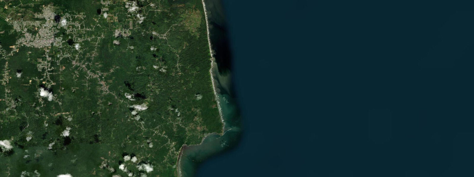
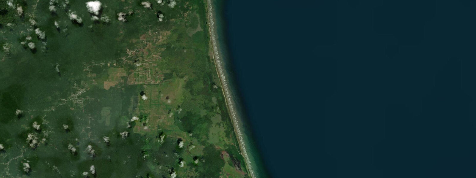
Manzanilla Beach is one of the longest unbroken Atlantic beaches in the Caribbean — a 36-kilometre straight of sand running north to south along the eastern coast of Trinidad, backed by a continuous curtain of coconut palms and, behind those, the Nariva Swamp. The beach faces east into the open Atlantic; swell from the northeast and east arrives unobstructed across the full Atlantic fetch, and the wave energy at Manzanilla is consistent year-round, with larger surf in August and September during the southern hemisphere swell season. Water is not flat here.
9 metres at springs — slightly higher than the Caribbean-facing coasts of the island. The beach is wild in character: there are no resorts, no beach bars, and no commercial facilities on the beach itself other than a handful of seafood vendors at the Manzanilla-Mayaro road junction at the north end. The government maintains picnic facilities and a car park at the beach entrance; on public holidays, particularly Carnival Monday and Tuesday and Easter weekend, Trinidadians from across the island arrive for cook-up barbecues, music, and collective beach time at a scale that transforms the usually quiet beach into one of the most animated gatherings in the Caribbean.
The rest of the year the beach is empty. The leatherback turtle (Dermochelys coriacea), the largest living chelonian, nests on the Atlantic beaches of eastern Trinidad from March through August. Manzanilla receives nesting leatherbacks, though the main nesting aggregation in Trinidad is at Grande Rivière on the north coast, which is managed as an ecotourism destination.
The Manzanilla nesting is less heavily managed; turtles come ashore at night to lay and return to the sea before dawn. Approaching nesting turtles without a guide or outside of authorised patrol hours is illegal and disturbs the nesting process. Nariva Swamp begins at the back of the coconut palm belt immediately behind the beach road.
The swamp is RAMSAR-listed, Trinidad's largest freshwater wetland, and the last significant habitat in Trinidad for the West Indian manatee (Trichechus manatus). Manatees forage in the swamp's water lettuce and aquatic vegetation; they are not reliably visible from the road but are seen by boat operators in the swamp interior. Predictions on this page come from Open-Meteo Marine, a gridded global ocean model.
3 metres on height — model-derived, not from a local gauge. The Institute of Marine Affairs and the Trinidad and Tobago Hydrographic Survey Office are the domestic reference authorities for this coast.
Tide questions about Manzanilla Beach
Quick answers to the most common questions about tide times, range, and water access at Manzanilla Beach.
Can I swim at Manzanilla Beach?
The beach is used for swimming by Trinidadians during public holidays and weekend outings, but the Atlantic conditions require respect. Wave height at Manzanilla ranges from 0.5 metres on calm trade wind days to 2 metres or more on swell events; the shore break and rip currents associated with the beach break are present at all times. There are no lifeguards. Experienced ocean swimmers who understand how to read currents can swim safely in moderate conditions; non-experienced swimmers should stay in the run-up zone or at the water's edge. During public holiday gatherings the beach becomes crowded and the social scene dominates the swimming.
How do I see leatherback turtles at Manzanilla?
Leatherback nesting at Manzanilla occurs from March through August. The nesting is not managed as intensively as Grande Rivière in the north (which has a structured ecotourism programme with guides). Independent visits to the Manzanilla beach at night during the nesting season may result in turtle encounters, but approaching nesting turtles without authorisation is illegal under the Conservation of Wildlife Act. The Turtle Village Trust in Grande Rivière is the most organised ecotourism operation for leatherback watching in Trinidad; visit Grande Rivière if the turtle experience is a primary objective.
What is in the Nariva Swamp behind the beach?
Nariva Swamp is Trinidad's largest freshwater wetland, RAMSAR-listed, covering approximately 6,234 hectares behind the Manzanilla beach corridor. The swamp includes freshwater marsh, palm swamp (moriche palm dominates much of the interior), and riparian forest. It is the last Trinidad habitat for the West Indian manatee (numbers estimated at fewer than 100 individuals in the swamp). Anacondas, spectacled caiman, and red howler monkeys are present. Manatee-watching boat tours operate from the Nariva access points and can be arranged through Port of Spain-based tour operators. Birdlife includes scarlet ibis, which roosts in the palm swamp at dusk.
How far is Manzanilla from Port of Spain?
Manzanilla is approximately 85 kilometres south-southeast of Port of Spain — about 1.5 to 2 hours by road via the Uriah Butler Highway and the Nariva-Mayaro Road. The route crosses the central plain and then turns east through the cocoa and coconut estates of Nariva County. The Manzanilla-Mayaro Road runs along the top of the coconut palm belt at the back of the beach for approximately 36 kilometres — a scenic drive with occasional beach access points. Return to Port of Spain by the same route; the Manzanilla-Valencia Road through the forest provides an alternative northern return.
What is the surf like at Manzanilla?
Manzanilla is a beach break — waves break over a sand bottom rather than reef, and the peak shifts along the beach with each swell direction. Wave height ranges from 0.5 to 2 metres depending on swell and season; August and September bring the largest surf from southern hemisphere sources. The break is not known on the Caribbean surf circuit as a precision wave, but surfers from Trinidad use it for its consistency and its proximity to Port of Spain relative to other surf beaches. Bodyboarding is popular here. No rental equipment is available at the beach; bring your own.
7-day tide table — Manzanilla Beach
Heights relative to MSL. Predictions: Open-Meteo Marine (MeteoFrance SMOC, 0.08° grid) — heights relative to MSL (not chart datum / LAT). Model-derived.
| Day | Type | Time | Height |
|---|---|---|---|
| Sat 04 Jul | High | 05:12 | 0.4m |
| Low | 11:42 | -0.5m | |
| High | 18:00 | 0.4m | |
| Low | 23:54 | -0.3m | |
| Sun 05 Jul | High | 05:51 | 0.4m |
| Low | 12:20 | -0.4m | |
| High | 18:36 | 0.3m | |
| Mon 06 Jul | Low | 00:45 | -0.3m |
| High | 06:43 | 0.3m | |
| Low | 13:02 | -0.4m | |
| High | 19:18 | 0.4m | |
| Tue 07 Jul | Low | 01:45 | -0.3m |
| High | 07:37 | 0.3m | |
| Low | 13:54 | -0.3m | |
| High | 20:10 | 0.4m | |
| Wed 08 Jul | Low | 02:52 | -0.3m |
| High | 08:50 | 0.2m | |
| Low | 14:52 | -0.3m | |
| High | 21:07 | 0.4m | |
| Thu 09 Jul | Low | 04:00 | -0.4m |
| High | 10:06 | 0.2m | |
| Low | 15:52 | -0.3m | |
| High | 22:12 | 0.4m | |
| Fri 10 Jul | Low | 05:15 | -0.5m |
| High | 11:45 | 0.2m | |
| Low | 17:00 | -0.2m | |
| High | 19:00 | -0.1m |