Icacos Point tide times
Icacos Point tide forecast — heights relative to MSL.
Today's tide times for Icacos Point
Tide times at Icacos Point on Saturday, 4 July 2026: first high tide at 06:02am. Sunrise 05:50am, sunset 06:32pm.
Tide chart for Icacos Point
24-hour cosine-interpolated curve around the present moment. Heights relative to MSL. Predictions: Predictions: Open-Meteo Marine (MeteoFrance SMOC, 0.08° grid).
Sun, moon and conditions on Sat 04 Jul
Snapshot at build time — refreshes daily. Sea state from Open-Meteo Marine.
Highs and lows next 7 days
Every predicted high and low for the next week, with the daily tidal coefficient (0–120; higher = bigger swing, > 95 means stronger currents).
Other spots nearby
The three closest curated TideTurtle locations to Icacos Point, measured by great-circle distance.
Today's solunar windows
Solunar tradition: major periods are the ≈3h windows around moon transit and opposition; minor are ≈2h around moonrise and moonset. Pair with the local tide stage and wind for the best read.
Cycle dates near Icacos Point
Next spring tide on Thu 09 Jul (range 1.1m). Next neap on Mon 06 Jul.
Spring tides cluster around new and full moons (biggest swings). Neap tides land on quarter moons (smallest swings). See the spring tide and neap tide glossary entries for the why.
About tides at Icacos Point
A short guide to the coastline at Icacos Point — geography, sea state, and what the tide is actually doing under your feet.
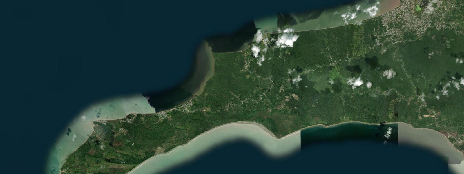
Icacos Point is the southwestern tip of Trinidad, a low-lying peninsula that protrudes into the Boca de la Serpiente — the Serpent's Mouth passage between Trinidad and Venezuela. The Venezuelan coast at Güiria is visible from Icacos Point on clear days, approximately 25 kilometres to the southwest across a passage that Christopher Columbus named in August 1498 when he was alarmed by the current-driven sea state he encountered on his third voyage. The Boca de la Serpiente's tidal stream, driven by the exchange between the Gulf of Paria to the north and the Atlantic to the south, reaches 3 to 4 knots at spring tides — a significant current in a narrow passage where wind-against-tide conditions produce standing waves and confused sea conditions.
The Gulf of Paria itself has a distinct tidal regime from the Caribbean coast — the enclosed gulf amplifies tidal range slightly, and the exchange through the Bocas passages (Boca del Dragón in the northwest and Boca de la Serpiente in the southwest) provides the primary water renewal for the Gulf. Icacos village is a fishing community at the end of a dead-end road from Siparia, approximately 60 kilometres south of Port of Spain. The road ends at the beach; the point is accessible by foot along the beach south of the village.
The community has a small jetty and a fish market that operates when the boats come in. Pirogue fishing is the principal livelihood — the boats cross the Boca de la Serpiente into Venezuelan waters (legal under longstanding informal fisheries arrangements) and return with snapper, grouper, and king fish. The beach at Icacos is Gulf of Paria-facing — it faces northwest into the enclosed gulf and is sheltered from the Atlantic swell.
The beach is grey-brown sand with turbid water influenced by the Orinoco sediment plume that enters the Gulf of Paria from the southeast and reduces water clarity throughout the gulf. This is not a swimming beach in the visual sense of clear Caribbean water; it is a working waterfront with a distinct geography. The closest thing to a tourist draw at Icacos is the experience of standing at the extreme southwestern point of Trinidad and looking south across the Boca de la Serpiente to the Venezuelan coast — a political, geographic, and maritime boundary that is as visually evident as Columbus found it alarming.
Predictions on this page come from Open-Meteo Marine, a gridded global ocean model. 3 metres on height — model-derived, not from a local gauge. The Trinidad and Tobago Coast Guard and the Hydrographic Survey Office maintain the navigational data for the Boca de la Serpiente passage.
Tide questions about Icacos Point
Quick answers to the most common questions about tide times, range, and water access at Icacos Point.
Can I see Venezuela from Icacos Point?
On clear days, yes. The Venezuelan coast at Güiria is approximately 25 kilometres to the southwest across the Boca de la Serpiente. The landmass of Venezuela is visible as a low dark line on the horizon in good visibility; on very clear days (typically December through March in the dry season when the air is least humid) the hills above Güiria are distinguishable. The passage between Trinidad and Venezuela at this point is patrolled by the Trinidad and Tobago Coast Guard and the Venezuelan Guardia Costera; the border is real and enforced, and the strong current in the Boca makes the passage inadvisable for any vessel without proper navigation equipment.
How strong is the current in the Boca de la Serpiente?
The Boca de la Serpiente tidal stream reaches 3 to 4 knots at peak spring tides, directed roughly northeast on the flood (water moving from Atlantic into the Gulf of Paria) and southwest on the ebb. The current is stronger in the central and southern sections of the passage where the channel narrows. Wind-against-tide conditions — northeast trade wind against a northeast-flowing ebb — produce a sharp chop that can be difficult for small craft. Columbus's 1498 account describes the roar of the conflicting currents. The Trinidad and Tobago Hydrographic Survey publishes the tidal stream atlas for the Bocas passages.
How do I get to Icacos Point from Port of Spain?
Drive south on the Uriah Butler Highway to San Fernando (approximately 40 minutes), then continue south through Siparia to Icacos on the Point Fortin road. The total distance from Port of Spain is approximately 130 kilometres; driving time is 2 to 2.5 hours depending on traffic on the southern highway. The road terminates at the Icacos beach; there is no public transport covering the full route. A 4WD is not required in dry weather but the final section of road can be muddy after rain. This is one of the more remote corners of Trinidad accessible by private vehicle without a boat.
What fish does the Icacos fleet catch?
The pirogue fleet from Icacos operates primarily in the Boca de la Serpiente and in Venezuelan waters to the southwest, targeting red snapper, grouper (black and red), king fish (wahoo), barracuda, cavalli (horse-eye jack), and various reef species. The passage and the reef structure on the Venezuelan shelf edge are productive fishing grounds; the fleet has informal fishing rights in Venezuelan waters under longstanding regional custom. The fish market at the village jetty operates when boats return, typically mid-morning. Venezuela's proximity and the free exchange of fishing knowledge between the two fleets has shaped Icacos's fishing culture.
Who was Columbus and why did he name this passage?
Christopher Columbus visited Trinidad and named both the Boca del Dragón in the northwest and the Boca de la Serpiente in the southwest during his third voyage in August 1498 — his first contact with the South American continent. He named them for the alarming sea conditions in both passages: the violent current-driven chop, the noise of the conflicting water masses, and the navigational danger they presented to his caravels. The Boca de la Serpiente (Serpent's Mouth) was the passage through which he exited the Gulf of Paria heading south; the naming combined the visual drama of the passage with the classical and biblical imagery that Columbus habitually applied to new geographical features.
7-day tide table — Icacos Point
Heights relative to MSL. Predictions: Open-Meteo Marine (MeteoFrance SMOC, 0.08° grid) — heights relative to MSL (not chart datum / LAT). Model-derived.
| Day | Type | Time | Height |
|---|---|---|---|
| Sat 04 Jul | High | 06:02 | 0.5m |
| Sun 05 Jul | Low | 00:40 | -0.3m |
| High | 06:40 | 0.4m | |
| Low | 13:02 | -0.5m | |
| High | 19:24 | 0.4m | |
| Mon 06 Jul | Low | 13:45 | -0.5m |
| High | 20:06 | 0.4m | |
| Tue 07 Jul | Low | 02:35 | -0.4m |
| High | 08:22 | 0.3m | |
| Low | 14:35 | -0.4m | |
| High | 20:51 | 0.5m | |
| Wed 08 Jul | Low | 03:40 | -0.4m |
| High | 21:48 | 0.5m | |
| Thu 09 Jul | Low | 04:40 | -0.5m |
| High | 22:50 | 0.5m | |
| Fri 10 Jul | Low | 05:45 | -0.6m |
| High | 12:22 | 0.2m |