Mariner's Cave tide times
Mariner's Cave tide forecast — heights relative to MSL.
Tide chart for Mariner's Cave
24-hour cosine-interpolated curve around the present moment. Heights relative to MSL. Predictions: Predictions: Open-Meteo Marine (MeteoFrance SMOC, 0.08° grid).
Sun, moon and conditions on Mon 06 Jul
Snapshot at build time — refreshes daily. Sea state from Open-Meteo Marine.
Highs and lows next 7 days
Every predicted high and low for the next week, with the daily tidal coefficient (0–120; higher = bigger swing, > 95 means stronger currents).
Other spots nearby
The three closest curated TideTurtle locations to Mariner's Cave, measured by great-circle distance.
Today's solunar windows
Solunar tradition: major periods are the ≈3h windows around moon transit and opposition; minor are ≈2h around moonrise and moonset. Pair with the local tide stage and wind for the best read.
Cycle dates near Mariner's Cave
Next spring tide on Thu 09 Jul (range 1.0m). Last neap on Sat 04 Jul.
Spring tides cluster around new and full moons (biggest swings). Neap tides land on quarter moons (smallest swings). See the spring tide and neap tide glossary entries for the why.
About tides at Mariner's Cave
A short guide to the coastline at Mariner's Cave — geography, sea state, and what the tide is actually doing under your feet.
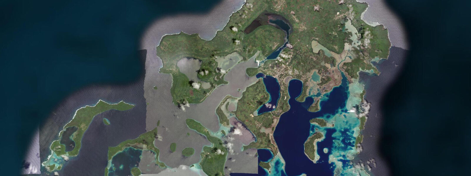
Mariner's Cave is a sea cave on the southern coast of Nuapapu Island in the Vava'u Group, approximately 7 kilometres northwest of Neiafu. The cave is unlike Swallows Cave in one fundamental respect: it has no surface-level entrance. Entry requires an underwater swim through a submerged passage approximately 5 metres below the surface, 6 to 8 metres long, before emerging into the cave's enclosed air chamber. The passage is navigable by a fit snorkeller or freediver without specialist equipment, but it is not suitable for casual swimmers or anyone with limited water confidence.
The cave's air chamber, once entered, is approximately 20 metres by 15 metres with a vaulted ceiling rising 5 to 8 metres above the water surface. The interior is dark — no direct sunlight enters — but the underwater passage brings filtered blue light from outside, giving the cave a dim blue glow at the waterline. The most distinctive physical phenomenon inside the cave is the air pressure variation caused by wave action outside. As a wave builds against the island, it compresses the air inside the cave — pressure rises by a small amount (a fraction of an atmosphere), and the change is perceptible to visitors inside as a mild fullness in the ears and sinuses. When the wave passes and the pressure releases, the air expands and cools, forming a visible mist that fills the cave for 2 to 3 seconds before dissipating. On larger wave days, the mist formation and dissipation cycle repeats with each wave set.
Mariner's Cave takes its name from William Mariner, a British sailor who was shipwrecked in the Vava'u Group in 1806 and spent four years living with the Tongan nobility before being rescued. He recorded a detailed account of Tongan culture and society, published in 1817 as An Account of the Natives of the Tonga Islands. The cave may have been used as a hiding place for a Tongan chief's wife during a period of political conflict — the story is documented in Mariner's account.
The tidal range at Mariner's Cave follows the Vava'u Group mixed semidiurnal regime: spring range approximately 1.0 to 1.2 metres. Tidal level affects the cave entry depth: at low water springs, the top of the passage is approximately 4 metres below the surface; at high water springs, it is approximately 5 metres. The additional depth at high water makes the passage slightly more demanding and reduces the amount of light visible from inside the cave looking out. Most operators time the visit to mid-tide for a compromise between depth and light.
Entry is weather-dependent. If ocean swell is running above approximately 0.5 to 0.8 metres on the southern Nuapapu coast, the wave action inside the cave becomes disorienting and the passage entry is unsafe — the surge through the passage can push a swimmer backward before they complete the transit. Boat operators cancel or postpone Mariner's Cave visits in rough conditions. Days with calm conditions and low swell give the best cave experience.
Predictions on this page come from Open-Meteo Marine, a gridded global ocean model. Accuracy is typically within plus or minus 45 minutes on timing and 0.2 to 0.3 metres on height — model-derived, not from a local gauge. The local tide authority is the Tonga Meteorological Service.
Tide questions about Mariner's Cave
Quick answers to the most common questions about tide times, range, and water access at Mariner's Cave.
Do I need scuba gear to enter Mariner's Cave?
No. Entry is by freediving (breath-hold) or snorkelling through the submerged passage, approximately 5 metres deep and 6 to 8 metres long. No scuba gear is required or used — the passage is too narrow for a buoyancy compensator and tank combination. What is required: confidence in open water, ability to dive to 5 metres on a breath-hold and swim horizontally 8 metres before surfacing, and composure in a dark, enclosed space. If you are uncomfortable with any of these, Mariner's Cave is not the appropriate activity. Your boat operator will assess conditions and provide a briefing before any water entry.
What is the mist effect inside Mariner's Cave?
Wave action against the Nuapapu Island coast alternately compresses and decompresses the air inside the cave. When a wave builds against the island, the air inside compresses slightly — pressure rises, and the change is perceptible as mild ear fullness. When the wave passes, the pressure releases: the air expands and cools to its dew point, forming a visible white mist that fills the cave for 2 to 3 seconds before dissipating as the air re-equilibrates. On days with regular wave sets, the mist formation and dissipation cycle repeats continuously. The effect is most dramatic with ocean swell of 0.3 to 0.6 metres; on completely calm days the mist is absent or minimal.
How deep is the entrance to Mariner's Cave?
The top of the underwater passage entrance is approximately 4 to 5 metres below the surface, depending on the tidal state. At low water springs, the entry is approximately 4 metres deep; at high water springs, approximately 5 metres. The passage is 6 to 8 metres long and exits at approximately 3 to 4 metres depth inside the cave, where the swimmer surfaces into the air chamber. A fit snorkeller comfortable with breath-hold diving can manage the entry; the return passage is the same depth and distance. Most operators time visits to mid-tide, which gives a passage depth of approximately 4.5 metres — a manageable middle ground.
What is the history behind the name Mariner's Cave?
The cave is named for William Mariner, a British sailor who survived the 1806 massacre of the British privateer Port-au-Prince in the Vava'u Group and spent four years living with Tongan nobility before repatriation. Mariner's detailed observations of Tongan culture and society were published in 1817 as An Account of the Natives of the Tonga Islands, compiled by Dr John Martin. The account remains one of the most important early ethnographies of Pacific island culture. The cave is said to have been used by a Tongan chief to hide his wife during a period of political conflict — the story is recounted in Mariner's account and is the origin of the name.
When is Mariner's Cave accessible?
The cave is accessible on days when ocean swell on the southern Nuapapu coast is below approximately 0.5 to 0.8 metres. If swell is above this threshold, wave surge through the underwater passage makes safe entry and exit impossible. Boat operators assess conditions before departure from Neiafu and cancel or redirect to Swallows Cave if Nuapapu is rough. The best conditions are during the calm spells between weather systems in the dry season (May to October) and in the wet season mornings before afternoon squalls build. Always ask your operator for an honest assessment of conditions before committing to the cave.
7-day tide table — Mariner's Cave
Heights relative to MSL. Predictions: Open-Meteo Marine (MeteoFrance SMOC, 0.08° grid) — heights relative to MSL (not chart datum / LAT). Model-derived.
| Day | Type | Time | Height |
|---|---|---|---|
| Mon 06 Jul | Low | 04:06 | 0.3m |
| High | 10:12 | 1.1m | |
| Low | 16:35 | 0.2m | |
| High | 22:51 | 1.1m | |
| Tue 07 Jul | Low | 04:54 | 0.3m |
| High | 11:03 | 1.1m | |
| Low | 17:18 | 0.3m | |
| High | 23:36 | 1.1m | |
| Wed 08 Jul | Low | 05:43 | 0.3m |
| High | 11:56 | 1.1m | |
| Low | 18:00 | 0.3m | |
| Thu 09 Jul | High | 12:51 | 1.1m |
| Low | 18:55 | 0.3m | |
| Fri 10 Jul | High | 01:13 | 1.2m |
| Low | 07:36 | 0.3m | |
| High | 13:46 | 1.1m | |
| Low | 19:46 | 0.3m | |
| Sat 11 Jul | High | 02:08 | 1.2m |
| Low | 08:35 | 0.2m | |
| High | 14:45 | 1.1m | |
| Low | 20:40 | 0.3m | |
| Sun 12 Jul | High | 03:00 | 1.3m |