Luangahu Island, Ha'apai tide times
Luangahu Island, Ha'apai tide forecast — heights relative to MSL.
Tide chart for Luangahu Island, Ha'apai
24-hour cosine-interpolated curve around the present moment. Heights relative to MSL. Predictions: Predictions: Open-Meteo Marine (MeteoFrance SMOC, 0.08° grid).
Sun, moon and conditions on Mon 06 Jul
Snapshot at build time — refreshes daily. Sea state from Open-Meteo Marine.
Highs and lows next 7 days
Every predicted high and low for the next week, with the daily tidal coefficient (0–120; higher = bigger swing, > 95 means stronger currents).
Other spots nearby
The three closest curated TideTurtle locations to Luangahu Island, Ha'apai, measured by great-circle distance.
Today's solunar windows
Solunar tradition: major periods are the ≈3h windows around moon transit and opposition; minor are ≈2h around moonrise and moonset. Pair with the local tide stage and wind for the best read.
Cycle dates near Luangahu Island, Ha'apai
Next spring tide on Fri 10 Jul (range 1.2m). Last neap on Sat 04 Jul.
Spring tides cluster around new and full moons (biggest swings). Neap tides land on quarter moons (smallest swings). See the spring tide and neap tide glossary entries for the why.
About tides at Luangahu Island, Ha'apai
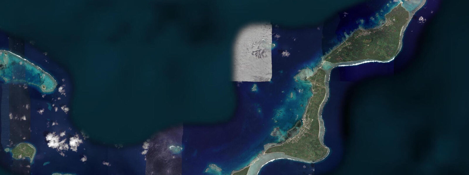
A short guide to the coastline at Luangahu Island, Ha'apai — geography, sea state, and what the tide is actually doing under your feet.
Luangahu is a small low coral island near Lifuka in the central Ha'apai group, accessible by boat from Pangai — the main town of Ha'apai, located on Lifuka Island approximately 5 kilometres to the northeast. The island sits on the fringing reef system that extends south and west of Lifuka, with a sand spit on its southern end that extends and contracts with the tidal cycle. At low water on a spring tide, the spit lengthens by 50 to 100 metres beyond the normal beach edge, turning a small island into an elongated sandbar. At high water it shrinks back to the tree-lined mound that defines the island's permanent character.
Tide data for Luangahu comes from Open-Meteo Marine's global ocean model. Timing accuracy is within ±45 minutes; height accuracy is within ±0.2 to 0.3 metres. Ha'apai experiences mixed semidiurnal tides with a spring range of 1.0 to 1.5 metres — moderate for the central Pacific. Two unequal high tides and two unequal lows per day; the diurnal inequality means planning the day's beach access around the tidal table is necessary. The reef flat that connects Luangahu to the broader Ha'apai reef system shallows significantly at low water, exposing coral that is submerged at high tide.
For swimmers and beach visitors, the sand beach on Luangahu's western face is the primary attraction. Protected from the easterly trade wind by the island itself, the western beach has calm, shallow water at all tidal stages. The swimming depth is best at high tide — the fringing reef that extends 20 to 40 metres offshore provides gentle wave breaking and a clean sand bottom inside. At low tide, the reef flat on the island's eastern side dries to ankle depth; walking the flat is possible with reef-safe footwear and rewards with tide pool observation.
For snorkellers, the fringing reef off Luangahu's northern and eastern faces is the productive zone. At high water the reef heads are at 0.5 to 1.5 metres, the coral coverage is moderate to good, and the fish assemblage is representative of Ha'apai's inner reef: parrotfish, wrasse, surgeonfish, and the occasional small reef shark in the channel between Luangahu and the adjacent reef. The window two hours either side of high water gives the most comfortable depth and the least sediment disturbance from tidal current over the reef flat.
Kayakers from Pangai run a standard circuit that takes in Luangahu as the easternmost point of a route through the western Ha'apai reef shallows. The paddle from Pangai's wharf to Luangahu crosses open water for approximately 4 kilometres; the channel is calm in easterly trade conditions but develops chop in westerly or strong southerly wind. The lee side of Luangahu provides a protected lunch stop before the return. Full-day kayak circuits that extend further south to the outer reef edge or north toward the Uoleva beach are operated by Ha'apai's small adventure tourism sector.
Fishing around Luangahu reflects the productive Ha'apai reef system. The channel between Luangahu and the Lifuka reef edge carries tidal current on the ebb that concentrates small trevally and barracuda. Shore fishing from Luangahu's eastern shore on a dropping tide — working lures across the current line as the water withdraws from the reef flat — produces the best results. Deeper water to the west of the island holds grouper and snapper accessible from a small boat with bottom rigs.
Luangahu has no permanent inhabitants and no infrastructure. Day visits are the standard format — bring water, sunscreen, and food. Boats from Pangai can drop visitors for a half-day and return. The island does not see the ferry and supply traffic that Lifuka handles, and on most weekdays the beach is empty except for the boat crew. Ha'apai as a whole is one of the quieter parts of Tonga's tourist circuit; the group lacks the infrastructure of Vava'u and sees a fraction of the visitor numbers.
The best visual moment at Luangahu for photographers is the low-water sand spit extension at spring low tide — roughly 10 minutes before and after the predicted low water, when the spit reaches its maximum extent and the flat calm water either side of the bar gives clear reflections. The easterly trade wind typically reduces to near-zero in the early morning before the gradient builds; combining the spring low tide with the pre-wind morning light gives the cleanest conditions for this type of image.
Tide questions about Luangahu Island, Ha'apai
Quick answers to the most common questions about tide times, range, and water access at Luangahu Island, Ha'apai.
What is the tidal range at Luangahu and how does it change the island's appearance?
Ha'apai experiences mixed semidiurnal tides with a spring range of 1.0 to 1.5 metres. At Luangahu, the tide's most visible effect is on the southern sand spit, which extends 50 to 100 metres beyond the tree-lined island edge at low water on springs and retreats to the island perimeter at high water. The reef flat on the island's eastern side dries to ankle depth at low spring tide; the western beach remains swimmable at all tides due to the reef protection. Tide data comes from Open-Meteo Marine — accuracy ±45 minutes and ±0.2 to 0.3 metres. Planning beach access around the tidal table improves the experience significantly.
How do I reach Luangahu from Pangai?
Pangai on Lifuka Island is approximately 5 kilometres northeast of Luangahu by water. Boat charter from Pangai's wharf is the standard access; there is no scheduled service to the island. Local boat owners at the wharf offer half-day and full-day charters; the crossing takes 15 to 30 minutes by outboard dinghy. Ha'apai's small tour operators can also arrange guided kayak day trips to Luangahu from Pangai. Pangai itself is reached by scheduled domestic flight from Nuku'alofa (Tonga's capital) via Real Tonga or Air Chathams, and by weekly ferry from Nuku'alofa on the MV 'Otuanga'ofa.
Is Luangahu a good snorkelling destination?
Luangahu's fringing reef on the northern and eastern faces offers moderate to good snorkelling at high water. The reef heads are at 0.5 to 1.5 metres depth when the tide is up, with parrotfish, wrasse, surgeonfish, and small reef sharks in the channel between the island and the adjacent reef. The optimal window is two hours either side of the predicted high tide — depth is maximised and tidal current over the reef flat is minimal. At low water the eastern reef flat dries significantly, limiting snorkelling to the channel areas and the deeper sections off the northern point. Water clarity inside the Ha'apai reef system averages 10 to 20 metres.
What fishing is productive around Luangahu?
The channel between Luangahu and the Lifuka reef edge carries a tidal current on the ebb that concentrates small trevally and barracuda — the best shore-fishing window is the two hours after the predicted high when the current starts running and baitfish are pushed to the channel edge. Working lures across the current line from Luangahu's eastern shore during the ebb produces consistent results. Bottom fishing from a small boat to the west of the island in deeper water targets grouper and snapper. The reef flat on the eastern side is productive for smaller species on low-tide wading sessions, but the water depth is minimal and the walk careful on reef-safe footwear.
Is there any infrastructure or accommodation on Luangahu?
No. Luangahu is uninhabited with no infrastructure. There is no fresh water, no shade structure, and no facilities of any kind. Day visits only — bring all supplies including water and food. The standard format is a half-day or full-day charter from Pangai with the boat crew waiting or returning at a set time. Some kayak tour operators from Ha'apai include Luangahu as a day-trip destination with packed lunches. The island is genuinely off-grid; the empty beach and quiet reef environment are the attraction, and the absence of infrastructure is part of what makes it so.
7-day tide table — Luangahu Island, Ha'apai
Heights relative to MSL. Predictions: Open-Meteo Marine (MeteoFrance SMOC, 0.08° grid) — heights relative to MSL (not chart datum / LAT). Model-derived.
| Day | Type | Time | Height |
|---|---|---|---|
| Mon 06 Jul | Low | 04:12 | 0.3m |
| High | 10:18 | 1.0m | |
| Low | 16:40 | 0.2m | |
| High | 22:57 | 1.0m | |
| Tue 07 Jul | Low | 05:02 | 0.3m |
| High | 11:06 | 1.0m | |
| Low | 17:24 | 0.2m | |
| High | 23:42 | 1.0m | |
| Wed 08 Jul | Low | 05:50 | 0.2m |
| High | 12:02 | 1.0m | |
| Low | 18:08 | 0.2m | |
| Thu 09 Jul | High | 12:51 | 1.0m |
| Low | 18:57 | 0.2m | |
| Fri 10 Jul | High | 01:19 | 1.2m |
| Low | 07:40 | 0.2m | |
| High | 13:46 | 1.0m | |
| Low | 19:50 | 0.2m | |
| Sat 11 Jul | High | 02:10 | 1.2m |
| Low | 08:35 | 0.2m | |
| High | 14:46 | 1.0m | |
| Low | 20:45 | 0.2m | |
| Sun 12 Jul | High | 03:04 | 1.2m |
| Low | 09:34 | 0.1m | |
| High | 12:00 | 0.4m |