Kilwa Kisiwani tide times
Kilwa Kisiwani tide forecast — heights relative to MSL.
Today's tide times for Kilwa Kisiwani
Tide times at Kilwa Kisiwani on Saturday, 4 July 2026: first low tide at 03:00am, first high tide at 06:07am, second low tide at 12:04pm, second high tide at 06:16pm. Sunrise 06:37am, sunset 06:14pm.
Tide chart for Kilwa Kisiwani
24-hour cosine-interpolated curve around the present moment. Heights relative to MSL. Predictions: Predictions: Open-Meteo Marine (MeteoFrance SMOC, 0.08° grid).
Sun, moon and conditions on Sat 04 Jul
Snapshot at build time — refreshes daily. Sea state from Open-Meteo Marine.
Highs and lows next 7 days
Every predicted high and low for the next week, with the daily tidal coefficient (0–120; higher = bigger swing, > 95 means stronger currents).
Other spots nearby
The three closest curated TideTurtle locations to Kilwa Kisiwani, measured by great-circle distance.
Today's solunar windows
Solunar tradition: major periods are the ≈3h windows around moon transit and opposition; minor are ≈2h around moonrise and moonset. Pair with the local tide stage and wind for the best read.
Cycle dates near Kilwa Kisiwani
Last spring tide on Sat 04 Jul (range 2.7m). Next neap on Fri 10 Jul.
Spring tides cluster around new and full moons (biggest swings). Neap tides land on quarter moons (smallest swings). See the spring tide and neap tide glossary entries for the why.
About tides at Kilwa Kisiwani
A short guide to the coastline at Kilwa Kisiwani — geography, sea state, and what the tide is actually doing under your feet.
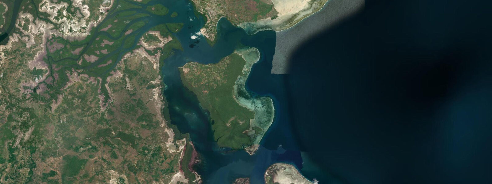
Kilwa Kisiwani is a tidal island off the coast of southern Tanzania, accessible by short boat crossing from Kilwa Masoko on the mainland. The island holds the ruins of the Kilwa Sultanate — a medieval Swahili city-state that, at its height between the 12th and 16th centuries, controlled one of the Indian Ocean's most significant trade routes: gold and ivory from Great Zimbabwe and the Sofala coast, traded north and east to Arabia, India, and China. The Arab traveller Ibn Battuta visited in 1331 and wrote that Kilwa was one of the most beautiful cities in the world.
That record is harder to square with the current ruins, but the scale of the remaining structures gives a sense of what was here. UNESCO inscribed the ruins as a World Heritage Site in 1981. 0 metres.
At low spring tide the tidal flats around the island's southern and eastern edges are exposed — a wide belt of sand and mud that extends 100 to 200 metres from the shoreline. The ruins closest to the shore, including sections of the Great Mosque's outer walls, sit just above the high water mark. At high spring tide the water reaches close to the base of the masonry in the lowest-lying sections.
The Great Mosque of Kilwa is the site's most substantial structure. Built in the 11th century and expanded significantly in the 14th and 15th centuries, it was the largest mosque in sub-Saharan Africa at the time of its peak use. The barrel-vaulted roof — a sophisticated construction technique for the period and geography — survives in the smaller Husuni Ndogo (Little Palace) section; the main prayer hall is now roofless, with the coral-rag pillars still standing in rows.
Husuni Kubwa (Great Palace), a 14th-century royal compound, is the largest single medieval building on the East African coast. Its audience hall, bathing pool, and trading area give a more complete picture of how the sultanate organised its commerce and court life. The Portuguese Fort Gereza, built between 1505 and 1510 after the Portuguese forced their way into the Indian Ocean trading system, was constructed over an earlier Arab structure.
The name Gereza derives from the Portuguese word for 'church' — the building was initially used partly for that purpose. It was subsequently used as a prison and customs post by successive powers and the walls are substantially intact. The boat crossing from Kilwa Masoko is 10 to 20 minutes depending on the vessel.
The crossing is possible at any tide, but at very low spring tide the channel is shallow in places and the local boatmen pick a route accordingly. The island itself has a small permanent community whose residents are the custodians of everyday life on the ruins site. The National Museums of Tanzania manage the archaeological heritage; entry fees apply.
Photography of the ruins is permitted without restriction. For tide photographers, the combination of coral-rag ruins, exposed tidal flat, and dawn light is a productive subject. The low water period around the spring low exposes the most foreground texture; sunrise timing relative to low water varies across the year and is worth calculating before the visit.
Predictions on this page come from Open-Meteo Marine, a gridded global ocean model. 3 metres on height — model-derived, not from a local gauge. The national authorities are the Tanzania Meteorological Authority (TMA) and Tanzania Ports Authority; the Zanzibar gauge provides the nearest long-term tidal reference.
Tide questions about Kilwa Kisiwani
Quick answers to the most common questions about tide times, range, and water access at Kilwa Kisiwani.
Why was the Kilwa Sultanate historically significant?
The Kilwa Sultanate, at its peak between the 12th and 16th centuries, controlled the most profitable section of the East African Indian Ocean trade: gold mined at Great Zimbabwe and the Sofala coast was funnelled through Kilwa northward to Arabia and eastward to India and China. The Arabic traveller Ibn Battuta visited in 1331 and ranked Kilwa among the finest cities he had seen. The sultanate's wealth funded the Great Mosque and Husuni Kubwa palace — the largest medieval structures in sub-Saharan Africa — and supported a cosmopolitan port culture that blended Bantu, Arab, Persian, and Indian influences. The Portuguese forcibly disrupted this system in 1505.
What are the main ruins to visit on Kilwa Kisiwani?
The three principal sites are the Great Mosque of Kilwa (11th-15th century, largest mosque in medieval sub-Saharan Africa), Husuni Kubwa (Great Palace, 14th century royal compound with trading area, audience hall, and bathing pool), and Fort Gereza (Portuguese fort built 1505-1510 over an earlier Arab structure, walls largely intact). A guided walk covering all three sites takes 2 to 3 hours. The National Museums of Tanzania manage the site; guides are available at the landing jetty. Allow a full morning or afternoon rather than a rushed 90 minutes.
How do I get to Kilwa Kisiwani from Kilwa Masoko?
Kilwa Masoko is the mainland town opposite the island, reachable from Dar es Salaam by overnight bus (around 8-9 hours south) or by light aircraft. From Kilwa Masoko harbour, local boats make the crossing to Kilwa Kisiwani in 10 to 20 minutes; fares are negotiable and trips run throughout the day. The crossing is possible at all tide states, though very low spring tide makes the channel shallow and the boatman takes a longer route. There is no fixed ferry service; arrange a return time with your boatman or the island-based guides.
Does the tide affect access to the ruins on Kilwa Kisiwani?
The ruins are accessible on foot at any tide — the main structures sit above the high water mark. At low spring tide the tidal flats on the island's southern side expose 100 to 200 metres of sand and mud, allowing circumnavigation of parts of the island on foot that are underwater at high water. Some sections of the outer mosque wall closest to shore are at the high water margin; the most dramatic tidal change is visible from the shore side of the fort and mosque area. For photography, low spring tide gives the most foreground texture with exposed flat and reflected sky.
What accommodation is available near Kilwa Kisiwani?
Kilwa Masoko on the mainland has basic guesthouses and one or two mid-range lodges — the town is small and accommodation options are limited. The island itself has a small permanent community but no tourist accommodation. Most visitors to Kilwa Kisiwani travel from Dar es Salaam on an extended day trip or stay one or two nights in Kilwa Masoko. Planning your visit to arrive in the morning after the overnight bus from Dar allows a full day at the ruins before the return journey. Advance booking of Kilwa Masoko accommodation is advisable if arriving on a weekend.
8-day tide table — Kilwa Kisiwani
Heights relative to MSL. Predictions: Open-Meteo Marine (MeteoFrance SMOC, 0.08° grid) — heights relative to MSL (not chart datum / LAT). Model-derived.
| Day | Type | Time | Height |
|---|---|---|---|
| Sat 04 Jul | Low | 03:00 | 0.2m |
| High | 06:07 | 1.5m | |
| Low | 12:04 | -0.8m | |
| High | 18:16 | 1.8m | |
| Sun 05 Jul | Low | 00:35 | -0.9m |
| High | 06:44 | 1.5m | |
| Low | 12:42 | -0.7m | |
| High | 18:53 | 1.7m | |
| Mon 06 Jul | Low | 01:10 | -0.8m |
| High | 07:23 | 1.5m | |
| Low | 13:25 | -0.6m | |
| High | 19:32 | 1.5m | |
| Tue 07 Jul | Low | 01:49 | -0.7m |
| High | 08:06 | 1.5m | |
| Low | 14:17 | -0.5m | |
| High | 20:21 | 1.3m | |
| Wed 08 Jul | Low | 02:35 | -0.6m |
| High | 09:02 | 1.4m | |
| Low | 15:23 | -0.3m | |
| High | 21:23 | 1.1m | |
| Thu 09 Jul | Low | 03:33 | -0.4m |
| High | 10:10 | 1.4m | |
| Low | 16:44 | -0.3m | |
| High | 22:40 | 0.9m | |
| Fri 10 Jul | Low | 04:45 | -0.4m |
| Sat 11 Jul | High | 00:12 | 0.9m |