Coco Beach tide times
Coco Beach tide forecast — heights relative to MSL.
Today's tide times for Coco Beach
Tide times at Coco Beach on Sunday, 21 June 2026: first low tide at 03:00am, first high tide at 08:18am, second low tide at 02:20pm, second high tide at 08:32pm. Sunrise 06:32am, sunset 06:16pm.
Tide chart for Coco Beach
24-hour cosine-interpolated curve around the present moment. Heights relative to MSL. Predictions: Predictions: Open-Meteo Marine (MeteoFrance SMOC, 0.08° grid).
Sun, moon and conditions on Sun 21 Jun
Snapshot at build time — refreshes daily. Sea state from Open-Meteo Marine.
Highs and lows next 7 days
Every predicted high and low for the next week, with the daily tidal coefficient (0–120; higher = bigger swing, > 95 means stronger currents).
Other spots nearby
The three closest curated TideTurtle locations to Coco Beach, measured by great-circle distance.
Today's solunar windows
Solunar tradition: major periods are the ≈3h windows around moon transit and opposition; minor are ≈2h around moonrise and moonset. Pair with the local tide stage and wind for the best read.
Cycle dates near Coco Beach
Last spring tide on Sun 21 Jun (range 2.1m). Next spring tide on Sat 27 Jun (range 2.3m). Next neap on Mon 22 Jun.
Spring tides cluster around new and full moons (biggest swings). Neap tides land on quarter moons (smallest swings). See the spring tide and neap tide glossary entries for the why.
About tides at Coco Beach
A short guide to the coastline at Coco Beach — geography, sea state, and what the tide is actually doing under your feet.
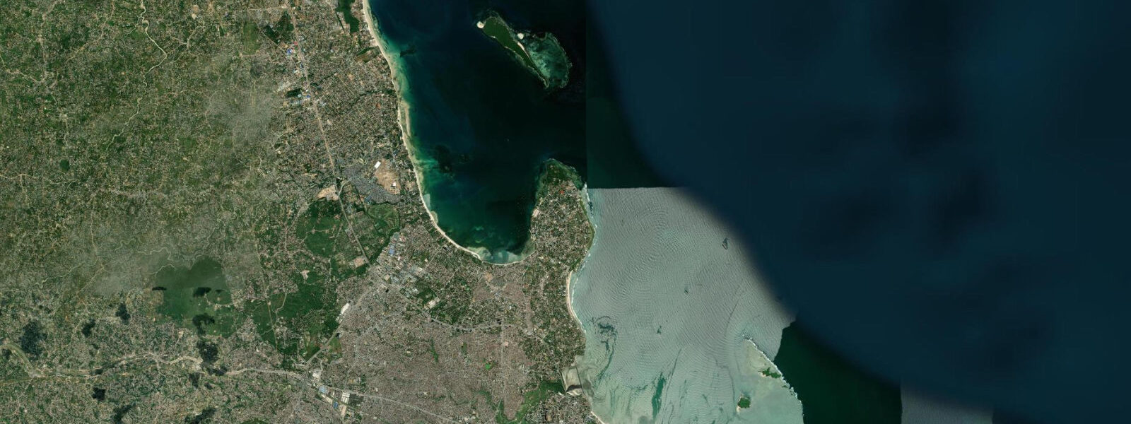
Coco Beach is on the Msasani Peninsula in northern Dar es Salaam, the closest accessible ocean beach to the city centre and one of the main public beach destinations for Dar's 6-plus million residents. The peninsula reaches into the Zanzibar Channel, giving the beach a northeast orientation; in the morning the channel is typically flat and the view across to the haze over Zanzibar is clear. By afternoon, the SE trade winds in the kusi season (May to October) build chop on the channel and the beach takes on a more active character.
The tidal range at Coco Beach follows the Dar es Salaam pattern: spring range approximately 3.0 metres, neap range around 1.3 to 1.5 metres. At low spring water, the beach widens by 200 to 300 metres as the tidal flat exposes — a firm sand and coral-rubble surface that is the main evening walking destination for Dar residents. The walk starts naturally as the sun drops in the west and the sand cools, typically from 17:00 onward, and the lowest tides of the lunar cycle produce the longest visible beach. The timing of this low-water window shifts by approximately 50 minutes per day through the lunar cycle, so the evening walk window aligns with a full spring low only a few days per month.
The Slipway marina and shopping complex sits 500 metres south of Coco Beach on the western side of the Msasani Peninsula, facing Msasani Bay rather than the open Zanzibar Channel. Water taxis to Bongoyo Island and Mbudya Island — both marine reserves within the Dar es Salaam Marine Reserve — depart from the Slipway jetty. The water-taxi schedule is posted on a board at the jetty and runs every 30 to 60 minutes depending on demand, but the timing of the last departure is constrained by tidal depth over the sandbar on the approach to Mbudya: when spring low water drops the bar depth below 0.8 metres, late-afternoon departures may be cancelled. Travellers planning a full day on the islands should confirm the last-return departure time on the day of travel.
The Dar es Salaam Sailing Club (DSC) operates from Msasani Bay on the peninsula's western shore, sheltered from the Zanzibar Channel swell. Dinghy and keelboat racing takes place on weekend mornings; the bay's tidal flat is shallow at low springs (0.3 to 0.5 metres over the inner sand) and the racing course shifts outward toward the channel entrance on the low-water legs. The paddleboarding scene on the bay is well-established; the calm morning water before the kusi builds is the preferred window.
Shore fishing at Coco Beach targets the species that move along the reef and rock edge at the northern headland of the peninsula: snapper, emperor fish, and occasionally kingfish and barracuda on lures. The incoming flood tide from 2 hours before low water through mid-flood is the most productive window as the current along the reef edge concentrates baitfish. The headland rocks are accessible on foot at low water; as the tide rises, the accessible area narrows to the higher ledges.
For beach walkers and families, the low-water window in the late afternoon is the main draw — the wide flat sand, the cooler temperature, and the city skyline visible to the south across Msasani Bay. Children play in the residual pools that collect in the coral-rubble depressions on the flat; these pools warm through the afternoon sun and are 5 to 10 degrees Celsius warmer than the open channel water by late afternoon. The flat is firm enough to walk barefoot on the sandy sections but the coral rubble patches require footwear — water sandals are the standard choice.
Tide predictions for Coco Beach come from Open-Meteo Marine, a gridded global ocean model. Accuracy is typically plus or minus 45 minutes on timing and 0.2 to 0.3 metres on height. The Tanzania Ports Authority operates the authoritative Dar es Salaam tide gauge; the TPA publishes annual tide tables that are the reference for all port operations and commercial vessels in Dar es Salaam harbour.
Tide questions about Coco Beach
Quick answers to the most common questions about tide times, range, and water access at Coco Beach.
When is the best time to visit Coco Beach for a beach walk?
The most popular window at Coco Beach is the low-water period in the late afternoon — from roughly 2 hours before low water to 1 hour after — when the tidal flat is at its widest (200 to 300 metres of exposed sand and rubble at spring tides) and the temperature has dropped enough from the midday heat to make walking comfortable. The sun begins its descent from around 17:00, cooling the sand surface and producing the long shadows and warm light that most beach walkers are looking for. Check the predicted low water time on this page: the best window is when low water falls between 16:00 and 19:00. This alignment occurs for roughly 5 to 7 consecutive days each lunar fortnight.
How do I get the water taxi to Bongoyo Island from Coco Beach?
The water taxi to Bongoyo Island departs from the Slipway jetty, 500 metres south of Coco Beach on the western side of the Msasani Peninsula. The Slipway is accessible by daladalas (shared minibuses) or taxi from central Dar es Salaam. Boats run every 30 to 60 minutes and the crossing takes approximately 20 minutes. The last departure time varies by tidal state: the boat needs at least 0.8 metres of depth over the sandbar on the Mbudya approach, and at spring low water this depth may not be met for late-afternoon crossings. On any day planning a trip to Bongoyo or Mbudya, check the predicted low water time on this page; if low water falls in the mid-afternoon, confirm the last-return boat time with the Slipway jetty before you go.
Is Coco Beach safe to swim at all tidal states?
Coco Beach on the Msasani Peninsula faces northeast into the Zanzibar Channel, which produces variable conditions. At low water, the exposed tidal flat is too shallow for comfortable swimming — the water is ankle to thigh depth for 100 to 150 metres from the waterline. Swimming is better at mid-flood and high water when depth is adequate close to the beach. The main hazard is tidal current: at springs the current along the beach can reach 1 to 1.5 knots, which is strong enough to sweep a swimmer along the peninsula. Swim parallel to the beach rather than toward the channel. During the kusi season (May to October), the afternoon SE wind builds surface chop on the channel; swimming conditions deteriorate from about 14:00 on strong-wind days. The calmer morning window — before 10:00 — is the most consistent swimming period.
What fishing is possible from Coco Beach?
Shore fishing at Coco Beach targets the rocky headland at the north end of the Msasani Peninsula, where snapper, emperor fish, and occasionally kingfish and barracuda are taken on the incoming flood tide. The flood window — from 2 hours before low water through to mid-flood — is when baitfish concentrate on the reef edge and larger predators follow. The rocks at the headland are accessible on foot at low water; fish the rising tide from these rocks as the water comes back in over the ledges. Spinning lures (10 to 30 grams) along the rock edge at dawn on the incoming tide is the local approach for barracuda and kingfish. Shore-cast bait fishing on the wider beach at night on the incoming tide produces snapper and grunter. Check current Tanzania Fisheries regulations before fishing; the Dar es Salaam Marine Reserve has designated no-take zones.
Where do the tide predictions for Coco Beach come from?
Open-Meteo Marine, a gridded global ocean model that generates tidal height estimates from a geographic grid rather than from harmonic analysis of a local tide gauge. Accuracy is typically plus or minus 45 minutes on timing and 0.2 to 0.3 metres on height. The authoritative tide gauge for Dar es Salaam is operated by the Tanzania Ports Authority (TPA); the TPA publishes annual tide tables for the Dar es Salaam gauge, which is the reference for all port operations and commercial vessels. These predictions are not for navigation or commercial vessel operations.
8-day tide table — Coco Beach
Heights relative to MSL. Predictions: Open-Meteo Marine (MeteoFrance SMOC, 0.08° grid) — heights relative to MSL (not chart datum / LAT). Model-derived.
| Day | Type | Time | Height |
|---|---|---|---|
| Sun 21 Jun | Low | 03:00 | -0.6m |
| High | 08:18 | 1.5m | |
| Low | 14:20 | -0.4m | |
| High | 20:32 | 1.4m | |
| Mon 22 Jun | Low | 02:48 | -0.6m |
| High | 09:16 | 1.4m | |
| Low | 15:26 | -0.3m | |
| High | 21:33 | 1.1m | |
| Tue 23 Jun | Low | 03:45 | -0.4m |
| High | 10:26 | 1.3m | |
| Low | 16:46 | -0.2m | |
| High | 22:46 | 0.9m | |
| Wed 24 Jun | Low | 04:50 | -0.3m |
| High | 11:36 | 1.3m | |
| Low | 18:07 | -0.2m | |
| Thu 25 Jun | High | 00:06 | 0.9m |
| Low | 06:00 | -0.3m | |
| High | 12:45 | 1.4m | |
| Low | 19:15 | -0.4m | |
| Fri 26 Jun | High | 01:16 | 0.9m |
| Low | 07:03 | -0.3m | |
| High | 13:38 | 1.5m | |
| Low | 20:11 | -0.5m | |
| Sat 27 Jun | High | 02:10 | 1.0m |
| Low | 07:54 | -0.4m | |
| High | 14:23 | 1.6m | |
| Low | 20:53 | -0.6m | |
| Sun 28 Jun | High | 02:00 | 1.1m |