Hualien tide times
Hualien tide forecast — heights relative to MSL.
Today's tide times for Hualien
Tide times at Hualien on Sunday, 21 June 2026: first low tide at 08:00am, first high tide at 09:54am. Sunrise 05:06am, sunset 06:43pm.
Tide chart for Hualien
24-hour cosine-interpolated curve around the present moment. Heights relative to MSL. Predictions: Predictions: Open-Meteo Marine (MeteoFrance SMOC, 0.08° grid).
Sun, moon and conditions on Sun 21 Jun
Snapshot at build time — refreshes daily. Sea state from Open-Meteo Marine.
Highs and lows next 7 days
Every predicted high and low for the next week, with the daily tidal coefficient (0–120; higher = bigger swing, > 95 means stronger currents).
Other spots nearby
The three closest curated TideTurtle locations to Hualien, measured by great-circle distance.
Today's solunar windows
Solunar tradition: major periods are the ≈3h windows around moon transit and opposition; minor are ≈2h around moonrise and moonset. Pair with the local tide stage and wind for the best read.
Cycle dates near Hualien
Next spring tide on Sat 27 Jun (range 1.3m). Next neap on Wed 24 Jun.
Spring tides cluster around new and full moons (biggest swings). Neap tides land on quarter moons (smallest swings). See the spring tide and neap tide glossary entries for the why.
About tides at Hualien
A short guide to the coastline at Hualien — geography, sea state, and what the tide is actually doing under your feet.
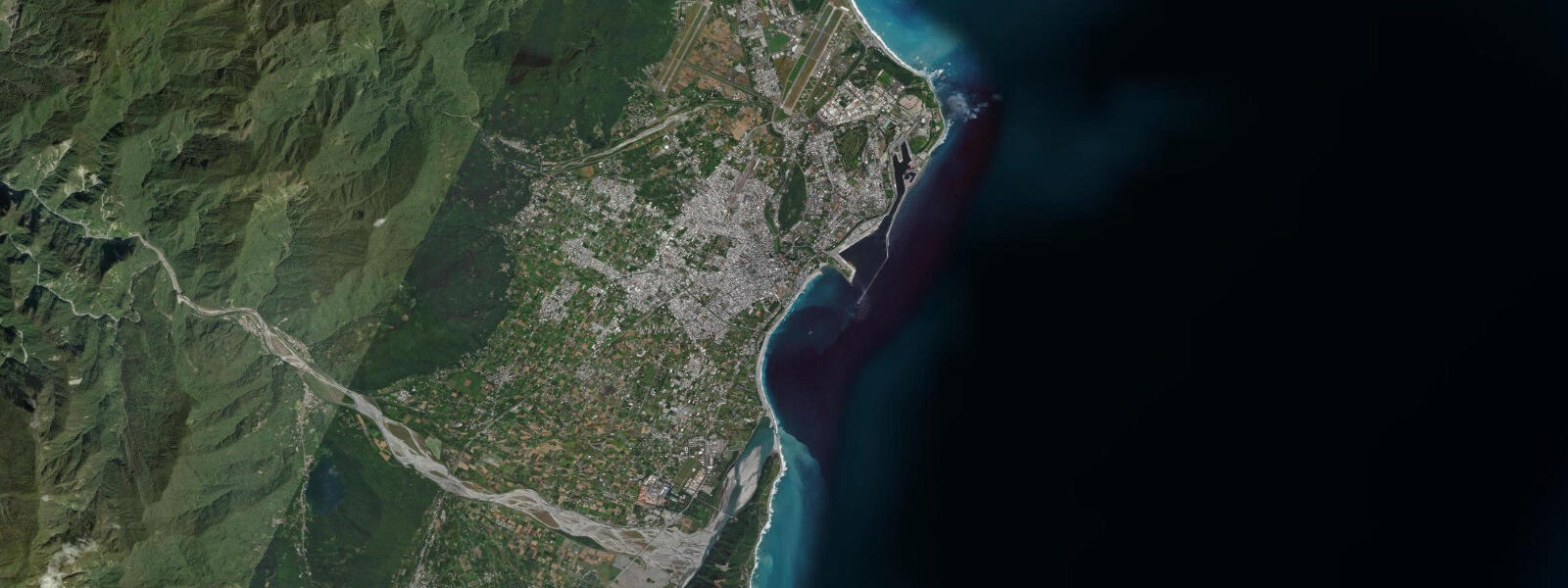
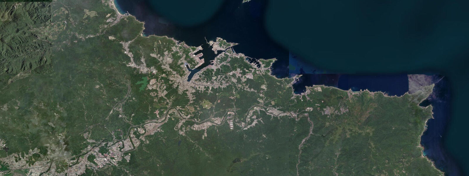
Hualien is the main city of Taiwan's east coast, positioned where the Central Mountain Range arrives at the Pacific and the flat alluvial plain at the Taroko gorge mouth holds the only significant lowland area on this otherwise sheer coastal face. Taroko National Park begins at the city's northern edge, where the Liwu River has cut a 20 km marble gorge through the Central Range — the gorge road is one of the most dramatic road routes in East Asia, with marble canyon walls rising 300 to 500 m directly above the road and river.
The tidal regime at Hualien is semidiurnal, driven directly by the open Pacific. Spring range runs approximately 2.0 to 2.5 m — a clean, well-behaved twice-daily cycle with two near-equal highs and two near-equal lows. The spring-neap variation across the lunar month gives the largest ranges around new and full moons. The Pacific tidal signal is consistent and reliable compared to the mixed diurnal regimes of enclosed gulfs to the west and south.
Qi Xingtan Beach (Seven Star Lake Beach) is the most visited coastal site directly accessible from Hualien city — a pebble beach 4 km north of the city centre, famous for the white and grey rounded stones that cover it rather than sand. The beach faces the Pacific directly; the gradient is steep, typical of pebble beaches, and the surf zone is active with Pacific swell. The spring tidal range of 2.0 to 2.5 m moves the waterline measurably on the steep pebble gradient — roughly 8 to 12 m between the spring high and low waterlines — but the beach's visual character doesn't change as dramatically as a flat sandy beach at the same range, because the pebble slope adjusts to the wave energy. Public art installations and stone-sculpture gardens run along the promenade above the beach; the Hualien County Stone Sculptural Museum is immediately adjacent.
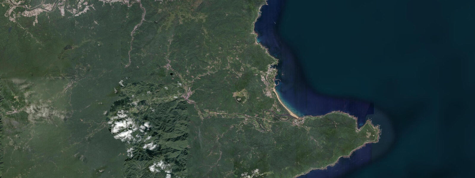
The Qingshui Cliffs (Qingshui Duanya) begin roughly 15 km north of Hualien at the coast road. These cliffs are among the world's most striking coastal landforms: the Coastal Range drops 1,000 to 2,000 m directly into the Pacific with minimal foothills, and the Su-Hua Highway is cut into the cliff face. The Pacific beats directly against the cliff base, and there is no beach or tidal flat at the cliff base — just vertical rock face to deep water. Tidal stage is irrelevant to viewing the cliffs as a scenic feature, though the drive along the Su-Hua is an experience in itself.
Hualien Port, immediately south of the city, handles aggregate export (marble and stone products from the Central Range), fishing fleet operations, and occasional cruise ship calls. The port approach is tide-insensitive for commercial traffic at this range. The Kuroshio Current runs northward along eastern Taiwan at 1 to 2 knots offshore; this warm, clear Pacific current is distinct from the coastal water in the port approaches and gives the offshore zone its characteristic colour.
The typhoon risk on the east coast is significant. Peak season runs July through October; systems crossing the Western Pacific make landfall on eastern Taiwan several times per decade. When a typhoon passes directly over or north of Taiwan, the east coast takes the full Pacific-facing exposure. The Su-Hua Highway closes during these events, and Taroko gorge closes as well. Taiwan's Central Weather Bureau (CWB) publishes authoritative tide predictions for Hualien and issues typhoon and marine warnings. For any activity where precise tidal timing matters, use the CWB tide tables — they are publicly accessible and computed from harmonic analysis of the Hualien gauge record.
Predictions on this page come from Open-Meteo Marine, a gridded global ocean model; accuracy is typically within plus or minus 45 minutes on timing and 0.2 to 0.3 m on height.
Tide questions about Hualien
Quick answers to the most common questions about tide times, range, and water access at Hualien.
When is the next high tide at Hualien?
The hero block at the top of this page shows the next predicted high at Hualien in local Taiwan Standard Time (TST, UTC+8, no daylight saving). Spring range at Hualien is approximately 2.0 to 2.5 m on a semidiurnal pattern — two highs and two lows per day, cycling on the 12-hour 25-minute lunar interval. The Taiwan Central Weather Bureau (CWB) publishes authoritative harmonic tide predictions for Hualien port that are computed from gauge-calibrated analysis and are more precise than the Open-Meteo gridded estimate. The CWB tide table is publicly accessible and should be the reference for any activity where precise timing matters.
What is the best time to visit Qi Xingtan (Seven Star Beach) at Hualien?
Qi Xingtan is a pebble beach facing the Pacific; the tidal stage affects the position of the surf zone on the steep pebble gradient but does not dramatically change the visual character of the beach the way a flat sandy beach changes. For photography, early morning in the dry season (October through April) gives the best conditions — the east-facing Pacific aspect catches the sunrise, the beach is uncrowded, and the low angle light catches the polished surface of the pebbles. The stone sculpture garden and promenade are accessible at all hours without any tidal constraint. The beach is busiest on summer weekends and public holidays; early-morning weekday visits in autumn or spring give the most space and best light.
How do I get to Taroko National Park from Hualien?
Taroko gorge entrance is approximately 4 km north of Hualien city centre. The gorge road (Provincial Highway 8) starts at the Taroko arch gate and runs 19 km through the marble canyon to Tianxiang village, the main stopping point inside the park. Bus and shuttle services run from Hualien train station to the park entrance and further into the gorge. The gorge road is not tide-dependent; however, it closes during and after heavy rain and typhoon events due to rockfall and landslide risk — a real consideration from July through October. Check the Taroko National Park website for current road closure status before visiting. The park entrance gate, the Shakadang Trail, and the Eternal Spring Shrine are accessible near the gorge entrance without travelling deep into the canyon.
What is the typhoon risk at Hualien and how does it affect visits?
Eastern Taiwan is directly exposed to Western Pacific typhoons, and Hualien takes the initial impact when systems track across the Pacific from the Philippines. Peak typhoon season runs July through October, with August and September statistically the busiest months for Taiwan direct hits. A close-approach or direct-hit system brings sustained winds above 100 km/h, heavy rain, Pacific swell of 6 to 8 m, and storm surge that briefly overwhelms the astronomical tidal signal entirely. The Su-Hua Highway and Taroko gorge road both close; air and rail services are disrupted for 24 to 48 hours. Taiwan's CWB issues typhoon watches and warnings with good lead time. If visiting in typhoon season, build 24 to 48 hours of schedule flexibility around storm events and monitor CWB advisories closely.
Where do these tide predictions come from?
Open-Meteo Marine, a gridded global ocean model. Accuracy is typically within plus or minus 45 minutes on timing and 0.2 to 0.3 m on height. For authoritative Hualien tide data, the Taiwan Central Weather Bureau (CWB) publishes harmonic tide predictions for Hualien port — computed from gauge-calibrated harmonic analysis, they are more precise than the Open-Meteo gridded estimate for planning around a specific high or low. For navigational use in the Hualien port approaches or the Kuroshio Current zone offshore, use CWB tide tables and official Taiwan hydrographic charts rather than gridded model estimates.
8-day tide table — Hualien
Heights relative to MSL. Predictions: Open-Meteo Marine (MeteoFrance SMOC, 0.08° grid) — heights relative to MSL (not chart datum / LAT). Model-derived.
| Day | Type | Time | Height |
|---|---|---|---|
| Sun 21 Jun | Low | 08:00 | 0.8m |
| High | 09:54 | 0.9m | |
| Mon 22 Jun | Low | 05:04 | 0.2m |
| High | 11:04 | 0.8m | |
| Low | 17:21 | 0.2m | |
| Tue 23 Jun | High | 00:03 | 0.9m |
| Low | 06:23 | 0.2m | |
| High | 12:38 | 0.7m | |
| Low | 18:12 | 0.3m | |
| Wed 24 Jun | High | 00:55 | 1.0m |
| Low | 07:45 | 0.2m | |
| High | 14:07 | 0.8m | |
| Low | 19:10 | 0.4m | |
| Thu 25 Jun | High | 01:45 | 1.1m |
| Low | 08:50 | 0.1m | |
| High | 15:21 | 0.8m | |
| Fri 26 Jun | Low | 09:42 | 0.0m |
| High | 16:15 | 0.8m | |
| Low | 21:04 | 0.4m | |
| Sat 27 Jun | High | 03:12 | 1.1m |
| Low | 10:18 | -0.1m | |
| High | 16:56 | 0.9m | |
| Low | 21:52 | 0.4m | |
| Sun 28 Jun | High | 03:55 | 1.2m |
| Low | 07:00 | 0.7m |