Colombo tide times
Colombo tide forecast — heights relative to MSL.
Today's tide times for Colombo
Tide times at Colombo on Friday, 31 July 2026: first high tide at 05:30am, first low tide at 08:34am, second high tide at 02:51pm, second low tide at 09:07pm. Sunrise 06:04am, sunset 06:29pm.
Tide chart for Colombo
24-hour cosine-interpolated curve around the present moment. Heights relative to MSL. Predictions: Predictions: Open-Meteo Marine (MeteoFrance SMOC, 0.08° grid).
Sun, moon and conditions on Fri 31 Jul
Snapshot at build time — refreshes daily. Sea state from Open-Meteo Marine.
Highs and lows next 7 days
Every predicted high and low for the next week, with the daily tidal coefficient (0–120; higher = bigger swing, > 95 means stronger currents).
Other spots nearby
The three closest curated TideTurtle locations to Colombo, measured by great-circle distance.
Today's solunar windows
Solunar tradition: major periods are the ≈3h windows around moon transit and opposition; minor are ≈2h around moonrise and moonset. Pair with the local tide stage and wind for the best read.
Cycle dates near Colombo
Next spring tide on Sat 01 Aug (range 0.7m). Next neap on Wed 05 Aug.
Spring tides cluster around new and full moons (biggest swings). Neap tides land on quarter moons (smallest swings). See the spring tide and neap tide glossary entries for the why.
About tides at Colombo
A short guide to the coastline at Colombo — geography, sea state, and what the tide is actually doing under your feet.
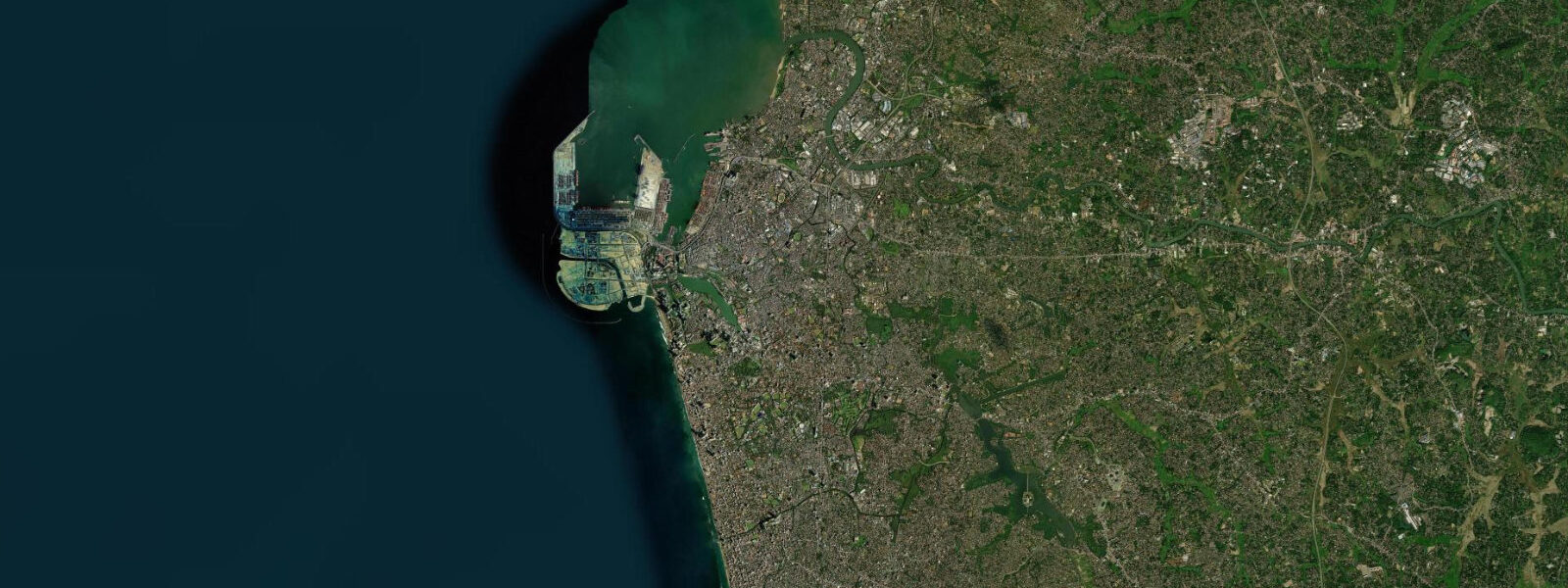
Colombo is Sri Lanka's commercial capital and its largest port, set on the western coast where the island faces the Arabian Sea. The harbour is one of the busiest transshipment hubs in the Indian Ocean — container ships queue offshore waiting for berth access, and the Colombo Port City development reclaimed 269 hectares from the sea on the south face of the old harbour, visibly pushing the shoreline westward into what used to be open water. Behind and alongside this industrial reality runs 50 kilometres of coast — the broad sandy sweep north toward Negombo airport, the fishing village beaches at Dehiwala and Mount Lavinia south of the city centre, and the Beira Lake lagoon system that sits inside the city itself.
The tidal regime at Colombo is mixed diurnal. Mean astronomical range is roughly 0.4 to 0.6 metres. The daily pattern shifts through the month as the moon's declination changes: on days around maximum declination you often get a clear dominant-high plus a smaller secondary, creating a noticeable inequality; around zero declination the pattern approaches two roughly equal highs and lows each day. Spring tides near new and full moons push toward 0.6 metres or slightly above; neap tides can compress the range to 0.2 to 0.3 metres. Colombo Port pilots time large vessel arrivals for the high-water window to maximise under-keel clearance in the main channel, which gives a sense of how even a 0.4 to 0.6 metre range matters in operational harbour decisions.
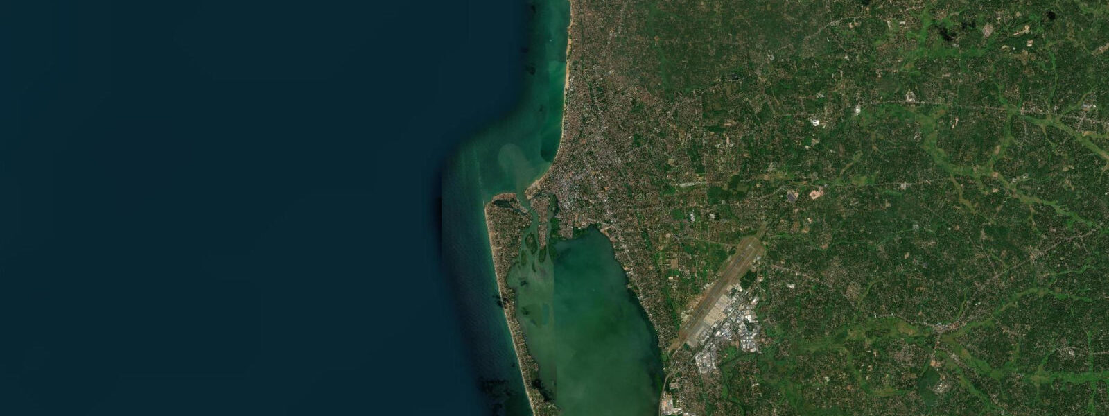
For those not operating a container ship, the practical tidal influence in Colombo is most felt at two locations. The fishing harbour at Muthurajawela, north of the city, and the Negombo Lagoon system behind the coast — a network of backwater channels worked by traditional outrigger canoe fishermen — both respond to the tidal pulse. At low water the lagoon channel margins go muddy and shallow; at high water the mangrove roots are inundated and the fish move in. Early morning high tides in the backwaters of Negombo are when the small-boat fishermen put their nets out; the incoming tide brings the fish into the shallower channels.
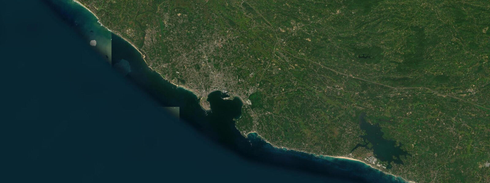
Mount Lavinia beach, the narrow strip of sand south of Colombo that backs onto the colonial-era hotel and the railway line, is one of the few urban beach options within city limits. The beach narrows noticeably at high water — the berm reduces to a few metres of sand against the seawall in some sections. At low water, the tidal flat extends 30 to 50 metres and the exposed sand holds the morning joggers and beach-volleyball games. This is a West-facing beach so the afternoon light is better than the morning — sunset photography from the Mount Lavinia headland, with the silhouette of fishing boats working the tidal edge, is a well-worn shot for good reason.
The Southwest Monsoon arrives in Colombo in May and breaks hard: the sea turns rough, the harbour bar gets confused chop when the swell meets the harbour outflow, and the coast from Colombo south through Galle is exposed to consistent 2 to 3 metre southwest swell. The fishing fleet reduces its offshore runs; the casual beach use essentially stops for four months. When the Northeast Monsoon establishes by October or November, the western coast calms and the season opens. December through March is the flat-water period on this coast — the mornings are clear, the harbour is calm, and the long beach strip north toward Negombo is swimmable.
Kayaking and paddleboarding on the open coast near Colombo is limited by port traffic, which is active 24 hours. The Beira Lake in the city centre, a lagoon fed by tidal channels, is a sheltered alternative for flat-water paddling but the water quality has historically been poor. The Negombo Lagoon system to the north is the better option — a network of channels through mangrove and paddy field, sheltered from ocean swell, with the tidal current working in your favour on the right half of the cycle.
Tide predictions on this page come from Open-Meteo Marine, a global ocean model that generates tidal estimates from hydrodynamic equations over a geographic grid. Accuracy is typically within plus or minus 45 minutes on timing and 0.2 to 0.3 metres on height. NARA — the National Aquatic Resources Research and Development Agency — maintains the official tide gauge network for Sri Lanka, and the Sri Lanka Ports Authority publishes the operational tide tables for Colombo Port. For any harbour navigation, pier operations, or activity depending on precise water-level data, those are the sources to use.
Tide questions about Colombo
Quick answers to the most common questions about tide times, range, and water access at Colombo.
When is the next high tide at Colombo?
The next predicted high tide at Colombo, displayed in Sri Lanka Standard Time (SLST, UTC+5:30), is shown at the top of this page. Colombo follows a mixed diurnal pattern — on some days the tide produces two unequal highs and two lows; on others a single dominant high and a prolonged low phase. The character shifts through the month with the moon's declination. Mean astronomical range is roughly 0.4 to 0.6 metres. The Sri Lanka Ports Authority publishes the official operational tide tables for Colombo Port, which are the authoritative reference for harbour navigation.
What is the typical tidal range at Colombo?
Colombo's mean astronomical tidal range is roughly 0.4 to 0.6 metres — microtidal by international classification, similar to the rest of Sri Lanka's western coast. Spring tides near new and full moons push toward 0.6 metres or slightly above; neap tides at the quarter moons can compress the swing to 0.2 to 0.3 metres. The Arabian Sea basin geometry produces a mixed diurnal signal rather than a clean twice-daily rhythm. Wind and wave setup from the Southwest Monsoon can add 20 to 40 centimetres to observed water level on top of the predicted tide, making the monsoon-season sea state more relevant to beach conditions than the tide table.
Where do the tide predictions for Colombo come from?
Predictions on this page come from Open-Meteo Marine, a free global ocean model that estimates tidal heights from hydrodynamic equations applied across a geographic grid rather than from harmonic analysis of a local Colombo gauge. Accuracy is typically within plus or minus 45 minutes on timing and 0.2 to 0.3 metres on height. NARA (National Aquatic Resources Research and Development Agency) operates the official tide gauge network around Sri Lanka and is the authoritative source for coastal water-level data. The Sri Lanka Ports Authority publishes operational tide tables specific to Colombo Port and is the reference for harbour-related decisions.
Is it safe to swim at Mount Lavinia beach near Colombo, and does the tide affect conditions?
Mount Lavinia is swimmable on calm days, primarily during the Northeast Monsoon season (November through March) when the western coast is sheltered. During the Southwest Monsoon (May through September), the beach is rough and swimming is not safe regardless of tidal phase. The tide affects beach width noticeably: at high water the sandy berm narrows significantly in some sections and the beach can be narrow against the seawall. At low water, the tidal flat extends 30 to 50 metres. Ocean rip currents along this coast are more significant than tidal current as a hazard — swim in front of the guarded zones rather than off the rocky headland ends, and check with the beach lifeguards on the day.
Can these tide times be used for Colombo Port navigation?
No. These predictions are for general coastal planning and activity timing, not for navigational use in Colombo Port. The port is one of the busiest transshipment hubs in the Indian Ocean; vessel movements are governed by operational tide tables from the Sri Lanka Ports Authority and pilotage decisions involve local knowledge that no gridded ocean model replicates. Open-Meteo Marine predictions carry uncertainty of plus or minus 45 minutes on timing and 0.2 to 0.3 metres on height — not precision adequate for under-keel clearance or port entry decisions. For all commercial maritime operations at Colombo, use the Sri Lanka Ports Authority's official data.
8-day tide table — Colombo
Heights relative to MSL. Predictions: Open-Meteo Marine (MeteoFrance SMOC, 0.08° grid) — heights relative to MSL (not chart datum / LAT). Model-derived.
| Day | Type | Time | Height |
|---|---|---|---|
| Fri 31 Jul | High | 05:30 | 0.4m |
| Low | 08:34 | 0.2m | |
| High | 14:51 | 0.8m | |
| Low | 21:07 | 0.1m | |
| Sat 01 Aug | High | 15:08 | 0.8m |
| Low | 21:37 | 0.1m | |
| Sun 02 Aug | High | 03:40 | 0.6m |
| Low | 09:25 | 0.1m | |
| High | 15:30 | 0.7m | |
| Mon 03 Aug | Low | 22:15 | 0.0m |
| Tue 04 Aug | High | 04:40 | 0.6m |
| Low | 10:24 | 0.2m | |
| High | 16:12 | 0.6m | |
| Low | 22:40 | 0.1m | |
| Wed 05 Aug | High | 05:12 | 0.6m |
| Low | 11:10 | 0.2m | |
| High | 16:45 | 0.6m | |
| Low | 23:12 | 0.1m | |
| Thu 06 Aug | High | 05:48 | 0.6m |
| Low | 23:36 | 0.1m | |
| Fri 07 Aug | High | 04:30 | 0.4m |