
Valencia tide times
Valencia tide forecast — heights relative to MSL.
Today's tide times for Valencia
Tide times at Valencia on Friday, 19 June 2026: first high tide at 02:00. Sunrise 06:34, sunset 21:31.
Tide chart for Valencia
24-hour cosine-interpolated curve around the present moment. Heights relative to MSL. Predictions: Predictions: Open-Meteo Marine (MeteoFrance SMOC, 0.08° grid).
Sun, moon and conditions on Fri 19 Jun
Snapshot at build time — refreshes daily. Sea state from Open-Meteo Marine.
Highs and lows next 7 days
Every predicted high and low for the next week, with the daily tidal coefficient (0–120; higher = bigger swing, > 95 means stronger currents).
Other spots nearby
The three closest curated TideTurtle locations to Valencia, measured by great-circle distance.

Today's solunar windows
Solunar tradition: major periods are the ≈3h windows around moon transit and opposition; minor are ≈2h around moonrise and moonset. Pair with the local tide stage and wind for the best read.
About tides at Valencia
A short guide to the coastline at Valencia — geography, sea state, and what the tide is actually doing under your feet.
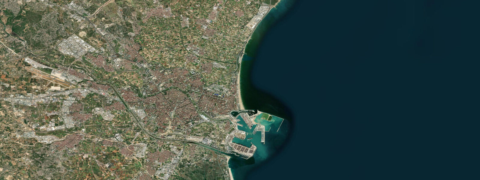
Valencia faces the western Mediterranean from Spain's east coast, and its coastal character has changed dramatically over the past 25 years. The Playa de la Malvarrosa — the city's main urban beach — was once industrial waterfront; the 2007 America's Cup transformed the port area into a functional marina and public space. The Mediterranean tidal range here is minimal: 0.2 to 0.3 metres. What drives water level changes at Valencia is wind — the tramontana from the north, the garbí from the southwest, and the levante from the east can push or pull water significantly more than the astronomical tide.
Malvarrosa and Patacona beaches run 3 kilometres north of the port, broad and backed by the Paseo Marítimo. The water is warm — 22 to 26°C from June through September — and the Mediterranean calm that characterises Valencian summer makes these beaches reliably flat for swimming and stand-up paddleboarding. The levante wind (from the east) creates the only regular surf at Malvarrosa, generating short-period 1 to 2 metre wind waves that local longboarders ride.
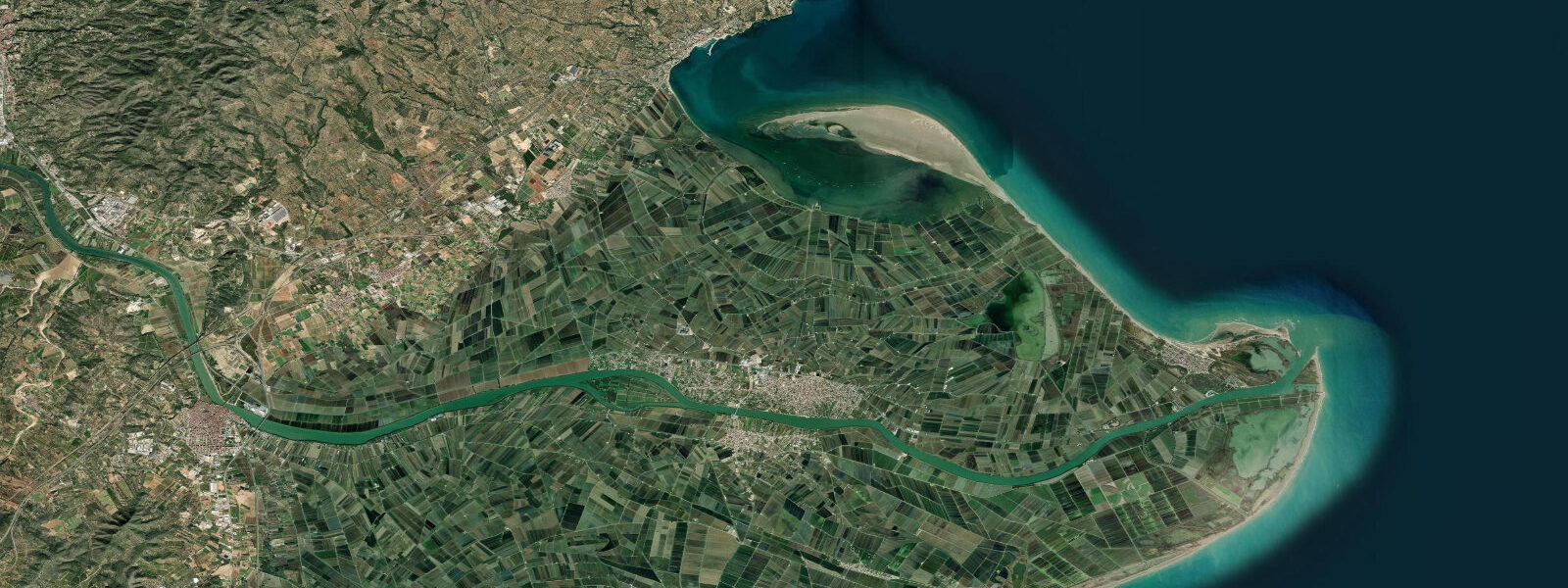
Albufera Natural Park, 10 kilometres south of Valencia, is a shallow freshwater lagoon separated from the sea by a narrow bar of land. Historically the lagoon supplied the rice that forms the base of paella (Valencia is the origin of the dish). The lagoon is connected to the sea by three canals, regulated by sluice gates, and the water level inside is managed for rice cultivation rather than tidal exchange. Boat tours of the Albufera reed beds at sunset are a standard Valencia day-trip.
The Port of Valencia, expanded for the 2007 America's Cup, has the largest container terminal in the Mediterranean. The port's southern fishing harbour retains a working fleet; fresh fish auctions run weekday afternoons at the Lonja del Pescado (the wholesale fish market) — the auction for turbot, sea bream, and red mullet is accessible to observers. The Mercado Central (Central Market) in the city sells the pick of the catch each morning.
For water sports, the Albufera lakes provide flat-water kayaking and the beach at El Saler (inside the natural park) is one of the more protected beaches near Valencia, sheltered from the north. El Perellonet and El Perelló further south are smaller, quieter beaches with shallow entry suitable for families.
Predictions on this page come from Open-Meteo Marine, a gridded global ocean model. Accuracy is typically within plus or minus 45 minutes on timing and 0.2 to 0.3 metres on height — model-derived, not from a local gauge. For the most accurate Mediterranean sea level data for Spain, consult Puertos del Estado at puertos.es.
Tide questions about Valencia
Quick answers to the most common questions about tide times, range, and water access at Valencia.
What is the tidal range at Valencia?
The Mediterranean at Valencia has a negligible astronomical tidal range — 0.2 to 0.3 metres at best. Water level changes are almost entirely wind-driven. The levante (east wind) pushes water onshore, raising sea level; the tramontana (north) and garbí (southwest) can lower or raise it. Planning beach activities by tide chart is not meaningful here — wind and swell forecasts matter far more.
Is there surf at Valencia?
Occasionally — the levante (east wind) generates short-period 1 to 2 metre wind waves at Malvarrosa and Patacona beaches. These conditions are most common in autumn (September through November) when Mediterranean depressions produce sustained easterly winds. The waves are not groundswell quality — they're choppy wind waves — but local longboarders and beginners ride them. Valencia is not a surf destination; it's a beach and paddling destination.
What is the Albufera Natural Park?
Albufera is a 21,000-hectare freshwater lagoon 10 km south of Valencia, separated from the Mediterranean by a narrow sandbar. It's the origin of Valencian rice cultivation and paella. The lagoon reed beds support breeding marsh harriers, purple herons, and little bitterns. Boat tours of the lagoon and surrounding rice fields run from El Palmar village (30 minutes from Valencia by bus). Sunset boat tours in autumn when the lagoon reflects orange sky over the rice stubble are the classic experience.
Where can I watch the fish auction in Valencia?
The Lonja del Pescado (wholesale fish auction) at the Port of Valencia runs weekday afternoons from around 4 p.m. Observers can watch the auction of the day's catch — sea bream, turbot, red mullet, squid, and whatever the trawlers bring in. Access to the auction floor is restricted to trade buyers; the viewing gallery is open. The fishing harbour is the southern section of the port complex, separate from the container terminal.
What are the best beaches near Valencia for families?
Malvarrosa and Patacona (urban beaches, backed by the Paseo Marítimo) are the closest — accessible by tram from the city centre. El Saler (inside Albufera Natural Park, 15 km south) is sheltered from the north wind and has shallower entry with fewer urban crowds. El Perellonet (20 km south) is quieter still with calm water ideal for children. All Valencia-area Mediterranean beaches have minimal tidal change — water access is consistent throughout the day.
8-day tide table — Valencia
Heights relative to MSL. Predictions: Open-Meteo Marine (MeteoFrance SMOC, 0.08° grid) — heights relative to MSL (not chart datum / LAT). Model-derived.
| Day | Type | Time | Height |
|---|---|---|---|
| Fri 19 Jun | High | 02:00 | -0.4m |
| Sat 20 Jun | — | ||
| Sun 21 Jun | — | ||
| Mon 22 Jun | — | ||
| Tue 23 Jun | — | ||
| Wed 24 Jun | Low | 11:00 | -0.5m |
| Thu 25 Jun | High | 20:00 | -0.4m |
| Fri 26 Jun | Low | 01:00 | -0.4m |