Mahon tide times
Mahon tide forecast — heights relative to MSL.
Today's tide times for Mahon
Tide times at Mahon on Friday, 19 June 2026: first high tide at 02:00. Sunrise 06:14, sunset 21:14.
Tide chart for Mahon
24-hour cosine-interpolated curve around the present moment. Heights relative to MSL. Predictions: Predictions: Open-Meteo Marine (MeteoFrance SMOC, 0.08° grid).
Sun, moon and conditions on Fri 19 Jun
Snapshot at build time — refreshes daily. Sea state from Open-Meteo Marine.
Highs and lows next 7 days
Every predicted high and low for the next week, with the daily tidal coefficient (0–120; higher = bigger swing, > 95 means stronger currents).
Other spots nearby
The three closest curated TideTurtle locations to Mahon, measured by great-circle distance.
Today's solunar windows
Solunar tradition: major periods are the ≈3h windows around moon transit and opposition; minor are ≈2h around moonrise and moonset. Pair with the local tide stage and wind for the best read.
About tides at Mahon
A short guide to the coastline at Mahon — geography, sea state, and what the tide is actually doing under your feet.
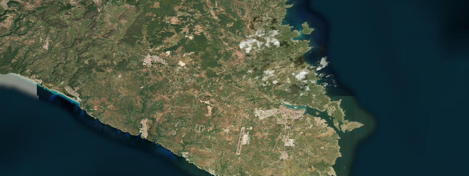
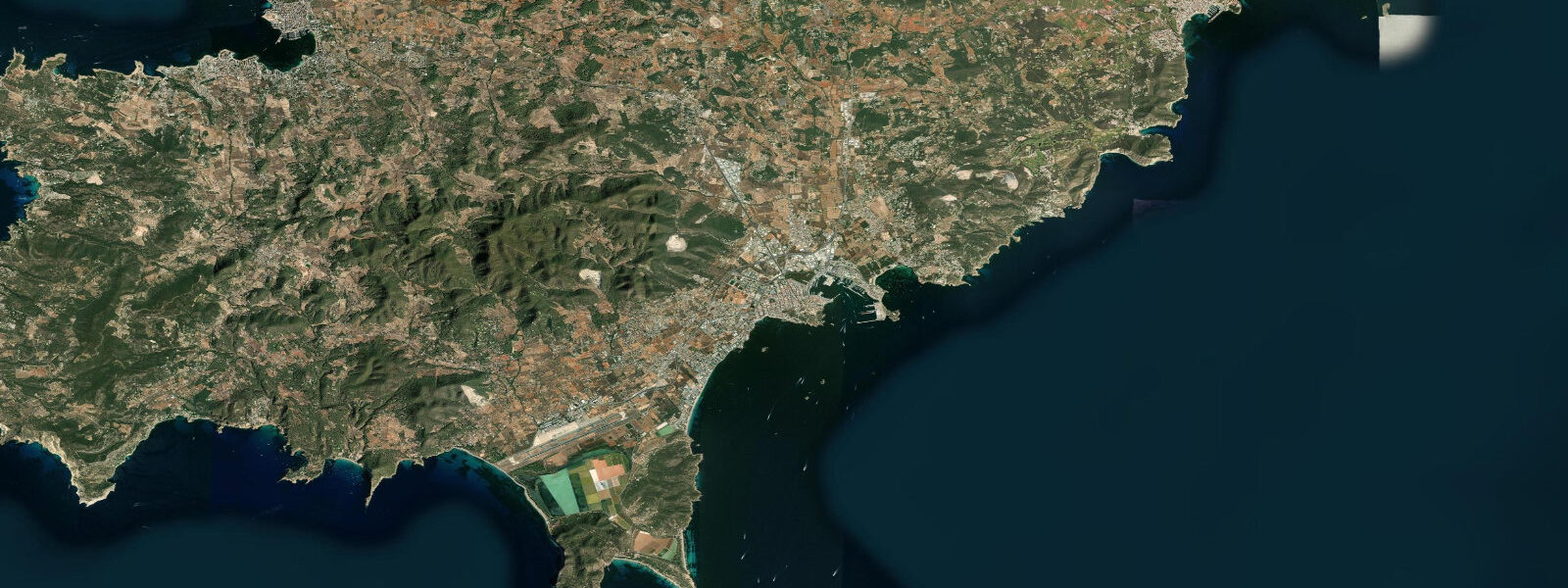
Mahon (Maó in Catalan) occupies the eastern end of Menorca, at the head of one of the largest natural deep-water harbours in the Mediterranean — a ría-like inlet approximately 8 kilometres long and 0.5 to 1.5 kilometres wide, formed by the same geological drowning that produced the Galician rías on the Atlantic coast but in a Mediterranean context. The British Royal Navy held Port Mahon as a strategic base from 1708 to 1802 (with French and Spanish interruptions), and the harbour's importance to 18th-century naval power was precisely its combination of deep water (18 to 25 metres in the main channel), long sheltered fetch, and position commanding the western Mediterranean.
The tidal regime at Mahon is Mediterranean microtidal. The mean spring range is approximately 0.2 metres — the astronomical tide is functionally invisible to casual observation. Water level in the harbour is governed primarily by two other forces: atmospheric pressure (an anticyclone can suppress sea level by 0.15 to 0.20 metres; a deep Atlantic low tracking over Spain raises it by a similar amount) and wind-driven setup (a sustained Tramontane or Levante pushing water against the harbour's closed eastern end can add 0.2 to 0.4 metres).
The harbour's enclosed geometry also produces characteristic seiching — standing oscillations of the harbour water mass in response to atmospheric pressure changes or wind forcing. The Port Mahon seiche has a dominant period of approximately 10 to 12 minutes, measurable on any sensitive tide gauge during a pressure event. This seiche — known locally as the rissaga in its more dramatic form, shared with Port Ciutadella on Menorca's west coast — can amplify weather-driven surges into destructive oscillations. The Ciutadella rissaga of 2006, triggered by a fast-moving atmospheric pressure wave, produced 4-metre harbour oscillations and caused significant vessel and infrastructure damage. Port Mahon, being longer and more open at its mouth, damps the rissaga oscillation more effectively than Ciutadella, but the harbour is not immune to surge events during deep Atlantic low pressure systems.
La Mola fortress, at the harbour mouth on the northern headland, was built by the British in the 18th century and expanded by Spain in the 19th century. It operated as a military prison through the 20th century and is now a heritage site and museum open to visitors. The views from the fortress walls across the harbour mouth and the open Mediterranean to the east are the best in Menorca for understanding why the harbour mattered to imperial navies. Es Castell (Georgetown in the British period) sits on the south shore of the harbour, approximately 3 kilometres east of Mahon town, and retains a grid-street British colonial plan visible on any map. The town square is named after its original British designation, and the local cuisine shows a distinct British influence — caldereta de llagosta (Menorcan lobster stew) and gin from Mahon's distillery (Xoriguer, made from distilled wine and juniper) are the defining local products.
Predictions on this page come from Open-Meteo Marine, a gridded global ocean model. Accuracy is typically within plus or minus 45 minutes on timing and 0.2 to 0.3 metres on height — model-derived, not from a local gauge. For authoritative Spanish tide data, consult Puertos del Estado (puertos.es/es/estadisticas-y-datos-del-mar).
Tide questions about Mahon
Quick answers to the most common questions about tide times, range, and water access at Mahon.
Does the tide actually matter for visiting Mahon Harbour?
In the conventional sense — planning around a 2 to 4 metre tidal drop to access beaches or docks — no. Menorca is fully Mediterranean microtidal with a mean spring range of approximately 0.2 metres. The astronomical tide is too small to affect beach access, boat mooring, or any coastal activity you might plan. What matters instead is wind and atmospheric pressure. A sustained Tramontane (north wind) or Levante (east wind) can raise harbour water level by 0.2 to 0.4 metres and produce uncomfortable conditions in the outer harbour. A deep low-pressure system over the western Mediterranean can suppress or elevate water level by 0.15 to 0.25 metres. Weather forecasts are the relevant planning tool here, not tide tables.
What is the rissaga and does it affect Mahon?
The rissaga is a meteorological seiche — a rapid oscillation of harbour water level driven by a fast-moving atmospheric pressure wave rather than by wind or tide. It is most destructive in Ciutadella Harbour on Menorca's west coast, where the harbour geometry amplifies the oscillation to dramatic heights (the 2006 rissaga reached 4 metres in Ciutadella). Port Mahon's longer, more open harbour geometry damps the effect considerably — the dominant seiche period at Mahon is approximately 10 to 12 minutes, and the oscillation amplitude during most pressure events is 0.1 to 0.3 metres, usually well within safe margins. During major Atlantic low-pressure events in late spring and summer, a moderate rissaga signal in Mahon is possible but typically much less severe than in Ciutadella.
How long was Mahon a British base and what did the British leave behind?
The British held Menorca and Port Mahon from 1708 to 1756 (when the French took it), regained it in 1763, lost it to Spain in 1782, recovered it briefly in 1798, and ceded it permanently to Spain in 1802 under the Treaty of Amiens. The British period left several visible marks: the town of Es Castell (Georgetown) retains its original British colonial grid plan; the Georgian-influenced architecture on some Mahon streets; Xoriguer gin, derived from the gin that British sailors demanded and the Menorcans learned to produce locally; and the La Mola fortress, substantially built and expanded under British and subsequent Spanish administration. The British influence on Menorcan cuisine — especially the British fondness for mayonnaise, which some food historians attribute to its alleged Menorcan origin — is debated but part of the local story.
What are the best dive sites around Mahon Harbour?
The harbour entrance channel and the rocky outcrops around La Mola and the outer harbour are the main dive sites accessible from Mahon. The clear Mediterranean water (typically 15 to 25 metres visibility in summer) and the absence of significant tidal current make these accessible dives for intermediate-level divers. Posidonia oceanica seagrass beds cover much of the harbour bottom at 3 to 12 metres depth and support sea bream, mullet, and occasional octopus. The wall dives around La Mola's rocky base reach 20 to 30 metres. There is no meaningful tidal current to plan around — entry and exit are governed by weather, sea state at the harbour mouth, and boat traffic schedules. Local dive centres in Mahon run guided boat dives to the outer harbour and to sites along the north and south Menorcan coast.
Can you take a boat tour of Mahon Harbour?
Glass-bottom boat tours of the harbour run from the Mahon quayside (Moll de Llevant) from April through October, with multiple departures daily in peak season. The standard tour covers the full harbour length — approximately 45 to 60 minutes — passing the La Mola fortress, the island of Llatzeret (18th-century naval quarantine station), Es Castell, and the inner harbour. The glass-bottom panels allow views of the Posidonia seagrass beds and the fish populations in the harbour's clear water. Tours depart at set times regardless of weather but may cancel in rough conditions — the outer harbour can be choppy with a Levante wind funnelling in from the east. Water taxis and private charter boats also operate from the same quay for self-organised harbour exploration.
3-day tide table — Mahon
Heights relative to MSL. Predictions: Open-Meteo Marine (MeteoFrance SMOC, 0.08° grid) — heights relative to MSL (not chart datum / LAT). Model-derived.
| Day | Type | Time | Height |
|---|---|---|---|
| Fri 19 Jun | High | 02:00 | -0.4m |
| Sat 20 Jun | — | ||
| Sun 21 Jun | Low | 10:00 | -0.6m |