Noro tide times
Noro tide forecast — heights relative to MSL.
Tide chart for Noro
24-hour cosine-interpolated curve around the present moment. Heights relative to MSL. Predictions: Predictions: Open-Meteo Marine (MeteoFrance SMOC, 0.08° grid).
Sun, moon and conditions on Sat 04 Jul
Snapshot at build time — refreshes daily. Sea state from Open-Meteo Marine.
Highs and lows next 7 days
Every predicted high and low for the next week, with the daily tidal coefficient (0–120; higher = bigger swing, > 95 means stronger currents).
Other spots nearby
The three closest curated TideTurtle locations to Noro, measured by great-circle distance.
Today's solunar windows
Solunar tradition: major periods are the ≈3h windows around moon transit and opposition; minor are ≈2h around moonrise and moonset. Pair with the local tide stage and wind for the best read.
About tides at Noro
A short guide to the coastline at Noro — geography, sea state, and what the tide is actually doing under your feet.
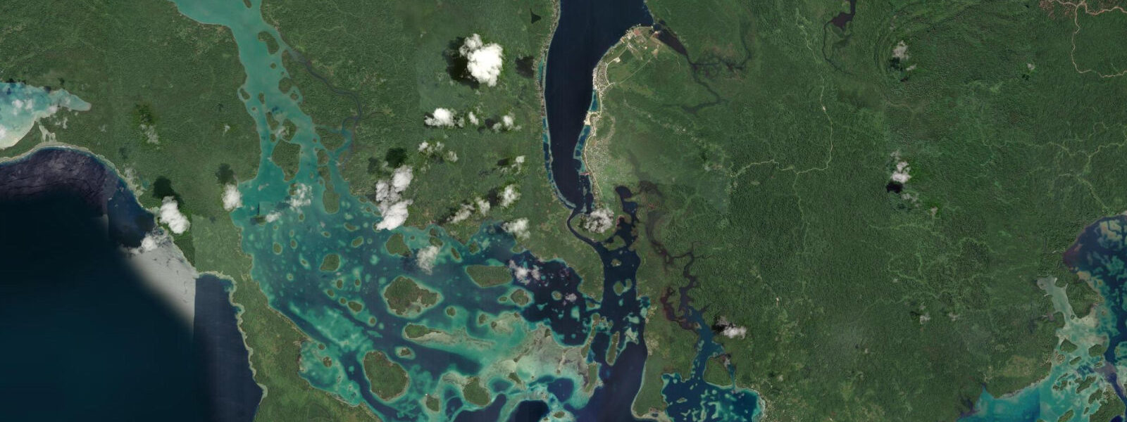
Noro is a working port town on the south coast of New Georgia, Western Province, Solomon Islands. The tuna cannery — operated by Solomon Taiyo and later NFD — has defined the town's economy for decades. Noro Harbour handles the largest vessels calling Western Province, and the working waterfront is the most active stretch of coastal infrastructure between Gizo and Honiara. It is not a tourism destination in the conventional sense, but it is a legitimate gateway to some of the most biologically rich reef systems in the Pacific.
Tides at Noro are mixed semidiurnal with a range of approximately 0.8 to 1.5 metres. The larger diurnal inequality — the difference between the higher and lower of the day's two highs — can exceed 0.4 metres on the same day. Open-Meteo Marine tide forecasts for Western Province are accurate to ±45 minutes on timing and ±0.2 to 0.3 metres on height. This matters practically for anyone moving between Noro and the outer islands: the boat passages between New Georgia and Rendova, Vangunu, and the barrier reef islands involve shallow reef crossings that change character significantly between high and low water.
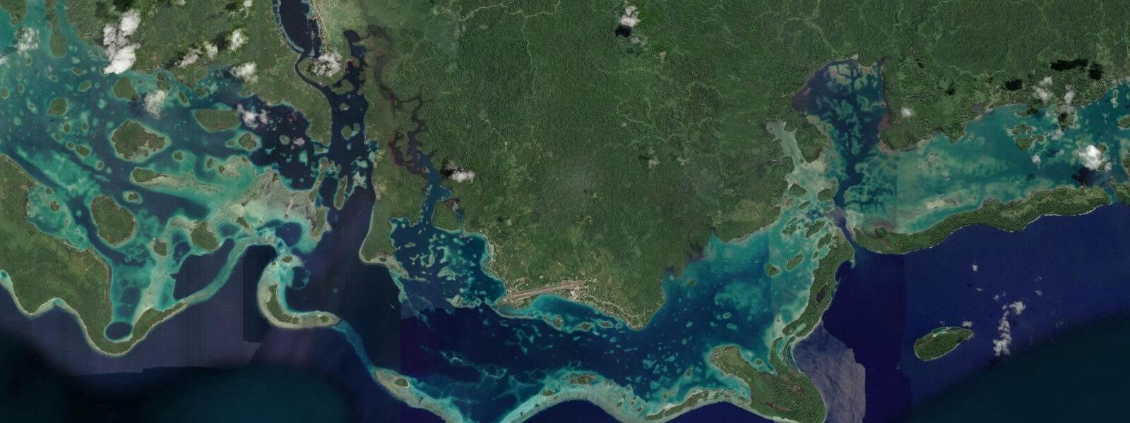
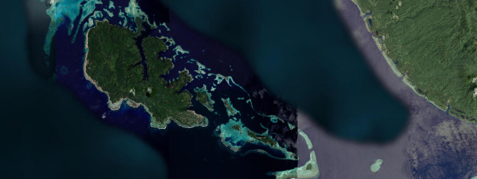
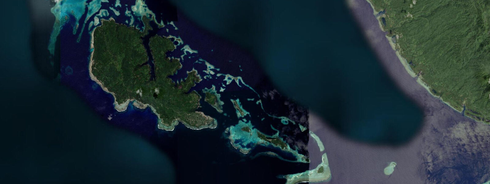
The Marovo Lagoon, widely cited as the largest saltwater lagoon in the world, begins roughly 30 kilometres east of Noro by boat. It is accessible by fibre-glass canoe or small charter vessel from Noro harbour. The lagoon's tidal circulation is complex — water enters and exits through multiple reef passages, and current direction and speed vary by passage and by tidal phase. Local skippers know the passages; visitors relying on open-water navigation tools alone will find the chart accuracy marginal in places. The diving inside Marovo is world-class: bommies, walls, and passage dives, with visibility regularly above 30 metres.
Noro's own coastal assets are functional rather than scenic. The harbour breakwater provides a sheltered anchorage in almost all wind directions. The cannery wharf dominates the waterfront, but fishing vessels dock at the adjacent small-craft facility and local canoe traffic moves constantly between the mainland and the barrier islands. For anglers, the deep water channels immediately outside Noro harbour hold yellowfin tuna, wahoo, and Spanish mackerel; the flood tide running through the main channel entrance concentrates baitfish and, with them, larger pelagics.
Kolombangara Island, the dormant volcanic cone visible across Kula Gulf from Noro, is a 20-kilometre boat trip north. Its lower slopes carry intact primary rainforest managed by the Kolombangara Island Biodiversity Conservation Association (KIBCA). Day trips are possible but require a full day: one way is 90 minutes by fast canoe. The coastal fringe of Kolombangara has shallow reef suitable for snorkelling at high water; at low tide, exposed reef flat makes entry difficult without reef shoes.
World War II history is embedded in the New Georgia landscape. The battle for Munda (30 kilometres west of Noro) was one of the most intense Allied campaigns in the Pacific in 1943. Wrecks litter the lagoon bottom and coastal shallows — Zero fighters, landing craft, and small vessels from both sides. The most accessible WWII dive sites from Noro include several aircraft wrecks in 10–25 metres in Kula Gulf, diveable at most tidal states but best on a slack tide to avoid disorienting currents.
Accommodation in Noro is limited to a small number of guesthouses serving the port and fishing industry. Gizo, the provincial capital 45 kilometres west by boat or an hour by road through Munda, has more options and its own domestic airport. Most itineraries use Gizo as the regional hub and Noro as a day stop or transit point to Marovo. The wharf-area market sells fresh fish daily — the tuna offloaded from cannery supply vessels is sold informally on the dock when the boats come in.
Tide questions about Noro
Quick answers to the most common questions about tide times, range, and water access at Noro.
How do you reach the Marovo Lagoon from Noro?
Marovo Lagoon starts approximately 30 kilometres east of Noro. The most practical route is by hired fibreglass canoe or small charter vessel from Noro Harbour, a journey of about 90 minutes to two hours depending on conditions and destination inside the lagoon. The reef passages into Marovo are tidal — some are only safely navigable within a couple of hours of high water, so coordinate departure time with your boat operator using the Open-Meteo Marine tide forecast, which gives timing to ±45 minutes accuracy. No ferry schedule connects Noro to the lagoon villages; transport is arranged informally through guesthouse contacts or directly at the wharf.
What tides should divers expect at Noro and nearby WWII wreck sites?
Noro sits in a mixed semidiurnal tidal regime with a range of 0.8 to 1.5 metres. The WWII aircraft wrecks and landing craft scattered across Kula Gulf are diveable at most tidal states — depths of 10 to 25 metres mean the absolute water level change is a fraction of total depth. The practical concern is tidal current through the gulf passages, which can run to 1.5 knots on a spring ebb. Plan dive entries within 60 to 90 minutes of slack water for the most comfortable conditions. Open-Meteo Marine forecasts are accurate to ±45 minutes and ±0.2–0.3 metres — adequate for slack-water planning with the recommended buffer built in.
Is Noro a practical base for fishing Western Province?
Noro Harbour is one of the best-positioned fishing bases in the Western Solomons. The deep-water channel immediately outside the harbour holds yellowfin tuna, wahoo, and Spanish mackerel, and the flood tide pushing through the main entrance concentrates baitfish reliably. Charter fishing vessels work out of the small-craft dock; bookings are informal — ask at the harbour or through your guesthouse. For reef fishing, the barrier island passages between Noro and Rendova are highly productive on a running tide. Marovo Lagoon, 90 minutes by fast canoe, adds coral trout and bonefish flats to the options. Serious offshore fishing for billfish requires a larger vessel; Gizo, 45 kilometres west, has better-resourced operators.
What is the closest airport to Noro and how do domestic connections work?
Munda Airport (IATA: MUA), about 30 kilometres west of Noro by road, is the primary regional airport for New Georgia. Solomon Airlines connects Munda to Honiara with multiple flights weekly on turboprop equipment; flight time is approximately 45 minutes. Gizo Airport (IATA: GZO) on Nusatupe Island, about 45 kilometres west of Noro by boat, is the alternative, with comparable Honiara frequencies. There is no direct international service to either airport — Honiara is the international gateway. Ground transport between Munda and Noro is by PMV (public minibus) or chartered vehicle on a sealed road. Boat transfer from Gizo is faster than road from Munda during normal conditions.
What WWII sites are accessible as day dives from Noro?
Several WWII aircraft wrecks lie in 10 to 25 metres in Kula Gulf and the approaches to New Georgia, accessible within 30 to 60 minutes by dive boat from Noro. Zero fighters and Wildcat hulks are among the most visited; exact locations are known to local dive operators but are not always on standard nautical charts. The Battle of Kula Gulf (July 1943) left surface warship debris across the gulf as well, though deeper naval wrecks require technical diving credentials. Day-trip logistics work best from Gizo with its established dive operators, but Noro-based access is viable for independent groups with their own charter boat. Slack-water timing — within 60 minutes of high or low — produces the best visibility and most manageable conditions at the aircraft wreck sites.
8-day tide table — Noro
Heights relative to MSL. Predictions: Open-Meteo Marine (MeteoFrance SMOC, 0.08° grid) — heights relative to MSL (not chart datum / LAT). Model-derived.
| Day | Type | Time | Height |
|---|---|---|---|
| Sat 04 Jul | — | ||
| Sun 05 Jul | High | 03:50 | 0.9m |
| Mon 06 Jul | — | ||
| Tue 07 Jul | — | ||
| Wed 08 Jul | — | ||
| Thu 09 Jul | — | ||
| Fri 10 Jul | Low | 11:00 | 0.2m |
| High | 21:10 | 0.9m | |
| Sat 11 Jul | Low | 10:00 | 0.2m |