Honiara tide times
Honiara tide forecast — heights relative to MSL.
Today's tide times for Honiara
Tide times at Honiara on Saturday, 27 June 2026: first low tide at 11:00am. Sunrise 06:35am, sunset 06:09pm.
Tide chart for Honiara
24-hour cosine-interpolated curve around the present moment. Heights relative to MSL. Predictions: Predictions: Open-Meteo Marine (MeteoFrance SMOC, 0.08° grid).
Sun, moon and conditions on Sat 27 Jun
Snapshot at build time — refreshes daily. Sea state from Open-Meteo Marine.
Highs and lows next 7 days
Every predicted high and low for the next week, with the daily tidal coefficient (0–120; higher = bigger swing, > 95 means stronger currents).
Other spots nearby
The three closest curated TideTurtle locations to Honiara, measured by great-circle distance.
Today's solunar windows
Solunar tradition: major periods are the ≈3h windows around moon transit and opposition; minor are ≈2h around moonrise and moonset. Pair with the local tide stage and wind for the best read.
About tides at Honiara
A short guide to the coastline at Honiara — geography, sea state, and what the tide is actually doing under your feet.
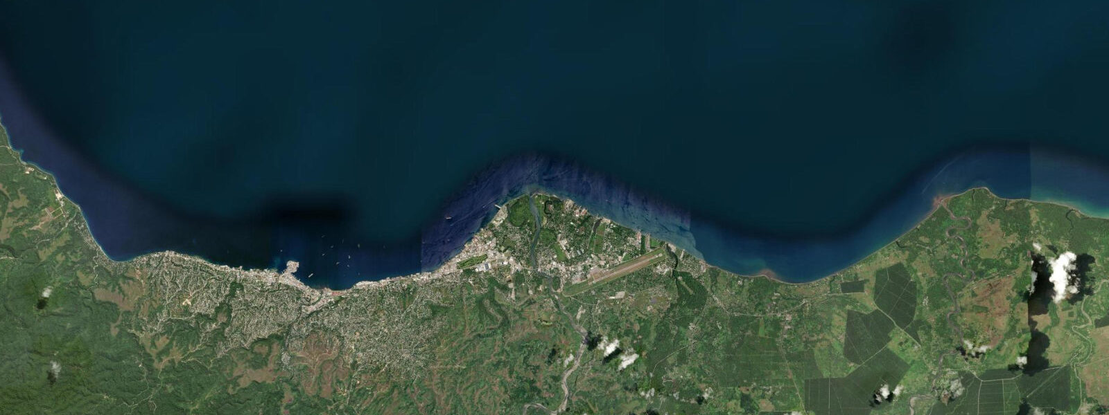
Honiara is the capital of the Solomon Islands, occupying a narrow coastal plain on the north coast of Guadalcanal, pressed between the sea and the steep ridgelines that run east–west across the island's interior. The city of roughly 80,000 sits on what is arguably the most historically significant coastal stretch in the Pacific: this shoreline, the ridges above it, and the passage north of Guadalcanal — Iron Bottom Sound — were the setting for one of the most consequential military campaigns of the Second World War. The Guadalcanal Campaign of August 1942 to February 1943 was the first major Allied offensive in the Pacific theatre; its outcome was the first strategic reversal Japan suffered in the war.
Iron Bottom Sound takes its name from the number of ships sunk in its waters during that campaign: over 50 vessels from both the Allied and Japanese fleets, resting in depths of 200–900 m between Guadalcanal and the Florida Islands to the north. The wrecks include destroyers, cruisers, and troop transports from both sides. The accessible wrecks begin outside the Sound proper — the Bonegi I (MV Hirokawa Maru) and Bonegi II (MV Kinugawa Maru) Japanese transport ships lie in 5–40 m depth just 10 km west of Honiara, reachable from the beach by snorkel on the shallow sections and by scuba on the deeper hull sections.
The tidal regime at Honiara is mixed semidiurnal with a spring range of 1.1–1.4 m. The range is moderate — typical for an equatorial Pacific island location — and the daily tidal cycle is influenced by diurnal inequality: the two high waters in a given day can differ by 0.2–0.4 m, and the two low waters similarly. The practical effect is that the lowest tides (the lower lows of a spring cycle) occur on a predictable schedule related to the lunar and seasonal cycle. At the lowest spring tides, the reef flat fronting Honiara's Point Cruz area and the Bonegi coast is exposed sufficiently for shore access to reef features not reachable at higher water.
Point Cruz Yacht Club is the social hub for the cruising-yacht community that transits Honiara between the Coral Sea and the eastern Pacific. The club marina sits inside Point Cruz, a small natural breakwater 2 km west of the central market. The marina depth is adequate for most cruising monohulls at all tidal states; the 1.2 m spring range is not a navigation hazard in the harbour basin. The marina is the departure point for dive charters, sportfishing boats, and island-hopping services to the Florida Islands, Nggela (formerly the Florida Islands), and the outer Guadalcanal coast.
Sportfishing from Honiara targets the pelagic species that move through the passages between Guadalcanal and the Florida Islands: yellowfin tuna, wahoo, mahi-mahi, and the giant trevally that work the current lines off Point Cruz on the ebb. The yacht club runs regular fishing competitions; the March–October season, when southeast trade winds moderate the sea state, is the most productive period for offshore fishing. Shore fishing from the rocky sections of coast east and west of the town centre produces reef species at any tidal state; the low-water exposure of the reef flat extends the accessible reef edge by 50–100 m.
For families, the Honiara waterfront and the beaches east of town at Tenaru (where the Battle of the Tenaru was fought in August 1942) provide accessible swimming. The Tenaru beach is cleaner than the town-centre waterfront and the reef flat offshore provides snorkelling at mid-tide and above. Sea temperature is 28–30°C throughout the year with minimal seasonal variation. The November–April cyclone season can produce rough conditions; the southeast trade-wind season (May–October) is the most reliable for marine activities.
For photographers, the Honiara central market at dawn — one of the most photogenic open-air markets in the Pacific — is the primary non-marine subject. The coastline west of town toward Bonegi, with the Guadalcanal hills rising behind the palm-lined coast, is the classic landscape shot at golden hour. Low-water conditions at the Bonegi beach expose the shallow wreck sections of the two transport ships, giving above-water foreground interest for wide-angle reef photography.
All tide predictions for Honiara come from the Open-Meteo Marine gridded model. Timing accuracy is ±45 minutes; height accuracy is ±0.3 m above Chart Datum.
Tide questions about Honiara
Quick answers to the most common questions about tide times, range, and water access at Honiara.
What are the Bonegi wrecks and when is the best time to visit them?
The Bonegi wrecks — MV Hirokawa Maru (Bonegi I) and MV Kinugawa Maru (Bonegi II) — are Japanese transport ships sunk in November 1942, lying 10 km west of Honiara in 5–40 m depth. Both are beach-accessible: snorkellers reach the shallowest sections (bow of Bonegi II at 3–5 m) without a boat; scuba divers use the deeper hull sections. Best conditions are at neap high water, when visibility is clearest and current over the wreck is minimal. At low spring water the shallowest sections drop to 2–3 m — accessible but tight. The wrecks carry soft coral and fish life; visibility runs 10–20 m on calm days. Open-Meteo predictions carry ±45 minutes and ±0.3 m uncertainty.
What is Iron Bottom Sound and why is it significant for divers?
Iron Bottom Sound is the body of water between Guadalcanal's north coast and the Florida Islands to the north, named for the density of warships sunk there during the 1942–43 Guadalcanal Campaign. Over 50 vessels from both Allied and Japanese fleets rest on the bottom at depths of 200–900 m — outside the range of recreational diving. The accessible wrecks are on the Guadalcanal coast itself, not in the main Sound: the Bonegi transport ships, at 5–40 m, are the primary dive targets. For historians and wreck divers, the Sound is significant as the most concentrated naval battlefield in the Pacific. Liveaboard dive expeditions based in Honiara access the wreck sites along the full north Guadalcanal coast.
What tidal conditions are best for fishing from Honiara?
Shore fishing from the rocky coast sections east and west of Honiara is productive at any tidal state, but the low-water window exposes 50–100 m more of the reef flat and gives access to casting positions not reachable at high water. The ebb current off Point Cruz concentrates giant trevally, barracuda, and reef species along the channel edge; the 90 minutes of peak ebb is the most active window for these species. Offshore fishing from the Point Cruz Yacht Club marina targets yellowfin tuna, wahoo, and mahi-mahi in the current lines between Guadalcanal and the Florida Islands. The May–October southeast trade-wind season is the most reliable fishing period; the November–April wet season is fishable but sea conditions are less predictable.
Is it safe to swim near Honiara and which beaches are best for families?
The Tenaru beach 12 km east of Honiara is the most suitable family swimming location near the capital — cleaner water than the town waterfront and a reef flat that provides snorkelling at mid-tide and above. Sea temperature is 28–30°C year-round. The town-centre waterfront near the central market is not recommended for swimming due to harbour activity and water quality. The May–October southeast trade-wind season gives the most consistently calm sea conditions. November–April cyclone season brings the possibility of rough conditions; day-to-day sea state can shift quickly during this period. Check current sea conditions before planning water activities. Open-Meteo tide predictions carry ±45 minutes and ±0.3 m uncertainty.
When does the Honiara central market operate and what is the best time to visit?
The Honiara central market on the waterfront operates seven days a week. The most photogenic and active time is early morning, from 06:00 to 08:30, when vendors arrive by boat and truck with fresh produce, fresh fish from overnight fishing boats, and fresh-cut tropical fruits. The fish section is the most tied to tidal activity — small fishing canoes return from overnight trips on the early morning flood, and the freshest catch arrives between 05:30 and 07:30. Saturday morning is the largest market day, when inter-island boat services bring produce from the outer islands. The market is less active on Sunday afternoons. The waterfront market area is busy and photogenic; permission to photograph individuals should be sought before framing portraits.
8-day tide table — Honiara
Heights relative to MSL. Predictions: Open-Meteo Marine (MeteoFrance SMOC, 0.08° grid) — heights relative to MSL (not chart datum / LAT). Model-derived.
| Day | Type | Time | Height |
|---|---|---|---|
| Sat 27 Jun | Low | 11:00 | 0.3m |
| Sun 28 Jun | High | 01:50 | 1.1m |
| Mon 29 Jun | Low | 10:50 | 0.2m |
| Tue 30 Jun | High | 02:50 | 1.1m |
| Low | 11:10 | 0.2m | |
| Wed 01 Jul | High | 03:20 | 1.1m |
| Low | 11:40 | 0.2m | |
| Thu 02 Jul | High | 03:54 | 1.1m |
| Low | 12:00 | 0.2m | |
| Fri 03 Jul | High | 20:00 | 0.7m |
| Low | 21:50 | 0.7m | |
| Sat 04 Jul | High | 04:42 | 1.1m |
| Low | 10:00 | 0.5m |