Auki tide times
Auki tide forecast — heights relative to MSL.
Today's tide times for Auki
Tide times at Auki on Saturday, 27 June 2026: first low tide at 11:00am. Sunrise 06:31am, sunset 06:08pm.
Tide chart for Auki
24-hour cosine-interpolated curve around the present moment. Heights relative to MSL. Predictions: Predictions: Open-Meteo Marine (MeteoFrance SMOC, 0.08° grid).
Sun, moon and conditions on Sat 27 Jun
Snapshot at build time — refreshes daily. Sea state from Open-Meteo Marine.
Highs and lows next 7 days
Every predicted high and low for the next week, with the daily tidal coefficient (0–120; higher = bigger swing, > 95 means stronger currents).
Other spots nearby
The three closest curated TideTurtle locations to Auki, measured by great-circle distance.
Today's solunar windows
Solunar tradition: major periods are the ≈3h windows around moon transit and opposition; minor are ≈2h around moonrise and moonset. Pair with the local tide stage and wind for the best read.
Cycle dates near Auki
Next spring tide on Tue 30 Jun (range 1.2m). Last neap on Sat 27 Jun. Next neap on Wed 01 Jul.
Spring tides cluster around new and full moons (biggest swings). Neap tides land on quarter moons (smallest swings). See the spring tide and neap tide glossary entries for the why.
About tides at Auki
A short guide to the coastline at Auki — geography, sea state, and what the tide is actually doing under your feet.
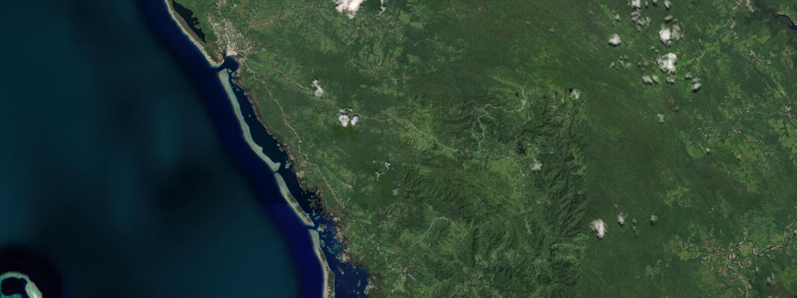
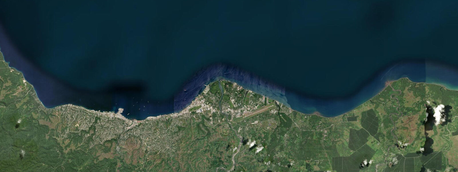
Auki is the capital of Malaita Province — the most populous province in the Solomon Islands — occupying a sheltered bay on the north coast of Malaita island, 120 kilometres northeast of Honiara across the Malaita Passage. A government ferry runs the crossing three or four times a week; the journey takes 3–4 hours across open water that can be rough when trade winds and tidal current interact in the passage.
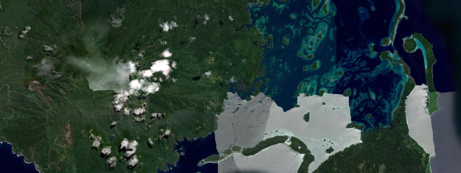
Malaita is culturally distinctive within the Solomon Islands. The Langa Langa Lagoon, extending along the west coast south of Auki, is home to the Lau people, who over centuries constructed a series of artificial islands on the reef flat — platforms of coral rubble and stone built up from the shallow lagoon floor into habitable islands. Forty-plus artificial islands, some of them centuries old, line the 25-kilometre length of the lagoon. The traditional currency of the region — tafuliae — is made on these islands from the shells of specific marine species: the red-pink shells of the Chama and Spondylus molluscs and the white shells of the Ovula ovum (egg cowrie). Shell money production is ongoing: it is used in bride-price negotiations, compensation ceremonies, and traditional exchange networks that function alongside the modern cash economy.
The tidal range at Auki is approximately 1.1 m on spring tides, mixed semidiurnal. This modest range has significant consequences for the Langa Langa Lagoon: the tidal cycle controls the water level in the lagoon and determines when the reef flat between the artificial islands is navigable. The smaller canoes and fibreglass dinghies that connect the artificial islands to the mainland can move through the lagoon at mid-tide and above; at low spring water, parts of the reef flat shoal to 0.1–0.3 m depth and require poling rather than motoring. The tide table for Auki is the essential planning tool for visiting the Langa Langa artificial islands.
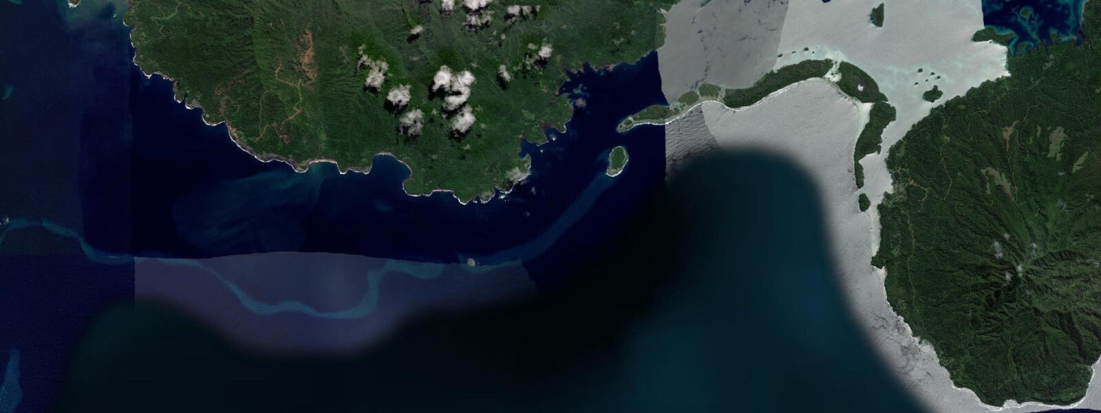
Access to the Langa Langa Lagoon from Auki is by boat — a 15–30 minute ride south along the coast to the lagoon entrance. Day trips from Auki visit the artificial islands, observe shell-money production, and snorkel on the fringing reef. The snorkelling is best at mid-tide and above on neap tides when current is minimal; the inter-island passages within the lagoon have tidal flow of 0.5–1.0 knots on spring tides. Sea temperature is 28–30°C year-round.
Auki's own waterfront and the adjacent bay provide the main anchorage for visiting yachts, inter-island ferries, and the small-boat traffic that connects Malaita's coastal communities. The bay is sheltered from the southeast by the Auki Peninsula and from the northwest by the mainland coast; the holding ground in the bay is reported as good. Tidal range of 1.1 m means that anchor chain scope requirements are modest — standard 5:1 scope at low water gives adequate depth allowance at high tide without dragging risk in normal conditions.
For anglers, the waters around Auki and the Malaita Passage support a productive reef and pelagic fishery. The passage between Malaita and the Florida Islands sees significant tidal current and is a known feeding ground for tuna, wahoo, and dogtooth tuna. Shore fishing from the Auki waterfront and the rocky headlands of the Auki Peninsula targets snapper, grouper, and trevally. The inter-island market at the Auki wharf on ferry arrival days (Tuesday, Thursday, Saturday) brings fish from the outer Malaita coast villages for sale.
Bird watching around Auki is dominated by the coastal forest and mangrove edge species. The mangrove fringes south of town, along the coast toward the Langa Langa Lagoon, hold herons, kingfishers, and the endemic Solomon Islands species visible at any tidal stage. Malaita island's forest interior holds endemic species accessible via the road south from Auki toward Dala.
For photographers, the Langa Langa artificial island community and the shell-money production process are unique subjects found nowhere else in the world. Photography of the islands from a boat at mid-tide, when the coral construction is visible above the waterline, produces the clearest images of the artificial-island structure. The Auki market at the wharf on ferry days is the most active commercial scene accessible from the town.
All tide predictions for Auki come from the Open-Meteo Marine gridded model. Timing accuracy is ±45 minutes; height accuracy is ±0.3 m above Chart Datum.
Tide questions about Auki
Quick answers to the most common questions about tide times, range, and water access at Auki.
What is the Langa Langa Lagoon and why is the tide important for visiting it?
Langa Langa Lagoon extends 25 km along Malaita's west coast south of Auki and contains 40-plus artificial islands constructed by the Lau people on the shallow reef flat. The tidal range at Auki is 1.1 m on springs; at low spring water, sections of the reef flat shoal to 0.1–0.3 m — passable only by shallow-draft canoe with a pole. Day trips should arrive at the lagoon on rising water to avoid grounding on the reef flat. The most practical departure from Auki is 2 hours before predicted high water, giving a rising-tide transit and the full high-water window at the artificial islands. Open-Meteo predictions carry ±45 minutes and ±0.3 m uncertainty.
What is tafuliae shell money and where is it made?
Tafuliae is traditional Malaitan shell money — strings of precisely drilled and polished shell discs made from specific marine species including Chama, Spondylus (red-pink discs), and Ovula ovum (white discs). Production is concentrated on the Langa Langa Lagoon artificial islands, where the shell material is collected from the adjacent reef. The process involves collecting shells at low tide from the reef flat, drilling and grinding the discs to standard dimensions, and stringing them to standard lengths. Shell money remains in active use for bride-price payments, compensation ceremonies, and traditional exchange. Day visits to the Langa Langa islands from Auki typically include observation of production and the opportunity to purchase small pieces directly from the makers.
How do I get to Auki from Honiara and what is the sea crossing like?
The government ferry from Honiara to Auki runs 3–4 times per week (Tuesday, Thursday, Saturday are the usual days; schedules change seasonally — confirm locally). The crossing is 120 km northeast across the Malaita Passage and takes 3–4 hours. Sea state on the crossing is influenced by the southeast trade-wind pattern (May–October) and by the tidal current in the Malaita Passage, which can run at 1.5–2.5 knots on spring tides. On spring tides with trade-wind chop, the crossing can be rough; neap tides in calm conditions (October–November, March–May) give the most comfortable passage. Small speedboat services from Honiara's Point Cruz wharf cover the crossing in under 2 hours but are rougher in chop.
Is snorkelling or diving available near Auki?
The Langa Langa Lagoon reef system provides the most accessible snorkelling near Auki. The fringing reef on the ocean side of the lagoon, and the inter-island passages, carry significant fish biodiversity typical of the Coral Triangle. Snorkelling is best at mid-tide and above on neap tides when current in the passages is below 0.5 knots. No dedicated dive operator is based in Auki; Honiara-based liveaboards occasionally include Malaita in their routes. The reef quality in the outer Malaita coast and in the passages around the Langa Langa Lagoon is high but rarely dived — most visitors to Auki are travelling for cultural rather than marine reasons. Sea visibility is typically 10–20 m in calm, neap-tide conditions.
What are the fishing conditions around Auki and the Malaita Passage?
The Malaita Passage between Malaita and the Florida Islands concentrates tidal current that draws tuna, wahoo, and dogtooth tuna to the current edges. The passage runs at 1.5–2.5 knots on spring tides; the flood phase is typically the most productive window for pelagic fishing. Shore fishing from the Auki waterfront and the Auki Peninsula headlands produces snapper, grouper, and trevally at all tidal stages. The inter-island market at the Auki wharf on ferry days sells fresh fish from outer coast villages — a useful indicator of what is running. Fishing trips from Auki require charter boats organised through guesthouses or local owners; no commercial charter industry exists.
8-day tide table — Auki
Heights relative to MSL. Predictions: Open-Meteo Marine (MeteoFrance SMOC, 0.08° grid) — heights relative to MSL (not chart datum / LAT). Model-derived.
| Day | Type | Time | Height |
|---|---|---|---|
| Sat 27 Jun | Low | 11:00 | 0.4m |
| Sun 28 Jun | High | 02:06 | 1.3m |
| Low | 19:55 | 0.6m | |
| Mon 29 Jun | High | 02:36 | 1.3m |
| Low | 09:56 | 0.2m | |
| Tue 30 Jun | High | 03:10 | 1.3m |
| Low | 10:24 | 0.1m | |
| High | 16:38 | 0.8m | |
| Low | 21:04 | 0.5m | |
| Wed 01 Jul | High | 03:40 | 1.4m |
| Low | 10:51 | 0.1m | |
| High | 17:04 | 0.8m | |
| Low | 21:37 | 0.5m | |
| Thu 02 Jul | High | 04:12 | 1.3m |
| Low | 11:19 | 0.1m | |
| Fri 03 Jul | High | 04:40 | 1.3m |
| Low | 11:43 | 0.1m | |
| High | 18:04 | 0.8m | |
| Low | 22:45 | 0.5m | |
| Sat 04 Jul | High | 05:10 | 1.3m |
| Low | 10:00 | 0.4m |