Joal-Fadiouth tide times
Joal-Fadiouth tide forecast — heights relative to MSL.
Today's tide times for Joal-Fadiouth
Tide times at Joal-Fadiouth on Saturday, 27 June 2026: first low tide at 12:00am, first high tide at 07:00am, second low tide at 12:57pm, second high tide at 07:16pm. Sunrise 06:41am, sunset 07:39pm.
Tide chart for Joal-Fadiouth
24-hour cosine-interpolated curve around the present moment. Heights relative to MSL. Predictions: Predictions: Open-Meteo Marine (MeteoFrance SMOC, 0.08° grid).
Sun, moon and conditions on Sat 27 Jun
Snapshot at build time — refreshes daily. Sea state from Open-Meteo Marine.
Highs and lows next 7 days
Every predicted high and low for the next week, with the daily tidal coefficient (0–120; higher = bigger swing, > 95 means stronger currents).
Other spots nearby
The three closest curated TideTurtle locations to Joal-Fadiouth, measured by great-circle distance.
Today's solunar windows
Solunar tradition: major periods are the ≈3h windows around moon transit and opposition; minor are ≈2h around moonrise and moonset. Pair with the local tide stage and wind for the best read.
Cycle dates near Joal-Fadiouth
Next spring tide on Thu 02 Jul (range 1.2m). Last neap on Sat 27 Jun. Next neap on Fri 03 Jul.
Spring tides cluster around new and full moons (biggest swings). Neap tides land on quarter moons (smallest swings). See the spring tide and neap tide glossary entries for the why.
About tides at Joal-Fadiouth
A short guide to the coastline at Joal-Fadiouth — geography, sea state, and what the tide is actually doing under your feet.
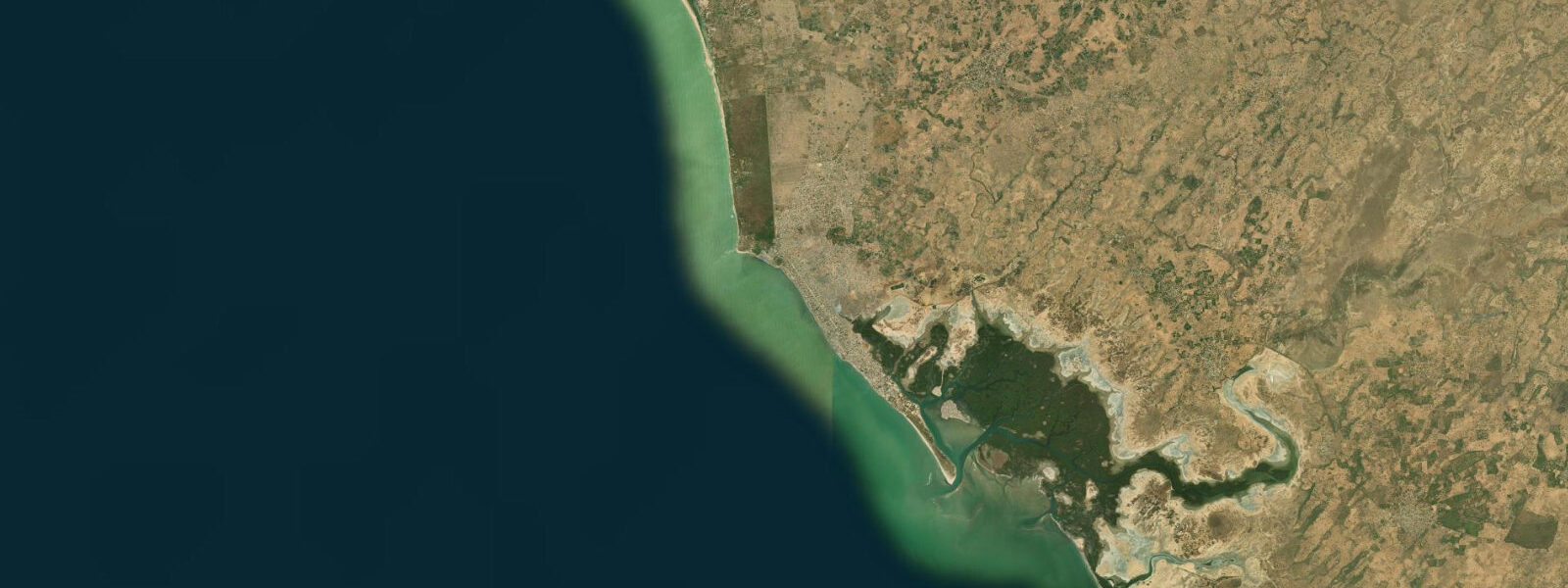
Joal-Fadiouth is a place of unusual geography: Joal is a fishing town on the mainland Petite Côte, and Fadiouth is a small island 500 m offshore connected by a wooden footbridge, built not on rock or sand but on 3,000 years of accumulated oyster and clam shells. The island's paths, buildings, and waterfront are all constructed on this compacted shell midden; the crunch of shells underfoot is the dominant sensory experience of walking Fadiouth. The shell island is flanked by a mangrove lagoon to the north and the open Atlantic to the south, with the Sine Saloum delta beginning 5 km south — making this the southernmost point of the Petite Côte and the northern edge of the delta ecosystem.
The tidal regime at Joal-Fadiouth is semidiurnal with a spring range of approximately 1.5 m. The combination of the Atlantic tide and the Sine Saloum delta's river input creates a dynamic tidal system in the lagoon channels behind Fadiouth. On spring tides, water level in the mangrove channels rises and falls 1.3–1.5 m over 6 hours; at mean neap tides, the range drops to 0.6–0.7 m. The tidal bore that develops in the Sine Saloum delta's main channels further south — one of the few tidal bores on the West African coast — is most pronounced in the Saloum and Diomboss channels during the highest spring tides of the year, when the incoming tide pushes up the channels as a discernible wave.
For kayakers and small-boat paddlers, the mangrove channels behind Fadiouth and the entrance to the Sine Saloum delta constitute one of the finest paddling environments in West Africa. The labyrinthine mangrove channels are navigable by kayak at mid-tide and above; at spring low water, some of the shallower inner channels dry to exposed mud and are inaccessible. Paddling with the flooding tide carries boats deeper into the mangrove system without effort; the ebb reverses all the channels simultaneously, and timing the exit is important on longer excursions. The mangrove ecosystem here hosts West African manatees, pelicans, grey herons, and kingfishers in numbers that make the channel paddling productive for wildlife observation at any tidal phase.
Fadiouth itself is a functioning community, not a preserved museum. Approximately 7,000 people live on the shell island; the economy is fishing, small-scale oyster harvesting from the mangrove channels, and tourism. The mixed Christian-Muslim cemetery on a separate small island 400 m north of Fadiouth — accessed by wooden pirogue or by walking the footbridge at low water — is one of Senegal's notable cultural landmarks: Christian and Muslim graves stand side by side, a material expression of the interfaith coexistence that characterises Joal's community history.
Oyster harvesting in the Fadiouth lagoon channels follows the tidal cycle directly. Women oyster harvesters (the work is traditionally female in Senegambian communities) work the mangrove roots at low water, when the root systems are exposed and the attached oysters are accessible. At high water the roots are submerged and the harvest is impossible. The harvesting window is the 2–3 hours around spring low water; on neap tides, with a range of only 0.6–0.7 m, less root surface is exposed and the harvest quantity is lower.
Fishing remains the primary economic activity. Joal's fishing beach is the last significant commercial beach launch operation before the Sine Saloum delta turns the coastline into mangrove-channel territory. Pirogues here work the inshore reefs and the lagoon channels, with the launch timing shaped by the same tidal and swell logic that applies at Saly and Mbour: flooding tide for launch, return timed to the afternoon flooding tide after the morning's work. The Joal market processes substantial quantities of dried and smoked fish for inland distribution — the drying racks along the beach road carry tilapia, barracuda, and red snapper in the dry season when the offshore winds carry the smell of drying fish across the entire town.
Photographers working Joal-Fadiouth find the early morning most productive: the wooden footbridge at dawn with mist over the mangrove, the shell-path alleyways of Fadiouth in the soft morning light before the heat builds, and the oyster harvesters working the low-water channel edges at first light on spring tide mornings. The cemetery island, photographed from the channel at low tide with the grave markers reflected in the still water, is the image most associated with this place.
All tide predictions for Joal-Fadiouth come from the Open-Meteo Marine gridded model. Timing accuracy is ±45 minutes; height accuracy is ±0.3 m above Chart Datum.
Tide questions about Joal-Fadiouth
Quick answers to the most common questions about tide times, range, and water access at Joal-Fadiouth.
What is the tidal range at Joal-Fadiouth and how does it affect the mangrove channels?
Spring tidal range at Joal-Fadiouth is approximately 1.5 m. The mangrove lagoon channels behind Fadiouth rise and fall 1.3–1.5 m on springs over a 6-hour cycle. Neap range drops to 0.6–0.7 m. At spring low water, some inner mangrove channels dry completely and are inaccessible by kayak or small boat. The oyster harvesting on the mangrove roots only occurs during the 2–3 hours around low water when the roots are exposed. The entrance to the Sine Saloum delta, 5 km south, carries the same spring range and produces tidal bores in the main channels during the highest spring tides of the year.
What is the Fadiouth shell island made of?
Fadiouth island is built on a 3,000-year accumulation of oyster and clam shells, deposited by successive generations of fishing and shellfish-harvesting communities. The shell midden has compacted into a solid substrate 2–4 m deep in the oldest sections, stable enough to support permanent buildings, paths, and the infrastructure of a community of approximately 7,000 people. The shells are the material of the island in a literal sense — paths, building foundations, and retaining walls along the waterfront are all constructed from shells. Walking the island, the crunch of shells is constant.
Is kayaking the Sine Saloum delta channels accessible from Joal?
Joal is the closest access point on the Petite Côte to the northern Sine Saloum delta channels. Kayak hire is available in both Joal and Fadiouth; guided channel tours run on half-day and full-day schedules. Paddle with the flooding tide into the mangrove system and plan the return on the ebb — fighting the ebb current in narrow channels adds 40–60 minutes to any return leg. West African manatees, pelicans, herons, and kingfishers are reliably sighted in the channels. The best wildlife visibility is in the early morning at mid-tide, before boat traffic builds. Crocodiles are present in some of the deeper delta channels further south.
What is the significance of the Fadiouth cemetery island?
The Fadiouth cemetery occupies a small shell island 400 m north of Fadiouth village, accessible by pirogue at all tide stages or by foot from the island's northern end at low water across exposed shell flats. The cemetery is notable for containing both Christian and Muslim graves in close proximity — reflecting Joal's historically mixed religious community (Joal was the birthplace of Senegal's first president, Léopold Sédar Senghor, a Catholic). The graves are marked with Christian crosses and Islamic crescent symbols side by side. The site is maintained and active; funerals continue to use the island, and visitor access is respectful rather than formal.
When can I watch the oyster harvesters working at Fadiouth?
Oyster harvesting from the mangrove root systems in the Fadiouth lagoon channels is done during the 2–3 hour window around spring low water, when the root systems are exposed above the water surface. The work is traditionally done by women. Spring tides occur roughly every two weeks, and the lowest low waters of the spring cycle (maximum exposure) are the most productive for harvesting. Check the tide table for Joal-Fadiouth and plan a visit on a spring ebb, arriving at the channel edge 1 hour before predicted low water. The eastern channel side of Fadiouth offers the most accessible viewpoint.
7-day tide table — Joal-Fadiouth
Heights relative to MSL. Predictions: Open-Meteo Marine (MeteoFrance SMOC, 0.08° grid) — heights relative to MSL (not chart datum / LAT). Model-derived.
| Day | Type | Time | Height |
|---|---|---|---|
| Sat 27 Jun | Low | 00:00 | -0.5m |
| High | 07:00 | 0.5m | |
| Low | 12:57 | -0.5m | |
| High | 19:16 | 0.4m | |
| Sun 28 Jun | Low | 01:04 | -0.5m |
| High | 07:40 | 0.5m | |
| Low | 13:39 | -0.5m | |
| High | 19:54 | 0.4m | |
| Mon 29 Jun | Low | 01:47 | -0.5m |
| High | 08:22 | 0.5m | |
| Tue 30 Jun | Low | 02:22 | -0.6m |
| High | 08:55 | 0.6m | |
| Low | 14:58 | -0.5m | |
| High | 21:06 | 0.5m | |
| Wed 01 Jul | Low | 02:58 | -0.5m |
| High | 21:35 | 0.5m | |
| Thu 02 Jul | Low | 03:33 | -0.5m |
| High | 10:00 | 0.7m | |
| Low | 16:07 | -0.5m | |
| High | 22:12 | 0.5m | |
| Fri 03 Jul | Low | 04:04 | -0.5m |
| High | 23:00 | 0.5m |