Salelologa tide times
Salelologa tide forecast — heights relative to MSL.
Tide chart for Salelologa
24-hour cosine-interpolated curve around the present moment. Heights relative to MSL. Predictions: Predictions: Open-Meteo Marine (MeteoFrance SMOC, 0.08° grid).
Sun, moon and conditions on Mon 29 Jun
Snapshot at build time — refreshes daily. Sea state from Open-Meteo Marine.
Highs and lows next 7 days
Every predicted high and low for the next week, with the daily tidal coefficient (0–120; higher = bigger swing, > 95 means stronger currents).
Other spots nearby
The three closest curated TideTurtle locations to Salelologa, measured by great-circle distance.
Today's solunar windows
Solunar tradition: major periods are the ≈3h windows around moon transit and opposition; minor are ≈2h around moonrise and moonset. Pair with the local tide stage and wind for the best read.
Cycle dates near Salelologa
Last spring tide on Sat 27 Jun (range 0.9m). Next spring tide on Wed 01 Jul (range 0.9m). Next neap on Sun 28 Jun.
Spring tides cluster around new and full moons (biggest swings). Neap tides land on quarter moons (smallest swings). See the spring tide and neap tide glossary entries for the why.
About tides at Salelologa
A short guide to the coastline at Salelologa — geography, sea state, and what the tide is actually doing under your feet.
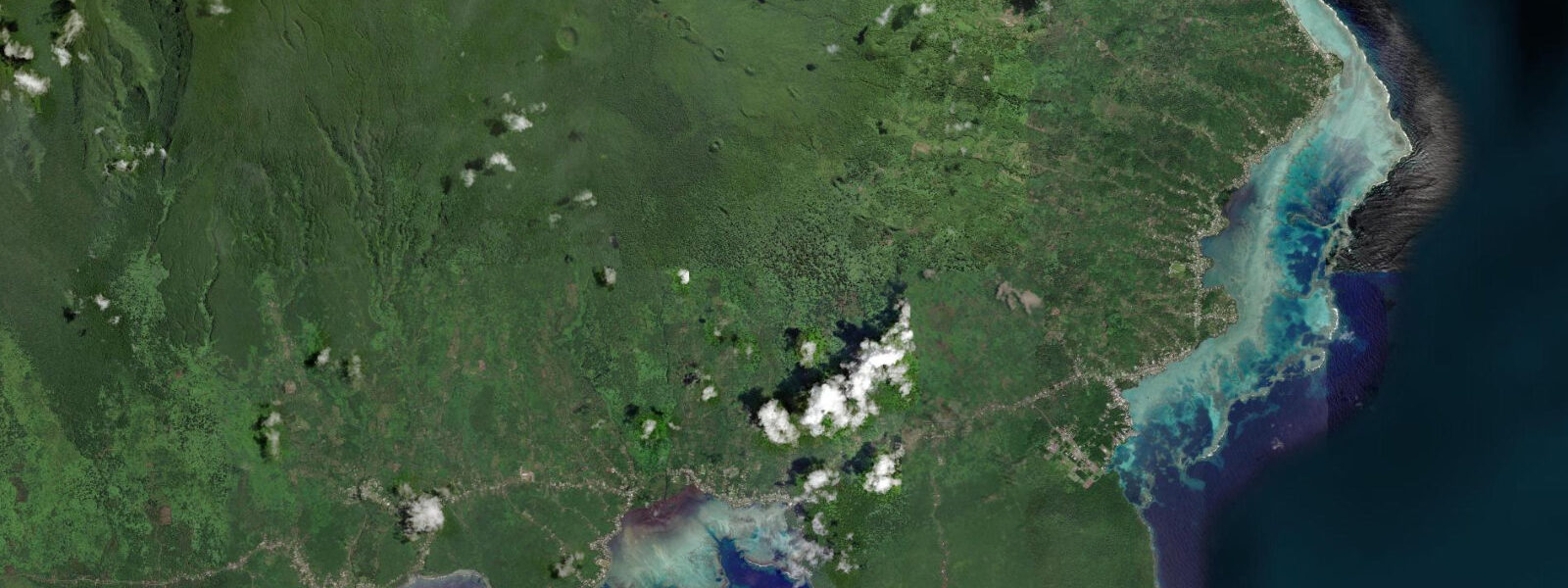
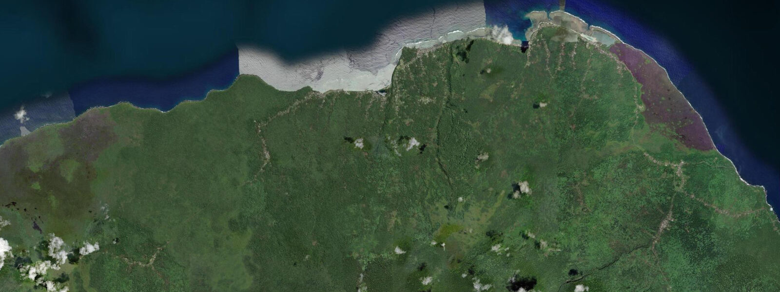
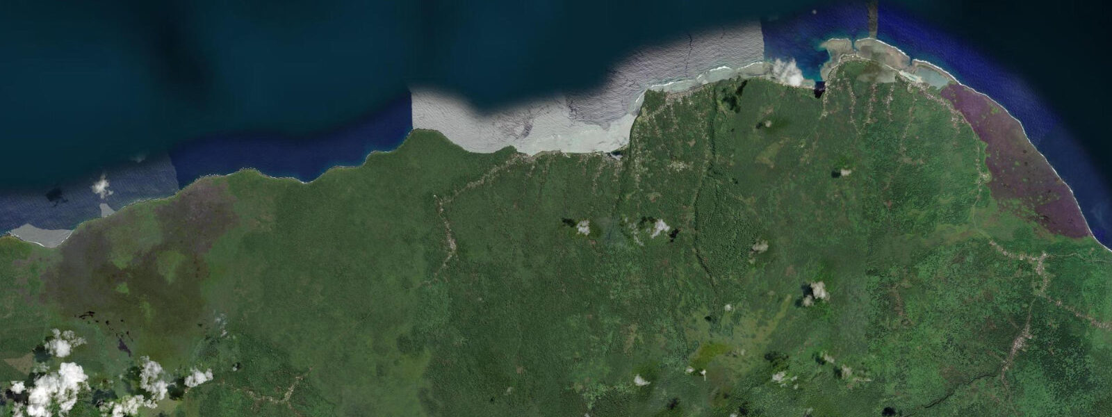
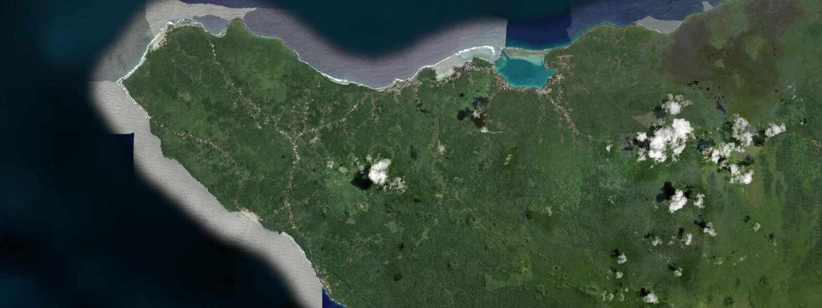
Salelologa is the main entry point for Savai'i, Samoa's largest island and one of the largest Polynesian islands outside New Zealand and Hawaii. The ferry from Mulifanua on Upolu takes 50–60 minutes and arrives at the small wharf on Savai'i's southeast coast. Beyond the wharf — a fuel dock, market stalls, and a handful of fale accommodation — the scale of Savai'i quickly asserts itself: the island is 70 km long and 40 km wide, mostly covered by rainforest, ancient lava flows, and villages connected by a single coastal road.
The tidal signal at Salelologa is essentially the same as at Apia, 70 km to the southeast across the Apolima Strait. Semidiurnal with diurnal inequality; spring range 1.0–1.2 m above Chart Datum. The key local variable is the Apolima Strait itself — the 16 km passage between Upolu and Savai'i is an accelerator for tidal current. On spring tides the ebb current through the strait reaches 2.0–2.5 knots, running southeast to northwest for roughly six hours. The ferry crosses with its engines; kayakers and paddlers attempting the strait crossing must time it carefully, targeting the one-hour window around slack water near high tide.
For beach families, the southeast Savai'i coast near Salelologa has calm, reef-protected water. The fringe reef absorbs most of the trade-wind swell, leaving the lagoon flat and clear in the mornings. The reef flat itself is accessible from multiple beach access points along the road south of town: at low spring water (below 0.5 m on the gauge) the flat is 0.1–0.2 m deep over the inner section, making it ideal for children exploring tide pools. Sea cucumbers, sea urchins, turban snails, and small reef fish concentrate on the reef flat at low tide. Return to shore before the flood reaches the 0.6 m mark, when deeper water and increasing current make the outer edge less predictable.
Anglers work the channels and reef edges around Salelologa by small boat. The strait current concentrates bait on the flooding tide, particularly at the reef passes north of the ferry terminal. Yellowfin tuna, wahoo, and mahi-mahi are caught in the strait on the flood; the evening ebb is better for bottom species along the reef drop-off at 25–40 m. Shore fishing from the point south of the wharf produces trevally and snapper at dawn. Cast parallel to the reef edge rather than over it — the flood current will work the lure along the wall without snagging.
Kayakers crossing to the small island of Manono (4 km west of the Salelologa ferry approach) should time the crossing for the two-hour slack-water window around high tide. The passage between the islets of Apolima and Manono funnels the ebb strongly northward — paddling against even 1.0 knot of current adds substantial distance to what looks like a short crossing on the chart. Manono is car-free and circuit-paddled comfortably in a half-day from Salelologa on a calm morning.
Photographers visiting Savai'i's southeast coast should plan around the morning low tide. The reef flat at low spring water picks up vivid colours from the shallow substrate — brown coral rubble, green algae patches, and the dark shapes of sea cucumbers — that reads well in the early horizontal light before 08:00. The ferry arrivals from Upolu create a brief human scene at the wharf around 07:00 and 10:00 on the morning departures — fishing pirogues, market goods, and inter-island travellers.
Salelologa is the logical base for exploring Savai'i's interior lava fields and the Pe'ape'a Cave, where swiftlets roost. Cyclone season (November–April) affects all coastal access here as on Upolu — check Samoa Meteorology Division alerts before planning any exposed-coast or offshore activity.
All tide predictions for Salelologa come from the Open-Meteo Marine gridded model. Timing accuracy is ±45 minutes; height accuracy is �±0.3 m above Chart Datum.
Tide questions about Salelologa
Quick answers to the most common questions about tide times, range, and water access at Salelologa.
How strong is the tidal current in the Apolima Strait between Upolu and Savai'i?
Spring ebb current through the Apolima Strait reaches 2.0–2.5 knots, running southeast to northwest for roughly six hours from mid-flood. The ferry crosses under engine power regardless of state. Kayakers and unpowered paddlers attempting the crossing should target the one-hour slack-water window centred on high tide — Open-Meteo Marine predictions carry ±45 minutes timing uncertainty, so plan to be on the water 30 minutes before predicted high to catch the slack. A spring high tide leaves the narrowest current window; a neap high gives a broader, lower-speed crossing opportunity.
When is the reef flat near Salelologa safe for children to explore?
The inner reef flat is safest when the gauge reads below 0.5 m — typically two hours either side of low spring water. At those levels the flat carries 0.1–0.2 m of water over the inner section, suitable for supervised children in reef shoes. Return to shore when the gauge climbs above 0.6 m; at that point the outer edge deepens and the flood current picks up speed. Reef shoes or old trainers are essential — the substrate includes sea urchins and coral rubble. Open-Meteo Marine tide predictions carry ±45 minutes timing uncertainty.
What is the best fishing strategy around the Salelologa ferry terminal?
Work the flooding tide for pelagics in the Apolima Strait — tuna, wahoo, and mahi-mahi concentrate where the flood current accelerates around the reef passes north of the terminal. Bottom fishing at the reef drop-off (25–40 m) is more productive on the evening ebb. Shore casting from the point south of the wharf at dawn targets trevally and snapper — cast parallel to the reef edge and let the current work the lure along the wall. The strait's 2.0–2.5 knot spring-ebb current makes anchoring unreliable on the ebb; run a drogue or drift-fish rather than anchoring in the main stream.
Can I kayak to Manono Island from Salelologa?
Yes, and it is a rewarding half-day trip. The crossing is 4 km to the island's east shore. Time your departure for the two-hour slack-water window around high tide to avoid the ebb current that runs strongly northward through the Apolima–Manono passage. Manono is car-free and circumnavigates comfortably in 2–3 hours by kayak. Return on the following flood before the ebb accelerates again. Calm mornings — before 09:00 when trade winds build — give the best paddling conditions. Open-Meteo Marine tide predictions carry ±45 minutes timing uncertainty.
Is the ferry terminal at Salelologa tidal-depth sensitive?
The Salelologa ferry wharf serves the inter-island passenger and vehicle ferry from Mulifanua. The ferry is a shallow-draught vessel purpose-built for this route and operates all tidal states. The wharf itself has fender piles that accommodate the 1.0–1.2 m spring tidal range. Draft is not a practical operational constraint. Weather is the primary delay factor — squalls and visibility in the strait can delay or cancel sailings regardless of tidal state. During cyclone season (November–April), sailings are cancelled on storm-warning days irrespective of tide.
7-day tide table — Salelologa
Heights relative to MSL. Predictions: Open-Meteo Marine (MeteoFrance SMOC, 0.08° grid) — heights relative to MSL (not chart datum / LAT). Model-derived.
| Day | Type | Time | Height |
|---|---|---|---|
| Mon 29 Jun | High | 04:54 | 1.2m |
| Low | 11:16 | 0.4m | |
| High | 17:23 | 1.1m | |
| Tue 30 Jun | Low | 11:56 | 0.4m |
| High | 17:56 | 1.1m | |
| Low | 23:50 | 0.4m | |
| Wed 01 Jul | High | 06:06 | 1.3m |
| Thu 02 Jul | Low | 00:24 | 0.4m |
| High | 06:45 | 1.2m | |
| Low | 13:10 | 0.4m | |
| High | 19:15 | 1.1m | |
| Fri 03 Jul | Low | 01:03 | 0.4m |
| High | 07:19 | 1.2m | |
| Low | 13:50 | 0.4m | |
| High | 19:50 | 1.1m | |
| Sat 04 Jul | Low | 01:48 | 0.4m |
| High | 08:00 | 1.2m | |
| Low | 14:24 | 0.4m | |
| Sun 05 Jul | High | 08:42 | 1.2m |
| Low | 12:00 | 0.7m |