Apia tide times
Apia tide forecast — heights relative to MSL.
Tide chart for Apia
24-hour cosine-interpolated curve around the present moment. Heights relative to MSL. Predictions: Predictions: Open-Meteo Marine (MeteoFrance SMOC, 0.08° grid).
Sun, moon and conditions on Mon 29 Jun
Snapshot at build time — refreshes daily. Sea state from Open-Meteo Marine.
Highs and lows next 7 days
Every predicted high and low for the next week, with the daily tidal coefficient (0–120; higher = bigger swing, > 95 means stronger currents).
Other spots nearby
The three closest curated TideTurtle locations to Apia, measured by great-circle distance.
Today's solunar windows
Solunar tradition: major periods are the ≈3h windows around moon transit and opposition; minor are ≈2h around moonrise and moonset. Pair with the local tide stage and wind for the best read.
Cycle dates near Apia
Next spring tide on Mon 29 Jun (range 0.8m). Next neap on Sun 28 Jun.
Spring tides cluster around new and full moons (biggest swings). Neap tides land on quarter moons (smallest swings). See the spring tide and neap tide glossary entries for the why.
About tides at Apia
A short guide to the coastline at Apia — geography, sea state, and what the tide is actually doing under your feet.
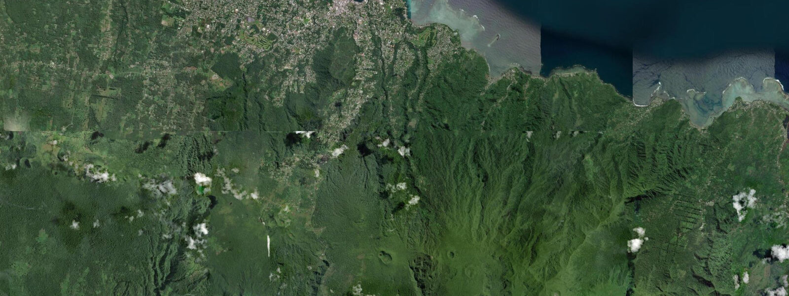
Apia sits on the north coast of Upolu, wrapped around a natural harbour that has been the commercial and political heart of Samoa since European traders arrived in the 1830s. The capital functions as the gateway to Independent Samoa: the international airport is at Faleolo 35 km to the west, the main ferry terminal connects to Savai'i, and the harbour handles inter-island cargo alongside the occasional cruise ship. Inland, 6 km south along a ridge road, sits Vailima — the colonial house where Robert Louis Stevenson spent the last four years of his life and is buried on the hillside above the estate. The house is now a museum open to visitors.
The tidal regime at Apia is semidiurnal with diurnal inequality. Spring range reaches 1.0–1.2 m above Chart Datum; neap range falls to 0.4–0.6 m. The two daily highs are not equal: on spring tides the higher high water reaches approximately 1.1 m above Chart Datum while the lower high water may reach only 0.7 m. Low water on a spring ebb drops to approximately 0.1 m above Chart Datum, briefly exposing the outer fringe reef flat in front of the town. The tidal cycle runs to local solar time shifted by roughly UTC+13 — the higher high water occurs in the early morning and mid-evening on most days of the neap cycle.
Apia Harbour is a working port, not a recreational beach zone. The foreshore along the main waterfront — Beach Road — is seawall and pavement. The nearest usable family beaches are Palolo Deep Marine Reserve 3 km west of the harbour, and Vaiala Beach immediately east of the town centre. Palolo Deep is a tidal platform with a submarine canyon dropping away from the reef edge: at low water the outer reef flat is 0.2–0.3 m deep and walkable in reef shoes, giving access to snorkelling over the canyon edge. Families should approach the outer edge only on the lower tides (below 0.5 m on the gauge) — the current that runs along the canyon rim strengthens significantly on the flood as oceanic water pours across the reef crest.
For anglers, the Apia area offers two productive scenarios. Shore fishing from the breakwater and harbour walls targets giant trevally, snapper, and goatfish; dawn and dusk on the ebb are the most consistent windows. Boat fishing out through the harbour entrance to the reef edge is accessible from the small-boat ramp at the western end of the harbour. The reef edge in 20–40 m holds yellowfin tuna and wahoo on the current lines; the best entry window is the last two hours of the flood, when clean oceanic water is pouring across the reef top and baitfish concentrate along the edge.
Kayakers use Apia as a staging point for the coast east toward Fagaloa Bay, a deeply indented bay 20 km from town whose interior creeks are tidal and mangrove-lined. The paddle out of Apia Harbour is straightforward in the morning before trade winds build; the eastward coast is exposed to northeast swell so conditions can deteriorate quickly from mid-morning. Photographers find Apia's waterfront most compelling at low tide just before sunrise: the exposed reef flat picks up colour and the fishing pirogues sit at their anchors with the main town backdrop. The clock tower at Mulinuu Peninsula catches the first light from 06:10 in the southern summer.
Boaters transiting through Apia check in at the main wharf. The harbour bar depth is 10 m at mean low water, presenting no draft restrictions for standard pleasure craft. The harbour is open all year but cyclone season (November–April) requires continuous monitoring of the Regional Specialised Meteorological Centre in Nadi, Fiji — Tropical Cyclone Harold in 2020 and Cyclone Evan in 2012 both produced surge conditions that temporarily reversed the tidal signal in the harbour.
All tide predictions for Apia come from the Open-Meteo Marine gridded model. Timing accuracy is ±45 minutes; height accuracy is ±0.3 m above Chart Datum.
Tide questions about Apia
Quick answers to the most common questions about tide times, range, and water access at Apia.
What is the tidal range at Apia and when does the reef flat at Palolo Deep become walkable?
Apia's spring tidal range is 1.0–1.2 m above Chart Datum, semidiurnal. The reef flat at Palolo Deep Marine Reserve becomes safely walkable in reef shoes when the gauge reads below 0.5 m — typically a two-hour window centred on low spring water. The outer reef edge should only be approached on these lower tides because the flood current along the canyon rim strengthens markedly as water pours back across the reef crest. Open-Meteo Marine predictions carry ±45 minutes timing uncertainty and ±0.3 m height uncertainty, so give yourself a buffer and arrive before the predicted low.
When is the best time to fish from the Apia breakwater?
Dawn and dusk on the ebb tide produce the most consistent results from Apia's breakwater and harbour walls. Target species are giant trevally, snapper, and goatfish. The last two hours of the flood is the preferred window for boat fishing along the reef edge outside the harbour entrance — clean oceanic water pushes across the reef top and concentrates baitfish on the edge. Yellowfin tuna and wahoo work the current lines in 20–40 m. Avoid night fishing from the outer breakwater during cyclone season (November–April) when squall lines can arrive with very little warning.
Is Apia Harbour safe to enter in all tidal conditions?
Yes — the harbour bar holds 10 m depth at mean low water, which imposes no draft restriction on standard pleasure craft or small commercial vessels. Tidal state is not a limiting factor for harbour entry; weather and swell height are the primary safety variables. Cyclone season runs November through April. The Regional Specialised Meteorological Centre in Nadi, Fiji issues tropical cyclone advisories that should be monitored continuously during this period. Storm surge during a direct cyclone hit can temporarily push water levels 1–3 m above the predicted tidal height.
What is the best tidal window for kayaking east toward Fagaloa Bay?
Depart Apia Harbour in the hour before sunrise to catch the morning glass before trade winds build after 09:00 local time. The tidal state matters less than the wind window on this stretch; however, aim to paddle the exposed coast sections on a flooding tide so a capsize or forced landing puts you in front of the flood rather than fighting the ebb home. The creek entrances at Fagaloa Bay are tidal and mangrove-lined — passable only on the upper two-thirds of the tidal range, roughly gauge readings above 0.4 m.
Does cyclone season affect the tidal predictions shown on TideTurtle?
The astronomical tide predictions remain accurate year-round. What cyclone season adds is storm surge — a meteorologically driven rise in sea level caused by low atmospheric pressure and onshore winds — that is entirely separate from the tidal prediction. During a cyclone within 200 km of Samoa, storm surge can add 1–3 m on top of the predicted tide, producing inundation well above any level shown on the tide chart. During cyclone season (November–April), combine TideTurtle tide data with real-time advisories from FMS Fiji and Samoa Meteorology Division before any coastal activity.
7-day tide table — Apia
Heights relative to MSL. Predictions: Open-Meteo Marine (MeteoFrance SMOC, 0.08° grid) — heights relative to MSL (not chart datum / LAT). Model-derived.
| Day | Type | Time | Height |
|---|---|---|---|
| Mon 29 Jun | High | 04:54 | 1.2m |
| Low | 11:22 | 0.4m | |
| High | 17:23 | 1.1m | |
| Tue 30 Jun | Low | 12:00 | 0.4m |
| High | 18:03 | 1.1m | |
| Low | 23:52 | 0.5m | |
| Wed 01 Jul | High | 06:12 | 1.2m |
| Low | 12:37 | 0.4m | |
| Thu 02 Jul | High | 06:43 | 1.2m |
| Low | 13:16 | 0.4m | |
| High | 19:16 | 1.0m | |
| Fri 03 Jul | Low | 01:10 | 0.4m |
| High | 07:24 | 1.2m | |
| Low | 13:52 | 0.4m | |
| High | 19:56 | 1.1m | |
| Sat 04 Jul | Low | 01:50 | 0.4m |
| High | 08:06 | 1.2m | |
| Low | 14:36 | 0.4m | |
| Sun 05 Jul | High | 08:45 | 1.1m |
| Low | 12:00 | 0.7m |