Cap Moule à Chique tide times
Cap Moule à Chique tide forecast — heights relative to MSL.
Today's tide times for Cap Moule à Chique
Tide times at Cap Moule à Chique on Saturday, 4 July 2026: first high tide at 04:45am, first low tide at 11:54am. Sunrise 05:40am, sunset 06:35pm.
Tide chart for Cap Moule à Chique
24-hour cosine-interpolated curve around the present moment. Heights relative to MSL. Predictions: Predictions: Open-Meteo Marine (MeteoFrance SMOC, 0.08° grid).
Sun, moon and conditions on Sat 04 Jul
Snapshot at build time — refreshes daily. Sea state from Open-Meteo Marine.
Highs and lows next 7 days
Every predicted high and low for the next week, with the daily tidal coefficient (0–120; higher = bigger swing, > 95 means stronger currents).
Other spots nearby
The three closest curated TideTurtle locations to Cap Moule à Chique, measured by great-circle distance.
Today's solunar windows
Solunar tradition: major periods are the ≈3h windows around moon transit and opposition; minor are ≈2h around moonrise and moonset. Pair with the local tide stage and wind for the best read.
About tides at Cap Moule à Chique
A short guide to the coastline at Cap Moule à Chique — geography, sea state, and what the tide is actually doing under your feet.
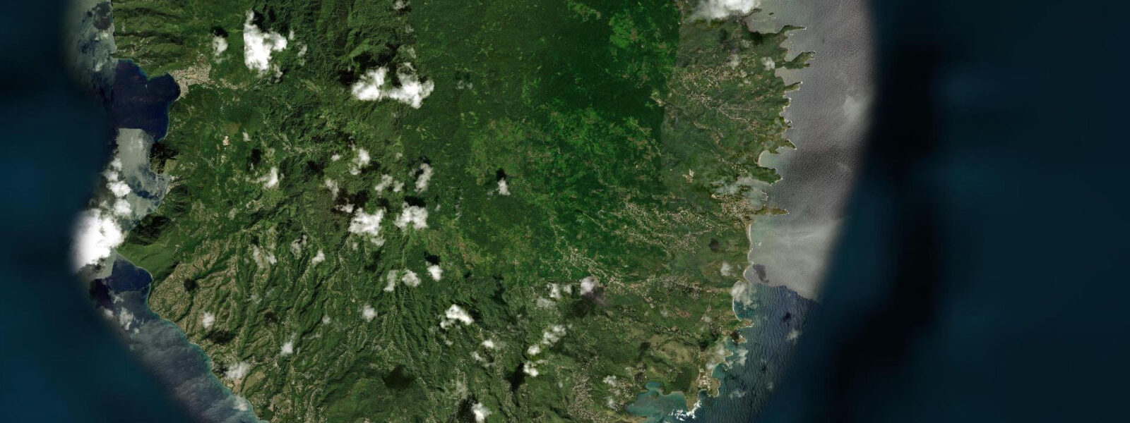
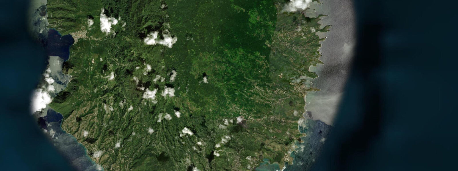
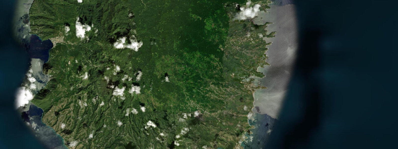
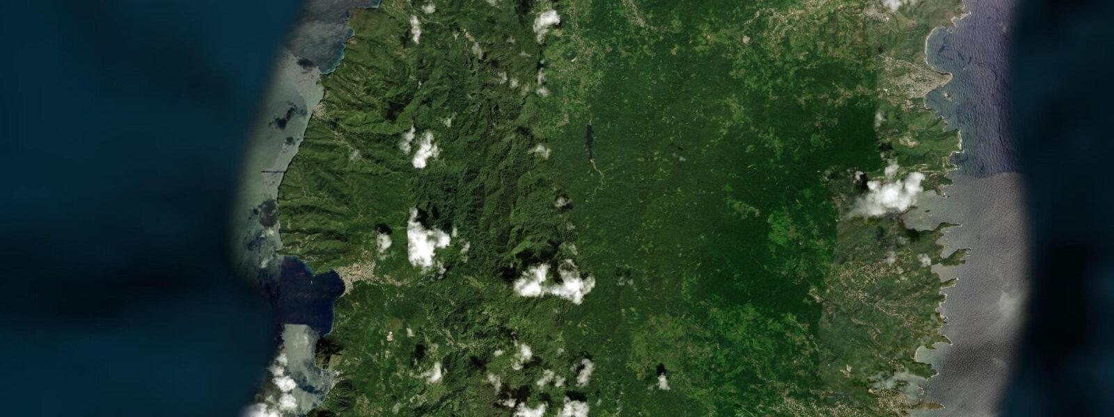
Cap Moule à Chique is the southernmost point of Saint Lucia, a headland where the land drops sharply to 272 metres above sea level at the lighthouse position, with vertical cliffs on the Atlantic side and a steep vegetated slope on the Caribbean. The lighthouse itself — a white tower at the highest point of the cape — is active and automated. The view from the lighthouse grounds is the primary draw: on a clear day both Saint Vincent (77 kilometres south-southeast) and Martinique (60 kilometres north) are visible simultaneously, making this one of the few points in the eastern Caribbean from which two neighbouring island nations can be seen at once.
The Atlantic Ocean and the Caribbean Sea are also visible on opposite sides of the cape, their different sea states distinguishable — the Atlantic more active to the east, the Caribbean typically calmer to the west — though the distinction is subtle on calm days and dramatic on days when northeast swell is running. The cape is geologically dramatic: the cliffs on the Atlantic side are sheer volcanic rock, dropping 100 to 200 metres to the sea below. The wave energy at the cliff base during swell conditions is significant; the cliffs are undercut by surge channels and sea caves that are audible from the clifftop.
This energy concentrated at the cape's tip drives the upwelling that makes the surrounding water productive for marine life. Brown boobies and frigatebirds are regular along the cliff face; red-billed tropicbirds nest in the cliff crevices and can be seen from the clifftop from March through August. The cape is reached by road from Vieux Fort — the road climbs steeply from sea level through scrub vegetation to the lighthouse gate.
The final section is unpaved but passable by regular vehicle in dry weather. Walking time from the gate to the lighthouse is approximately 20 minutes. The road continues past the lighthouse to an overlook above the Atlantic face.
The passage between Cap Moule à Chique and the Maria Islands, 3 kilometres east, is exposed to the Atlantic trades and runs with a current; the Maria Islands boat tours from Vieux Fort navigate this passage. 5 metres spring. Predictions on this page come from Open-Meteo Marine, a gridded global ocean model.
3 metres on height — model-derived, not from a local gauge. The Saint Lucia Meteorological Service and the Caribbean Meteorological Organization provide regional sea-state data.
Tide questions about Cap Moule à Chique
Quick answers to the most common questions about tide times, range, and water access at Cap Moule à Chique.
Can I see Saint Vincent from Cap Moule à Chique?
Yes, on clear days. Saint Vincent is approximately 77 kilometres south-southeast — visible as a dark landmass on the horizon from the lighthouse grounds. The best visibility is in the early morning before convective cloud builds over the warm Caribbean Sea. January through March, when trade winds keep the atmosphere clear of humidity haze, gives the most reliable inter-island visibility. Martinique, 60 kilometres to the north, is also visible on clear days from the lighthouse, making this the only point in Saint Lucia from which both neighbouring islands are observable simultaneously.
How do I drive to Cap Moule à Chique?
From Vieux Fort town, drive south on the road that passes the airport perimeter and continues along the coast toward the cape. The road climbs steeply from sea level once past the airport; the final kilometre is unpaved but manageable by a regular car in dry conditions — a 4WD is advisable in wet weather as the unpaved section has loose gravel. The lighthouse gate is the end of the vehicle access; park and walk 20 minutes to the lighthouse and the clifftop overlooks. The total driving time from Vieux Fort town is approximately 10 to 15 minutes.
What seabirds are seen at Cap Moule à Chique?
Red-billed tropicbirds nest in the cliff crevices on the Atlantic face and are visible from the clifftop from March through August when pairs are returning to nest sites and feeding adults stream past the cape. Brown boobies and magnificent frigatebirds are present year-round along the cliff line. The upwelling around the cape attracts feeding seabirds including brown pelicans and various tern species. Sooty terns and bridled terns are present in summer. The clifftop position allows looking down on flying seabirds rather than up at them — a reverse perspective that makes wing pattern identification easier.
Is Cap Moule à Chique accessible by foot from Vieux Fort?
The cape is approximately 3 kilometres south of Vieux Fort town centre by road, and a road walk is possible but not comfortable due to the lack of pavement on the upper section and the exposure to traffic. A trail from the airport perimeter through the scrub to the cape exists but is not formally maintained. By bicycle is practical on the paved lower section; the unpaved upper section requires a mountain bike. Most visitors drive. The road surface and gradient make this unsuitable as a casual walk but manageable for those with experience on unpaved terrain.
What is the significance of the name Moule à Chique?
The name is French, from the colonial period when France controlled Saint Lucia. The etymology is debated: one interpretation is that 'moule' refers to a mussel (the bivalve shellfish) and 'chique' to a type of sand flea (chigoe flea), suggesting a cape where both were abundant on the shore — a working description from early settlers rather than a romantic name. A competing interpretation links 'moule' to a mould or form shape, describing the curved profile of the headland. The name has been in continuous use since the French colonial period and was retained unchanged after British administration took permanent hold of Saint Lucia in 1814.
7-day tide table — Cap Moule à Chique
Heights relative to MSL. Predictions: Open-Meteo Marine (MeteoFrance SMOC, 0.08° grid) — heights relative to MSL (not chart datum / LAT). Model-derived.
| Day | Type | Time | Height |
|---|---|---|---|
| Sat 04 Jul | High | 04:45 | 0.5m |
| Low | 11:54 | 0.1m | |
| Sun 05 Jul | High | 19:00 | 0.4m |
| Mon 06 Jul | Low | 13:00 | 0.1m |
| Tue 07 Jul | High | 20:10 | 0.5m |
| Wed 08 Jul | Low | 04:00 | 0.2m |
| High | 09:10 | 0.3m | |
| Low | 14:10 | 0.2m | |
| High | 21:00 | 0.5m | |
| Thu 09 Jul | Low | 05:00 | 0.1m |
| High | 21:50 | 0.5m | |
| Fri 10 Jul | Low | 06:10 | 0.0m |
| High | 19:00 | 0.3m |