Saint-Philippe tide times
Saint-Philippe tide forecast — heights relative to MSL.
Today's tide times for Saint-Philippe
Tide times at Saint-Philippe on Saturday, 4 July 2026: first high tide at 04:00am, first low tide at 08:38am. Sunrise 06:55am, sunset 05:47pm.
Tide chart for Saint-Philippe
24-hour cosine-interpolated curve around the present moment. Heights relative to MSL. Predictions: Predictions: Open-Meteo Marine (MeteoFrance SMOC, 0.08° grid).
Sun, moon and conditions on Sat 04 Jul
Snapshot at build time — refreshes daily. Sea state from Open-Meteo Marine.
Highs and lows next 7 days
Every predicted high and low for the next week, with the daily tidal coefficient (0–120; higher = bigger swing, > 95 means stronger currents).
Other spots nearby
The three closest curated TideTurtle locations to Saint-Philippe, measured by great-circle distance.
Today's solunar windows
Solunar tradition: major periods are the ≈3h windows around moon transit and opposition; minor are ≈2h around moonrise and moonset. Pair with the local tide stage and wind for the best read.
Cycle dates near Saint-Philippe
Last spring tide on Sat 04 Jul (range 0.6m). Next neap on Wed 08 Jul.
Spring tides cluster around new and full moons (biggest swings). Neap tides land on quarter moons (smallest swings). See the spring tide and neap tide glossary entries for the why.
About tides at Saint-Philippe
A short guide to the coastline at Saint-Philippe — geography, sea state, and what the tide is actually doing under your feet.
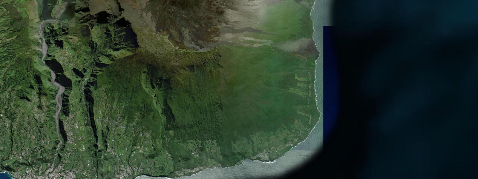
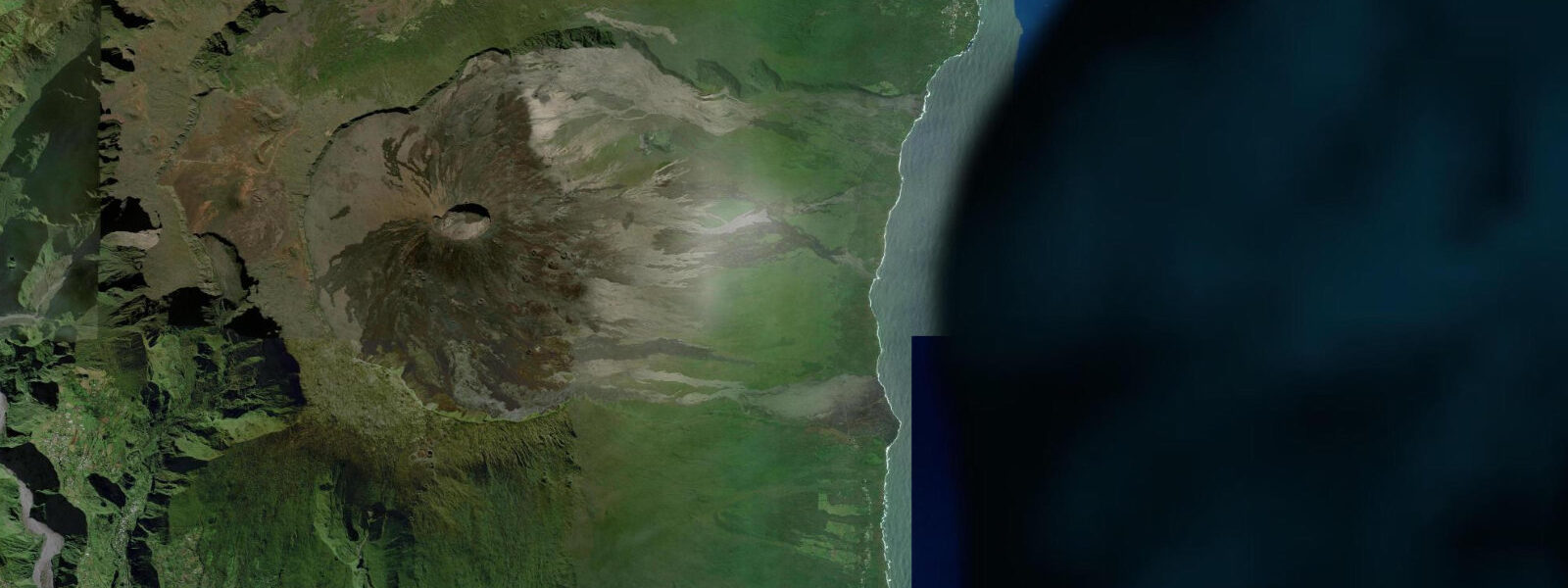
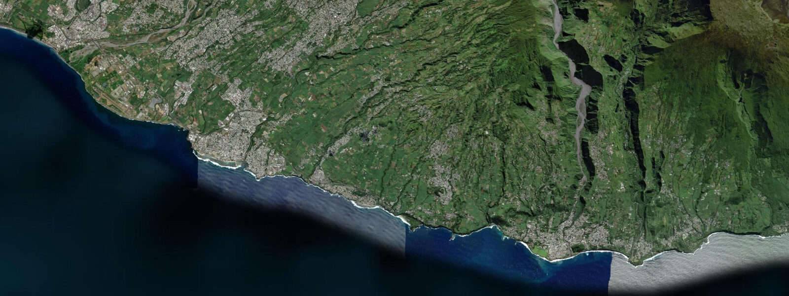
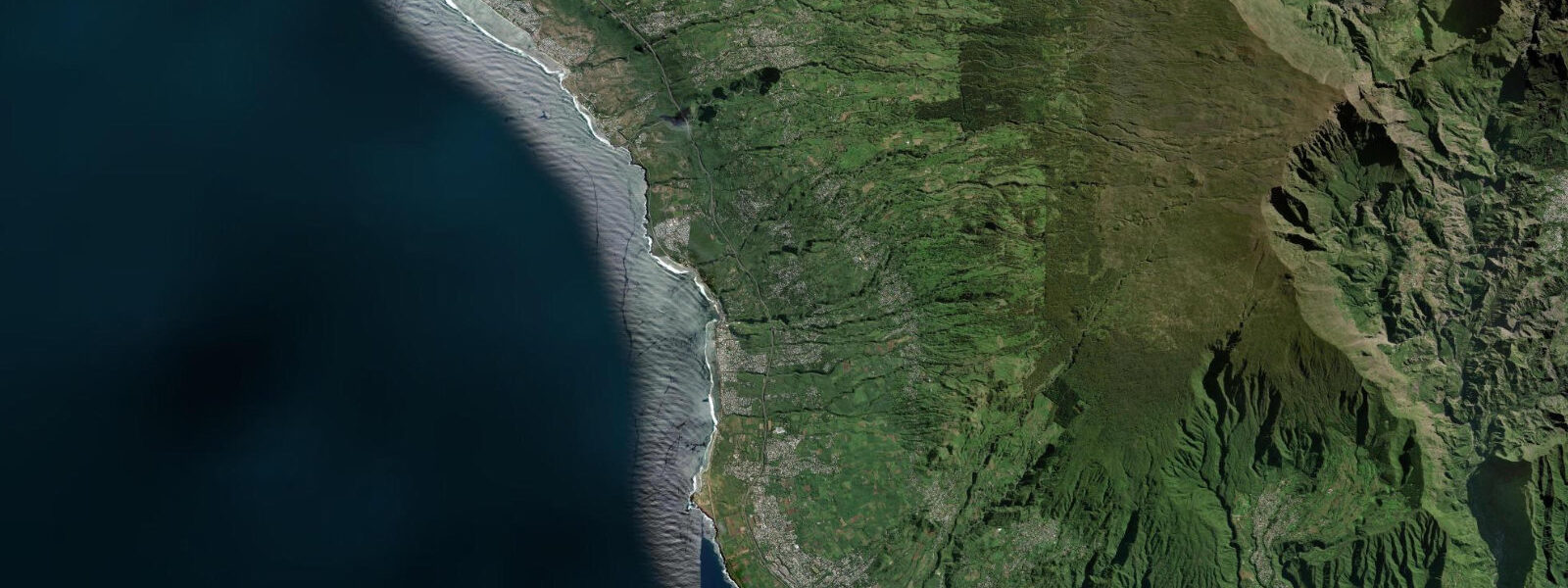
Saint-Philippe sits at the southeastern corner of Réunion, below the active volcanic zone of Piton de la Fournaise — one of the world's most active volcanoes. The coastline here is among the most dramatically formed on Earth: black lava flows that entered the sea decades or centuries ago have solidified into jagged benches and sea stacks, while newer flows periodically extend the island's shoreline seaward. The sea is the southern Indian Ocean, fully exposed to swells arriving from the Southern Ocean with nothing between here and Antarctica to moderate them across thousands of kilometres.
This is not a swimming beach. The south coast of Réunion has no lagoon protection — the fringing reef that shelters the west coast and part of the north does not extend here. Waves arrive directly from the Southern Ocean, refract around the lava headlands, and break with genuine force on the rocky shore. Swell heights of 2-4 m are routine in winter (June-August); the summer cyclone season (November-April) can bring substantially larger swells associated with passing tropical systems. These are conditions that demand respect from anyone approaching the water's edge.
The appeal is spectacular rather than recreational in the conventional sense. The sight of long-period Southern Ocean swell running up lava shelves, exploding into spray towers, and retreating back across the black rock is genuinely elemental — one of those coastal experiences that reminds you of the ocean's actual scale and power. The black sand beach at Basse Vallée, just east of Saint-Philippe village, is a small pocket of volcanic black sand trapped between lava flows. It exists and is recognisable as a beach, but is not safe for swimming due to shorebreak and rip currents.
Tides at Saint-Philippe follow the SW Indian Ocean semi-diurnal pattern, with spring ranges of approximately 0.6-1.0 m. Réunion's tidal range is modest by world standards, amplified slightly on the exposed south coast compared to the sheltered west. The tidal variation affects the safety of lava shelf walking at the margins: low tide exposes more flat lava bench area, but the swells continue regardless of the tide state. Local knowledge is essential before walking the coastal lava shelves, which have claimed lives when unexpected large wave sets arrived on what seemed like a calm day.
The area serves as a gateway to lava coast walking trails (sentiers littoraux) that follow the shoreline east toward the active flow zone at Grand Brûlé. The vegetation behind the lava is the dense pandanus and screw pine forest of Réunion's windward south — a humid, moss-draped landscape where the mountain meets the ocean in a continuous vertical transition from active volcano summit to sea level. The combination of geological drama, forest ecology, and ocean exposure makes the Saint-Philippe coast one of the most distinctive natural environments anywhere in the Indian Ocean islands.
The community of Saint-Philippe itself is small and self-contained — a few hundred residents, a church, a market, and the agricultural land that climbs steeply behind the village toward the volcano slopes. The village has been affected by lava flows in the past; residents have a matter-of-fact relationship with the geological activity that defines their landscape. Talking to locals about the volcano and the sea — the two forces that shape daily life here — gives a perspective on coastal existence that is entirely unlike anything available on the tourist-oriented west coast of the island. The road into Saint-Philippe from the west passes through the transition from Réunion's dry western climate to the humid windward south, and the vegetation changes around you as the landscape becomes wetter and the cloud base drops — a physical reminder that the island's geography generates its own weather at every scale.
Tide questions about Saint-Philippe
Quick answers to the most common questions about tide times, range, and water access at Saint-Philippe.
What are tides like at Saint-Philippe, Réunion?
Saint-Philippe experiences semi-diurnal SW Indian Ocean tides with a modest spring range of approximately 0.6-1.0 m. Réunion's tidal range is small compared to the open Atlantic or the northern Gulf. The practical reality is that wave action from Southern Ocean swell dwarfs the tidal signal here — a 2-3 m swell on top of a 0.8 m tidal range means the water level varies continuously and unpredictably at the shoreline. Low tide exposes more of the lava shelf but does not make the coast significantly safer for shore activities. Open-Meteo predictions (±45 min, ±0.3 m) give the background tidal state; real-time wave and swell data from surf forecasting services is more operationally important for planning any coastal activity here.
Is it safe to walk on the lava shelves at Saint-Philippe?
Walking the coastal lava shelves near Saint-Philippe carries real risk and has resulted in fatalities when unexpected wave sets arrived on seemingly calm days. The lava bench can be completely dry for extended periods during a low swell window, then be swept by a large wave without warning. Rules for safer lava shelf walking: never turn your back to the sea; watch wave patterns from high ground before descending to bench level; never go down alone; avoid the benches during swell periods above 1.5 m; check the surf forecast before going. Local trail information from Réunion's ONF (Office National des Forêts) covers the coastal sentiers and their current accessibility status. The hike itself, when conditions are suitable, is extraordinary — there is nowhere else where you walk across lava that entered the sea within your own lifetime.
When is the best time to visit Saint-Philippe?
May through October (Réunion's dry season and austral winter) is the most reliable visiting window. Cyclone risk is zero June-September, the southeast trade wind keeps humidity manageable, and air temperature of 20-26°C at sea level is comfortable. Southern Ocean swell is present year-round but peaks in the austral winter — June-August can bring the most dramatic wave conditions, which is spectacular to watch from the cliffs but makes coastal access more restricted. The austral summer (November-April) is the cyclone season; direct hits are not frequent but indirect swell from passing systems can arrive with little warning. March-April before the cyclone season ends can be excellent if no active system is nearby.
Can I swim or snorkel at Saint-Philippe?
Not safely. Saint-Philippe has no lagoon, no reef protection, and the coastline is rocky lava with direct Southern Ocean swell exposure on all sections. There are no safe swimming beaches in the immediate Saint-Philippe area. The black sand pocket at Basse Vallée looks inviting but has strong shorebreak and rip currents that have caused incidents. Snorkelling requires calm, protected water — conditions not available on the south coast at any state of tide or swell. For swimming and snorkelling on Réunion, the west coast is the correct destination: Boucan Canot, Saint-Gilles-les-Bains, or Saint-Leu, where the fringing reef creates the lagoon conditions that make in-water activities genuinely safe.
What is the volcanic landscape like near Saint-Philippe?
Saint-Philippe sits at the edge of Réunion's active volcanic zone. The recent lava flows from Piton de la Fournaise eruptions — some in living memory, some within the last decade — are visible as black tongues reaching the sea east of the village. The coastal trail toward Grand Brûlé passes over flows of different ages, the difference in weathering and vegetation giving a visible timeline: bare black glass from a recent flow, then grey cracked lava with pioneer plant species, then older flows with full forest cover. The tourist road (Route Nationale 2) was buried by lava flows in 2007 and the section was rebuilt further inland. Eruption frequency at Piton de la Fournaise is high — check current volcanic alert status from the Observatoire Volcanologique before hiking in or near the active zone.
8-day tide table — Saint-Philippe
Heights relative to MSL. Predictions: Open-Meteo Marine (MeteoFrance SMOC, 0.08° grid) — heights relative to MSL (not chart datum / LAT). Model-derived.
| Day | Type | Time | Height |
|---|---|---|---|
| Sat 04 Jul | High | 04:00 | 0.8m |
| Low | 08:38 | 0.3m | |
| Sun 05 Jul | High | 02:47 | 0.9m |
| Low | 09:12 | 0.3m | |
| Mon 06 Jul | High | 03:18 | 0.8m |
| Low | 09:50 | 0.4m | |
| High | 16:15 | 0.8m | |
| Low | 22:15 | 0.5m | |
| Tue 07 Jul | High | 03:54 | 0.8m |
| Low | 10:20 | 0.4m | |
| High | 17:00 | 0.8m | |
| Low | 23:10 | 0.5m | |
| Wed 08 Jul | High | 18:10 | 0.8m |
| Thu 09 Jul | Low | 00:50 | 0.5m |
| Fri 10 Jul | High | 20:54 | 0.9m |
| Sat 11 Jul | Low | 03:00 | 0.5m |