Al Zubarah tide times
Al Zubarah tide forecast — heights relative to MSL.
Today's tide times for Al Zubarah
Tide times at Al Zubarah on Saturday, 4 July 2026: first low tide at 03:00am, first high tide at 07:25pm. Sunrise 04:48am, sunset 06:31pm.
Tide chart for Al Zubarah
24-hour cosine-interpolated curve around the present moment. Heights relative to MSL. Predictions: Predictions: Open-Meteo Marine (MeteoFrance SMOC, 0.08° grid).
Sun, moon and conditions on Sat 04 Jul
Snapshot at build time — refreshes daily. Sea state from Open-Meteo Marine.
Highs and lows next 7 days
Every predicted high and low for the next week, with the daily tidal coefficient (0–120; higher = bigger swing, > 95 means stronger currents).
Other spots nearby
The three closest curated TideTurtle locations to Al Zubarah, measured by great-circle distance.
Today's solunar windows
Solunar tradition: major periods are the ≈3h windows around moon transit and opposition; minor are ≈2h around moonrise and moonset. Pair with the local tide stage and wind for the best read.
Cycle dates near Al Zubarah
Last spring tide on Sat 04 Jul (range 1.1m). Next neap on Wed 08 Jul.
Spring tides cluster around new and full moons (biggest swings). Neap tides land on quarter moons (smallest swings). See the spring tide and neap tide glossary entries for the why.
About tides at Al Zubarah
A short guide to the coastline at Al Zubarah — geography, sea state, and what the tide is actually doing under your feet.
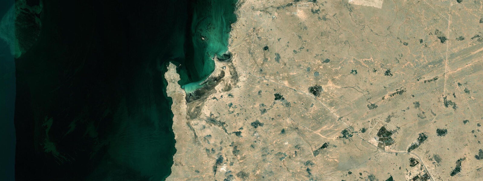
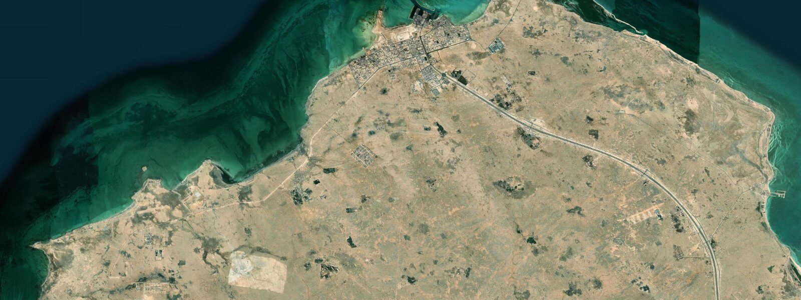
Al Zubarah is a UNESCO World Heritage archaeological site on the northwest coast of Qatar, a 30-kilometre drive from the nearest town of Madinat ash Shamal. The fortified pearling and trading town was founded in the late 18th century and at its peak in the early 19th century was one of the more significant ports on the western Gulf coast, home to tens of thousands of inhabitants engaged in the pearl trade. The town was abandoned in 1938 following political conflict; the buildings slowly buried under windblown sand, and the site remained sealed until systematic excavation began in the 1980s.
Today the site consists of the restored Al Zubarah Fort — a square coastal tower built by Qatar in 1938 on the ruins of the town — and the buried archaeological zone extending inland and along the coast, with excavation trenches showing the street grid, courtyard houses, mosques, and harbour infrastructure of the 18th and 19th century town. The UNESCO inscription in 2013 recognised the site as one of the best-preserved examples of a Gulf pearling settlement.
The coast at Al Zubarah faces northwest across the Gulf toward Iran. Tide predictions here use Open-Meteo Marine's global model. Timing accuracy ±45 minutes, height accuracy ±0.2 to 0.3 metres. The northwestern Gulf has mixed semidiurnal tides with spring range of 1.5 to 2.5 metres and significant diurnal inequality. Shallow Gulf waters amplify wind effects: the shamal (northwest wind) generates significant wave action on this coast and can produce surge of 0.5 to 0.8 metres above predicted water levels.
The original townspeople of Al Zubarah used the tidal cycle and seasonal wind patterns intimately. Pearl diving fleets departed northward on the summer's end shamal, and the tidal channels behind the town's seawall controlled access to the inner harbour. The excavation has revealed the sea wall foundations and the tidal basin used by the dhow fleet.
For archaeological visitors, the fort museum provides context for the excavation and the Gulf pearling trade. The excavation site itself is open to the public on designated paths; the buried street layout is visible in the trenches. The coastal setting — flat desert meeting the Gulf, with the fort silhouetted against the water — is one of the more visually distinctive heritage sites in Qatar.
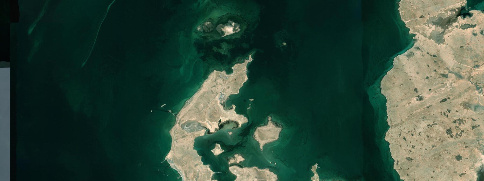
The northwest Qatar coast beyond Al Zubarah is among the least developed stretches of Gulf coastline in Qatar. Mangrove stands in sheltered bays and extensive tidal flats support flamingo flocks and wading bird populations. The drive north from Madinat ash Shamal passes through uninhabited coastal desert, reaching Al Zubarah as an almost startling isolation of heritage in a flat landscape.
The sediment stratigraphy at Al Zubarah reveals the full sequence of the site's occupation. Archaeologists from the Danish-Qatari excavation team have identified layers dating from the pre-Islamic period through the Islamic medieval period to the 18th and 19th century pearling town. The continuity of coastal occupation at this specific location reflects the natural harbour qualities of the bay — a gentle beach gradient, protection from the dominant northwest shamal, and proximity to the pearl banks that were the Gulf's economic foundation for centuries.
The pearl banks off Al Zubarah on the northwest Qatar shelf were among the productive grounds that attracted the town's founding population. At low spring tide, small sections of the offshore bank are shallow enough to see clearly from the surface; the oyster-bearing substrates are at 6 to 15 metres depth across the bank system. Local fishermen from Madinat ash Shamal still work the offshore area, though pearl oysters are no longer commercially harvested.
The interpretive museum inside the Al Zubarah Fort is one of the better small maritime museums in the Gulf. Exhibits cover the pearling trade's social structure, the dhow designs used by the Al Zubarah fleet, and the town's relationship with Bahrain and the Al Khalifa family. Scale models of the town in its peak period show the urban density and harbour layout that archaeology has confirmed. The museum is air-conditioned, which is appreciated after the exposed coastal walk around the fort perimeter.
Tide questions about Al Zubarah
Quick answers to the most common questions about tide times, range, and water access at Al Zubarah.
What is the tidal range at Al Zubarah?
Al Zubarah is on the northwest Qatar coast, facing the central Persian Gulf. Mixed semidiurnal tides with significant diurnal inequality; spring range approximately 1.5 to 2.5 metres. Tide data here uses Open-Meteo Marine's global model, with ±45 minutes timing accuracy and ±0.2 to 0.3 metres height accuracy. The shallow Gulf at this location amplifies wind effects; the shamal (northwest wind) creates surge and wave action on the exposed northwest coast that can add 0.5 to 0.8 metres above the tidal baseline. In winter shamal conditions, the coastal path near the fort can receive wave spray.
What is the history of Al Zubarah?
Al Zubarah was founded in the late 18th century by traders from Kuwait and the Arabian mainland. It grew rapidly to become one of the major pearling towns of the western Gulf, with an estimated 10,000 to 20,000 inhabitants at its peak. The town's wealth attracted the interest of regional powers including the Al Khalifa (who later became rulers of Bahrain) and eventually Wahhabi-aligned forces from central Arabia. The town was attacked and largely evacuated in 1811 and again in later conflicts; by 1938 it had been fully abandoned. Sand-burial of the structures preserved the urban layout, which archaeological excavation has revealed with exceptional completeness.
How do I visit the Al Zubarah archaeological site?
Al Zubarah is 105 kilometres northwest of Doha. The drive takes 90 minutes on the main coastal road via Madinat ash Shamal. The site is managed by the Qatar Museums Authority; the Al Zubarah Fort is open to visitors with a small entrance fee and contains a museum on the site's history and the Gulf pearling trade. Excavation trenches on the site perimeter are visible from designated walkways. The site is open daily except Tuesdays; confirm opening hours with Qatar Museums before travel as seasonal hours apply. The coastal road passes through restricted military zones on approach; follow the signed public road rather than attempting coastal shortcuts.
What wildlife is visible at Al Zubarah?
The tidal flats and mangrove stands along the northwest Qatar coast near Al Zubarah are productive for birds. Greater flamingos feed on the intertidal mud between October and April, with flocks of hundreds common in the shallows behind the coastal dune ridge. Wading birds — plovers, sandpipers, herons — work the tide edges. The offshore waters north of Al Zubarah are part of the northwest Gulf pearling bank system; dugong have been recorded in the seagrass beds offshore. The flat coastal desert behind the site hosts the characteristic Gulf desert fauna: Arabian sand gazelles are present in the uninhabited zone north of Madinat ash Shamal.
Why was Al Zubarah abandoned?
Al Zubarah's decline followed a combination of military conflict and economic disruption. The town was attacked multiple times by regional rivals during the early 19th century. After the final conflict, a significant portion of the population relocated to Bahrain, which the Al Khalifa family (originally from Al Zubarah) now ruled. The remaining population continued until 1938, when a political dispute between Qatar and Bahrain over the site resulted in Bahraini forces occupying the area and the Qatari authority evacuating the remaining inhabitants. The timing coincided almost exactly with the collapse of the Gulf pearl trade due to Japanese cultured pearls — so the economic basis for the town had already been destroyed when the final political events ended its occupation.
7-day tide table — Al Zubarah
Heights relative to MSL. Predictions: Open-Meteo Marine (MeteoFrance SMOC, 0.08° grid) — heights relative to MSL (not chart datum / LAT). Model-derived.
| Day | Type | Time | Height |
|---|---|---|---|
| Sat 04 Jul | Low | 03:00 | -0.1m |
| High | 19:25 | 1.0m | |
| Sun 05 Jul | Low | 14:23 | 0.2m |
| High | 20:10 | 0.9m | |
| Mon 06 Jul | Low | 03:13 | -0.2m |
| High | 21:00 | 0.7m | |
| Tue 07 Jul | Low | 03:50 | -0.2m |
| High | 10:15 | 0.6m | |
| Low | 16:06 | 0.1m | |
| Wed 08 Jul | High | 10:52 | 0.7m |
| Low | 17:15 | 0.1m | |
| High | 22:56 | 0.6m | |
| Thu 09 Jul | Low | 05:18 | -0.0m |
| High | 11:38 | 0.7m | |
| Low | 18:22 | 0.0m | |
| Fri 10 Jul | High | 00:04 | 0.6m |
| Low | 06:22 | 0.0m | |
| High | 12:24 | 0.7m |