Ras Laffan tide times
Ras Laffan tide forecast — heights relative to MSL.
Today's tide times for Ras Laffan
Tide times at Ras Laffan on Saturday, 4 July 2026: first low tide at 03:00am, first high tide at 06:22am, second low tide at 12:12pm, second high tide at 06:45pm. Sunrise 04:45am, sunset 06:30pm.
Tide chart for Ras Laffan
24-hour cosine-interpolated curve around the present moment. Heights relative to MSL. Predictions: Predictions: Open-Meteo Marine (MeteoFrance SMOC, 0.08° grid).
Sun, moon and conditions on Sat 04 Jul
Snapshot at build time — refreshes daily. Sea state from Open-Meteo Marine.
Highs and lows next 7 days
Every predicted high and low for the next week, with the daily tidal coefficient (0–120; higher = bigger swing, > 95 means stronger currents).
Other spots nearby
The three closest curated TideTurtle locations to Ras Laffan, measured by great-circle distance.

Today's solunar windows
Solunar tradition: major periods are the ≈3h windows around moon transit and opposition; minor are ≈2h around moonrise and moonset. Pair with the local tide stage and wind for the best read.
Cycle dates near Ras Laffan
Last spring tide on Sat 04 Jul (range 1.2m). Next spring tide on Fri 10 Jul (range 1.0m). Next neap on Wed 08 Jul.
Spring tides cluster around new and full moons (biggest swings). Neap tides land on quarter moons (smallest swings). See the spring tide and neap tide glossary entries for the why.
About tides at Ras Laffan
A short guide to the coastline at Ras Laffan — geography, sea state, and what the tide is actually doing under your feet.
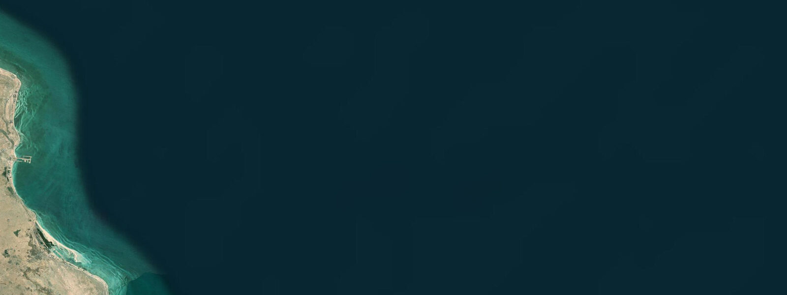
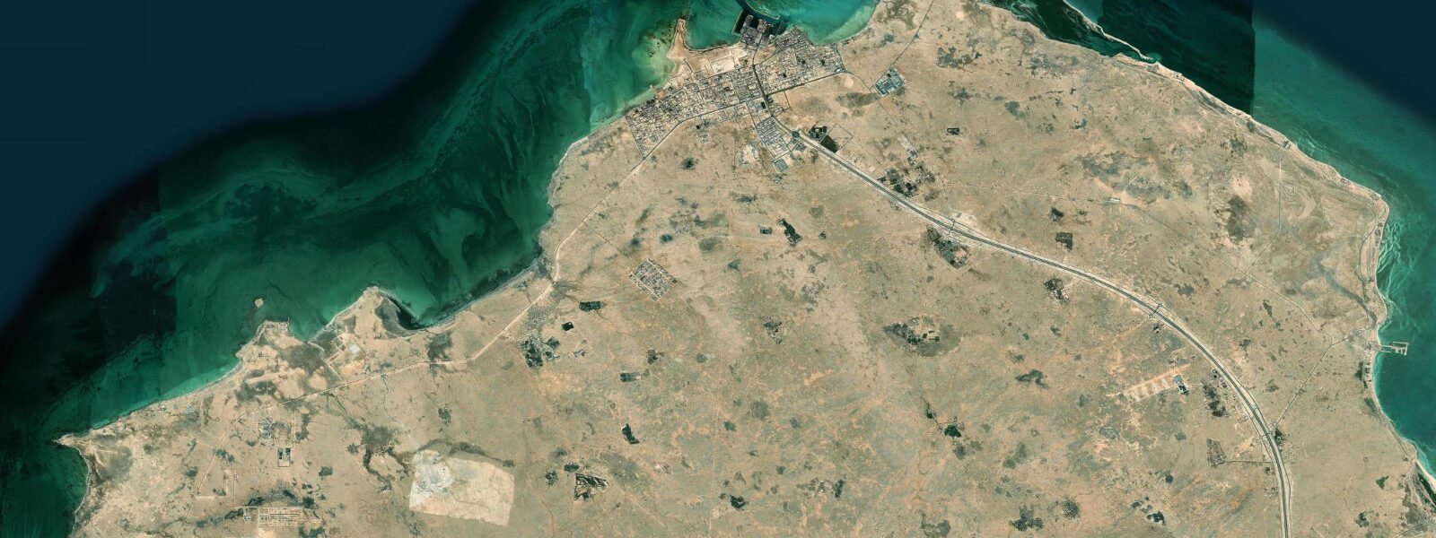
Ras Laffan is Qatar's major industrial city on the northeast coast, home to the world's largest liquefied natural gas (LNG) export terminal. The North Field — the world's largest natural gas reservoir — lies offshore of Ras Laffan; the infrastructure to extract, liquefy, and export this gas has transformed an uninhabited desert headland into the industrial engine of Qatar's economy over 30 years. The LNG trains, storage tanks, and the loading jetties that project into the Gulf are visible from some distance offshore.
For coastal and tidal purposes, Ras Laffan is relevant for two reasons: the industrial port has created a significant stretch of managed coastline on Qatar's northeast coast that previously did not exist, and the waters around the LNG terminal are among the most carefully monitored coastal waters in the Gulf for tide, current, and meteo-ocean conditions — LNG carrier navigation is tide and weather sensitive.
Tide predictions for Ras Laffan use Open-Meteo Marine's global model. Timing accuracy ±45 minutes, height accuracy ±0.2 to 0.3 metres. The northeast Qatar coast has mixed semidiurnal tides with significant diurnal inequality; spring range runs approximately 1.5 to 2.5 metres. The shallow Gulf amplifies wind effects: the shamal can add 0.5 to 0.8 metres of surge. LNG carrier operations at Ras Laffan are typically planned for favourable tide and weather windows, and the port's own real-time metocean monitoring informs these decisions.
The coast around Ras Laffan, outside the restricted industrial zone, retains some natural tidal flat habitat. The headland structure and the shelter provided by the port breakwaters have created low-energy inshore areas where seagrass and coral patches persist. Dugong have been recorded in the seagrass beds north of the industrial zone.
Flamingo populations use the tidal flats around the small bays north and south of the Ras Laffan industrial perimeter between October and April. These locations — accessible by the coastal road that runs north from Al Khor — provide some of the easier flamingo observation on the northeast Qatar coast. The combination of flamingos in the foreground and LNG flare stacks in the background is one of the more distinctly contemporary Gulf coastal landscapes.
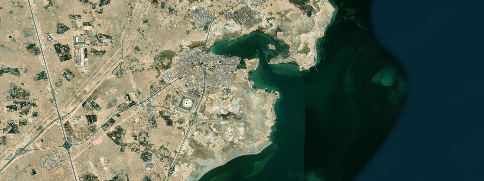
Al Khor city, 25 kilometres south of Ras Laffan, is the urban service centre for the northeast Qatar coast and the practical base for visiting this section of coastline. The coastal road north of Al Khor passes several accessible tidal flat viewpoints before reaching the Ras Laffan industrial zone perimeter.
The metocean monitoring infrastructure at Ras Laffan is among the most sophisticated on the Gulf coast. QatarGas and RasGas (now merged as Qatar Energy) operate networks of wave buoys, tide gauges, weather stations, and current meters in the approaches to the loading terminals. Data from these instruments is used for real-time and forecast-based vessel routing. The tidal prediction model used for LNG carrier operations is calibrated against the tide gauge record; the resulting operational tide predictions are substantially more precise than the Open-Meteo Marine model used for the public tidal data on this platform.
The fishing community at Al Khor, 25 kilometres south, has historically fished the waters of the northeast Qatar shelf including the zone around Ras Laffan. The development of the industrial city has modified fishing access in the immediate port zone, but the waters north of the port boundary remain accessible. Platform structure around the LNG terminal jetties has created artificial reef habitat that concentrates grouper and sea bream; fishing adjacent to (but outside) the restricted zone is practised by local anglers.
The Al Khor Corniche, the waterfront promenade of Al Khor city, is a practical base for the northeast Qatar coast. The corniche park has sheltered seating and views over Al Khor bay, which retains mangrove stands and flamingo habitat despite the city's proximity. Early morning visits in October through April find flamingos and herons feeding in the shallow bay. The contrast between the Al Khor residential cityscape and the flamingo colony in the adjacent bay is typical of the Qatar Gulf coast where urban development and wildlife habitat exist in close proximity.
Tide questions about Ras Laffan
Quick answers to the most common questions about tide times, range, and water access at Ras Laffan.
What is the tidal range at Ras Laffan?
Ras Laffan is on the northeast Qatar coast facing the Persian Gulf. Mixed semidiurnal tides with significant diurnal inequality; spring range approximately 1.5 to 2.5 metres. Tide predictions use Open-Meteo Marine's global model, with ±45 minutes timing accuracy and ±0.2 to 0.3 metres height accuracy. The industrial port at Ras Laffan operates its own real-time metocean monitoring for LNG carrier berthing operations; the port authority data is more precise than the model predictions for the immediate port area, but is not publicly available.
Can I visit the Ras Laffan industrial area?
Ras Laffan Industrial City is a restricted zone. Entry requires a valid permit from the Ras Laffan Industrial City administration or sponsorship by a company with operations in the zone. Tourist access is not available. The coastal road north from Al Khor passes along the perimeter of the industrial zone and gives external views of the LNG infrastructure. The tidal flat areas north and south of the industrial perimeter are accessible from this road. For business visitors, entry is coordinated through the specific company or project you are visiting.
What is the North Field and why is it significant?
The North Field is an offshore natural gas reservoir underlying the continental shelf of Qatar and extending into Iranian waters (where it is known as South Pars). It is the world's largest known natural gas field by area and reserve volume. Qatar's LNG export industry, centred on Ras Laffan, has made Qatar one of the world's largest LNG exporters and transformed it from a small Gulf emirate into one of the highest-income countries on earth. The field was discovered in 1971; the first LNG shipment from Ras Laffan was made in 1997. Production expansion projects ongoing as of 2025 are increasing capacity to serve long-term LNG supply contracts.
What wildlife is found around Ras Laffan?
The tidal flats immediately north and south of the Ras Laffan industrial perimeter, accessible from the coastal road, support greater flamingo from October through April. Wading birds — greater sand plover, grey plover, western reef heron — feed on the tidal flat at low tide. Dugong have been recorded in the seagrass beds of the nearshore zone north of the port, though sightings are uncommon. The offshore waters around the North Field production platforms support fish populations; sport fishing from Al Khor targets the grouper and sea bream associated with the platform structure.
How do LNG carriers navigate to and from Ras Laffan?
LNG carriers approaching Ras Laffan transit through the shallow northeastern Gulf, using the designated deepwater shipping channels that avoid the extensive shallow bank and reef system. Vessels are piloted from the channel entrance by Qatar-licensed maritime pilots; the berth approach requires precise tide window management because the loading berths have minimum keel clearance requirements. Carriers typically arrive and depart on favourable tide phases that maximise under-keel clearance. The port's metocean system monitors tidal stage, water temperature (which affects vessel buoyancy), and wind speed in real time. The fully loaded carrier departure on a favourable tide window is a carefully choreographed operation involving the full port pilot and tug fleet.
8-day tide table — Ras Laffan
Heights relative to MSL. Predictions: Open-Meteo Marine (MeteoFrance SMOC, 0.08° grid) — heights relative to MSL (not chart datum / LAT). Model-derived.
| Day | Type | Time | Height |
|---|---|---|---|
| Sat 04 Jul | Low | 03:00 | 0.2m |
| High | 06:22 | 0.6m | |
| Low | 12:12 | -0.0m | |
| High | 18:45 | 1.1m | |
| Sun 05 Jul | Low | 01:40 | -0.0m |
| High | 07:07 | 0.6m | |
| Low | 12:54 | -0.0m | |
| High | 19:15 | 1.0m | |
| Mon 06 Jul | Low | 02:15 | -0.2m |
| High | 07:52 | 0.5m | |
| Low | 13:36 | -0.1m | |
| High | 19:54 | 0.9m | |
| Tue 07 Jul | Low | 02:43 | -0.2m |
| High | 08:52 | 0.6m | |
| Low | 14:36 | -0.0m | |
| High | 20:36 | 0.8m | |
| Wed 08 Jul | Low | 15:43 | 0.0m |
| High | 21:23 | 0.7m | |
| Thu 09 Jul | Low | 04:18 | -0.2m |
| High | 10:55 | 0.7m | |
| Low | 17:00 | 0.0m | |
| High | 22:23 | 0.6m | |
| Fri 10 Jul | Low | 05:16 | -0.3m |
| High | 12:03 | 0.7m | |
| Low | 18:24 | -0.0m | |
| High | 23:47 | 0.5m | |
| Sat 11 Jul | Low | 02:00 | 0.3m |