Al Ruwais tide times
Al Ruwais tide forecast — heights relative to MSL.
Today's tide times for Al Ruwais
Tide times at Al Ruwais on Saturday, 4 July 2026: first low tide at 03:00am, first high tide at 07:37am, second low tide at 01:10pm, second high tide at 07:14pm. Sunrise 04:47am, sunset 06:31pm.
Tide chart for Al Ruwais
24-hour cosine-interpolated curve around the present moment. Heights relative to MSL. Predictions: Predictions: Open-Meteo Marine (MeteoFrance SMOC, 0.08° grid).
Sun, moon and conditions on Sat 04 Jul
Snapshot at build time — refreshes daily. Sea state from Open-Meteo Marine.
Highs and lows next 7 days
Every predicted high and low for the next week, with the daily tidal coefficient (0–120; higher = bigger swing, > 95 means stronger currents).
Other spots nearby
The three closest curated TideTurtle locations to Al Ruwais, measured by great-circle distance.
Today's solunar windows
Solunar tradition: major periods are the ≈3h windows around moon transit and opposition; minor are ≈2h around moonrise and moonset. Pair with the local tide stage and wind for the best read.
Cycle dates near Al Ruwais
Last spring tide on Sat 04 Jul (range 1.3m). Next spring tide on Fri 10 Jul (range 1.1m). Next neap on Mon 06 Jul.
Spring tides cluster around new and full moons (biggest swings). Neap tides land on quarter moons (smallest swings). See the spring tide and neap tide glossary entries for the why.
About tides at Al Ruwais
A short guide to the coastline at Al Ruwais — geography, sea state, and what the tide is actually doing under your feet.
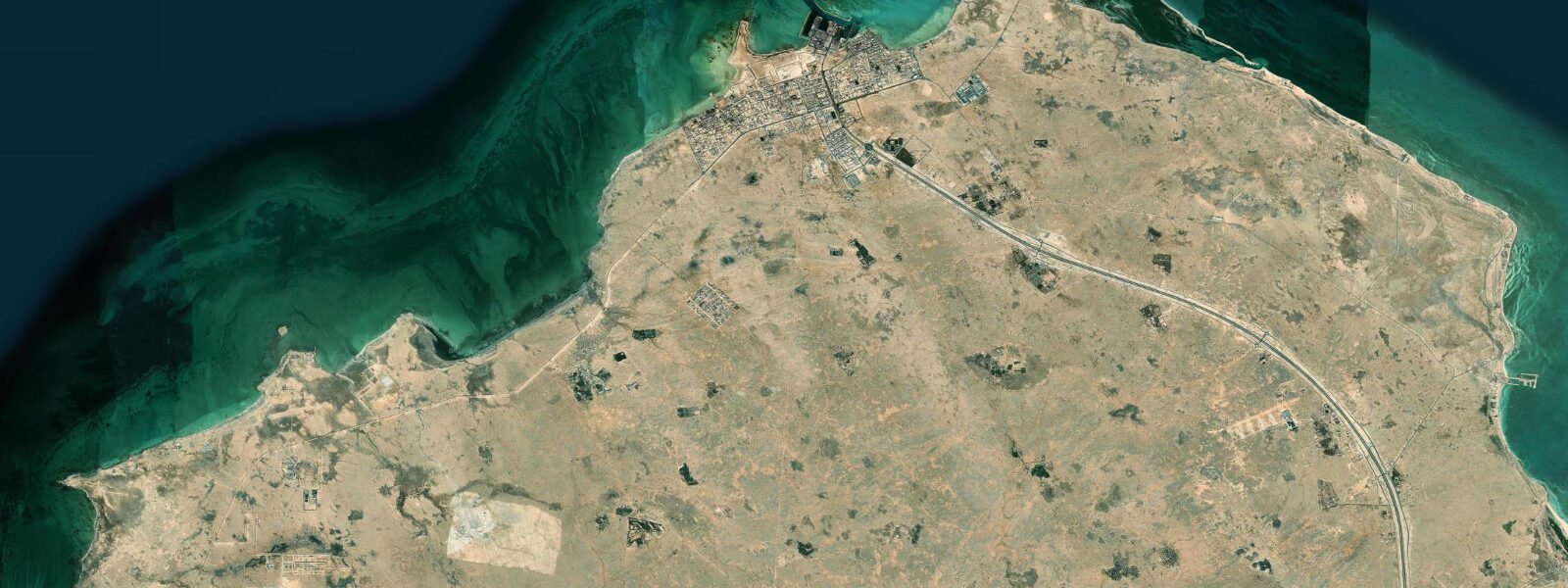
Al Ruwais sits at the very tip of the Qatar Peninsula, the northernmost settlement on a finger of land that points toward Bahrain and the open Gulf. It is a small traditional fishing town — one of Qatar's oldest coastal settlements — that retains more of its original character than most of the rapidly urbanised coast near Doha. The dhow yard at Al Ruwais is the last functioning traditional dhow-building site in Qatar, where wooden fishing and pearl-diving boats are still constructed and repaired using techniques passed through generations of Qatari coastal craftsmen.
The tidal character at Al Ruwais reflects its exposed northern position. The tip of the Qatar Peninsula faces the relatively open Bahrain Channel, where tidal energy is higher than in the protected southern Gulf. Spring tidal range here is typically 1.4-2.0 m, and the tidal currents offshore run notably stronger than on the calmer Doha coast. The channel between Qatar and Bahrain has historically been the most important pearl-diving ground in the entire Gulf, and the complex pattern of tidal shoals and deeper channels gave the pearl divers navigation routes and timing cues passed down over centuries within the fishing families of northern Qatar.
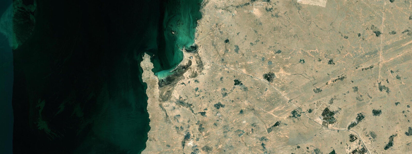
The water around Al Ruwais is clearer than the inner Gulf sites, with visibility reaching 8-12 m in winter when cooler temperatures and reduced biological productivity combine with light Shamal wind to produce the best conditions of the year. Mangrove creeks fringe parts of the northern coast, providing nursery habitat for juvenile fish and a roosting area for herons and egrets. These are small stands compared to those further south at Al Khor, but they represent the northern limit of mangrove distribution in Qatar and give the coast a different ecological texture from the bare sandy beaches further south.
Al Ruwais is a genuine off-the-beaten-track destination by Qatari standards — most tourism is concentrated in Doha and the nearby coast, and the drive north takes about an hour and a half on good roads through the flat Qatar interior. The town has basic food and fuel services but no tourist infrastructure of any kind. The appeal is the authenticity: a working fishing harbour, the dhow yard in active operation, the sea-smell of the tidal flats at low tide, and the broad vista north over the Gulf toward the distant shimmer of Bahrain's towers on clear days. For anyone wanting to see what Qatar's coast looked like before the oil era transformed everything south of here, Al Ruwais is the most accessible window into that world.
The light at Al Ruwais in the hour before sunset, when the sun is low over the Gulf and the sky to the west catches colour, is exceptional by Gulf standards. The open horizon, uninterrupted by towers or industrial structures, and the traditional boats in the harbour catching the orange light create a scene more associated with the pre-oil Gulf coast than with the 21st-century Qatar most visitors experience in Doha. This is worth timing deliberately: plan arrival at the peninsula tip with three hours before sunset and use the remaining light for the harbour, the dhow yard, and finally the open coastal view to the north. The drive back south from Al Ruwais along the Gulf coast road as the sun goes down is one of the better ways to end a day in Qatar — the flat peninsula coastline illuminated by low-angle light, the Gulf calm in the evening air, and the knowledge that you have seen a corner of the country that most of the population has not visited in the past year. The northern peninsula tip, viewed from a small boat offshore, shows the full taper of the Qatar landmass ending in a low sandy point with nothing but Gulf water in every direction — a geographic clarity that the built-up Doha coast cannot offer.
Tide questions about Al Ruwais
Quick answers to the most common questions about tide times, range, and water access at Al Ruwais.
What are tides like at Al Ruwais?
Al Ruwais faces the Bahrain Channel, giving it a more energetic tidal signature than the sheltered Doha coast. Spring tidal range is typically 1.4-2.0 m with the semi-diurnal pattern standard across the Gulf. Tidal currents offshore and in the channel are noticeable — boat operators from Al Ruwais habitually plan departures and returns around the tide direction and strength. The shallow shoals north of the peninsula can be very shallow at low water; local fishermen know the navigable channels, but unfamiliar boats need care and should carry charts or use local knowledge. Open-Meteo gridded predictions apply (±45 min, ±0.3 m). The mangrove creek systems on the northern coast are best explored at high tide when the channels are navigable by kayak or small boat.
Is the dhow yard at Al Ruwais open to visitors?
The Al Ruwais dhow yard is an active working facility, not a museum. Visiting is generally possible during working hours — the craftsmen work in the open yard and are accustomed to occasional curious visitors — but there is no formal admission process, guided tours, or visitor infrastructure of any kind. Respectful, unobtrusive observation is accepted; participatory interaction depends on the craftsmen's workload and disposition on the day. Photography is usually fine but ask first as a courtesy. Arabic or Qatari Arabic speakers will have a much richer experience than those relying on gestures alone. The yard is most active in the cooler months (October-April) when working conditions are comfortable. Summer visits are possible but shorter working hours due to heat.
What fishing can I do at Al Ruwais?
Al Ruwais is one of Qatar's best shore and boat fishing locations. The northern channel waters have higher fish diversity and better clarity than the inner Gulf sites around Doha. Shore fishing from the harbour breakwaters and rocky northern points targets hammour (grouper), seabream, and nagroor (emperor fish). Boat fishing from Al Ruwais extends to the offshore shoals where kingfish (king mackerel), queenfish, and cobia are caught in addition to the reef species. Local fishermen occasionally take small groups on informal charters — no formal sport fishing operator is based here, so connections are best made at the harbour in the early morning. Best season: October-April. The channel tides concentrate fish on structure and shoal edges.
When is the best time to visit Al Ruwais?
October through April covers the comfortable coastal window. November to March is the peak for fishing, birdwatching on the mangrove creeks, and general exploration of the northern coastline. The drive from Doha is pleasant in winter — the Qatar interior looks spare but the light is clear, and the northern coast reveals itself on arrival with real impact. March and April are excellent: the dhow yard is in full operation, migrating birds are passing through the mangrove creeks, and the weather is the most pleasant of the year before summer's arrival. Summer (June-September) is very hot — the northern tip position means full exposure to the Shamal wind as well as the fierce heat. The road is good year-round and weekend crowds are very light compared to Doha's beaches.
Is there anywhere to snorkel or dive near Al Ruwais?
The waters off the northern tip of Qatar near Al Ruwais have reasonable reef structure and better clarity than the inner Gulf sites. Snorkelling directly from the harbour area is possible at high tide when the rocky edges near the breakwater are covered, though the harbour has active boat traffic to manage. The more interesting snorkel sites are reachable by small boat from the harbour — approximately 15-30 minutes offshore where isolated coral patches sit on sandy bottom at 3-8 m depth. No dive operator is based in Al Ruwais itself; Doha-based operators occasionally run day trips to the northern Qatar sites when demand justifies it. Visibility of 6-10 m is realistic in winter under calm conditions, and water temperature is 20-24°C November-March, comfortable in a 3 mm wetsuit.
8-day tide table — Al Ruwais
Heights relative to MSL. Predictions: Open-Meteo Marine (MeteoFrance SMOC, 0.08° grid) — heights relative to MSL (not chart datum / LAT). Model-derived.
| Day | Type | Time | Height |
|---|---|---|---|
| Sat 04 Jul | Low | 03:00 | -0.1m |
| High | 07:37 | 0.8m | |
| Low | 13:10 | 0.1m | |
| High | 19:14 | 1.1m | |
| Sun 05 Jul | Low | 02:00 | -0.2m |
| High | 08:16 | 0.8m | |
| Low | 13:57 | 0.1m | |
| High | 19:53 | 1.0m | |
| Mon 06 Jul | Low | 02:42 | -0.3m |
| High | 09:00 | 0.7m | |
| Low | 14:46 | -0.0m | |
| High | 20:43 | 0.8m | |
| Tue 07 Jul | Low | 03:16 | -0.3m |
| High | 09:45 | 0.7m | |
| Low | 15:40 | -0.0m | |
| High | 21:39 | 0.8m | |
| Wed 08 Jul | Low | 04:02 | -0.2m |
| High | 10:25 | 0.8m | |
| Low | 16:40 | -0.0m | |
| High | 22:40 | 0.7m | |
| Thu 09 Jul | Low | 04:53 | -0.1m |
| High | 11:19 | 0.8m | |
| Low | 17:48 | -0.1m | |
| High | 23:46 | 0.7m | |
| Fri 10 Jul | Low | 05:55 | -0.1m |
| High | 12:13 | 0.8m | |
| Low | 19:00 | -0.2m | |
| Sat 11 Jul | High | 01:10 | 0.6m |