Pagudpud tide times
Pagudpud tide forecast — heights relative to MSL.
Today's tide times for Pagudpud
Tide times at Pagudpud on Sunday, 21 June 2026: first low tide at 08:00, first high tide at 11:15, second low tide at 20:00. Sunrise 05:21, sunset 18:35.
Tide chart for Pagudpud
24-hour cosine-interpolated curve around the present moment. Heights relative to MSL. Predictions: Predictions: Open-Meteo Marine (MeteoFrance SMOC, 0.08° grid).
Sun, moon and conditions on Sun 21 Jun
Snapshot at build time — refreshes daily. Sea state from Open-Meteo Marine.
Highs and lows next 7 days
Every predicted high and low for the next week, with the daily tidal coefficient (0–120; higher = bigger swing, > 95 means stronger currents).
Other spots nearby
The three closest curated TideTurtle locations to Pagudpud, measured by great-circle distance.
Today's solunar windows
Solunar tradition: major periods are the ≈3h windows around moon transit and opposition; minor are ≈2h around moonrise and moonset. Pair with the local tide stage and wind for the best read.
About tides at Pagudpud
A short guide to the coastline at Pagudpud — geography, sea state, and what the tide is actually doing under your feet.
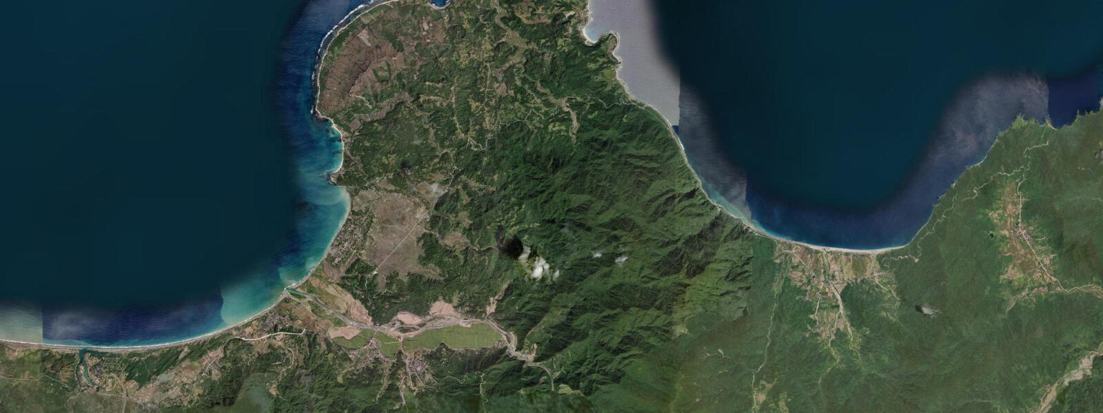
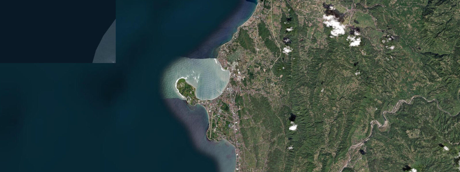
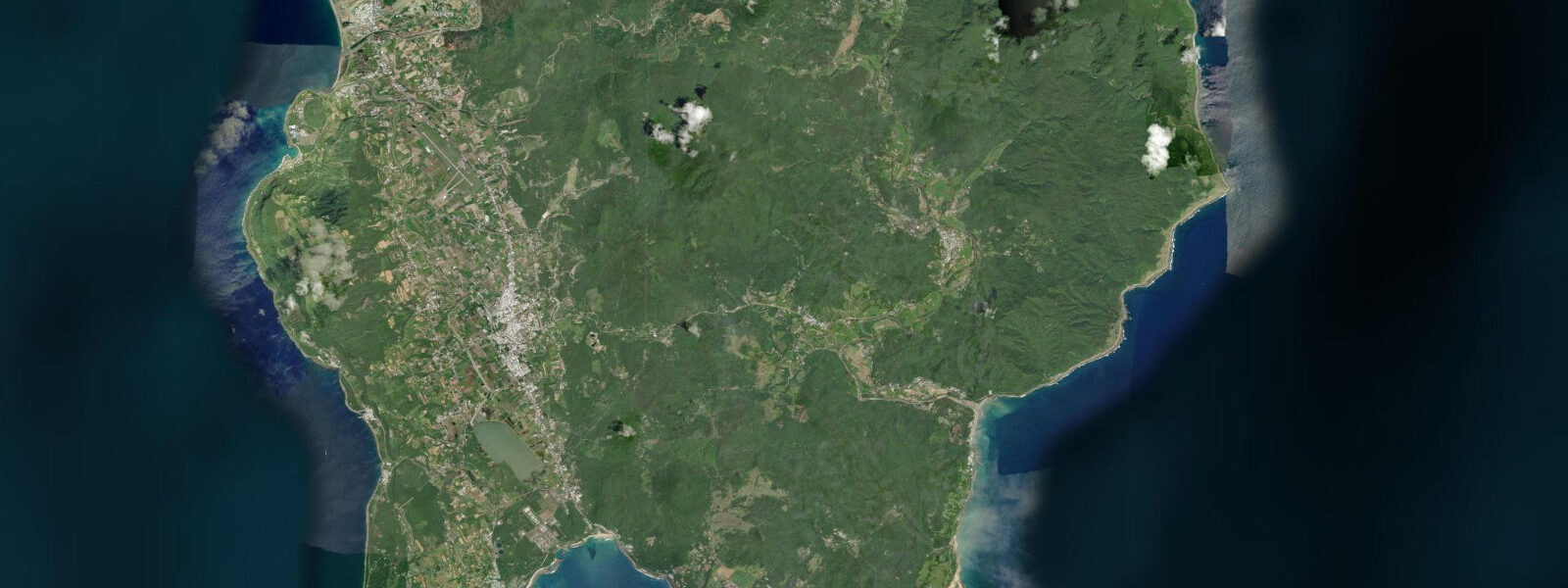
Pagudpud occupies the far northwestern corner of Ilocos Norte, at the northern tip of the Luzon mainland where the South China Sea meets the Luzon Strait. The landscape here is open and windswept: the Bangui Wind Farm, a row of 20 wind turbines spread along 10 kilometres of coastline immediately south of Pagudpud, faces the full northeast fetch of the South China Sea and is one of the most wind-consistent sites in the Philippines — the turbines run at high capacity factor during the NE monsoon season. Pagudpud's two main coastal destinations are Saud Beach and the Blue Lagoon (Maira-ira Beach), separated by a low headland about 5 kilometres apart.
Saud Beach is the wider, more accessible stretch — a crescent of white sand facing northwest, backed by coconut palms, with a calm inshore that works as a swimming beach and a break further out that receives small wind swell in season. The water is a distinct blue-green owing to the proximity to the Luzon Strait deep water; the shallow sandy shelf drops off relatively steeply by Philippine beach standards. Maira-ira Beach (the Blue Lagoon) is accessed by a short trail from the road end above the headland.
The beach sits in a naturally sheltered cove formed by the headland and a limestone point — the Blue Lagoon name refers to the unusually vivid blue-green water colour in the cove, which results from the combination of white sand, shallow water, and direct sunlight. The cove is calmer than Saud Beach because the headland breaks the direct swell exposure, making it swimmable in conditions that push whitecaps onto Saud. 2 metres on the South China Sea side — similar to La Union further south.
The Bangui Wind Farm turbine access road runs along the shoreline between the beach and the wind turbine pylons; the site operates commercially and turbine access is restricted, but the beach below the turbines at the base of the pylons is public shoreline. Fishing along the Ilocos Norte coast targets yellowfin tuna, mahi-mahi, and flying fish in the deeper Luzon Strait water — the Luzon Strait is one of the major current corridors in the western Pacific, connecting the South China Sea to the Pacific Ocean via a channel roughly 350 km wide and 2,400 metres deep. Pelagic fish concentrate on the current edges.
Shore anglers at the rocky Kapurpurawan Rock Formation 8 kilometres south of Pagudpud, with its eroded white limestone pinnacles forming the coastal shelf, work the surge channels between the coral heads on the incoming tide. 5 hours; from Manila via the Tarlac–Pangasinan–La Union–Ilocos Sur–Ilocos Norte coastal highway, allow 8 to 10 hours. Most visitors combine Pagudpud with the Vigan heritage city (2 hours south of Laoag) into a 3-day Ilocos Norte circuit.
The Paoay Church (San Agustin Church Paoay, 1710, Baroque style with distinctive earthquake-designed flying buttresses) is approximately 35 km south of Laoag and an easy route stop. Accommodation at Pagudpud is concentrated at Saud Beach — a mix of beach resorts and budget guesthouses. The beach at Saud is swimmable and calm for most of the year except during active Amihan (NE monsoon) periods; the casuarina-backed stretch behind the beach reduces the wind at the waterline.
Photographers favour the late afternoon light at both Saud Beach and the Bangui turbine line, when the golden light from the west backfills the turbines and hits the white sand at a low angle. 3 metres on height. PAGASA is the authoritative Philippine tide source.
Tide questions about Pagudpud
Quick answers to the most common questions about tide times, range, and water access at Pagudpud.
What is the Blue Lagoon (Maira-ira Beach) and why is the water so blue?
Maira-ira Beach — known locally as the Blue Lagoon — is a sheltered cove 5 km east of Saud Beach, accessed by a short trail from the road end. The vivid blue-green water colour results from the combination of white coral-sand floor, relatively shallow depth (1 to 3 metres in the inner cove), and direct sunlight — the same optical effect that gives turquoise colour to shallow tropical lagoons across the Pacific. The headland and a limestone point partially shelter the cove from the direct northwest swell exposure, making the water calmer than the open Saud Beach. The cove is swimmable throughout the tidal cycle; the visible water colour is most intense around midday with the sun overhead.
What is the Bangui Wind Farm, and can visitors get close to the turbines?
The Bangui Wind Farm is a 33-MW commercial wind installation of 20 turbines (1.65 MW each, 70 m rotor diameter) strung along 10 km of the Ilocos Norte coastline. The turbines run at high capacity factor during the NE monsoon (October to March) when the northeast fetch across the South China Sea delivers sustained high wind. The installation was the first offshore-adjacent wind farm in Southeast Asia when commissioned in 2005. The turbine access road and turbine bases are fenced commercial property; visitors can photograph from the beach below the pylons (public shoreline). The visual spectacle of the turbines in line above the beach is the primary visitor draw, not access to the machines themselves.
What is the typical tide range at Pagudpud, and does it affect beach conditions?
Spring range at Pagudpud is approximately 0.8 to 1.2 metres on the South China Sea side — modest by global standards. The tidal swing does change the visible beach width: at low spring tide, Saud Beach gains roughly 15 to 20 metres of additional sand flat below the normal high-water line, and the rocky outcrops at either end of the beach expose. At high tide the beach narrows back to the coconut-palm line. At Maira-ira cove the change is subtler because the protected geometry buffers the full tidal range. The dominant variable for beach and swimming conditions is wind and swell, not tide.
Where do these tide predictions come from?
Open-Meteo Marine, a gridded global ocean model; accuracy is typically ±45 minutes on timing and ±0.2 to 0.3 metres on height. PAGASA (Philippine Atmospheric, Geophysical and Astronomical Services Administration) is the authoritative Philippine tide source. For the Pagudpud area, PAGASA's Ilocos Norte marine forecast and the La Union gauge predictions provide the closest harmonic reference. The Luzon Strait wind forecast from PAGASA is the more relevant planning input for any visit, as Pagudpud is one of the windiest points on the Luzon coastline.
Is this safe to use for navigation?
No. The Luzon Strait is one of the major deep-water passages in the western Pacific, carrying significant commercial shipping, naval vessels, and submarine cables between the Pacific and the South China Sea. The Ilocos Norte coastline has several offshore shoals, and the Bangui coast has wind turbine foundations extending to the seabed. For vessel operations in the area, use NAMRIA Philippine charts and the Philippine Coastal Pilot. PAGASA publishes authoritative marine forecasts and tide predictions for the Luzon north coast. TideTurtle predictions here are for coastal planning only and are not calibrated to a local harmonic gauge.
8-day tide table — Pagudpud
Heights relative to MSL. Predictions: Open-Meteo Marine (MeteoFrance SMOC, 0.08° grid) — heights relative to MSL (not chart datum / LAT). Model-derived.
| Day | Type | Time | Height |
|---|---|---|---|
| Sun 21 Jun | Low | 08:00 | 0.8m |
| High | 11:15 | 1.0m | |
| Low | 20:00 | 0.6m | |
| Mon 22 Jun | — | ||
| Tue 23 Jun | — | ||
| Wed 24 Jun | High | 03:00 | 0.9m |
| Low | 10:00 | 0.8m | |
| Thu 25 Jun | High | 03:45 | 1.1m |
| Fri 26 Jun | Low | 20:15 | 0.5m |
| Sat 27 Jun | High | 05:00 | 1.1m |
| Low | 20:45 | 0.5m | |
| Sun 28 Jun | High | 05:40 | 1.2m |