Pisco, Peru tide times
Pisco, Peru tide forecast — heights relative to MSL.
Today's tide times for Pisco, Peru
Tide times at Pisco, Peru on Saturday, 4 July 2026: first low tide at 01:18, first high tide at 09:00, second low tide at 16:45, second high tide at 20:50. Sunrise 06:29, sunset 17:49.
Tide chart for Pisco, Peru
24-hour cosine-interpolated curve around the present moment. Heights relative to MSL. Predictions: Predictions: Open-Meteo Marine (MeteoFrance SMOC, 0.08° grid).
Sun, moon and conditions on Sat 04 Jul
Snapshot at build time — refreshes daily. Sea state from Open-Meteo Marine.
Highs and lows next 7 days
Every predicted high and low for the next week, with the daily tidal coefficient (0–120; higher = bigger swing, > 95 means stronger currents).
Other spots nearby
The three closest curated TideTurtle locations to Pisco, Peru, measured by great-circle distance.

Today's solunar windows
Solunar tradition: major periods are the ≈3h windows around moon transit and opposition; minor are ≈2h around moonrise and moonset. Pair with the local tide stage and wind for the best read.
Cycle dates near Pisco, Peru
Last spring tide on Fri 03 Jul (range 0.7m). Next neap on Sat 04 Jul.
Spring tides cluster around new and full moons (biggest swings). Neap tides land on quarter moons (smallest swings). See the spring tide and neap tide glossary entries for the why.
About tides at Pisco, Peru
A short guide to the coastline at Pisco, Peru — geography, sea state, and what the tide is actually doing under your feet.
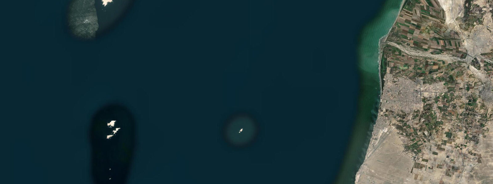
Pisco sits at the northern end of Paracas Bay, sheltered by the Paracas Peninsula to the south and open to the Pacific to the west across the bay mouth. The port handles commercial fishing and bulk cargo, and serves as one of the departure points for boat tours to the Ballestas Islands 20 km to the southwest — a protected archipelago holding Peru's most accessible colony of Humboldt penguins, Peruvian boobies in enormous numbers, and one of the largest South American sea lion haul-outs on the coast.
The tidal pattern is mixed semidiurnal Pacific, influenced by the Humboldt Current: spring range 1.5–2.5 m. Open-Meteo Marine provides forecast data — timing accuracy ±45 minutes, height accuracy ±0.2–0.3 m. At the bay's northern end, the tidal signal is relatively undistorted from the open-coast Pacific pattern, though the bay geometry provides some shelter from wind-driven setup.
The Ballestas Islands boat tour departs from the Pisco or Paracas dock (14 km south) in the early morning. The 2-hour circuit around the islands passes within metres of the guano-covered rocks where Humboldt penguins stand in the surf zone alongside Peruvian boobies, red-legged cormorants, and the ever-present Inca terns. South American sea lions pile onto the lower ledges. Boats must maintain a set distance from the rocks but the viewing is close enough for a 200 mm lens to fill the frame.
For anglers, the Pisco Bay system is productive for corvina and flounder on the sandy bottom at the northern end of the bay, and for bonito and sierra mackerel on the open edges where the current concentrates bait. The pier at the Pisco port is the main shore-fishing access point. Low water on a spring tide exposes sandy flats immediately south of the port that local families wade for shellfish.
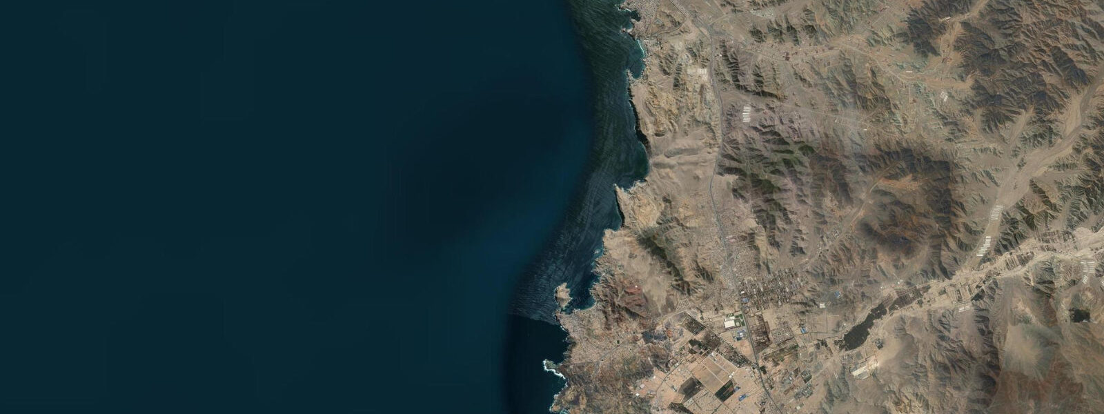
The 2007 earthquake (magnitude 8.0) significantly damaged the city centre of Pisco and the historic San Clemente de Mancera church — reconstruction is ongoing but the colonial core is fragmentary. The newer rebuilt areas and the waterfront malecón are functional. Pisco is primarily a logistics and gateway town for the Paracas Reserve and Ballestas Islands rather than a destination in itself, but it's a useful base with more accommodation options than Paracas town.
Pisco's name attaches to the grape brandy produced in the Ica Valley immediately inland — the pisco-producing region runs from the valleys east of the port south to Nazca. The regional airport at Pisco (Capitán FAP Renán Elías Olivera) handles domestic flights and some Nazca Lines overflight tours.
Tide questions about Pisco, Peru
Quick answers to the most common questions about tide times, range, and water access at Pisco, Peru.
What is the best way to see the Ballestas Islands from Pisco?
Most Ballestas Island tours depart from the dock at Paracas town, 14 km south of Pisco, rather than from Pisco itself — this is the standard tour hub. The speedboat circuit takes approximately 2 hours and departs in the morning (typically 8–10 am) to take advantage of the calmer sea state before the afternoon winds build. The tour passes the Candelabro geoglyph etched into the coastal hillside before reaching the islands. No landing on the islands is permitted — all viewing is from the moving boat. Booking the day before or on the morning of departure is generally possible outside of peak Peruvian school holiday periods.
What is the tidal range at Pisco and how does it affect the bay?
Spring tidal range is 1.5–2.5 m — mixed semidiurnal Pacific with the range driven by the Humboldt Current coast pattern. The bay at Pisco is sheltered from southwest swell by the Paracas Peninsula, so the tidal change is the primary driver of water level variation rather than wave setup. At low water, sandy flats at the northern end of the bay become accessible for shellfish gathering and wading. Open-Meteo Marine provides the tide forecast with ±45-minute timing and ±0.2–0.3 m height accuracy. Anglers and small boat operators launching from the Pisco port use the rising tide window for the most productive approach to the sandy flat species — corvina and flounder.
What damaged the historic centre of Pisco?
The magnitude 8.0 earthquake of 15 August 2007 struck at 6:41 pm local time, causing catastrophic damage to Pisco. Approximately 80% of the city's buildings were destroyed or severely damaged. The historic centre, including the Plaza de Armas and the colonial-era San Clemente de Mancera church, suffered major structural losses. Over 500 people died in Pisco and the surrounding area. Reconstruction has been slow and incomplete — the rebuilt commercial areas and port function normally, but the colonial heritage of the centre is largely gone. Travellers expecting a picturesque historic port will find a partially rebuilt functional town.
How cold is the water at Pisco for swimming?
Sea surface temperature at Pisco is 14–18°C year-round, driven by the Humboldt Current upwelling — cool by the standards of any tropical or subtropical coast. The coolest period is July–October when the upwelling is strongest (temperatures can drop below 14°C). The warmest months are January–April when the ENSO-neutral upwelling relaxes slightly. In El Niño years, temperatures can rise to 20–22°C, which historically has catastrophic effects on the local fishery and seabird colonies. For recreational swimming, a 3 mm wetsuit or shorty is comfortable. Most tourists visiting for the Ballestas Islands tours don't enter the water.
What shore fishing is accessible from the Pisco waterfront?
The Pisco port pier and the beach sections south toward Paracas town give anglers access to the bay bottom at 3–8 m depth — corvina, Peruvian flounder, and occasional lenguado (sole) are the main species on cut bait or squid on the sandy bottom. The outer rocks at the bay entrance hold the same bonito and sierra mackerel that populate the whole Paracas coast — cast metal lures into the current seams at dawn and dusk. Spring low water exposes sandy flats immediately south of the port where locals collect razor clams and small bivalves by wading. A simple hand line or spinning rod with a 3–6 m paternoster rig is the local standard for pier fishing.
7-day tide table — Pisco, Peru
Heights relative to MSL. Predictions: Open-Meteo Marine (MeteoFrance SMOC, 0.08° grid) — heights relative to MSL (not chart datum / LAT). Model-derived.
| Day | Type | Time | Height |
|---|---|---|---|
| Sat 04 Jul | Low | 01:18 | -0.1m |
| High | 09:00 | 0.6m | |
| Low | 16:45 | 0.0m | |
| High | 20:50 | 0.2m | |
| Sun 05 Jul | Low | 01:54 | -0.0m |
| High | 22:00 | 0.2m | |
| Mon 06 Jul | Low | 02:42 | 0.0m |
| High | 09:54 | 0.5m | |
| Tue 07 Jul | Low | 17:54 | -0.1m |
| Wed 08 Jul | High | 00:45 | 0.3m |
| Low | 05:15 | 0.1m | |
| High | 11:06 | 0.4m | |
| Low | 18:06 | -0.1m | |
| Thu 09 Jul | High | 12:00 | 0.4m |
| Low | 18:54 | -0.1m | |
| Fri 10 Jul | High | 12:54 | 0.4m |
| Low | 18:00 | -0.0m |