
Paracas, Peru tide times
Paracas, Peru tide forecast — heights relative to MSL.
Today's tide times for Paracas, Peru
Tide times at Paracas, Peru on Saturday, 4 July 2026: first high tide at 09:04, first low tide at 16:45, second high tide at 21:00. Sunrise 06:29, sunset 17:49.
Tide chart for Paracas, Peru
24-hour cosine-interpolated curve around the present moment. Heights relative to MSL. Predictions: Predictions: Open-Meteo Marine (MeteoFrance SMOC, 0.08° grid).
Sun, moon and conditions on Sat 04 Jul
Snapshot at build time — refreshes daily. Sea state from Open-Meteo Marine.
Highs and lows next 7 days
Every predicted high and low for the next week, with the daily tidal coefficient (0–120; higher = bigger swing, > 95 means stronger currents).
Other spots nearby
The three closest curated TideTurtle locations to Paracas, Peru, measured by great-circle distance.
Today's solunar windows
Solunar tradition: major periods are the ≈3h windows around moon transit and opposition; minor are ≈2h around moonrise and moonset. Pair with the local tide stage and wind for the best read.
Cycle dates near Paracas, Peru
Last spring tide on Fri 03 Jul (range 0.6m). Next neap on Sat 04 Jul.
Spring tides cluster around new and full moons (biggest swings). Neap tides land on quarter moons (smallest swings). See the spring tide and neap tide glossary entries for the why.
About tides at Paracas, Peru
A short guide to the coastline at Paracas, Peru — geography, sea state, and what the tide is actually doing under your feet.
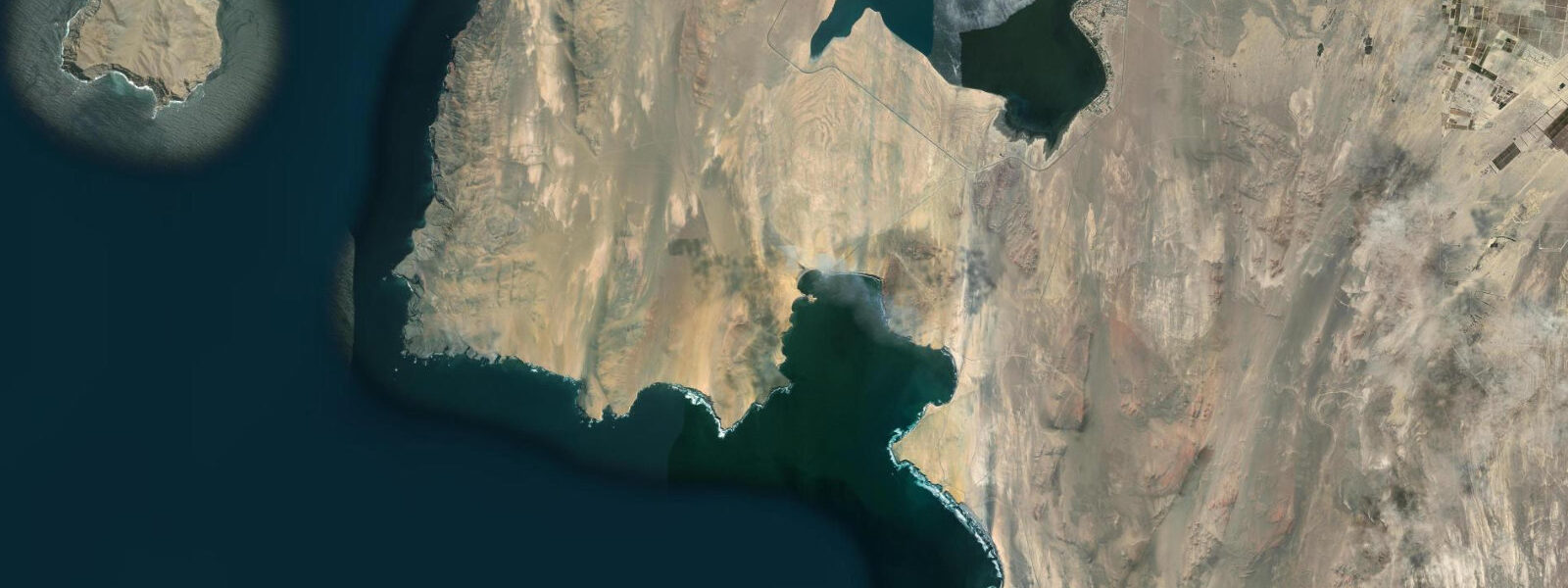
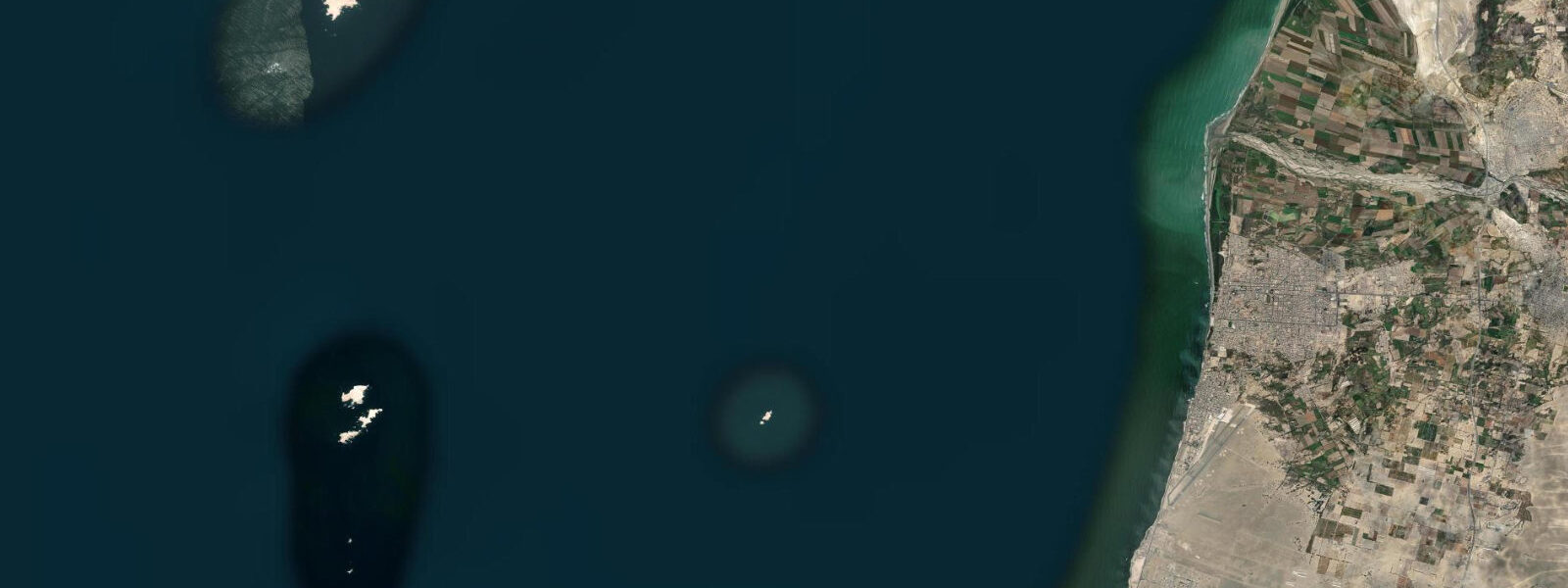
Paracas sits on the northern shore of the peninsula of the same name, 250 km south of Lima on the Pacific coastal desert. The Paracas National Reserve covers the peninsula and the adjacent sea — some 335,000 hectares of protected land and marine territory, encompassing the cold upwelling zone where the Humboldt Current drives one of the most productive marine ecosystems on Earth. The Ballestas Islands, 20 km offshore from El Chaco port, hold approximately 150,000 Humboldt penguins, tens of thousands of Peruvian boobies, fur seal colonies, and dolphin pods that are present year-round on the nutrient-rich cold water.
The tidal regime at Paracas is Pacific semidiurnal with a mean range of approximately 1.0 to 1.5 metres — larger than the Caribbean locations, with the tide playing a more significant role in planning activities on the beach and at the reserve access points. Two clearly distinct highs and two lows per day characterize the pattern, with a modest diurnal inequality. The Humboldt Current upwelling periodically creates mesosynoptic sea-level anomalies — the cold water wedging shoreward from offshore can depress coastal sea level by several centimetres over multi-day periods, which appears as an apparent shift in the tide prediction. On longer timescales, El Niño years warm the surface water, suppress the upwelling, and shift the sea level anomaly the other way.
The Ballestas Islands are reached by fast zodiac or pangas from El Chaco dock in 30 minutes. The crossing is over open Pacific; sea state depends on the wind and the swell forecast rather than the tide. The tours run standard morning departures (around 07:00–08:00) to catch the birds during their most active feeding period. The sealions on the island rocks are at their most accessible at low tide when the haul-out platforms are fully exposed; a spring low, around 0.2 to 0.3 m above chart datum, extends the visible haul-out surfaces significantly. The tour operators run regardless of tide state, but timing a visit to a morning low tide enhances the sea lion viewing.
The Candelabra (Candelabro) geoglyph, carved into the hillside facing the bay north of Paracas, is visible from the boat crossing to the Ballestas — a 180-metre trident-shaped figure whose origin and age are debated (possibly Paracas culture, possibly colonial-era navigation marker). It is not accessible on foot from land.
For anglers, the Humboldt Current upwelling drives one of the most productive inshore fisheries in the world. The anchoveta (Engraulis ringens) schools that support the bird and marine mammal populations also underpin the Peruvian artisanal fishmeal and anchovy fishery based at El Chaco. Sport fishing for corvina (Cilus gilberti) is the target inshore; the fish hold in the surf zone and the tidal rip at the rocky headlands on the falling tide, particularly in the two hours before the predicted low water. The El Chaco pier and the rocky points south of the port are the primary shore-casting stations.
The beaches of Paracas National Reserve south of El Chaco are accessible by car on the reserve's one road (no public transport inside the reserve; entrance fee required). Playa La Mina and Playa Lagunillas are the main beach stops — both are wide, open Pacific beaches with the cold, clear upwelling water, strong rip currents on windy days, and absolute prohibition on swimming (the reserve prohibits swimming at most of its Pacific beaches due to current and swell hazards). The beaches are for wildlife observation, walking, and photography, not swimming.
The dominant atmospheric condition at Paracas is the Paracas wind — a powerful south-to-southwest afternoon wind that builds daily from around 12:00 and can reach 40+ knots by mid-afternoon, driving a veil of sand and dust across the peninsula. Morning activities before 12:00 are calm; afternoon activities on the open peninsula require eye protection and secured equipment.
Predictions on this page come from Open-Meteo Marine, a global gridded ocean model. Accuracy is ±45 minutes on timing and ±0.2 to 0.3 metres on height. For the Peruvian coast, the SENAHMI (Servicio Nacional de Meteorología e Hidrología del Perú) and the DHN (Dirección de Hidrografía y Navegación de la Marina de Guerra del Perú) publish authoritative tidal tables.
Tide questions about Paracas, Peru
Quick answers to the most common questions about tide times, range, and water access at Paracas, Peru.
When is the next high tide at Paracas?
The predicted next high tide at Paracas is shown at the top of this page in Peru Standard Time (PET, UTC-5). Mean range is approximately 1.0 to 1.5 metres — Pacific semidiurnal. The Humboldt Current can produce sea-level anomalies that shift the actual level from the predicted by several centimetres over multi-day periods. Predictions come from Open-Meteo Marine (gridded, ±45 min / ±0.2–0.3 m); the DHN (Peruvian Navy Hydrographic Directorate) publishes the authoritative harmonic tide tables for this coast.
What is the tide range at Paracas and does it affect visits to the Ballestas Islands?
Mean spring range at Paracas is approximately 1.0 to 1.5 metres. A morning spring low tide, around 0.2 to 0.3 m above chart datum, exposes more of the sea lion haul-out platforms at the Ballestas and improves viewing. Tour operators run at fixed morning departure times regardless of tide — timing your visit to coincide with a low or mid-tide morning improves the sea lion observation. The crossing itself (30 minutes by panga) depends on swell and wind, not tide.
Is it safe to swim at Paracas reserve beaches?
Swimming is prohibited at most Paracas National Reserve beaches — the Pacific surf, strong rip currents on wind-driven days, and the reserve management rules all apply. The afternoon Paracas wind (building from 12:00 daily to 40+ knots) creates unsafe conditions for in-water activities. El Chaco has a small beach near the dock where local families swim in the morning calm; it is calmer than the open reserve beaches but the water temperature is 14–17°C even in summer due to the Humboldt upwelling.
What is the Paracas wind and when does it blow?
The Paracas wind is a strong south-to-southwest thermal wind that builds daily over the peninsula, typically starting around 11:30–12:00 and peaking at 25–45 knots by mid-afternoon before easing after sunset. It is driven by the temperature differential between the cold Pacific and the hot desert interior. It blows strongest December through March. Morning activities (boat to Ballestas, driving reserve circuit) should be completed before noon; afternoon outdoor activities require windproof clothing and eye protection.
Is this safe to use for navigation?
No. TideTurtle is a planning tool, not a nautical almanac. Navigation along the Peruvian Pacific coast, including the approach to El Chaco and the Ballestas Islands, requires current charts from the DHN and the relevant Peruvian nautical publications. The strong afternoon Paracas wind and Pacific swell require careful weather routing. Open-Meteo Marine predictions are not a substitute for authoritative harmonic data for any vessel operation.
7-day tide table — Paracas, Peru
Heights relative to MSL. Predictions: Open-Meteo Marine (MeteoFrance SMOC, 0.08° grid) — heights relative to MSL (not chart datum / LAT). Model-derived.
| Day | Type | Time | Height |
|---|---|---|---|
| Sat 04 Jul | High | 09:04 | 0.6m |
| Low | 16:45 | 0.0m | |
| High | 21:00 | 0.1m | |
| Sun 05 Jul | Low | 02:00 | -0.0m |
| High | 22:10 | 0.2m | |
| Mon 06 Jul | Low | 02:50 | 0.0m |
| High | 10:00 | 0.5m | |
| Tue 07 Jul | Low | 03:50 | 0.1m |
| High | 10:42 | 0.4m | |
| Low | 17:54 | -0.1m | |
| Wed 08 Jul | High | 11:15 | 0.4m |
| Low | 18:18 | -0.1m | |
| Thu 09 Jul | High | 12:10 | 0.3m |
| Low | 19:06 | -0.1m | |
| Fri 10 Jul | High | 13:00 | 0.3m |
| Low | 18:00 | -0.0m |