Rabaul, East New Britain, PNG tide times
Rabaul, East New Britain, PNG tide forecast — heights relative to MSL.
Today's tide times for Rabaul, East New Britain, PNG
Tide times at Rabaul, East New Britain, PNG on Saturday, 4 July 2026: first high tide at 10:00am, first low tide at 12:50pm. Sunrise 05:59am, sunset 05:51pm.
Tide chart for Rabaul, East New Britain, PNG
24-hour cosine-interpolated curve around the present moment. Heights relative to MSL. Predictions: Predictions: Open-Meteo Marine (MeteoFrance SMOC, 0.08° grid).
Sun, moon and conditions on Sat 04 Jul
Snapshot at build time — refreshes daily. Sea state from Open-Meteo Marine.
Highs and lows next 7 days
Every predicted high and low for the next week, with the daily tidal coefficient (0–120; higher = bigger swing, > 95 means stronger currents).
Other spots nearby
The three closest curated TideTurtle locations to Rabaul, East New Britain, PNG, measured by great-circle distance.
Today's solunar windows
Solunar tradition: major periods are the ≈3h windows around moon transit and opposition; minor are ≈2h around moonrise and moonset. Pair with the local tide stage and wind for the best read.
About tides at Rabaul, East New Britain, PNG
A short guide to the coastline at Rabaul, East New Britain, PNG — geography, sea state, and what the tide is actually doing under your feet.
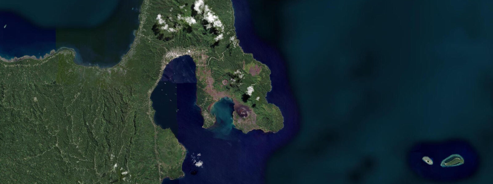
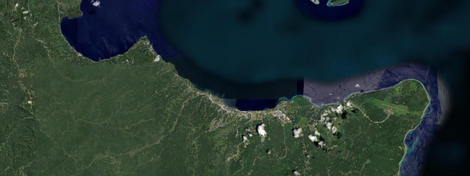
Rabaul sits inside Simpson Harbour, a near-perfect circular bay at the northeastern tip of New Britain Island: the drowned remnant of a volcanic caldera roughly 8 km across, its crater walls forming the rim of hills that surround the harbour on three sides. The single navigable entrance through Blanche Bay to the northeast made this harbour coveted by every colonial and military power that understood Pacific geography. The German colonial administration chose Rabaul as the capital of German New Guinea precisely because of this harbour. The Imperial Japanese Navy chose it as the hub of its South Pacific operations for the same reason.
From January 1942 to August 1945, Rabaul was the most heavily fortified Japanese base in the South Pacific. Over 100,000 Japanese troops were ultimately garrisoned here; the tunnel networks hand-excavated into the volcanic hillsides ran for hundreds of kilometres, accommodating submarine pens, hospital wards, ammunition stores, command centres, and aircraft hangars. After Allied air superiority cut the sea supply lines in 1944, those 100,000 troops remained in place — cut off, slowly starving, but never defeated in the field. They surrendered in September 1945 after the war ended. The tunnels are the most extensive surviving example of Japanese WWII fortification in the Pacific; guided tours run through the accessible sections, including the submarine pen and the Japanese barge tunnels at Tavurvur's base.
Then on 19 September 1994, Tavurvur volcano on the eastern harbour rim and Vulcan on the western rim erupted simultaneously. Pyroclastic flows and ash falls buried most of the Rabaul town centre in 24 hours. The 1994 eruption produced one of the most-filmed volcanic events in Pacific history; the photograph of ash-buried Rabaul church towers became the iconic image. The new administrative and commercial centre relocated to Kokopo, 20 km east. Old Rabaul is not demolished — it is partly preserved under and around the ash: the pre-eruption street grid visible in places, some buildings partially excavated and re-used, the intact colonial-era Chinese shophouses standing on the waterfront strip.
Tavurvur still vents steam daily and has erupted on a smaller scale since 1994. The Rabaul Volcanological Observatory monitors activity continuously and posts access advisories; the viewpoint on the caldera rim road gives a direct line of sight to the active crater and is typically open. Climbing the cone requires checking the current advisory. Pacific semidiurnal, spring range 1.5 to 2.0 m at Simpson Harbour. The caldera geometry produces a modest tidal current at the single harbour entrance; the WWII wreck sites inside the harbour are accessible at all tide states, though the entrance current of 0.5 to 1.5 knots on the ebb is relevant for dive boats timing their passage out to the deeper sites beyond Blanche Bay. Predictions on this page come from Open-Meteo Marine (gridded model, ±45 min / ±0.2–0.3 m). The Gazelle Peninsula cultural landscape around Rabaul includes the Tolai people's traditional baining ceremony practices — fire dances using large baining masks conducted at initiation events — which are occasionally accessible to outside visitors through cultural tour operators in Kokopo. The Kokopo Cultural Centre in the new town holds artefacts from the colonial, WWII, and traditional Tolai periods in a well-organised museum format; the WWII section complements the outdoor tunnel and field site visits. The Rabaul Caldera is an active volcanic system, and the volcanic cones of Tavurvur and Vulcan sit at the caldera rim close to the water. Tavurvur erupted most recently in 2014, covering much of the former town in ash. The area's extraordinary geological history attracts a specific category of traveller willing to navigate the limited infrastructure; understanding tidal state is essential for accessing the ash-covered foreshore and for timing boat trips to the Simpson Harbour islands. The Simpson Harbour anchorage inside the caldera is one of the most dramatic in the Pacific; yachts shelter here during cyclone season (November through April) but tidal range, at around 1.3 m, is manageable for most deep-keeled vessels. Fishing from the volcanic rock platforms on the caldera rim is influenced by tidal state; the platforms are exposed only at low water and require careful footing on the rough lava surface. War history diving — the harbour holds numerous Second World War wrecks including Japanese Zero fighters and midget submarines — is largely tide-neutral given the depths involved, though surface conditions at the caldera entrance improve on the slack.
Tide questions about Rabaul, East New Britain, PNG
Quick answers to the most common questions about tide times, range, and water access at Rabaul, East New Britain, PNG.
When is the next high tide at Rabaul?
The hero block shows the next predicted high at Rabaul / Simpson Harbour in Papua New Guinea Time (PGT, UTC+10). Pacific semidiurnal, spring range 1.5 to 2.0 m. The caldera harbour entrance runs 0.5 to 1.5 knots on the ebb; dive boats time their exit passage through Blanche Bay to avoid the peak ebb current for the outer harbour wreck sites. Predictions from Open-Meteo Marine (gridded model, ±45 min / ±0.2–0.3 m). The entrance current at Blanche Bay runs 0.5 to 1.5 knots on springs; dive boats timing their exit through the entrance to the outer harbour wreck sites should do so on the flood or at slack.
What is the tidal range at Rabaul?
Spring range runs 1.5 to 2.0 m; neap range about 0.7 to 1.0 m. The caldera basin of Simpson Harbour introduces a slight amplification of the tidal range compared to the open New Britain coast; the 1.5 to 2.0 m spring range is above the Pacific average for this longitude. The harbour depth means the tidal change affects vessel draft and dock access but not beach morphology. The caldera geometry of Simpson Harbour concentrates the tidal current at the single entrance; the 1.5 to 2.0 m spring range is above the Pacific average for this longitude.
Where do these predictions come from?
Open-Meteo Marine, a free gridded global ocean model, accuracy ±45 min / ±0.2–0.3 m. The National Maritime Safety Authority of Papua New Guinea publishes tidal data; Rabaul is a reference station in PNG tide tables. Local dive operators apply empirical timing corrections for the Blanche Bay entrance and the outer harbour wreck sites. The National Maritime Safety Authority of PNG publishes tidal data; Rabaul is a reference station in the PNG tide tables. Local operators apply empirical corrections for the entrance passage.
Is it safe to approach Tavurvur volcano?
Tavurvur is an active volcano with a documented eruption history through 1994 and subsequent smaller events. The Rabaul Volcanological Observatory (RVO) monitors seismic activity and gas emissions continuously, posting access advisories on its website. The caldera rim road viewpoint is typically open during quiet periods; the approach to the base and the cone itself follows the current RVO advisory. Check the RVO website or contact a Kokopo-based tour operator for the current status before planning a volcano visit. The Rabaul Volcanological Observatory website posts real-time activity levels; the observatory is staffed 24 hours and the website is updated within hours of any significant activity change.
Is this safe to use for navigation?
No. TideTurtle is a planning tool. Simpson Harbour, the Blanche Bay entrance, and the East New Britain coast carry commercial shipping and require proper chart navigation. The WWII wrecks inside the harbour create submerged obstructions; dive boat positioning over specific wreck sites is done with local guide knowledge. Use National Maritime Safety Authority of PNG chart products for vessel operations. National Maritime Safety Authority of PNG chart products cover Simpson Harbour and the East New Britain coast; the harbour WWII wreck obstructions are marked on the current charts.
8-day tide table — Rabaul, East New Britain, PNG
Heights relative to MSL. Predictions: Open-Meteo Marine (MeteoFrance SMOC, 0.08° grid) — heights relative to MSL (not chart datum / LAT). Model-derived.
| Day | Type | Time | Height |
|---|---|---|---|
| Sat 04 Jul | High | 10:00 | 0.5m |
| Low | 12:50 | 0.4m | |
| Sun 05 Jul | High | 03:18 | 1.0m |
| Low | 12:50 | 0.4m | |
| Mon 06 Jul | High | 03:00 | 0.9m |
| Tue 07 Jul | — | ||
| Wed 08 Jul | — | ||
| Thu 09 Jul | — | ||
| Fri 10 Jul | — | ||
| Sat 11 Jul | Low | 09:00 | 0.1m |