Kokopo, East New Britain tide times
Kokopo, East New Britain tide forecast — heights relative to MSL.
Today's tide times for Kokopo, East New Britain
Tide times at Kokopo, East New Britain on Saturday, 4 July 2026: first low tide at 12:15pm. Sunrise 05:59am, sunset 05:51pm.
Tide chart for Kokopo, East New Britain
24-hour cosine-interpolated curve around the present moment. Heights relative to MSL. Predictions: Predictions: Open-Meteo Marine (MeteoFrance SMOC, 0.08° grid).
Sun, moon and conditions on Sat 04 Jul
Snapshot at build time — refreshes daily. Sea state from Open-Meteo Marine.
Highs and lows next 7 days
Every predicted high and low for the next week, with the daily tidal coefficient (0–120; higher = bigger swing, > 95 means stronger currents).
Other spots nearby
The three closest curated TideTurtle locations to Kokopo, East New Britain, measured by great-circle distance.
Today's solunar windows
Solunar tradition: major periods are the ≈3h windows around moon transit and opposition; minor are ≈2h around moonrise and moonset. Pair with the local tide stage and wind for the best read.
About tides at Kokopo, East New Britain
A short guide to the coastline at Kokopo, East New Britain — geography, sea state, and what the tide is actually doing under your feet.
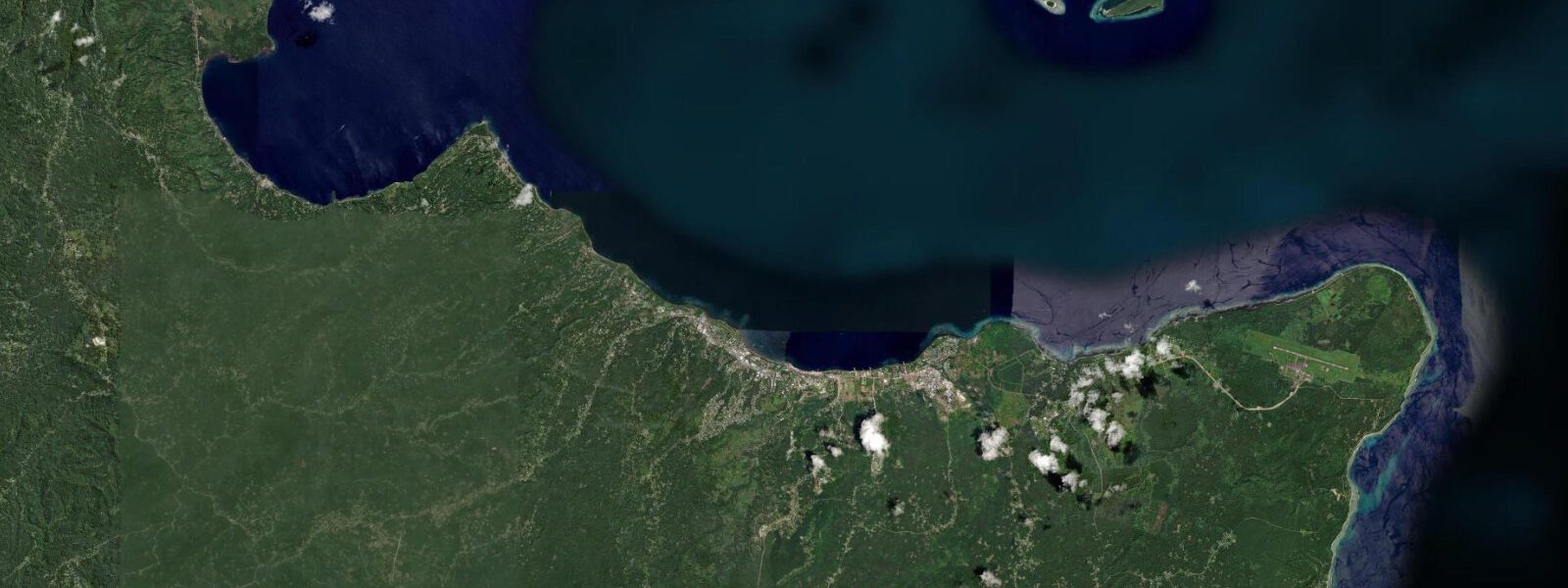
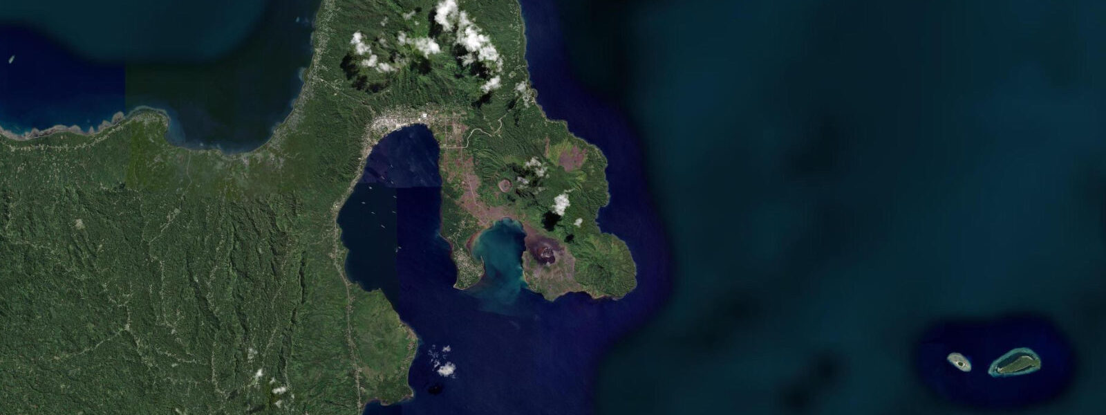
Kokopo is the provincial capital of East New Britain, built on the shore of Blanche Bay after the 1994 volcanic eruption that buried much of old Rabaul in volcanic ash and pyroclastic debris. The eruption of Tavurvur and Vulcan in September 1994 destroyed approximately 80 percent of Rabaul's buildings, and the provincial government and most commercial operations relocated 18 kilometres along the bay shore to Kokopo. Rabaul itself was not completely abandoned — a small community remains, surrounded by ash fields and crumbling colonial buildings — but Kokopo is now the functional capital. Tavurvur is still active; its perfect ash cone is visible 15 kilometres across the bay from Kokopo's waterfront.
Blanche Bay is a drowned volcanic caldera, and its harbour geography reflects this origin: a near-circular enclosed bay, deep in the centre, with narrow entrances on the eastern side that create tidal flow through the passage on the flood and ebb. The town's waterfront faces southwest into the bay, protected from the Pacific swell that wraps around the Cape Gazelle Peninsula to the north.
Tide data for Kokopo is sourced from Open-Meteo Marine's global ocean model. Timing accuracy is within ±45 minutes; height accuracy is within ±0.2 to 0.3 metres. East New Britain experiences mixed semidiurnal tides with a spring range of approximately 1.5 to 2.5 metres — notably larger than the small-island Melanesian norm and reflecting the proximity to the Bismarck Sea's open-ocean tidal signal. The diurnal inequality is moderate; the two daily highs and lows differ but not as dramatically as in the northwest Indian Ocean.
For divers, Blanche Bay and the waters around the Cape Gazelle Peninsula hold a significant concentration of World War II wrecks. Japanese ships, aircraft, and harbour infrastructure from the Rabaul area lie in 10 to 45 metres — among the highest density of WWII maritime archaeological material in the Pacific. The most accessible site, the Bismarck (a Japanese merchant vessel), sits in 15 to 30 metres off the shore northeast of Kokopo. Low-tide diving exposes the shallowest wreck sections most clearly; the preferred entry is on the high-water slack to avoid current in the bay entrance.
For history visitors, the Kokopo Museum houses an extensive WWII collection: Japanese military vehicles, artefacts from the tunnel complex dug into the hillsides, and the full historical account of Rabaul's role as Japan's largest Pacific base and the setting of some of the war's more brutal episodes. The tunnel system itself, the Yamamoto Bunkers above Rabaul town, is accessible by road; guided tours run most mornings. The contrast between the wartime tunnel infrastructure and the active volcanic landscape it sits in — Tavurvur still erupting periodically, the ash fields from 1994 still visible — gives Kokopo an historical weight unlike any other Pacific port.
For kayakers and paddlers, Blanche Bay's enclosed geometry makes it one of the more sheltered paddling environments in PNG. The tidal flow through the bay entrance creates a manageable current — detectable but not dangerous — and the bay interior is protected from ocean swell. The 15-kilometre paddle across the bay to the Rabaul waterfront and back is a full-day trip on a calm day; start at the morning high water to ride the ebb across and the flood back.
Fishing in Blanche Bay targets the species that move through the entrance channels with the tidal current: queenfish, trevally, barracuda, and Spanish mackerel are taken on lures from the town beach and from small boats. The best fishing is in the two hours either side of low water when the current is running strongest through the bay entrance and bait fish are concentrated at the flow edges.
Kokopo's waterfront market is active early morning on weekdays, with fish, garden produce, and betelnut from communities across East New Britain. The fish section sees the daily catch from the bay and from nearby reef areas around the Cape Gazelle Peninsula. The town has adequate accommodation and is the standard base for all East New Britain tourism — Rabaul visits, volcano tours, and WWII diving operations all route through Kokopo.
Tide questions about Kokopo, East New Britain
Quick answers to the most common questions about tide times, range, and water access at Kokopo, East New Britain.
What is the tidal range at Kokopo and how does it affect diving the WWII wrecks?
Kokopo experiences mixed semidiurnal tides with a spring range of roughly 1.5 to 2.5 metres. The bay entrance channels create a tidal current on the flood and ebb that affects the shallowest wreck sites. The Bismarck wreck in 15 to 30 metres is most accessible on the high-water slack — current speed through the bay drops to near-zero for 20 to 30 minutes around the high, allowing controlled descent to the shallowest wreck sections. Tide data here comes from Open-Meteo Marine — accuracy ±45 minutes on timing and ±0.2 to 0.3 metres on height. Dive operators in Kokopo time all wreck departures around the tidal schedule.
Can I still visit Rabaul, and is it safe with Tavurvur active?
Old Rabaul town is accessible by road 18 kilometres from Kokopo and is visited regularly for the WWII sites, the volcanic landscape, and the Yamamoto Bunkers. Tavurvur erupts periodically — typically small ash emissions rather than the 1994-scale event — and the Rabaul Volcanological Observatory monitors it continuously. When Tavurvur is in minor eruption, ash falls on the eastern bay area; the volcano is visible from Kokopo across the bay. Access to the summit area is restricted during activity, but the broader Rabaul town area and the bunker sites remain open except during significant eruptions. Check current activity status with the RVO before visiting.
How do I access the WWII tunnel and bunker complex near Kokopo?
The Yamamoto Bunkers complex — tunnels dug into the hillside above Rabaul town that served as Japanese command headquarters — is the primary accessible site and is signposted from Rabaul's main street. Guided tours run most mornings; local guides provide historical context for the tunnels, the Japanese command structure, and the final years of the Rabaul garrison. The Kokopo Museum is a second site, 18 kilometres away in Kokopo itself. Additional Japanese tunnel systems and gun emplacements are scattered across the Cape Gazelle Peninsula and in the hills above Kokopo, many accessible on foot with a guide.
What fishing is productive around Blanche Bay?
The tidal current through Blanche Bay's entrance channels concentrates baitfish and the predators that follow them. The two hours either side of low water — when current speed is highest in the entrance — produce the best results for queenfish, trevally, barracuda, and Spanish mackerel on lures and jigs. Shore fishing from the Kokopo waterfront works the same tidal phase. Small boat fishing around the Cape Gazelle Peninsula accesses reef structure outside the bay where coral trout and red bass are present on light to medium tackle. Local boat hire is available at the waterfront market.
What is the best base for exploring East New Britain — Kokopo or Rabaul?
Kokopo is the correct base for the majority of visitors. It has the airport, the main hotels, the museum, and the logistical infrastructure for diving, tours, and onward travel. Rabaul has limited accommodation — a couple of guesthouses in a town that is still partly buried in the 1994 ash fields — and is best treated as a day excursion from Kokopo. The 18-kilometre drive takes 20 to 30 minutes on sealed road. For liveaboard dive operations or specific WWII site work, some operators base out of Rabaul's waterfront for proximity to the wreck sites, but most visiting divers sleep in Kokopo and run early-morning boat departures across the bay.
8-day tide table — Kokopo, East New Britain
Heights relative to MSL. Predictions: Open-Meteo Marine (MeteoFrance SMOC, 0.08° grid) — heights relative to MSL (not chart datum / LAT). Model-derived.
| Day | Type | Time | Height |
|---|---|---|---|
| Sat 04 Jul | Low | 12:15 | 0.3m |
| Sun 05 Jul | — | ||
| Mon 06 Jul | — | ||
| Tue 07 Jul | — | ||
| Wed 08 Jul | High | 01:00 | 0.8m |
| Thu 09 Jul | Low | 09:45 | 0.3m |
| Fri 10 Jul | — | ||
| Sat 11 Jul | High | 00:00 | 1.0m |
| Low | 09:00 | 0.1m | |