Pearl Islands, Panama tide times
Pearl Islands, Panama tide forecast — heights relative to MSL.
Today's tide times for Pearl Islands, Panama
Tide times at Pearl Islands, Panama on Friday, 19 June 2026: first low tide at 12:07am, first high tide at 06:31am, second low tide at 12:37pm, second high tide at 06:46pm. Sunrise 05:58am, sunset 06:36pm.
Tide chart for Pearl Islands, Panama
24-hour cosine-interpolated curve around the present moment. Heights relative to MSL. Predictions: Predictions: Open-Meteo Marine (MeteoFrance SMOC, 0.08° grid).
Sun, moon and conditions on Fri 19 Jun
Snapshot at build time — refreshes daily. Sea state from Open-Meteo Marine.
Highs and lows next 7 days
Every predicted high and low for the next week, with the daily tidal coefficient (0–120; higher = bigger swing, > 95 means stronger currents).
Other spots nearby
The three closest curated TideTurtle locations to Pearl Islands, Panama, measured by great-circle distance.
Today's solunar windows
Solunar tradition: major periods are the ≈3h windows around moon transit and opposition; minor are ≈2h around moonrise and moonset. Pair with the local tide stage and wind for the best read.
Cycle dates near Pearl Islands, Panama
Last spring tide on Thu 18 Jun (range 4.7m). Next neap on Wed 24 Jun.
Spring tides cluster around new and full moons (biggest swings). Neap tides land on quarter moons (smallest swings). See the spring tide and neap tide glossary entries for the why.
About tides at Pearl Islands, Panama
A short guide to the coastline at Pearl Islands, Panama — geography, sea state, and what the tide is actually doing under your feet.
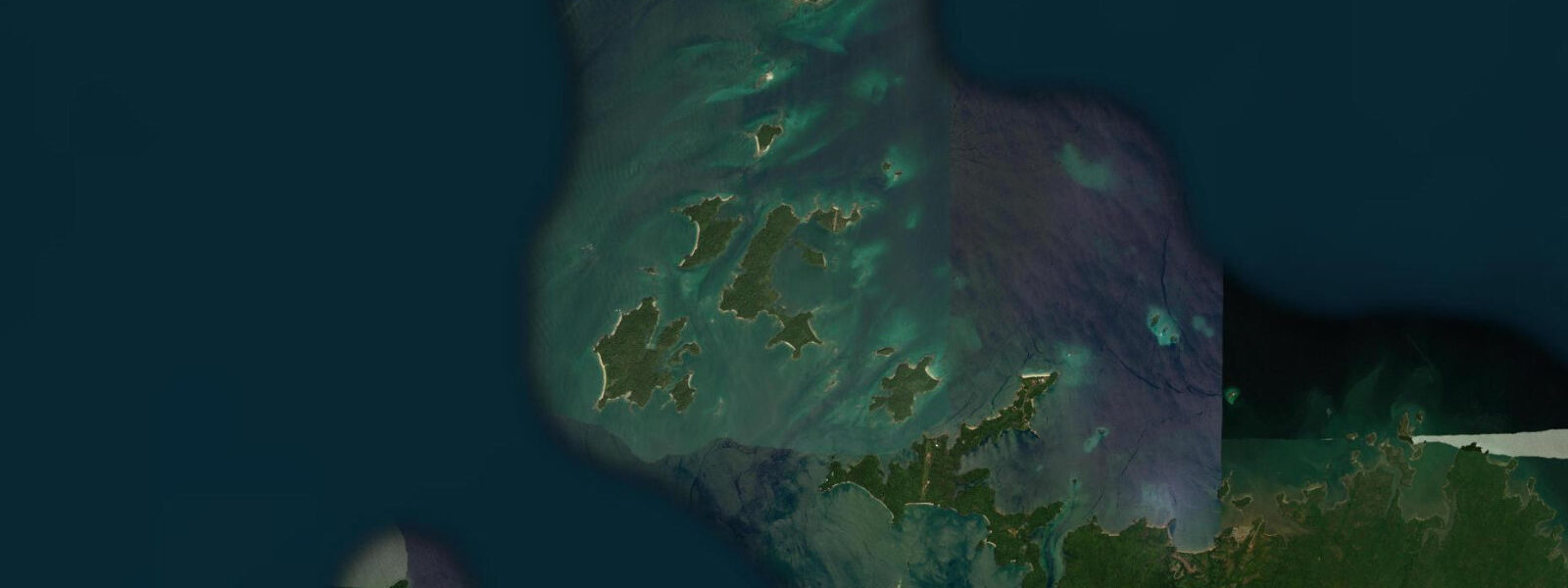
The Pearl Islands sit 60 kilometres southeast of Panama City in the Gulf of Panama, an archipelago of more than 90 islands and islets strung across warm Pacific water. From the northwest side of Isla Contadora on a clear morning, Panama City's skyline is visible on the horizon. The gulf's funnel geometry — wide mouth opening to the Pacific, narrowing toward the coast — produces the largest tidal range in Central America. Spring tides run 4.0–5.5 m, semidiurnal, two full cycles per day. Neap tides compress the range to 2.0–3.0 m but never eliminate the drama.
The consequence of that tidal range is immediate on the ground. Around Isla Contadora, the three main beaches — Playa Ejecutiva, Playa Larga, and Playa de Las Suecas — change character completely through the cycle. At low spring water, tidal flats extend 200–400 m into the shallow bays on the sheltered side of the island. That expanse of exposed sand and seagrass flat is dry, walkable, and warm underfoot by mid-morning. Four hours later the same flat is under a metre and a half of water. Beach families need to read that rhythm before setting down for the day: pick a position at mid-tide, know which direction the waterline is moving, and bring an anchor for umbrellas when the afternoon wind picks up.
For kayakers and snorkellers, high water opens passages between the outer islets that are too shallow at low tide for anything but wading. The reef systems around the smaller islands — particularly the cluster south of Isla del Rey — show clearly at low water and become accessible for drift snorkelling on the flood as current pushes through the channels. Tidal current between islands can run 1–2 knots on a spring flood; plan crossings to run with the current, not against it.
The Pearl Islands carry a specific history that the water has always shaped. Spanish colonial pearl exports from the Las Perlas fishery financed significant portions of the conquest of the Americas. Inca ransom gold passed through Panama City; Las Perlas pearls funded fleets. The archipelago was the most productive oyster pearl fishery in the western hemisphere for two centuries, and the name is not metaphor — the islands were literally named for what came out of the water. The fishery collapsed under overexploitation, and commercial pearl diving ended, but the context gives the place a weight beyond the resort brochure version of itself.
Isla San José, the second-largest island in the archipelago, holds a private eco-resort and some of the most intact dry tropical forest in Panama. Isla del Rey is the largest — inhabited, with small fishing communities that still work the gulf for tuna and snapper. The contrast between the resort island of Contadora and the working communities on Del Rey reflects the archipelago's dual character: international visitor traffic on one end, Pacific fishing culture on the other.
Humpback whales move into the Gulf of Panama from July through November. These are Southern Hemisphere humpbacks (Megaptera novaeangliae) using the equatorial Pacific as a winter breeding and calving ground. Las Perlas is one of the most consistent sighting locations on the Pacific coast of Central America. Boats from Contadora run dedicated whale-watching trips from late July; casual sightings from inter-island ferries are common through September and October. The whales are not predictable on any given day, but the season is reliable enough that July through October is when to go if that's the priority.
Anglers working the gulf target yellowfin tuna, wahoo, mahi-mahi, and Pacific sailfish in the blue water beyond the archipelago. Inshore, the tidal channels between islands hold roosterfish and jack on the tide changes. Fishing the incoming tide through the narrow passes between the outer islands is the local technique — current concentrates baitfish, and the predators stack up behind the pinch points.
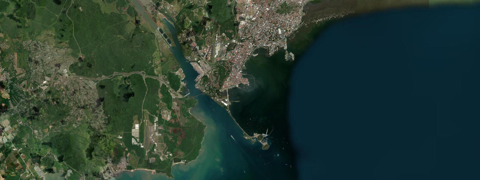
Access to Isla Contadora is either a 30-minute flight from Panama City's Albrook Airport on small charter aircraft, or a 90-minute fast-ferry crossing from the Causeway at Amador. The sea crossing is rougher in the afternoon when the gulf trade wind builds; morning departures are more comfortable. The island has a small resort airstrip, two hotels, and a handful of rental properties. Most day visitors take the ferry and return the same day.
Tide data for Pearl Islands, Panama comes from the Open-Meteo Marine API, a gridded model product. Timing accuracy is ±45 minutes, height accuracy ±0.3 m — usable for trip planning, not for navigation.
Tide questions about Pearl Islands, Panama
Quick answers to the most common questions about tide times, range, and water access at Pearl Islands, Panama.
What is the tidal range at the Pearl Islands and when does it peak?
The Pearl Islands experience semidiurnal tides — two highs and two lows per day — driven by the Gulf of Panama's funnel geometry. Mean spring range is 4.0–5.5 m, the largest in Central America. Spring tides occur around new and full moon, roughly every two weeks. Neap tides reduce the range to 2.0–3.0 m. Low spring water around Isla Contadora exposes tidal flats extending 200–400 m into the shallow bays; high spring water covers them completely. Check the tide table for the day before planning any beach activity — the difference between a wide sand flat and waist-deep water is a matter of hours.
When is the best time to see humpback whales at Las Perlas?
Southern Hemisphere humpback whales (Megaptera novaeangliae) use the Gulf of Panama as a winter breeding and calving ground from July through November. The waters around the Pearl Islands are among the most reliable sighting locations on the Central American Pacific coast. Peak activity is typically August through October, when calves are present alongside adults. Dedicated whale-watching boats operate from Isla Contadora during the season. Sightings from inter-island ferries are common throughout the season. There is no guaranteed sighting on any single day, but the seasonal presence is consistent year to year.
How do I get to Isla Contadora from Panama City?
Two options: a 30-minute charter flight from Albrook Airport in Panama City, or a 90-minute fast-ferry crossing from the Causeway at Amador. The sea crossing is rougher in the afternoon when the gulf trade wind picks up — morning departures are considerably more comfortable. The island has a small resort airstrip that receives scheduled charter services. Most day visitors take the morning ferry and return in the early afternoon. Overnight accommodation is available at two hotels and several rental properties on the island. The ferry option is cheaper; the flight is faster and weather-independent.
Is kayaking between the Pearl Islands safe with such a large tidal range?
Kayaking the archipelago is excellent but requires respect for tidal current. Spring flood and ebb currents in the narrow passes between islands run 1–2 knots; in confined channels between the outer islets, potentially higher. Plan crossings to move with the current, not against it. High water opens shallow passages that are impractical at low tide; low water exposes reef structure that can be hazardous to navigation in a kayak if you don't know the ground. Bring a tide table, plan your route around tidal windows, and do not attempt inter-island crossings in the afternoon when gulf trade wind and opposing current combine.
What is the pearl-fishing history of Las Perlas?
The Archipiélago de Las Perlas was the most productive oyster pearl fishery in the western hemisphere during the Spanish colonial period, from the early 16th century through the 18th century. Spanish colonial pearl exports from Las Perlas funded significant military and administrative operations across the Americas. Indigenous divers were used — and destroyed — in the fishery under forced-labour conditions. The archipelago's name reflects its commercial identity: these were the islands that produced the pearls. The fishery collapsed under centuries of overexploitation. Commercial pearl diving ended long before the 20th century, and the pearl oyster (Pinctada mazatlanica) populations have not recovered to anything near historical abundance.
7-day tide table — Pearl Islands, Panama
Heights relative to MSL. Predictions: Open-Meteo Marine (MeteoFrance SMOC, 0.08° grid) — heights relative to MSL (not chart datum / LAT). Model-derived.
| Day | Type | Time | Height |
|---|---|---|---|
| Fri 19 Jun | Low | 00:07 | -2.0m |
| High | 06:31 | 2.8m | |
| Low | 12:37 | -1.5m | |
| High | 18:46 | 2.6m | |
| Sat 20 Jun | Low | 01:01 | -1.7m |
| High | 07:18 | 2.6m | |
| Low | 13:35 | -1.3m | |
| High | 19:36 | 2.3m | |
| Sun 21 Jun | Low | 01:57 | -1.4m |
| High | 08:09 | 2.4m | |
| Mon 22 Jun | Low | 02:52 | -1.2m |
| High | 09:04 | 2.2m | |
| Low | 15:28 | -1.1m | |
| High | 21:34 | 1.7m | |
| Tue 23 Jun | Low | 03:44 | -1.0m |
| High | 10:07 | 2.0m | |
| Low | 16:21 | -1.0m | |
| High | 22:48 | 1.6m | |
| Wed 24 Jun | Low | 04:35 | -0.9m |
| High | 11:15 | 1.9m | |
| Low | 17:14 | -0.9m | |
| High | 23:56 | 1.6m | |
| Thu 25 Jun | Low | 05:28 | -0.7m |
| High | 12:15 | 1.9m | |
| Low | 18:00 | -0.9m |