Red Frog Beach, Panama tide times
Red Frog Beach, Panama tide forecast — heights relative to MSL.
Today's tide times for Red Frog Beach, Panama
Tide times at Red Frog Beach, Panama on Saturday, 4 July 2026: first high tide at 03:42am, first low tide at 10:00pm. Sunrise 06:13am, sunset 06:52pm.
Tide chart for Red Frog Beach, Panama
24-hour cosine-interpolated curve around the present moment. Heights relative to MSL. Predictions: Predictions: Open-Meteo Marine (MeteoFrance SMOC, 0.08° grid).
Sun, moon and conditions on Sat 04 Jul
Snapshot at build time — refreshes daily. Sea state from Open-Meteo Marine.
Highs and lows next 7 days
Every predicted high and low for the next week, with the daily tidal coefficient (0–120; higher = bigger swing, > 95 means stronger currents).
Other spots nearby
The three closest curated TideTurtle locations to Red Frog Beach, Panama, measured by great-circle distance.
Today's solunar windows
Solunar tradition: major periods are the ≈3h windows around moon transit and opposition; minor are ≈2h around moonrise and moonset. Pair with the local tide stage and wind for the best read.
About tides at Red Frog Beach, Panama
A short guide to the coastline at Red Frog Beach, Panama — geography, sea state, and what the tide is actually doing under your feet.
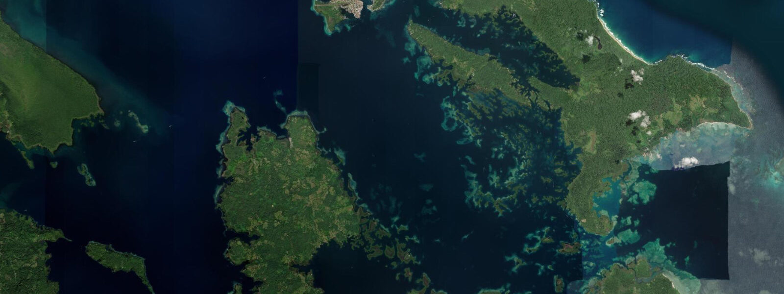
Red Frog Beach is on the Caribbean-facing south coast of Isla Bastimentos, the second-largest island in the Bocas del Toro archipelago. Access is by water taxi from Bocas del Toro town to the Bastimentos dock at Old Bank, then a 15-minute walk across a low forest ridge on a maintained trail, or by direct water taxi to the beach itself on calmer days. The beach is named for the Oophaga pumilio population in the adjacent forest — the Bocas del Toro endemic red morph of the strawberry poison-dart frog, found in density throughout the leaf litter and low vegetation of the coastal forest.
The beach itself is a 1.2-kilometre arc of white-to-cream sand curving between two rocky headlands. The south-facing orientation means it receives a direct Caribbean swell from the south and southeast, producing a shore break absent from the sheltered inner bay beaches. On calm days the water is gin-clear over the reef patches directly offshore — visibility reaches 15 metres in the absence of surge — and the fringing reef starts at chest depth. On days with any significant swell, the shore break breaks hard on the sand and the entry-exit to the reef requires timing the gaps between sets.
The tidal regime at Red Frog Beach is the standard Bocas del Toro microtidal pattern: spring range 20 to 40 centimetres. The small tidal movement does not materially change the character of the beach — the sand flat width varies by a few metres between high and low, and the reef depth above the coral surface changes by at most 20 centimetres. The dominant variable in surf and snorkelling conditions is the swell: Caribbean swells from the northeast trade window produce cleaner, more consistent surf; south and southeast swells push directly into the bay and are less organised on the shore break.
The reef at Red Frog Beach is part of the Bastimentos National Marine Park, the first marine park established in Central America. The park covers the reef system, the seagrass beds, and the nesting beaches on the outer Bastimentos coast; the leatherback, hawksbill, and green turtle nesting season runs from March through September, with peak activity from May through August. Rangers from the national park authority (ANAM) patrol the beach at night during nesting season; visitors who encounter a nesting turtle should observe from a minimum distance and follow the ranger's direction on lighting and approach.
Snorkelling directly from the beach reaches the closest reef patches within five minutes of the waterline. The reef at Red Frog has coral coverage that reflects the park protection: brain coral heads 1 to 2 metres in diameter, gorgonian fans in the 5 to 8 metre zone, and the invertebrate density that comes with low fishing pressure. The fish species list includes sergeant majors, parrotfish, blue tang, and the spotted eagle ray that works the sand channels between coral heads. Nurse sharks rest in the deeper sandy patches; they are not aggressive to snorkellers who maintain distance.
The forest behind the beach is the place to look for the frogs that give the beach its name. The trail from the Bastimentos dock passes through the densest part of the frog habitat — the leaf litter on both sides of the path at 20 to 50 centimetres above ground holds the animals at high density. Morning is the most active period; the frogs are less visible in the midday heat. The larger Bastimentos forest, accessible from trails behind the beach, also holds toucans, three-toed sloths, and the howler monkey population that makes itself known from dawn.
For paddlers, the passage from Old Bank around the eastern headland to Red Frog Beach is a 30-minute kayak in calm conditions, following the sheltered inner coast before rounding the point. The outer bay between Old Bank and Red Frog is exposed to south swell; check the conditions before committing to the open water crossing.
Tide predictions for Red Frog Beach come from Open-Meteo Marine, a global gridded ocean model. Accuracy is within plus or minus 45 minutes on timing and 0.2 to 0.3 metres on height. On a 20 to 40 centimetre spring coast the swell and wind state is more actionable than the tide table for planning water entry.
Tide questions about Red Frog Beach, Panama
Quick answers to the most common questions about tide times, range, and water access at Red Frog Beach, Panama.
How do I get to Red Frog Beach from Bocas del Toro town?
The standard route is a water taxi from the Bocas del Toro town dock to Old Bank on Isla Bastimentos — approximately 15 minutes and a few dollars — followed by a 15-minute walk across the island on a maintained trail. The trail rises gently over the forest ridge and descends to the beach. An alternative is a direct water taxi to the beach itself, available from some operators on the town dock; this is possible in calm conditions but requires the boat to land on the open beach, which is impractical when there is any meaningful swell. Red Frog Beach is also accessible by private boat. Budget around 30 to 45 minutes total travel time from Bocas town regardless of route.
What is the best snorkelling depth and time of day at Red Frog Beach?
The closest reef patches start at chest to waist depth, 50 to 80 metres offshore from the waterline at normal water level. The main reef zone with the densest coral coverage runs from 2 to 8 metres depth. Given the microtidal range of 20 to 40 centimetres, the depth above the reef surface is effectively constant across the tidal cycle. Morning is the most consistent time for visibility: before the afternoon wind develops surface chop and before any rain has run off from the forest behind the beach. Visibility in calm conditions reaches 12 to 15 metres. After significant Caribbean swell or rain, visibility drops to 3 to 5 metres as suspended sediment moves through the water column.
Can I see the red poison-dart frogs even if I am not a naturalist?
Yes. The Oophaga pumilio population along the trail from Old Bank to Red Frog Beach and in the forest immediately behind the beach is dense enough that most visitors with 20 minutes on the trail will see multiple individuals without searching hard. The frogs are bright red-orange, roughly 2 centimetres long, and highly visible on the dark leaf litter and green vegetation at ground level. They are active throughout the day but most visible in the morning. The key is to slow down and scan at ground level rather than walking at normal pace. The frogs are not handled — the skin secretions cause irritation on mucous membranes.
What sea turtle species nest at Red Frog Beach and when?
Three sea turtle species nest on the Bastimentos outer coast beaches within the National Marine Park, including the Red Frog Beach area. Leatherback turtles (the largest, reaching 2 metres in length) nest from March through July, with peak activity in April and May. Green turtles nest from June through September. Hawksbill turtles nest in lower numbers across a similar season. All three are protected under Panamanian law and the park regulations; nesting females must not be disturbed, and lights on the beach are prohibited during nesting season to avoid disorienting hatchlings. Park rangers patrol the beach at night during the season and can arrange guided night observation on specific nesting beaches.
Is the surf at Red Frog Beach suitable for swimmers and children?
Red Frog Beach faces south-southeast and receives direct Caribbean swell without the shelter of the inner bay. On calm days with less than 0.5 metres of swell the shore break is gentle and the water is safe for supervised children and confident swimmers. When any significant swell arrives — common after Caribbean weather systems or during the northeast trade season from November through March — the shore break becomes steep and punchy on the sand and the entry-exit through the surf requires active swimming ability. The microtidal range of 20 to 40 centimetres means tide state does not significantly change the shore break character; swell size is the controlling variable. On days with 1-plus metre swell, children should remain on the sand.
6-day tide table — Red Frog Beach, Panama
Heights relative to MSL. Predictions: Open-Meteo Marine (MeteoFrance SMOC, 0.08° grid) — heights relative to MSL (not chart datum / LAT). Model-derived.
| Day | Type | Time | Height |
|---|---|---|---|
| Sat 04 Jul | High | 03:42 | 0.4m |
| Low | 22:00 | 0.2m | |
| Sun 05 Jul | High | 04:00 | 0.3m |
| Low | 23:00 | 0.2m | |
| Mon 06 Jul | High | 04:10 | 0.3m |
| Low | 10:50 | 0.1m | |
| High | 18:00 | 0.4m | |
| Tue 07 Jul | Low | 11:00 | 0.1m |
| Wed 08 Jul | High | 19:00 | 0.4m |
| Thu 09 Jul | Low | 12:00 | 0.1m |
| High | 19:45 | 0.5m |