Khasab tide times
Khasab tide forecast — heights relative to MSL.
Today's tide times for Khasab
Tide times at Khasab on Saturday, 4 July 2026: first high tide at 04:00am, first low tide at 06:58am, second high tide at 01:26pm, second low tide at 07:11pm. Sunrise 05:26am, sunset 07:11pm.
Tide chart for Khasab
24-hour cosine-interpolated curve around the present moment. Heights relative to MSL. Predictions: Predictions: Open-Meteo Marine (MeteoFrance SMOC, 0.08° grid).
Sun, moon and conditions on Sat 04 Jul
Snapshot at build time — refreshes daily. Sea state from Open-Meteo Marine.
Highs and lows next 7 days
Every predicted high and low for the next week, with the daily tidal coefficient (0–120; higher = bigger swing, > 95 means stronger currents).
Other spots nearby
The three closest curated TideTurtle locations to Khasab, measured by great-circle distance.
Today's solunar windows
Solunar tradition: major periods are the ≈3h windows around moon transit and opposition; minor are ≈2h around moonrise and moonset. Pair with the local tide stage and wind for the best read.
Cycle dates near Khasab
Last spring tide on Sat 04 Jul (range 1.7m). Next spring tide on Fri 10 Jul (range 1.8m). Next neap on Sun 05 Jul.
Spring tides cluster around new and full moons (biggest swings). Neap tides land on quarter moons (smallest swings). See the spring tide and neap tide glossary entries for the why.
About tides at Khasab
A short guide to the coastline at Khasab — geography, sea state, and what the tide is actually doing under your feet.
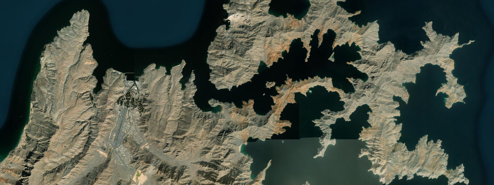
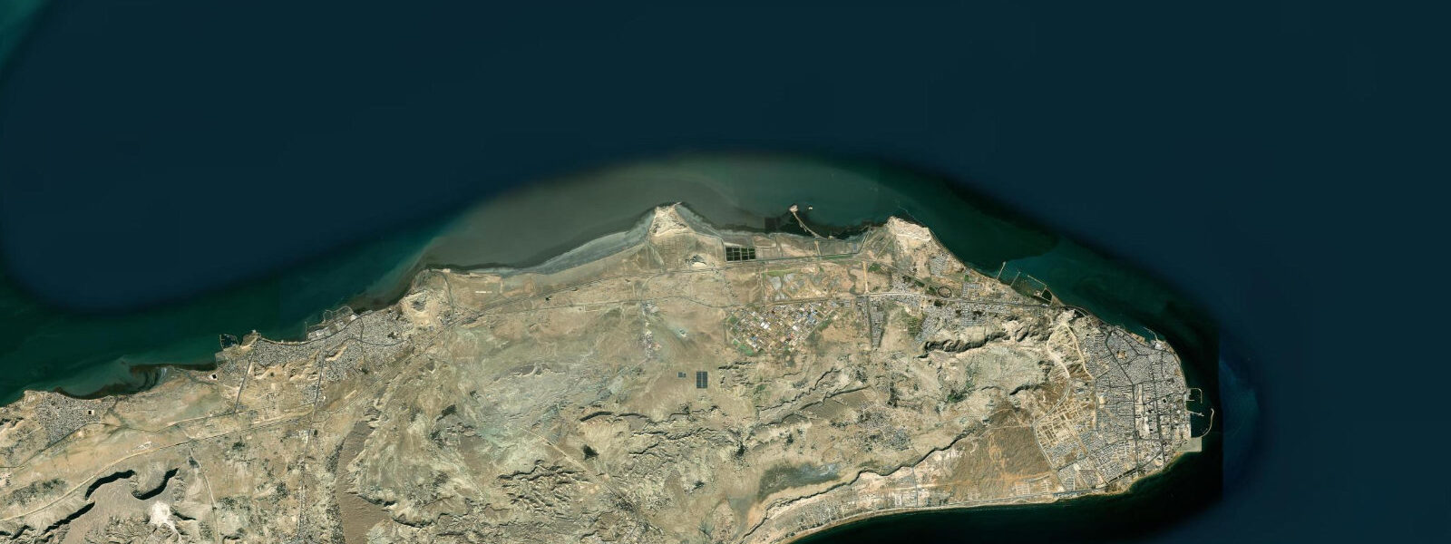
Khasab is the main town of the Musandam Peninsula, a piece of Omani territory that is geographically separated from the rest of Oman by the United Arab Emirates — an exclave connected to mainland Oman only by sea or air, surrounded by UAE territory on three sides and by the Strait of Hormuz and the Gulf of Oman on the fourth. The landscape is extraordinary: the Hajar Mountains rise almost directly from the sea, their limestone ridges cut by deep marine inlets called khors, which have the profile and scale of Norwegian fjords but were carved by tectonic faulting and seismic uplift rather than glaciation. The khor system — Khor ash Sham, Khor Qida, and several smaller inlets — creates a protected waterway network of exceptional clarity and depth.
Dhow cruises on the khors are the defining Khasab activity, and for one reason above all: bottlenose dolphins (Tursiops truncatus) are permanently resident in the khor system and have become habituated to the traditional wooden dhow boats. Encounters are not guaranteed but are described by operators as nearly so in the main season (October to May). The dolphins follow the dhows, bow-ride, and approach to within metres. The khor's sheltered water and exceptional visibility make the interaction as clear from the surface as it is underwater.
The view from the khors toward Iran is a striking geopolitical illustration: at the Strait of Hormuz's narrowest point, 13 km separate Omani Musandam from Iranian Hormozgan province. The Iranian coast is visible on clear days, and the shipping traffic through the strait — one of the world's most critical oil transport corridors, through which roughly 20 percent of global petroleum passes — is a constant background presence. Dhow captains can point out the tanker traffic that moves through the deepwater channel between the two coasts.
Khasab Fort, an early 17th-century Portuguese structure later reinforced by the Omani rulers, stands at the town entrance and houses a small museum of Musandam's maritime culture and history. The fort's watchtower is accessible and gives a panoramic view of the khor entrance and the town.
The tidal regime at Khasab and in the Strait of Hormuz is mixed semidiurnal with a spring range of 1.5 to 2.0 m. The Strait of Hormuz acts as a tidal choke point between the Gulf of Oman to the east and the Persian Gulf to the west; the tidal signal amplifies as it propagates into the shallow Persian Gulf, producing spring ranges of 2 to 3 m at the Gulf's head. At Khasab the tidal current through the strait's navigable channels runs at 1 to 2 knots at springs, and the combination of tidal current, commercial traffic, and the constrained channel geometry makes the outer approaches a significant navigation consideration for small craft.
Predictions on this page come from Open-Meteo Marine, a gridded global ocean model. Accuracy is typically within plus or minus 45 minutes on timing and 0.2 to 0.3 m on height — at Khasab's 1.5 to 2.0 m spring range, the height uncertainty is roughly 10 to 20 percent of the total signal. For authoritative Omani tide data, the Directorate General of Meteorology (DGMET) of the Oman Aviation and Meteorology Authority publishes tide tables for Omani ports including Khasab.
Tide questions about Khasab
Quick answers to the most common questions about tide times, range, and water access at Khasab.
When is the next high tide at Khasab?
The hero block at the top of this page shows the next predicted high at Khasab in local Oman Standard Time (GST, UTC+4). Khasab has a Strait of Hormuz mixed semidiurnal tide — two unequal highs and two unequal lows per day — with a spring range of 1.5 to 2.0 m. The Directorate General of Meteorology (DGMET) in Oman publishes the authoritative tide tables for Khasab and other Omani ports.
What is the tidal range at Khasab?
Mean spring range at Khasab is 1.5 to 2.0 m. The Strait of Hormuz carries a tidal current of 1 to 2 knots at spring tides through the navigable channels between Musandam and Iran. This current is relevant for dhow navigation and for any small craft transiting the strait. Neap range compresses to roughly 0.5 to 1.0 m. The tidal signal amplifies further as it propagates into the shallow Persian Gulf to the west.
Where do these tide predictions come from?
Open-Meteo Marine, a free gridded global ocean model. At Khasab's 1.5 to 2.0 m spring range, the model's typical accuracy (plus or minus 45 minutes, 0.2 to 0.3 m) is 10 to 20 percent of the total signal — more reliable here than at microtidal stations. For authoritative Omani tide data, the Directorate General of Meteorology (DGMET) of the Oman Aviation and Meteorology Authority publishes tide tables for principal Omani ports.
How do I arrange a dhow cruise from Khasab?
Dhow cruises from Khasab operate from the main harbour and from several tour operators in the town. Half-day and full-day options are available, with the full-day cruise covering the main khor system (Khor ash Sham) and offering the best opportunity for dolphin encounters. Most operators provide snorkelling stops in the clear khor water, lunch on board, and a visit to Telegraph Island (Jazirat al Maqlab), the site of a 19th-century British telegraph relay station. Bookings through Khasab Travel and Tours and similar operators can be made in advance online or at the harbour on arrival. The main season is October to May; summer (June to September) is very hot and some operators reduce frequency.
Is this safe to use for navigation?
No. TideTurtle is a planning tool for recreational coastal activity, not a navigation resource. The Strait of Hormuz carries dense commercial shipping traffic — tankers, container ships, and naval vessels — and is subject to international maritime regulations governing transit passage. The tidal current at springs runs 1 to 2 knots through the navigable channels. For vessel operations in the strait, use the UK Hydrographic Office (UKHO) charts for the area, the Directorate General of Meteorology (DGMET) tide tables, and the current Notices to Mariners for the Strait of Hormuz. Open-Meteo Marine gridded predictions do not replace authoritative navigation sources.
8-day tide table — Khasab
Heights relative to MSL. Predictions: Open-Meteo Marine (MeteoFrance SMOC, 0.08° grid) — heights relative to MSL (not chart datum / LAT). Model-derived.
| Day | Type | Time | Height |
|---|---|---|---|
| Sat 04 Jul | High | 04:00 | 0.2m |
| Low | 06:58 | -0.6m | |
| High | 13:26 | 1.1m | |
| Low | 19:11 | -0.0m | |
| Sun 05 Jul | High | 01:06 | 1.2m |
| Low | 19:55 | -0.1m | |
| Mon 06 Jul | High | 01:51 | 1.1m |
| Low | 08:05 | -0.4m | |
| High | 14:33 | 1.1m | |
| Low | 20:42 | -0.2m | |
| Tue 07 Jul | High | 02:45 | 1.0m |
| Low | 08:47 | -0.3m | |
| High | 15:14 | 1.1m | |
| Low | 21:34 | -0.3m | |
| Wed 08 Jul | High | 03:46 | 0.9m |
| Low | 09:39 | -0.2m | |
| High | 15:54 | 1.1m | |
| Low | 22:42 | -0.4m | |
| Thu 09 Jul | High | 04:55 | 0.8m |
| Low | 10:40 | -0.0m | |
| High | 16:46 | 1.1m | |
| Low | 23:52 | -0.5m | |
| Fri 10 Jul | High | 06:25 | 0.8m |
| Low | 11:53 | 0.0m | |
| High | 17:47 | 1.0m | |
| Sat 11 Jul | Low | 01:01 | -0.7m |
| High | 03:00 | -0.4m |