Bonny Island tide times
Bonny Island tide forecast — heights relative to MSL.
Today's tide times for Bonny Island
Tide times at Bonny Island on Friday, 3 July 2026: first low tide at 01:00am, first high tide at 06:20am, second low tide at 12:05pm, second high tide at 05:53pm. Sunrise 06:24am, sunset 06:46pm.
Tide chart for Bonny Island
24-hour cosine-interpolated curve around the present moment. Heights relative to MSL. Predictions: Predictions: Open-Meteo Marine (MeteoFrance SMOC, 0.08° grid).
Sun, moon and conditions on Fri 03 Jul
Snapshot at build time — refreshes daily. Sea state from Open-Meteo Marine.
Highs and lows next 7 days
Every predicted high and low for the next week, with the daily tidal coefficient (0–120; higher = bigger swing, > 95 means stronger currents).
Other spots nearby
The three closest curated TideTurtle locations to Bonny Island, measured by great-circle distance.

Today's solunar windows
Solunar tradition: major periods are the ≈3h windows around moon transit and opposition; minor are ≈2h around moonrise and moonset. Pair with the local tide stage and wind for the best read.
Cycle dates near Bonny Island
Last spring tide on Fri 03 Jul (range 1.5m). Next neap on Thu 09 Jul.
Spring tides cluster around new and full moons (biggest swings). Neap tides land on quarter moons (smallest swings). See the spring tide and neap tide glossary entries for the why.
About tides at Bonny Island
A short guide to the coastline at Bonny Island — geography, sea state, and what the tide is actually doing under your feet.
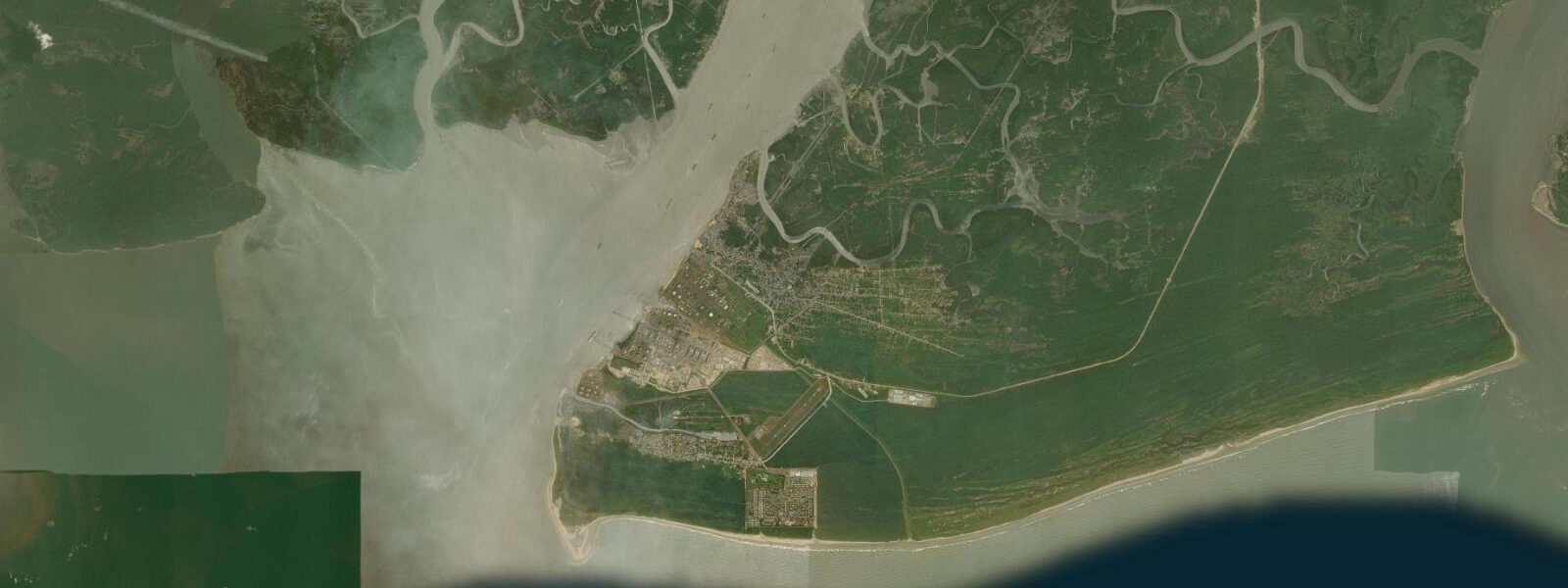
Bonny Island sits at the point where the Bonny River breaks through its barrier island system and meets the Gulf of Guinea. The town is small, the waterfront is functional, and the history embedded in the place is enormous. Bonny was one of the principal slave-trading ports on the West African coast during the 18th century, controlled by the Ibani (Bonny) Kingdom and handling an estimated 300,000 to 400,000 enslaved people over the course of the trade — a volume that made it one of the highest-throughput points on the entire Atlantic circuit.
The town's layout still reflects the trading-house era: the waterfront, the compounds of the major merchant families, the old church built by the same European missionaries who arrived with the abolitionists in the early 19th century. The Ijaw and Ibani communities who live here today are the descendants of the fishing and trading families who worked these waters before, during, and after the slave trade. That history sits alongside an equally enormous present: the Nigeria LNG plant on the eastern side of Bonny Island is one of the world's largest liquefied natural gas facilities, processing gas from the offshore Niger Delta fields and loading it onto LNG carriers that head for Europe, Asia, and the Americas.
The plant was built on what was formerly mangrove swamp and barrier beach, and the industrial infrastructure it requires — jetties, pipelines, support vessel traffic — has transformed the eastern shore of the island beyond recognition. The western and southern margins retain remnant mangrove, and it is here that the natural character of the Bonny River estuary is still legible. 8 metres.
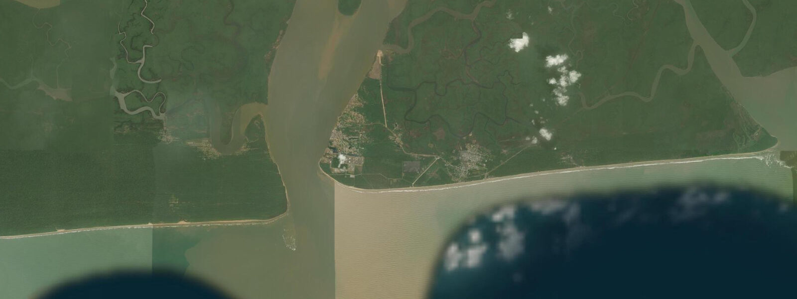
The delta amplifies the tidal signal compared to the open Gulf of Guinea coast, and the river channel adds velocity: on the ebb, river outflow and tidal current combine to produce fast-moving water in the main channel and in the narrower creeks between barrier islands. Local ferry operators and fishing boat crews work with this current as a matter of daily practice — they know to leave on the flood and time returns to the ebb. For anyone visiting by small boat, the practical advice is the same: plan creek navigation around tidal state, not just distance.
3 m accuracy. The remnant mangrove sections on the island's eastern and southern margins hold mangrove kingfisher, pied kingfisher, African fish eagle, and the mudskipper and fiddler crab communities typical of healthy Niger Delta intertidal habitat. Artisanal fishing in the Bonny River targets bonga shad, catfish, tilapia, and barracuda; the cast-net fishing from canoes on the creek margins at dawn is the most visible traditional practice still running at scale.
Access from Port Harcourt is by ferry (daily government service from Rumuola Ferry Terminal, around 45 minutes to one hour) or speedboat (20–30 minutes). There is no road bridge; Bonny is island-only access. The ferry crossing itself gives a comprehensive view of the LNG plant, the offshore rig tenders anchored in the channel, and the artisanal fishing canoes working around the edges of the industrial traffic — a compression of everything the Niger Delta is in one 45-minute boat ride.
The artisanal fishing community at Bonny works the Bonny River and the creek margins with cast nets and traditional basket traps, targeting bonga shad, catfish, and tilapia at the tidal margins. These traditional fishing practices have persisted alongside the industrial LNG operation — the two coexist in the same waterway, separated by a few hundred metres of channel.
Tide questions about Bonny Island
Quick answers to the most common questions about tide times, range, and water access at Bonny Island.
What is the historical significance of Bonny Island?
Bonny was one of the major slave-trading ports in West Africa during the 18th century, controlled by the Ibani (Bonny) Kingdom. The port handled an estimated 300,000–400,000 enslaved people shipped to the Americas between 1700 and 1830. The town was also significant in the 19th-century palm oil trade after abolition, when Bonny became a major exporting hub — the historical shift is reflected in its name 'Rivers' for what is now Rivers State. The waterfront retains traces of the colonial trading-house era. Today the NLNG plant represents the latest chapter in a long history of resource extraction, now natural gas rather than human lives or agricultural commodities.
How do tides affect navigation in the Bonny River and surrounding creeks?
The Niger Delta amplifies tidal range, and at Bonny the semi-diurnal spring tides reach 1.2–1.8 metres. The river current and the tidal current combine on the ebb, producing fast-moving water in the main channel and the narrower creeks. Local ferry and fishing boat operators time their departures to avoid the strongest ebb current — particularly in the constricted sections between barrier islands where flow accelerates. On the flood, the incoming tide slackens and then reverses the current, making the upriver run easier. For small-boat operators visiting the creek margins, the standard advice is to plan return journeys for the flood tide. Open-Meteo Marine predictions carry ±45 min accuracy; local boatmen are the authoritative source on current timing.
What wildlife remains in the Bonny Island mangroves?
Industrial development has significantly reduced the mangrove extent on Bonny Island, but remnant stands on the eastern and southern margins still hold the core Niger Delta mangrove species assemblage. Mangrove kingfisher, pied kingfisher, African fish eagle, and various herons and egrets are regular. Mudskippers — the intertidal fish that moves between water and air — are abundant on exposed mud at low tide, alongside fiddler crabs and mangrove periwinkles harvested by local women at low water. West African manatees are present in the wider Bonny River system but rarely sighted near the industrial zone. The creek edges away from the LNG plant have the most intact habitat.
How do I get to Bonny Island from Port Harcourt?
The standard route is by ferry from the Rumuola Ferry Terminal in Port Harcourt city. The government ferry service runs a daily schedule (typically morning departure from Port Harcourt, return in the afternoon) and takes around 45 minutes to 1 hour. Speedboat services are also available from the same terminal and cut the crossing to 20–30 minutes, though at higher cost. There is no road bridge to Bonny; all access is by water. Check current ferry schedules on arrival in Port Harcourt — services can be disrupted by weather, low tides (which affect the terminal approach), and occasional operational issues. The ferry crossing gives a good view of the LNG plant and the industrial waterfront as you approach.
Is Bonny Island safe to visit?
Bonny is an active industrial port and fishing community, not a tourist infrastructure town. The general security situation in Rivers State has historically been variable; the creeks and offshore areas of the Niger Delta have seen maritime security incidents over the years, though Bonny's LNG presence means it has a higher security footprint than more remote delta communities. The town itself is generally navigable during the day. Standard precautions apply: travel with a local contact or guide familiar with current conditions, avoid moving by water after dark, and check current UK FCDO or US State Department advisories for Rivers State before travelling. As of 2025, the main security concerns in the Niger Delta are concentrated in remote creek areas rather than the Bonny town waterfront.
8-day tide table — Bonny Island
Heights relative to MSL. Predictions: Open-Meteo Marine (MeteoFrance SMOC, 0.08° grid) — heights relative to MSL (not chart datum / LAT). Model-derived.
| Day | Type | Time | Height |
|---|---|---|---|
| Fri 03 Jul | Low | 01:00 | -0.7m |
| High | 06:20 | 0.7m | |
| Low | 12:05 | -0.4m | |
| High | 17:53 | 0.7m | |
| Sat 04 Jul | Low | 00:26 | -0.8m |
| High | 06:57 | 0.7m | |
| Sun 05 Jul | Low | 00:58 | -0.8m |
| High | 19:20 | 0.6m | |
| Mon 06 Jul | Low | 01:38 | -0.7m |
| High | 08:17 | 0.7m | |
| Low | 14:17 | -0.4m | |
| High | 20:13 | 0.5m | |
| Tue 07 Jul | Low | 02:21 | -0.6m |
| High | 09:02 | 0.7m | |
| Low | 15:16 | -0.4m | |
| High | 21:10 | 0.5m | |
| Wed 08 Jul | Low | 03:15 | -0.5m |
| High | 09:55 | 0.7m | |
| Thu 09 Jul | Low | 04:13 | -0.4m |
| High | 10:55 | 0.7m | |
| Low | 17:40 | -0.5m | |
| Fri 10 Jul | High | 00:00 | 0.4m |